File:Tunnel under disused railway - geograph.org.uk - 1770836.jpg
Jump to navigation
Jump to search
Size of this preview: 800 × 533 pixels. Other resolutions: 320 × 213 pixels | 640 × 426 pixels | 1,024 × 682 pixels | 1,280 × 852 pixels | 2,560 × 1,704 pixels | 3,088 × 2,056 pixels.
Original file (3,088 × 2,056 pixels, file size: 3.73 MB, MIME type: image/jpeg)
Captions
Captions
Add a one-line explanation of what this file represents
Summary[edit]
| Description |
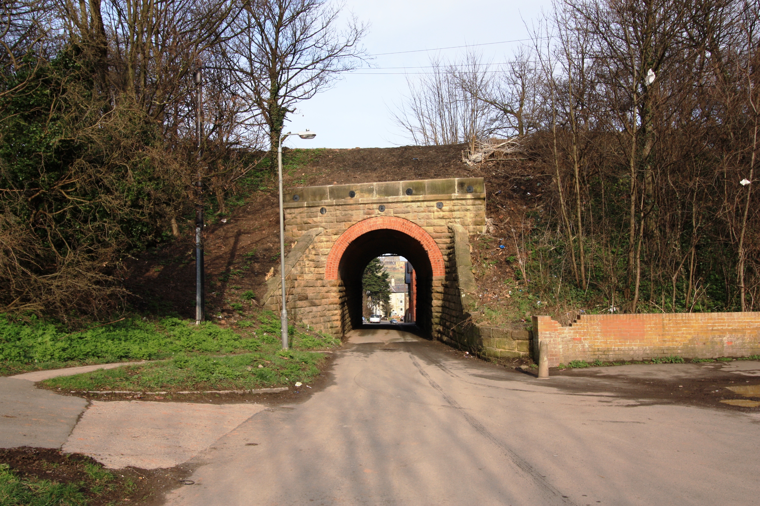
English: Tunnel under disused railway. This photograph shows a view of a tunnel underneath the (now disused) railway line which used to run between Scarborough (in the south) and Staithes (in the north). The section of track that lies to the right of the tunnel is now used as a walkway (see here: 1770856 ); a flight of steps on the other side of the tunnel provides access to this. The picture was taken looking in an east-north-easterly direction towards Fishburn Park. |
| Date | |
| Source | From geograph.org.uk |
| Author | Philip Barker |
| Attribution (required by the license) | Philip Barker / Tunnel under disused railway / |
| Camera location | | View this and other nearby images on: OpenStreetMap |
|---|
| Object location | | View this and other nearby images on: OpenStreetMap |
|---|
Licensing[edit]

|
This image was taken from the Geograph project collection. See this photograph's page on the Geograph website for the photographer's contact details. The copyright on this image is owned by Philip Barker and is licensed for reuse under the Creative Commons Attribution-ShareAlike 2.0 license.
|
This file is licensed under the Creative Commons Attribution-Share Alike 2.0 Generic license.
Attribution: Philip Barker
- You are free:
- to share – to copy, distribute and transmit the work
- to remix – to adapt the work
- Under the following conditions:
- attribution – You must give appropriate credit, provide a link to the license, and indicate if changes were made. You may do so in any reasonable manner, but not in any way that suggests the licensor endorses you or your use.
- share alike – If you remix, transform, or build upon the material, you must distribute your contributions under the same or compatible license as the original.

_heading:67.00&language=en)
_heading:67.00&language=en)
File history
Click on a date/time to view the file as it appeared at that time.
| Date/Time | Thumbnail | Dimensions | User | Comment | |
|---|---|---|---|---|---|
| current | 14:01, 14 March 2011 | | 3,088 × 2,056 (3.73 MB) | GeographBot (talk | contribs) | == {{int:filedesc}} == {{Information |description={{en|1=Tunnel under disused railway This photograph shows a view of a tunnel underneath the (now disused) railway line which used to run between Scarborough (in the south) and Staithes (in the north). The |
You cannot overwrite this file.
File usage on Commons
There are no pages that use this file.