File:U.S. Washington location map.svg
(Redirected from File:USA Washington location map.svg)

Size of this PNG preview of this SVG file: 800 × 563 pixels. Other resolutions: 320 × 225 pixels | 640 × 451 pixels | 1,024 × 721 pixels | 1,280 × 901 pixels | 2,560 × 1,803 pixels | 1,501 × 1,057 pixels.
Original file (SVG file, nominally 1,501 × 1,057 pixels, file size: 561 KB)
Captions
Captions
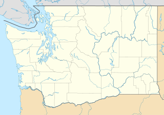
Picture of Washington with lines marking out the borders of each country.
Waller-Sean city-Clover Creek,WA
Summary[edit]
| Description |
Quadratische Plattkarte, N-S-Streckung 150.0 %. Geographische Begrenzung der Karte:
Equirectangular projection, N/S stretching 150.0 %. Geographic limits of the map:
|
| Date | |
| Source | Own work |
| Author | Alexrk2 |
| Other versions |
Derivative works of this file: FirstCitizensBancShares footprint.png Derivative works of this file:
|


|
This map has been made or improved in the German Kartenwerkstatt (Map Lab). You can propose maps to improve as well.
|
Licensing[edit]
I, the copyright holder of this work, hereby publish it under the following licenses:

|
Permission is granted to copy, distribute and/or modify this document under the terms of the GNU Free Documentation License, Version 1.2 or any later version published by the Free Software Foundation; with no Invariant Sections, no Front-Cover Texts, and no Back-Cover Texts. A copy of the license is included in the section entitled GNU Free Documentation License. |
This file is licensed under the Creative Commons Attribution 3.0 Unported license.
- You are free:
- to share – to copy, distribute and transmit the work
- to remix – to adapt the work
- Under the following conditions:
- attribution – You must give appropriate credit, provide a link to the license, and indicate if changes were made. You may do so in any reasonable manner, but not in any way that suggests the licensor endorses you or your use.
You may select the license of your choice.
File history
Click on a date/time to view the file as it appeared at that time.
| Date/Time | Thumbnail | Dimensions | User | Comment | |
|---|---|---|---|---|---|
| current | 16:20, 2 October 2009 | | 1,501 × 1,057 (561 KB) | Alexrk2 (talk | contribs) | == Beschreibung == {{Information |Description= {{de|Positionskarte von Washington, USA}} Quadratische Plattkarte, N-S-Streckung 150.0 %. Geographische Begrenzung der Karte: * N: 49.2° N * S: 45.3° N * W: 125.0° W * O: 116 |
You cannot overwrite this file.
File usage on Commons
The following 24 pages use this file:
- File:Costco footprint map USA 2021-01.png
- File:Dollar Tree footprint map 2020-12.png
- File:Family Dollar footprint map 2020-12.png
- File:FirstCitizensBancShares footprint.png
- File:Speedway Footprint 2020 August.png
- File:Speedway Jun2018 to Aug2020 comparison.png
- File:Target stores footprint 2020-12.png
- File:USA Washington location map.svg (file redirect)
- File:FirstCitizensBancShares footprint.png
- File:USA Washington relief location map.jpg
- File:Speedway Footprint 2020 August.png
- File:Speedway Jun2018 to Aug2020 comparison.png
- File:Target stores footprint 2020-12.png
- File:Valero brands branded gas stations 2020-12.png
- File:Dollar Tree footprint map 2020-12.png
- File:Family Dollar footprint map 2020-12.png
- File:Walmart locations with on-site fuel stations map 2020-20.png
- File:Walmart branded fuel stations map 2020-12.png
- File:Costco footprint map USA 2021-01.png
- File:USA Washington relief location map.jpg
- File:Valero brands branded gas stations 2020-12.png
- File:Walmart branded fuel stations map 2020-12.png
- File:Walmart locations with on-site fuel stations map 2020-20.png
- Category:Bank of America Fifth Avenue Plaza
File usage on other wikis
The following other wikis use this file:
- Usage on af.wikipedia.org
- Usage on an.wikipedia.org
- Usage on ar.wikipedia.org
- Usage on ast.wikipedia.org
- Usage on azb.wikipedia.org
- بلینقهام، واشینقتون
- اولمپیا، واشینقتون
- پریری هایتس، واشینقتون
- استنزبری لیک، واشینقتون
- باتل ایست، واشینقتون
- ویلاپا، واشینقتون
- چلن فالز، واشینقتون
- بارنیز جانکشن، واشینقتون
- سامیت ویو، واشینقتون
- توربوی، واشینقتون
- بویدز، واشینقتون
- دنویل، واشینقتون
- ریدروود، واشینقتون
- اسکاموکاوا ولی، واشینقتون
- واونا، واشینقتون
- بلفیر، واشینقتون
- هوداسپورت، واشینقتون
- بتل، واشینقتون
- لاپوش، واشینقتون
- کلیفدل، واشینقتون
- انتای، واشینقتون
- ساندی لیک، واشینقتون
- کاپوسین، واشینقتون
- نایل، واشینقتون
- روزبرق، واشینقتون
- کووچی، واشینقتون
- تامپیکو، واشینقتون
- هنسویل، واشینقتون
- آوتلوک، واشینقتون
- مالو، واشینقتون
- لوفال، واشینقتون
- سکیو، واشینقتون
- مکمیلین، واشینقتون
- کولرو، واشینقتون
- بولوارد پارک، واشینقتون
- پارکر، واشینقتون
- کراکر، واشینقتون
- دونالد، واشینقتون
- واکاندا، واشینقتون
- چیکو، واشینقتون
View more global usage of this file.