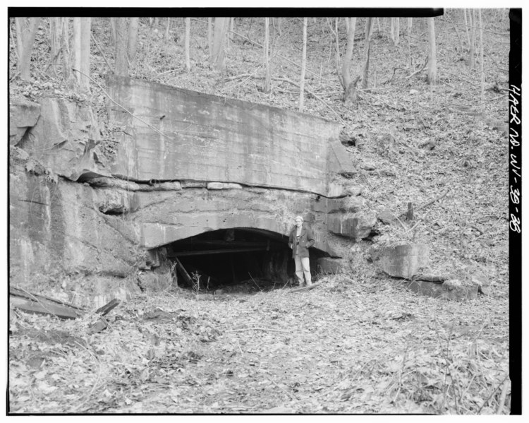
File:VIEW OF CONCRETE PORTAL OF MAIN DRIFT OPENING WITH ERIC DELONY SERVING AS A SCALE FIGURE - Kaymoor Coal Mine, South side of New River, upstream of New River Gorge Bridge, HAER WVA,10-FAY.V, 2-38.tif
Jump to navigation
Jump to search
Size of this JPG preview of this TIF file: 750 × 599 pixels. Other resolutions: 301 × 240 pixels | 601 × 480 pixels | 961 × 768 pixels | 1,280 × 1,023 pixels | 2,560 × 2,045 pixels | 5,000 × 3,995 pixels.
Original file (5,000 × 3,995 pixels, file size: 19.05 MB, MIME type: image/tiff)
Captions
Captions
Add a one-line explanation of what this file represents
Summary[edit]
| VIEW OF CONCRETE PORTAL OF MAIN DRIFT OPENING WITH ERIC DELONY SERVING AS A SCALE FIGURE - Kaymoor Coal Mine, South side of New River, upstream of New River Gorge Bridge, Fayetteville, Fayette County, WV | ||||
|---|---|---|---|---|
| Title |
VIEW OF CONCRETE PORTAL OF MAIN DRIFT OPENING WITH ERIC DELONY SERVING AS A SCALE FIGURE - Kaymoor Coal Mine, South side of New River, upstream of New River Gorge Bridge, Fayetteville, Fayette County, WV |
|||
| Description |
Kay, James; Low Moor Iron Company; New River and Pocahontas Consol. Coal Company; Berwind-White Corporation; O'Connell, Kristen, transmitter; Morris, Scott, transmitter; DeBoer, Ruth, transmitter; Morris, Jeremy, delineator; Daley, Scott, delineator; McClung, Kevin, delineator; Bonenberger, Danny, delineator |
|||
| Depicted place | West Virginia; Fayette County; Fayetteville | |||
| Date | Documentation compiled after 1968 | |||
| Dimensions | 4 x 5 in. | |||
| Current location |
Library of Congress Prints and Photographs Division Washington, D.C. 20540 USA http://hdl.loc.gov/loc.pnp/pp.print |
|||
| Accession number |
HAER WVA,10-FAY.V, 2-38 |
|||
| Credit line |
|
|||
| Notes |
|
|||
| Source | https://www.loc.gov/pictures/item/wv0288.photos.372652p | |||
| Permission (Reusing this file) |
|
|||

File history
Click on a date/time to view the file as it appeared at that time.
| Date/Time | Thumbnail | Dimensions | User | Comment | |
|---|---|---|---|---|---|
| current | 08:21, 5 August 2014 |  | 5,000 × 3,995 (19.05 MB) | Fæ (talk | contribs) | GWToolset: Creating mediafile for Fæ. HABS 2014-08-04 (3601:3800) Penultimate Tranche! |
You cannot overwrite this file.
File usage on Commons
The following page uses this file: