File:Viae Flaminia Aemilia Postumia.jpg
Jump to navigation
Jump to search

Size of this preview: 770 × 599 pixels. Other resolutions: 308 × 240 pixels | 617 × 480 pixels | 987 × 768 pixels | 1,280 × 996 pixels | 2,424 × 1,887 pixels.
Original file (2,424 × 1,887 pixels, file size: 1,018 KB, MIME type: image/jpeg)
Captions
Captions
Add a one-line explanation of what this file represents
| Description |
|
||||||||
| Date | |||||||||
| Source | it:Utente:EH101 | ||||||||
| Author | it:Utente:EH101 | ||||||||
| Permission (Reusing this file) |
EH101 at the Italian-language Wikipedia, the copyright holder of this work, hereby publishes it under the following license:
|
||||||||
| Other versions | Derivative works of this file: Italy bassa parmense on bassa padana map.svg |

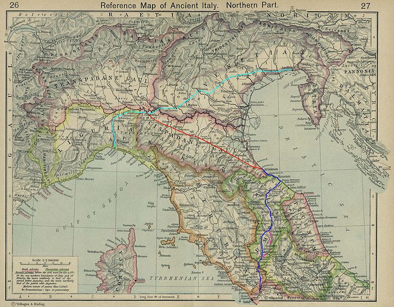
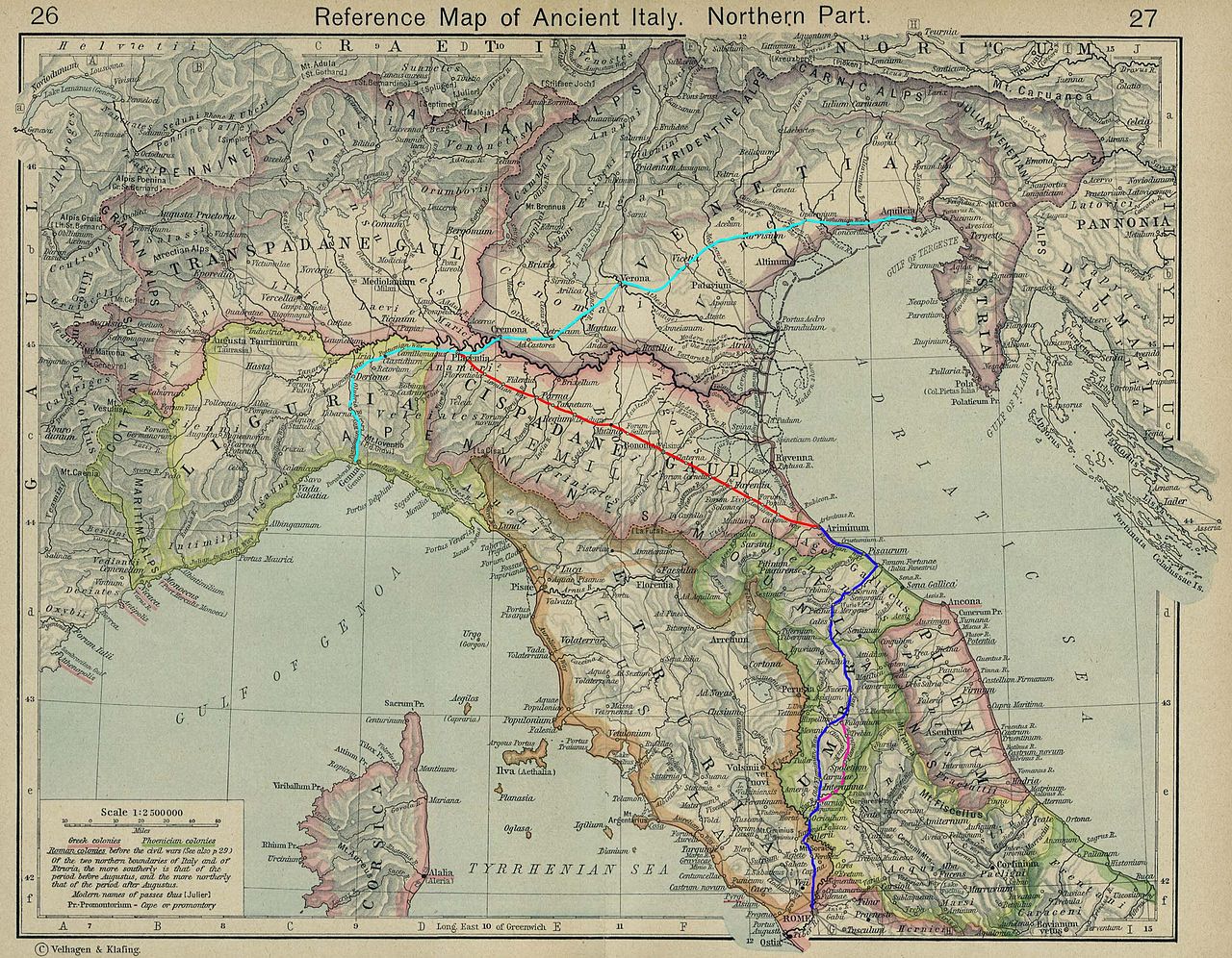
Based on a map from "Historical Atlas" by William R. Shepherd, New York, Henry Holt and Company, 1923 now in Public Domain. Courtesy of the University of Texas Libraries, The University of Texas at Austin. [1]
![[1]](http://www.lib.utexas.edu/maps/historical/shepherd/italy_ancient_north.jpg)
File history
Click on a date/time to view the file as it appeared at that time.
| Date/Time | Thumbnail | Dimensions | User | Comment | |
|---|---|---|---|---|---|
| current | 00:19, 29 August 2007 | | 2,424 × 1,887 (1,018 KB) | EH101 (talk | contribs) | {{Information |Description={{it|il sistema viario dell'antica Roma per la direttrice Nord-Est. in sequenza partendo da Roma: in blu la ''via Flaminia'', segue in rosso la ''via Aemilia'' che si collega alla ''via Postumia'' con arrivo ad Aquileia'''}} {{e |
You cannot overwrite this file.
File usage on Commons
The following 4 pages use this file:
File usage on other wikis
The following other wikis use this file:
- Usage on ca.wikipedia.org
- Usage on cy.wikipedia.org
- Usage on en.wikipedia.org
- Usage on eo.wikipedia.org
- Usage on es.wikipedia.org
- Usage on et.wikipedia.org
- Usage on he.wikipedia.org
- Usage on id.wikipedia.org
- Usage on it.wikipedia.org
- Usage on ja.wikipedia.org
- Usage on la.wikipedia.org
- Usage on mk.wikipedia.org
- Usage on no.wikipedia.org
- Usage on sl.wikipedia.org
- Usage on sv.wikipedia.org
- Usage on uk.wikipedia.org
- Usage on www.wikidata.org