File:Virginia and Florida by W. Blaeu (MAM, Madrid, 413) 01.jpg
Jump to navigation
Jump to search
Size of this preview: 793 × 600 pixels. Other resolutions: 317 × 240 pixels | 635 × 480 pixels | 1,015 × 768 pixels | 1,280 × 968 pixels | 2,560 × 1,936 pixels | 3,120 × 2,360 pixels.
Original file (3,120 × 2,360 pixels, file size: 2.36 MB, MIME type: image/jpeg)
Captions
Captions
Add a one-line explanation of what this file represents
| Description |
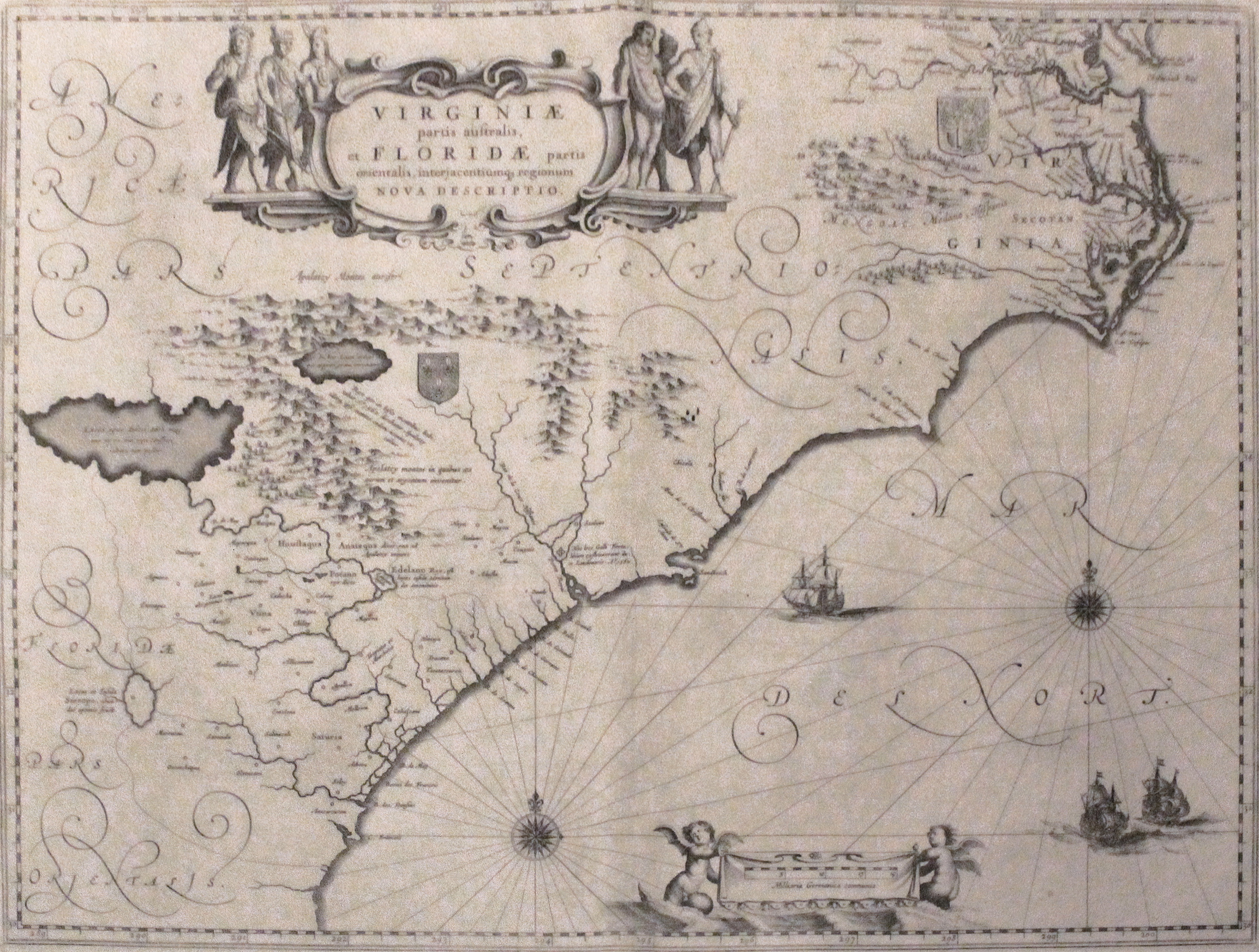
English: Map depicting the former Colony of Virginia (according to the Second Charter) and part of Florida.
Español: Mapa que muestra la antigua Colonia de Virginia (según la Segunda Carta) y parte de Florida. |
||||||||||||||||||||||||||
| Date | between 1609 and 1638 | ||||||||||||||||||||||||||
| Source | Photograph: Luis García (Zaqarbal), 12 September 2013. | ||||||||||||||||||||||||||
| Creator |
|
||||||||||||||||||||||||||
| Permission (Reusing this file) |
|
||||||||||||||||||||||||||
| Geotemporal data | |||||||||||||||||||||||||||
| Date depicted | between 1609 and 1638 | ||||||||||||||||||||||||||
| Map location |
English: Nowadays Virgina, North Carolina, South Carolina, Georgia and north of Florida.
Español: Los actuales estados de Virginia, Carolina del Norte, Carolina del Sur, Georgia y norte de Florida. |
||||||||||||||||||||||||||
| Georeferencing | If inappropriate please set warp_status = skip to hide. | ||||||||||||||||||||||||||
| Bibliographic data | |||||||||||||||||||||||||||
| Language | Latin | ||||||||||||||||||||||||||
| Archival data | |||||||||||||||||||||||||||
| Collection |
|
||||||||||||||||||||||||||
| Accession number |
413 |
||||||||||||||||||||||||||
| Dimensions | height: 382 cm (12.5 ft); width: 503 cm (16.5 ft) | ||||||||||||||||||||||||||
| Medium | paper | ||||||||||||||||||||||||||
| Notes | Museum's website – Web del museo – Site du musée | ||||||||||||||||||||||||||


File history
Click on a date/time to view the file as it appeared at that time.
| Date/Time | Thumbnail | Dimensions | User | Comment | |
|---|---|---|---|---|---|
| current | 17:53, 29 January 2016 | | 3,120 × 2,360 (2.36 MB) | Zaqarbal (talk | contribs) | Photo taken by Luis García (Zaqarbal) on September 12th, 2013. Hereby released into the public domain. |
| 17:44, 29 January 2016 |  | 3,120 × 2,360 (2.36 MB) | Zaqarbal (talk | contribs) | Photo taken by Luis García (Zaqarbal) on September 12th, 2013. Hereby published under GFDL and Cc-by-sa-3.0-ES licenses. |
You cannot overwrite this file.
File usage on Commons
The following page uses this file:
File usage on other wikis
The following other wikis use this file:
- Usage on ar.wikipedia.org
- Usage on en.wikipedia.org
- Usage on hy.wikipedia.org
- Usage on pl.wikipedia.org
_01.jpg&oldid=450589370)