File:Vue Sud de Céret, entre son église paroissiale et son pont du Diable, depuis la montée au mas Boher.jpg
Jump to navigation
Jump to search

Size of this preview: 800 × 600 pixels. Other resolutions: 320 × 240 pixels | 640 × 480 pixels | 1,024 × 768 pixels | 1,280 × 960 pixels | 2,560 × 1,920 pixels | 3,840 × 2,880 pixels.
Original file (3,840 × 2,880 pixels, file size: 2.53 MB, MIME type: image/jpeg)
Captions
Captions
Add a one-line explanation of what this file represents
Summary[edit]
| Description |
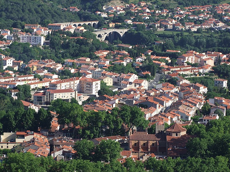
Français : Après la démolition de ses remparts, l'extension de Céret s'est d'abord faite au Nord du centre ancien, pour rejoindre le pont du Diable, (en haut du cliché), son principal accès depuis le Moyen-Age, d'ailleurs assez proche à l'aval de son premier pont d'époque romaine. |
| Date | |
| Source | Own work |
| Author | Damusmedia |
Licensing[edit]
I, the copyright holder of this work, hereby publish it under the following license:
This file is licensed under the Creative Commons Attribution-Share Alike 4.0 International license.
- You are free:
- to share – to copy, distribute and transmit the work
- to remix – to adapt the work
- Under the following conditions:
- attribution – You must give appropriate credit, provide a link to the license, and indicate if changes were made. You may do so in any reasonable manner, but not in any way that suggests the licensor endorses you or your use.
- share alike – If you remix, transform, or build upon the material, you must distribute your contributions under the same or compatible license as the original.
File history
Click on a date/time to view the file as it appeared at that time.
| Date/Time | Thumbnail | Dimensions | User | Comment | |
|---|---|---|---|---|---|
| current | 17:53, 22 January 2021 | | 3,840 × 2,880 (2.53 MB) | Damusmedia (talk | contribs) | Uploaded own work with UploadWizard |
You cannot overwrite this file.
File usage on Commons
There are no pages that use this file.