File:World Map 1855.jpg
Jump to navigation
Jump to search

Size of this preview: 800 × 569 pixels. Other resolutions: 320 × 227 pixels | 640 × 455 pixels | 1,024 × 728 pixels | 1,280 × 910 pixels | 2,560 × 1,820 pixels | 6,701 × 4,763 pixels.
Original file (6,701 × 4,763 pixels, file size: 2.74 MB, MIME type: image/jpeg)
Captions
Captions
Add a one-line explanation of what this file represents
Summary[edit]
| Description |
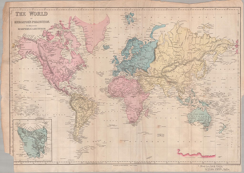
English: The World on Mercator’s Projection.
Most of Antarctica not drawn, except part of the coast between 100°E and 160°E. Inset in lower left corner shows Van Diemen’s Land. |
| Date | |
| Source | J. Calvin Smith: Harper’s Statistical Gazetteer of the World. Harper & Brothers, New York 1855. Internet Archive |
| Author | Published by Harper's, NY |
Licensing[edit]
This media file is in the public domain in the United States. This applies to U.S. works where the copyright has expired, often because its first publication occurred prior to January 1, 1929, and if not then due to lack of notice or renewal. See this page for further explanation.
|
 | |
 |
This image might not be in the public domain outside of the United States; this especially applies in the countries and areas that do not apply the rule of the shorter term for US works, such as Canada, Mainland China (not Hong Kong or Macao), Germany, Mexico, and Switzerland. The creator and year of publication are essential information and must be provided. See Wikipedia:Public domain and Wikipedia:Copyrights for more details.
|
File history
Click on a date/time to view the file as it appeared at that time.
| Date/Time | Thumbnail | Dimensions | User | Comment | |
|---|---|---|---|---|---|
| current | 19:38, 27 October 2012 | | 6,701 × 4,763 (2.74 MB) | INeverCry (talk | contribs) | {{Information |Description="The World on Mercator's Projection" 1855 |Source=http://archive.org/details/worldonmercators00jcsm |Date=1855 |Author=Published by Harper's, NY |Permission= |other_versions= }} Category:1855 maps [[Category:Mercator pro... |
You cannot overwrite this file.
File usage on Commons
There are no pages that use this file.