File:World war one French general eaths location map.png
Jump to navigation
Jump to search
Size of this preview: 624 × 600 pixels. Other resolutions: 250 × 240 pixels | 499 × 480 pixels | 799 × 768 pixels | 1,065 × 1,024 pixels | 2,000 × 1,923 pixels.
Original file (2,000 × 1,923 pixels, file size: 671 KB, MIME type: image/png)
Captions
Captions
Add a one-line explanation of what this file represents
Summary
[edit]
| Description |
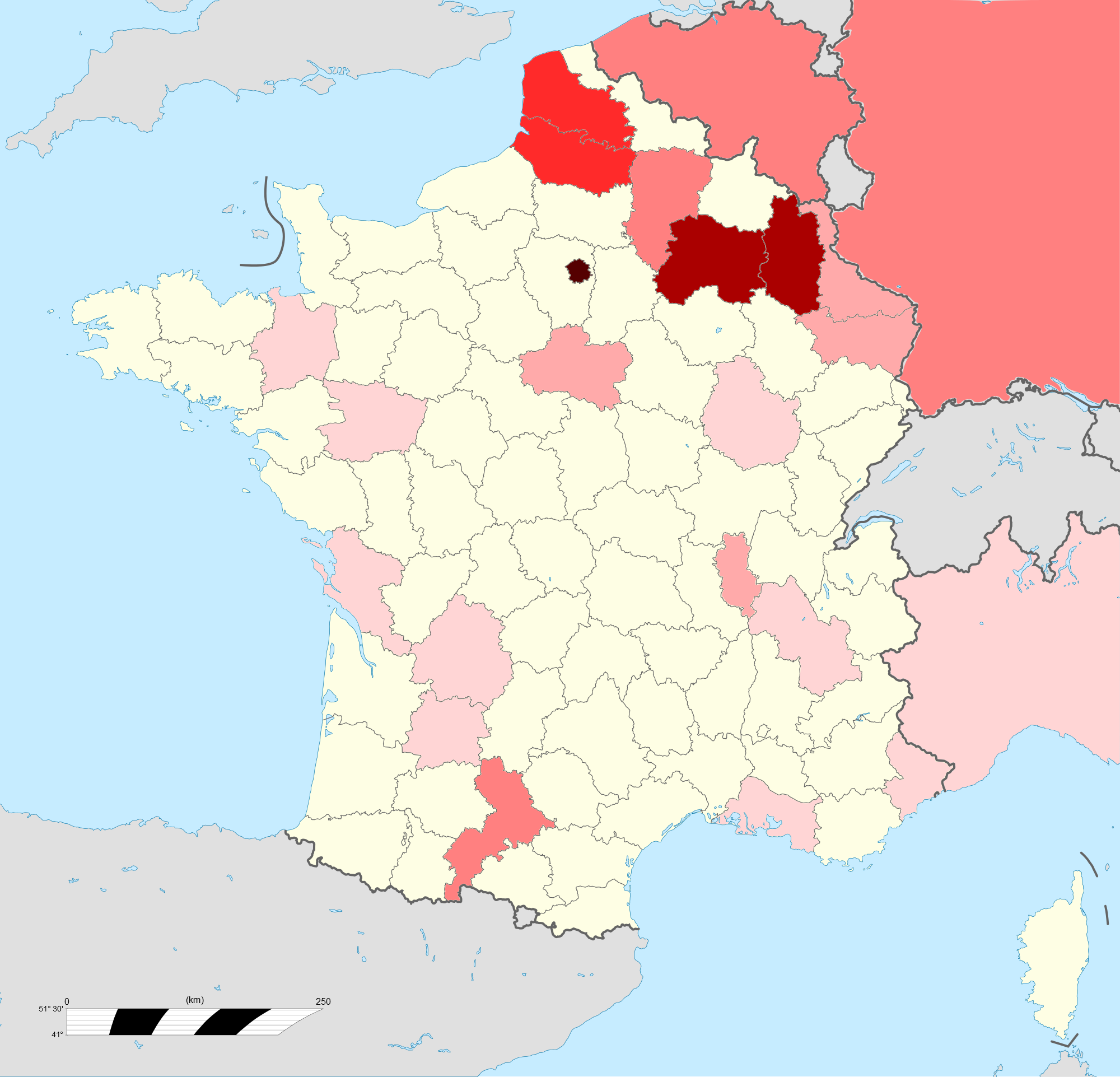
English: Map showing the departments or countries of death of French generals killed in the First World War. Shaded according to number of deaths (6 levels of shading: 1,2,3,5,10,13). Three deaths not shown (1 unknown location, 1 Mediterranean, 1 Serbia) |
| Date | |
| Source | File:France location map-Departements 1871-1914.svg |
| Author | Derivative of above file, all changes made by myself and released under the same licence, |
Licensing
[edit]
This file is licensed under the Creative Commons Attribution-Share Alike 3.0 Unported license.
- You are free:
- to share – to copy, distribute and transmit the work
- to remix – to adapt the work
- Under the following conditions:
- attribution – You must give appropriate credit, provide a link to the license, and indicate if changes were made. You may do so in any reasonable manner, but not in any way that suggests the licensor endorses you or your use.
- share alike – If you remix, transform, or build upon the material, you must distribute your contributions under the same or compatible license as the original.
File history
Click on a date/time to view the file as it appeared at that time.
| Date/Time | Thumbnail | Dimensions | User | Comment | |
|---|---|---|---|---|---|
| current | 09:42, 10 March 2013 | | 2,000 × 1,923 (671 KB) | Dumelow (talk | contribs) | User created page with UploadWizard |
You cannot overwrite this file.
File usage on Commons
The following page uses this file:
File usage on other wikis
The following other wikis use this file:
- Usage on en.wikipedia.org