File:Yorkshire Dales National Park map 2016.svg
Jump to navigation
Jump to search

Size of this PNG preview of this SVG file: 477 × 599 pixels. Other resolutions: 191 × 240 pixels | 382 × 480 pixels | 611 × 768 pixels | 815 × 1,024 pixels | 1,631 × 2,048 pixels | 1,153 × 1,448 pixels.
Original file (SVG file, nominally 1,153 × 1,448 pixels, file size: 1.08 MB)
Captions
Captions
Add a one-line explanation of what this file represents
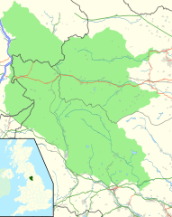
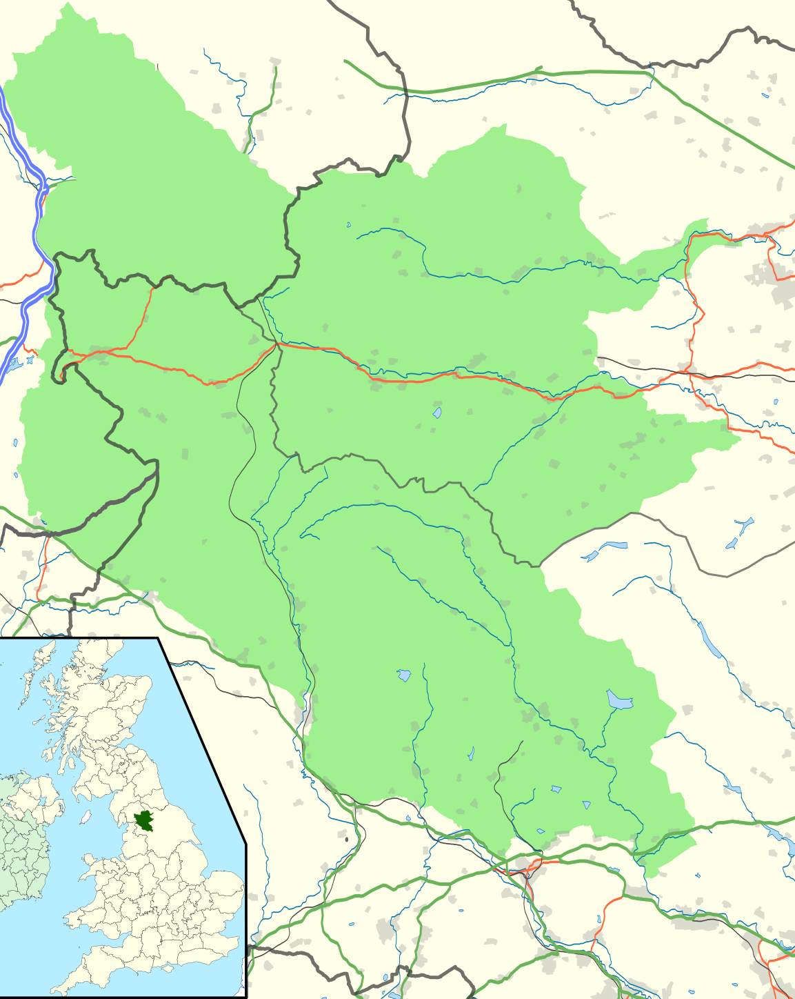
| Description | Map of the Yorkshire Dales National Park as extended on 1 August 2016, in the North and West Ridings of Yorkshire and in Westmorland |
| Date | |
| Source | Yorkshire Dales National Park map.svg |
| Author | Hogweard |
| Permission (Reusing this file) |
This file is licensed under the Creative Commons Attribution-Share Alike 4.0 International license. Attribution: Wikishire
|
File history
Click on a date/time to view the file as it appeared at that time.
| Date/Time | Thumbnail | Dimensions | User | Comment | |
|---|---|---|---|---|---|
| current | 06:41, 1 August 2016 | | 1,153 × 1,448 (1.08 MB) | Hogweard (talk | contribs) | {{Information |Description=Map of the Yorkshire Dales National Park as extended on 1 August 2016, in the North and West Ridings of Yorkshire and in Westmorland |Source=[[:File:Yorkshire Dales National Park map.svg|Yorkshire Dales National Park map.svg]... |
You cannot overwrite this file.
File usage on Commons
The following page uses this file:
File usage on other wikis
The following other wikis use this file:
- Usage on en.wikipedia.org
- Usage on pl.wikipedia.org