File:2024 Assassination Attempt of Donald Trump Diagram With Arrows.png
קפיצה לניווט
קפיצה לחיפוש
גודל התצוגה המקדימה הזאת: 800 × 487 פיקסלים. רזולוציות אחרות: 320 × 195 פיקסלים | 640 × 389 פיקסלים | 1,024 × 623 פיקסלים | 1,280 × 779 פיקסלים | 2,563 × 1,559 פיקסלים.
לקובץ המקורי (2,563 × 1,559 פיקסלים, גודל הקובץ: 780 ק"ב, סוג MIME: image/png)
כיתובים
כיתובים
נא להוסיף משפט שמסביר מה הקובץ מייצג
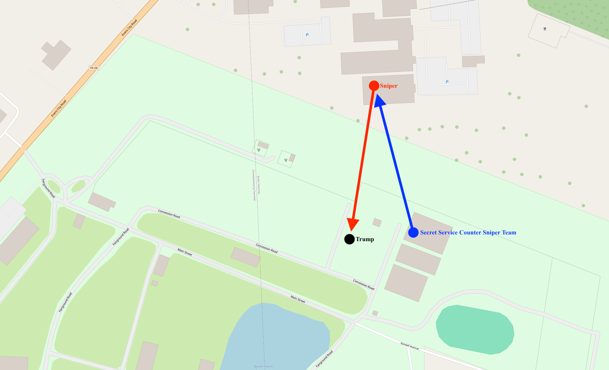
A map diagram illustrating the locations of the attacker, Donald Trump, and the Secret Service Counter Assault Team

|
קיימת תמונה חדשה תמונה זו בגרסה וקטורית בפורמט "SVG". It should be used in place of this raster image.
File:2024 Assassination Attempt of Donald Trump Diagram With Arrows.png → File:Assassination attempt of Donald Trump diagram.svg
למידע נוסף אודות גרפיקה וקטורית, אנא קראו אודות המעבר של ויקישיתוף לתמונות בפורמט SVG. ראו גם מידע אודות התמידה של מדיה-ויקי בתמונות בפורמט SVG. |
 |
תקציר
[עריכה]
| תיאור |
English: A map diagram illustrating the locations of the attacker, Donald Trump, and the Secret Service Counter Assault Team |
|||
| תאריך יצירה | ||||
| מקור | openstreetmap.org | |||
| יוצר |
OpenStreetMap contributors |
|||
| אישורים והיתרים (שימוש חוזר בקובץ זה) |
OpenStreetMap data is available under the Open Database License (details). Standard style map tiles are licensed as ODbL Produced Works.
|
|||
| Georeferencing | If inappropriate please set warp_status = skip to hide. |
היסטוריית הקובץ
ניתן ללחוץ על תאריך/שעה כדי לראות את הקובץ כפי שנראה באותו זמן.
| תאריך/שעה | תמונה ממוזערת | ממדים | משתמש | הערה | |
|---|---|---|---|---|---|
| נוכחית | 02:35, 14 ביולי 2024 | | 1,559 × 2,563 (780 ק"ב) | Cyrogigabyte (שיחה | תרומות) | Uploaded own work with UploadWizard |
אין באפשרותך לדרוס את הקובץ הזה.
שימוש בקובץ
אין דפים המשתמשים בקובץ זה.
שימוש גלובלי בקובץ
אתרי הוויקי השונים הבאים משתמשים בקובץ זה:
- שימוש באתר da.wikipedia.org
- שימוש באתר ga.wikipedia.org
- שימוש באתר incubator.wikimedia.org
- שימוש באתר shn.wikipedia.org
- שימוש באתר simple.wikipedia.org
- שימוש באתר sv.wikipedia.org
- שימוש באתר tl.wikipedia.org