File:A map of the Eastern boundary of France to illustrate Article III in The First Peace of Paris 30th May 1814.jpg
קפיצה לניווט
קפיצה לחיפוש
גודל התצוגה המקדימה הזאת: 752 × 600 פיקסלים. רזולוציות אחרות: 301 × 240 פיקסלים | 602 × 480 פיקסלים | 963 × 768 פיקסלים | 1,280 × 1,021 פיקסלים | 2,091 × 1,668 פיקסלים.
לקובץ המקורי (2,091 × 1,668 פיקסלים, גודל הקובץ: 1.87 מ"ב, סוג MIME: image/jpeg)
כיתובים
כיתובים
נא להוסיף משפט שמסביר מה הקובץ מייצג
תקציר[עריכה]
| תיאור |
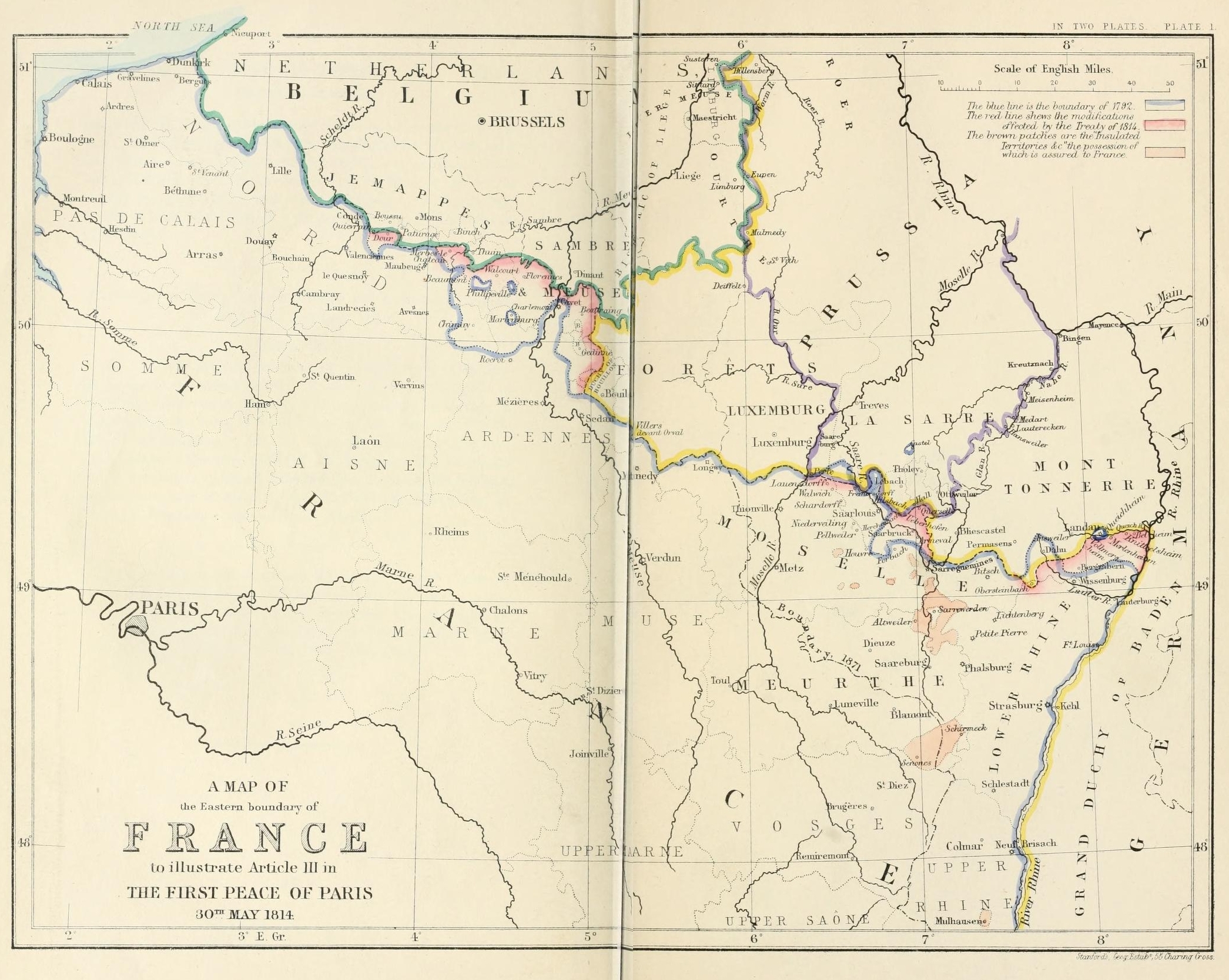
English: A map of the Eastern boundary of France to illustrate Article III in The First Peace of Paris 30th May 1814 |
| תאריך יצירה | |
| מקור | Edward Hertslet (1875). The map of Europe by treaty; showing the various political and territorial changes which have taken place since the general peace of 1814, London, Butterworths. p. opposite 28, 351 |
| יוצר | Edward Hertslet; and Stafford's Geng Estab, 55 Charing Cross |
רישיון[עריכה]
|
יצירה זו נמצאת בנחלת הכלל במדינת המקור ובמדינות אחרות בהם תקופת זכויות היוצרים היא משך חיי היוצר ו-70 שנה (או פחות) מפטירתו.
This work is in the public domain in the United States because it was published (or registered with the U.S. Copyright Office) before January 1, 1929. | |
| הקובץ הזה זוהה כקובץ חופשי מכל מגבלה ידועה תחת חוק זכויות היוצרים, כולל כל הזכויות הקשורות והסמוכות. | |
היסטוריית הקובץ
ניתן ללחוץ על תאריך/שעה כדי לראות את הקובץ כפי שנראה באותו זמן.
| תאריך/שעה | תמונה ממוזערת | ממדים | משתמש | הערה | |
|---|---|---|---|---|---|
| נוכחית | 21:31, 3 בספטמבר 2014 | | 1,668 × 2,091 (1.87 מ"ב) | PBS (שיחה | תרומות) | User created page with UploadWizard |
אין באפשרותך לדרוס את הקובץ הזה.
שימוש בקובץ
אין דפים המשתמשים בקובץ זה.
שימוש גלובלי בקובץ
אתרי הוויקי השונים הבאים משתמשים בקובץ זה:
- שימוש באתר en.wikipedia.org
- שימוש באתר es.wikipedia.org
- שימוש באתר fr.wikipedia.org
- שימוש באתר he.wikipedia.org
- שימוש באתר it.wikipedia.org
- שימוש באתר ja.wikipedia.org
- שימוש באתר pnb.wikipedia.org
- שימוש באתר sl.wikipedia.org
- שימוש באתר sr.wikipedia.org
- שימוש באתר sv.wikipedia.org
- שימוש באתר tt.wikipedia.org
- שימוש באתר ur.wikipedia.org