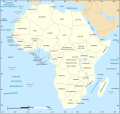
File:African continent-la.svg
מתוך Wikimedia Commons
קפיצה לניווט
קפיצה לחיפוש

גודל התצוגה המקדימה הזאת מסוג PNG של קובץ ה־SVG הזה: 635 × 600 פיקסלים. רזולוציות אחרות: 254 × 240 פיקסלים | 508 × 480 פיקסלים | 813 × 768 פיקסלים | 1,084 × 1,024 פיקסלים | 2,169 × 2,048 פיקסלים | 1,525 × 1,440 פיקסלים.
לקובץ המקורי (קובץ SVG, הגודל המקורי: 1,525 × 1,440 פיקסלים, גודל הקובץ: 741 ק"ב)
מידע על הקובץ
נתונים מובְנים
כיתובים
כיתובים
נא להוסיף משפט שמסביר מה הקובץ מייצג
| תיאורAfrican continent-la.svg |
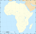
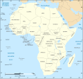
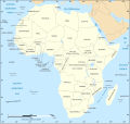
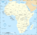
Latina: Tabula geographica Latine continentis Africae (07/2011) Français : Carte politique du continent africain telle qu'en 07/2011 avec légende en latin. English: Political map, translated into Latin, of the continent of Africa as of July 2011 (07/2011) Lambert azimutal equal-area projection, WGS84 datum, standard meridian: 15°E, standard parallel: 0°Scale: 1:15,000,000 (accuracy: 3,75 km) |
| תאריך יצירה | (UTC) |
| מקור | |
| יוצר |
|
| גרסאות אחרות |
[עריכה]
|
| זוהי תמונה מרוטשת, זאת אומרת שהתמונה שונתה בצורה דיגיטלית מהמקור. Modifications: Latin translation. את התמונה המקורית ניתן לראות ב: African continent-fr.svg. השינוי בוצע על ידי Amphipolis.
|
אני, בעל זכויות היוצרים על היצירה הזאת, מפרסם אותה בזאת תחת הרישיונות הבאים:
- יש לך חופש:
- לשתף – להעתיק, להפיץ ולהעביר את העבודה
- לערבב בין עבודות – להתאים את העבודה
- תחת התנאים הבאים:
- ייחוס – יש לתת ייחוס הולם, לתת קישור לרישיון, ולציין אם נעשו שינויים. אפשר לעשות את זה בכל צורה סבירה, אבל לא בשום צורה שמשתמע ממנה שמעניק הרישיון תומך בך או בשימוש שלך.
- שיתוף זהה – יצירת רמיקס, שינוי או בנייה על סמך החומר הזה, תטיל עליך חובה להפיץ את התרומות שלך לפי תנאי רישיון זהה או תואם למקור.
| הקובץ הזה מתפרסם לפי תנאי רישיון קריאייטיב קומונז ייחוס-שיתוף זהה 3.0 לא מותאם. | ||
| ||
| תבנית רישוי זו הוספה לקובץ כחלק מעדכון רישיון GFDL.http://creativecommons.org/licenses/by-sa/3.0/CC BY-SA 3.0Creative Commons Attribution-Share Alike 3.0truetrue |

|
מוענקת בכך הרשות להעתיק, להפיץ או לשנות את המסמך הזה, לפי תנאי הרישיון לשימוש חופשי במסמכים של גנו, גרסה 1.2 או כל גרסה מאוחרת יותר שתפורסם על־ידי המוסד לתוכנה חופשית; ללא פרקים קבועים, ללא טקסט עטיפה קדמית וללא טקסט עטיפה אחורית. עותק של הרישיון כלול בפרק שכותרתו הרישיון לשימוש חופשי במסמכים של גנו.http://www.gnu.org/copyleft/fdl.htmlGFDLGNU Free Documentation Licensetruetrue |
אפשר לבחור את הרישיון שמתאים לך.
יומן העלאה מקורי
[עריכה]This image is a derivative work of the following images:
- File:African_continent-fr.svg licensed with Cc-by-sa-2.5,2.0,1.0, Cc-by-sa-3.0-migrated, GFDL
- 2011-07-14T19:39:55Z Sting 1525x1440 (757418 Bytes) Sudan/South Sudan 2011-07 border update
- 2009-03-12T21:28:38Z Sting 1525x1440 (773348 Bytes) Correction Sao Tome (again) ; all fonts in DejaVu condensed
- 2009-01-10T19:52:08Z Sting 1525x1440 (766974 Bytes) Correction Sao Tome
- 2008-06-27T21:24:01Z Sting 1525x1440 (768579 Bytes) "Rép. du Congo" name correction
- 2008-06-27T01:46:54Z Sting 1525x1440 (768455 Bytes) One name correction
- 2008-06-26T23:37:59Z Sting 1525x1440 (768465 Bytes) Completely new drawing with known projection ; new colors
- 2006-05-31T22:56:10Z Sting 1390x1295 (626331 Bytes) {{Information |Description=Political map of the [[:Category:Maps of Africa|African continent]] with French caption |Source=Several bitmap-type maps |Date= May 2006 |Author= Eric Gaba ([[User:Sting|Sting]]) |Permission=GFDL or
Uploaded with derivativeFX
היסטוריית הקובץ
ניתן ללחוץ על תאריך/שעה כדי לראות את הקובץ כפי שנראה באותו זמן.
| תאריך/שעה | תמונה ממוזערת | ממדים | משתמש | הערה | |
|---|---|---|---|---|---|
| נוכחית | 18:44, 6 בדצמבר 2020 | 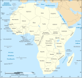 | 1,440 × 1,525 (741 ק"ב) | Sting (שיחה | תרומות) | Swaziland => Eswatini |
| 18:09, 28 בספטמבר 2011 | 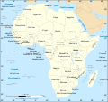 | 1,440 × 1,525 (741 ק"ב) | Amphipolis (שיחה | תרומות) | {{Information |Description={{la|Tabula geographica Latine continentis Africae (07/2011)}} {{fr|Carte politique du continent africain telle qu'en 07/2011 avec légende en latin.}} Lambert azimutal e |
אין באפשרותך לדרוס את הקובץ הזה.
שימוש בקובץ
הדפים הבאים משתמשים בקובץ הזה:
- User:Magog the Ogre/Multilingual legend/2020 December 1-10
- Commons:Translation possible/En savoir plus
- File:Africa map blank.svg
- File:Africa map no countries.svg
- File:African continent-br.svg
- File:African continent-ca.svg
- File:African continent-cs.svg
- File:African continent-da.svg
- File:African continent-de.png
- File:African continent-de.svg
- File:African continent-en.svg
- File:African continent-es.svg
- File:African continent-fr.svg
- File:African continent-it.svg
- File:African continent-ka.svg
- File:African continent-ku.svg
- File:African continent-la.svg
- File:African continent-mk.svg
- File:African continent-nb.svg
- File:African continent-pl.png
- File:African continent-pl.svg
- File:African continent-pt.svg
- File:African continent-ru.svg
- File:African continent-uk.svg
- File:African continent-ur2.svg
- File:African continent-繁體中文.png
- File:African continent-繁體中文.svg
- File:African continent sr.svg
- File:Afrik kárttá smn.svg
- Template:Other versions/African continent
שימוש גלובלי בקובץ
אתרי הוויקי השונים הבאים משתמשים בקובץ זה:
- שימוש באתר la.wikipedia.org
מטא־נתונים
קובץ זה מכיל מידע נוסף, שכנראה הגיע ממצלמה דיגיטלית או מסורק שבהם הקובץ נוצר או עבר דיגיטציה.
אם הקובץ שונה ממצבו הראשוני, כמה מהנתונים להלן עלולים שלא לשקף באופן מלא את הקובץ הנוכחי.
| כותרת קצרה | Tabula geographica Latine continentis Africae |
|---|---|
| רוחב | 1524.9999 |
| גובה | 1439.9999 |
