File:Ancient Orient.png
둘러보기로 이동
검색으로 이동

미리 보기 크기: 800 × 516 픽셀 다른 해상도: 320 × 206 픽셀 | 640 × 413 픽셀 | 1,024 × 661 픽셀 | 1,280 × 826 픽셀 | 2,560 × 1,652 픽셀 | 4,365 × 2,816 픽셀
원본 파일 (4,365 × 2,816 픽셀, 파일 크기: 10.18 MB, MIME 종류: image/png)
캡션
설명
이 파일이 나타내는 바에 대한 한 줄 설명을 추가합니다
파일 설명
[편집]
| 설명 |
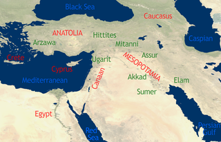
English: See Image:Orient 27 43 22 55 blank map.png for a blank map.
self-created in November 2004 on the basis of the 2002 NASA Blue Marble image.[1] |
| 날짜 | 2004년 11월 15일 (원본 올리기 일시) |
| 출처 | This compound image uses free material land_shallow_topo_east.tif from NASA Visible Earth (formerly "Blue Marble") and world.200407.3x21600x21600.C1.png from JULY, BLUE MARBLE NEXT GENERATION |
| 저자 | Dbachmann and Cush at en.wikipedia |
라이선스
[편집]
For the current map
[편집]
| 이 작품은 저작자인 Cush에 의해 퍼블릭 도메인으로 공개된 작품입니다. 이 공개 선언은 전 세계적으로 유효합니다. 만약 저작권의 포기가 법률적으로 가능하지 않은 경우, |
For the previous map
[편집]
| 이 작품은 저작자인 영어 위키백과의 Dbachmann에 의해 퍼블릭 도메인으로 공개된 작품입니다. 이 공개 선언은 전 세계적으로 유효합니다. 만약 저작권의 포기가 법률적으로 가능하지 않은 경우, Dbachmann은 이 작품을 법적으로 허용되는 한도 내에서 누구나 자유롭게 어떤 목적으로도 제한 없이 사용할 수 있도록 허용합니다. |
기존 올리기 기록
[편집]
The original description page was here. All following user names refer to en.wikipedia.
- 2004-11-15 08:40 Dbachmann 429×274×8 (213130 bytes) {{PD}}
파일 역사
날짜/시간 링크를 클릭하면 해당 시간의 파일을 볼 수 있습니다.
| 날짜/시간 | 섬네일 | 크기 | 사용자 | 설명 | |
|---|---|---|---|---|---|
| 현재 | 2010년 10월 22일 (금) 13:34 | | 4,365 × 2,816 (10.18 MB) | Cush (토론 | 기여) | Enhanced and enlarged version with city names and locations. Unfortunately the map had to be scaled to 88% of the original (due to size constraints on WP) so that the city labels are a little blurred. |
| 2010년 10월 22일 (금) 13:25 |  | 429 × 274 (208 KB) | Cush (토론 | 기여) | restored previous version, grrr | |
| 2010년 10월 22일 (금) 13:19 |  | 4,960 × 3,200 (12.11 MB) | Cush (토론 | 기여) | Enhanced and enlarged version with city names and locations | |
| 2008년 7월 25일 (금) 01:25 |  | 429 × 274 (208 KB) | File Upload Bot (Magnus Manske) (토론 | 기여) | {{BotMoveToCommons|en.wikipedia}} {{Information |Description={{en|see en::Image:Orient 27 43 22 55 blank map.png for a blank map. self-created in November 2004 on the basis of the 2002 NASA en:Blue Marble image.[http://earthobservatory.nasa. |
이 파일을 덮어쓸 수 없습니다.
이 파일을 사용하는 문서
이 파일을 사용하는 문서가 없습니다.
이 파일을 사용하고 있는 모든 위키의 문서 목록
다음 위키에서 이 파일을 사용하고 있습니다:
- af.wikipedia.org에서 이 파일을 사용하고 있는 문서 목록
- am.wikipedia.org에서 이 파일을 사용하고 있는 문서 목록
- ar.wikipedia.org에서 이 파일을 사용하고 있는 문서 목록
- arz.wikipedia.org에서 이 파일을 사용하고 있는 문서 목록
- be-tarask.wikipedia.org에서 이 파일을 사용하고 있는 문서 목록
- be.wikipedia.org에서 이 파일을 사용하고 있는 문서 목록
- bn.wikipedia.org에서 이 파일을 사용하고 있는 문서 목록
- ca.wikipedia.org에서 이 파일을 사용하고 있는 문서 목록
- cs.wikipedia.org에서 이 파일을 사용하고 있는 문서 목록
- en.wikipedia.org에서 이 파일을 사용하고 있는 문서 목록
- Talk:Arabic
- Talk:Delian League
- Talk:Adamic language
- Talk:Alyattes of Lydia
- Talk:Bible
- Talk:Biblical canon
- Talk:Books of the Bible
- Talk:Behistun Inscription
- Talk:Battle of Marathon
- Talk:Cassandra
- Talk:Antisemitism in Christianity
- Talk:Dragon
- Talk:Epistle of James
- Talk:Flat Earth
- Talk:Book of Genesis
- Talk:Hebrew alphabet
- Talk:History of ancient Israel and Judah
- Talk:Religion in pre-Islamic Arabia
- Talk:Jerusalem
- Talk:Japheth
- Talk:Lucifer
- Talk:Masada
- Talk:New Testament
- Talk:Old Testament
- Talk:Roman Empire
- Talk:Resurrection of Jesus
- Talk:Satan
- Talk:Temple in Jerusalem
- Talk:Names of God in Judaism
- Talk:Great Tribulation
- Talk:Matthias the Apostle
- Talk:Acre, Israel
- Talk:Harp
- Talk:Nevi'im
- Talk:Cambyses II
- Talk:Gospel of Luke
- Talk:Tantalus
- Talk:Semitic languages
- Talk:Kingdom of Kush
- Talk:Zoroastrianism
이 파일의 더 많은 사용 내역을 봅니다.