File:Atalaya (Peru) Rios Tambo+Ucayali.jpg
קפיצה לניווט
קפיצה לחיפוש
גודל התצוגה המקדימה הזאת: 800 × 600 פיקסלים. רזולוציות אחרות: 320 × 240 פיקסלים | 640 × 480 פיקסלים | 1,024 × 768 פיקסלים | 1,280 × 960 פיקסלים | 2,560 × 1,920 פיקסלים | 4,416 × 3,312 פיקסלים.
לקובץ המקורי (4,416 × 3,312 פיקסלים, גודל הקובץ: 1.76 מ"ב, סוג MIME: image/jpeg)
כיתובים
כיתובים
נא להוסיף משפט שמסביר מה הקובץ מייצג
תקציר
[עריכה]_Rios_Tambo%2BUcayali.jpg&action=edit§ion=1)
| תיאור |
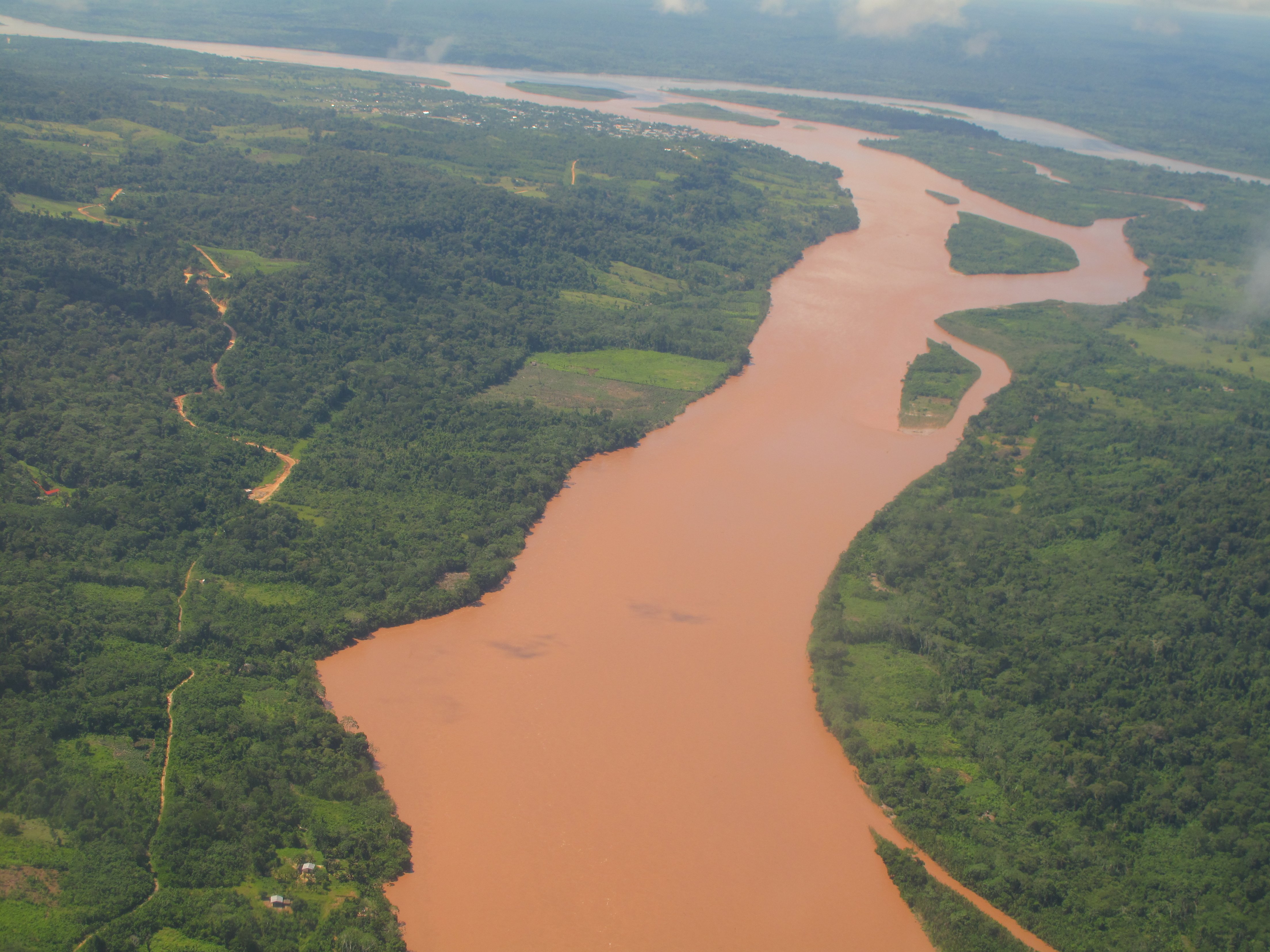
English: Aerial view of the confluence of the Río Tambo (from bottom to top) and the Río Urubamba (in the background, from right to left) forming the Río Ucayali (left). The city at the confluence is Atalaya in the Peruvian Region of Ucayali.
Deutsch: Luftbild des Zusammenflusses des Río Tambo (im Bild von vorne nach hinten fliessend) und des Río Urubamba (von rechts nach links) bei Atalaya (Ucayali, Peru). Der vereinte Fluss heisst von hier weg Ucayali (nach links fliessend).
Español: Vista aérea de la confluencia de los Ríos Tambo (delante) y Urubamba (derecha, al fondo) cerca de la ciudad de Atalaya (Región Ucayali, Perú), formando el Río Ucayali. |
| תאריך יצירה | |
| מקור | נוצר על־ידי מעלה היצירה |
| יוצר | Maurice Chédel |
רישיון
[עריכה]_Rios_Tambo%2BUcayali.jpg&action=edit§ion=2)
| ברצוני, בעלי זכויות היוצרים על יצירה זו, לשחרר יצירה זו לנחלת הכלל. זה תקף בכל העולם. יש מדינות שבהן הדבר אינו אפשרי על פי חוק, אם כך: אני מעניק לכל אחד את הזכות להשתמש בעבודה זו לכל מטרה שהיא, ללא תנאים כלשהם, אלא אם כן תנאים כאלה נדרשים על פי חוק. |
היסטוריית הקובץ
ניתן ללחוץ על תאריך/שעה כדי לראות את הקובץ כפי שנראה באותו זמן.
| תאריך/שעה | תמונה ממוזערת | ממדים | משתמש | הערה | |
|---|---|---|---|---|---|
| נוכחית | 12:19, 12 באפריל 2010 | | 3,312 × 4,416 (1.76 מ"ב) | Altiplano (שיחה | תרומות) | {{Information |Description={{en|1=Aerial view of the confluence of the Río Tambo (from bottom to top) and the Río Urubamba (in the background, from right to left) forming the Río Ucayali (left). The city at the confluence is Atalaya in the Peruvian Reg |
אין באפשרותך לדרוס את הקובץ הזה.
שימוש בקובץ
הדפים הבאים משתמשים בקובץ הזה:
שימוש גלובלי בקובץ
אתרי הוויקי השונים הבאים משתמשים בקובץ זה:
- שימוש באתר af.wikipedia.org
- שימוש באתר ar.wikipedia.org
- שימוש באתר arz.wikipedia.org
- שימוש באתר ast.wikipedia.org
- שימוש באתר ay.wikipedia.org
- שימוש באתר be.wikipedia.org
- שימוש באתר bg.wikipedia.org
- שימוש באתר bn.wikipedia.org
- שימוש באתר bs.wikipedia.org
- שימוש באתר ca.wikipedia.org
- שימוש באתר ceb.wikipedia.org
- שימוש באתר cv.wikipedia.org
- שימוש באתר de.wikipedia.org
- שימוש באתר en.wikipedia.org
- שימוש באתר eo.wikipedia.org
- שימוש באתר es.wikipedia.org
- שימוש באתר eu.wikipedia.org
- שימוש באתר fa.wikipedia.org
- שימוש באתר fr.wikipedia.org
- שימוש באתר fr.wikivoyage.org
- שימוש באתר gl.wikipedia.org
- שימוש באתר he.wikipedia.org
- שימוש באתר hr.wikipedia.org
- שימוש באתר hu.wikipedia.org
- שימוש באתר hy.wikipedia.org
- שימוש באתר id.wikipedia.org
- שימוש באתר it.wikipedia.org
- שימוש באתר ja.wikipedia.org
- שימוש באתר kk.wikipedia.org
- שימוש באתר lt.wikipedia.org
- שימוש באתר ml.wikipedia.org
צפייה בשימושים גלובליים נוספים של קובץ זה.
_Rios_Tambo%2BUcayali.jpg)
_Rios_Tambo%2BUcayali.jpg&oldid=806049818)