File:Austrian Empire (1815).svg
둘러보기로 이동
검색으로 이동

SVG 파일의 PNG 형식의 미리보기 크기: 450 × 456 픽셀. 다른 해상도: 237 × 240 픽셀 | 474 × 480 픽셀 | 758 × 768 픽셀 | 1,011 × 1,024 픽셀 | 2,021 × 2,048 픽셀
원본 파일 (SVG 파일, 실제 크기 450 × 456 픽셀, 파일 크기: 691 KB)
캡션
설명
이 파일이 나타내는 바에 대한 한 줄 설명을 추가합니다
파일 설명
[편집]


.svg)
.svg)
.svg)
.svg)
.svg)


.svg)
.svg)
.svg)


.png)
.png)


.svg)


.svg)

.svg)


.svg)
.svg)
.svg)
.svg)


.svg)
.png)


.svg)


.svg)
.svg)


.svg)


.svg)


.svg&action=edit§ion=1)
.svg)
.svg)
.svg)
.svg)
.svg)
.svg)
.svg)
_cropped.svg)
.svg)
.svg)
.svg)
.svg)
.svg)
.svg)
.svg)
.svg)
.svg)
.svg)
.svg)
.svg)
.svg)
.svg)
.svg)
.svg)
.svg)
.svg)
.svg)
.svg)
.svg)
.svg)
.svg)
.svg)
.svg)
.svg)
.svg)
.svg)
.svg)
.svg)
.svg)
.svg)
.svg)
.svg)
.svg)
.svg)
.svg)
.svg)
.svg)
.svg)
.svg)
.svg)
.svg)
.svg)
.svg)
파일 역사
날짜/시간 링크를 클릭하면 해당 시간의 파일을 볼 수 있습니다.
| 날짜/시간 | 섬네일 | 크기 | 사용자 | 설명 | |
|---|---|---|---|---|---|
| 현재 | 2019년 4월 16일 (화) 09:58 | | 450 × 456 (691 KB) | TRAJAN 117 (토론 | 기여) | +++ |
| 2013년 8월 12일 (월) 21:20 |  | 450 × 456 (654 KB) | TRAJAN 117 (토론 | 기여) | Update | |
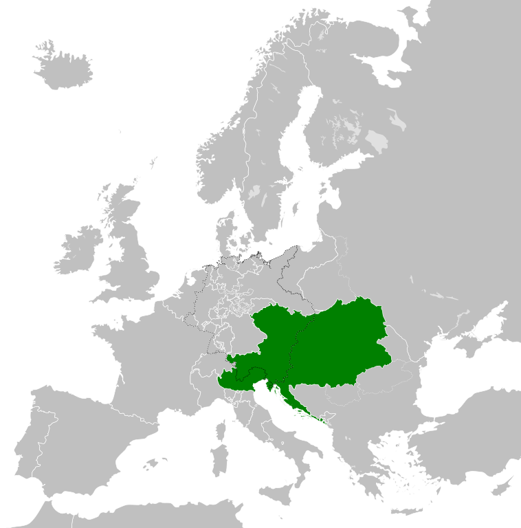
| 2013년 8월 12일 (월) 05:47 |  | 450 × 456 (1 MB) | TRAJAN 117 (토론 | 기여) | {{Information |Description ={{en|1=The Austrian Empire in 1815.}} |Source ={{own}} {{AttribSVG|Blank map of Europe 1815.svg|Alphathon}} |Author =TRAJAN 117 {{created with Inkscape}} |Date =2013-08-12 |Pe... |
이 파일을 덮어쓸 수 없습니다.
이 파일을 사용하는 문서
100개 이상의 문서가 이 파일을 사용하고 있습니다. 다음 목록은 이 파일을 사용하는 처음 문서 100개만 보여주고 있습니다. 이 파일을 사용하는 모든 문서 목록을 볼 수 있습니다.
.svg)
- User:Alphathon/Historical Europe
- File:Albania 1956-1990.svg
- File:Albanian Kingdom (1935).svg
- File:Albanian Kingdom (1939).svg
- File:Austro-Hungarian Monarchy (1914).svg
- File:Blank map of Europe 1812.svg
- File:Blank map of Europe 1890.svg
- File:Blank map of Europe 1914.svg
- File:Blank map of Europe 1929-1938.svg
- File:Blank map of Europe 1956-1990.svg
- File:Blank map of Europe October 1938 - March 1939.svg
- File:Bulgaria 1956-1990.svg
- File:Confederation of the Rhine (1812).svg
- File:Czechoslovakia 1956–1990.svg
- File:East Germany 1956-1990.svg
- File:First French Empire 1812.svg
- File:Free City Danzig 1930.svg
- File:German Empire 1914.svg
- File:Hellenic Republic (1935).svg
- File:Hungary 1956-1990.svg
- File:InterwarCentralEurope.png
- File:Kingdom of Bulgaria (1914).svg
- File:Kingdom of Greece (1890).svg
- File:Kingdom of Greece (1914).svg
- File:Kingdom of Greece (1973).svg
- File:Kingdom of Italy (Napoleonic).svg
- File:Kingdom of Montenegro (1914).svg
- File:Kingdom of Serbia (1890).svg
- File:Kingdom of Serbia (1914).svg
- File:Map of the Republic of Serbia (2006–2008).svg
- File:Poland 1930.svg
- File:Poland 1956-1990.svg
- File:Prince-Bishopric of Montenegro (1812).svg
- File:Principality of Albania (1914).svg
- File:Principality of Bulgaria (1890).svg
- File:Principality of Montenegro (1890).svg
- File:Republic of Montenegro (2006).svg
- File:Romania 1956-1990.svg
- File:Territory of the Serbian Uprising (1812).svg
- File:Voivodeship of Moldavia (1812).svg
- File:Voivodeship of Wallachia (1812).svg
- File:Weimar Republic 1930.svg
- File:West Germany 1956-1990.svg
- File:Yugoslavia 1956-1990.svg
- Category:1804 in Austria
- Category:1806 in Austria
- Category:1811 in Austria
- Category:1812 in Austria
- Category:1813 in Austria
- Category:1815 in Austria
- Category:1817 in Austria
- Category:1818 in Austria
- Category:1819 in Austria
- Category:1820 in Austria
- Category:1821 in Austria
- Category:1822 in Austria
- Category:1823 in Austria
- Category:1824 in Austria
- Category:1825 in Austria
- Category:1826 in Austria
- Category:1827 in Austria
- Category:1828 in Austria
- Category:1829 in Austria
- Category:1830 in Austria
- Category:1831 in Austria
- Category:1832 in Austria
- Category:1833 in Austria
- Category:1835 in Austria
- Category:1836 in Austria
- Category:1837 in Austria
- Category:1838 in Austria
- Category:1839 in Austria
- Category:1840 in Austria
- Category:1841 in Austria
- Category:1842 in Austria
- Category:1843 in Austria
- Category:1844 in Austria
- Category:1845 in Austria
- Category:1846 in Austria
- Category:1847 in Austria
- Category:1848 in Austria
- Category:1849 in Austria
- Category:1850 in Austria
- Category:1851 in Austria
- Category:1852 in Austria
- Category:1853 in Austria
- Category:1854 in Austria
- Category:1855 in Austria
- Category:1856 in Austria
- Category:1857 in Austria
- Category:1858 in Austria
- Category:1859 in Austria
- Category:1860 in Austria
- Category:1861 in Austria
- Category:1862 in Austria
- Category:1863 in Austria
- Category:1864 in Austria
- Category:1865 in Austria
- Category:1866 in Austria
- Category:1867 in Austria
.svg)
.svg)
.svg)
.svg)
이 파일이 쓰이고 있는 문서 목록 더 보기.
이 파일을 사용하고 있는 모든 위키의 문서 목록
다음 위키에서 이 파일을 사용하고 있습니다:
- af.wikipedia.org에서 이 파일을 사용하고 있는 문서 목록
- ast.wikipedia.org에서 이 파일을 사용하고 있는 문서 목록
- azb.wikipedia.org에서 이 파일을 사용하고 있는 문서 목록
- ba.wikipedia.org에서 이 파일을 사용하고 있는 문서 목록
- bg.wikipedia.org에서 이 파일을 사용하고 있는 문서 목록
- br.wikipedia.org에서 이 파일을 사용하고 있는 문서 목록
- ce.wikipedia.org에서 이 파일을 사용하고 있는 문서 목록
- cs.wikipedia.org에서 이 파일을 사용하고 있는 문서 목록
- cy.wikipedia.org에서 이 파일을 사용하고 있는 문서 목록
- de.wikipedia.org에서 이 파일을 사용하고 있는 문서 목록
- el.wikipedia.org에서 이 파일을 사용하고 있는 문서 목록
- en.wikipedia.org에서 이 파일을 사용하고 있는 문서 목록
- es.wikipedia.org에서 이 파일을 사용하고 있는 문서 목록
- fi.wikipedia.org에서 이 파일을 사용하고 있는 문서 목록
- frr.wikipedia.org에서 이 파일을 사용하고 있는 문서 목록
- fr.wikipedia.org에서 이 파일을 사용하고 있는 문서 목록
- ga.wikipedia.org에서 이 파일을 사용하고 있는 문서 목록
- gd.wikipedia.org에서 이 파일을 사용하고 있는 문서 목록
- gl.wikipedia.org에서 이 파일을 사용하고 있는 문서 목록
- he.wikipedia.org에서 이 파일을 사용하고 있는 문서 목록
- hi.wikipedia.org에서 이 파일을 사용하고 있는 문서 목록
- hr.wikipedia.org에서 이 파일을 사용하고 있는 문서 목록
- hy.wikipedia.org에서 이 파일을 사용하고 있는 문서 목록
- id.wikipedia.org에서 이 파일을 사용하고 있는 문서 목록
- id.wikibooks.org에서 이 파일을 사용하고 있는 문서 목록
- incubator.wikimedia.org에서 이 파일을 사용하고 있는 문서 목록
- is.wikipedia.org에서 이 파일을 사용하고 있는 문서 목록
- it.wikipedia.org에서 이 파일을 사용하고 있는 문서 목록
- jam.wikipedia.org에서 이 파일을 사용하고 있는 문서 목록
- ja.wikipedia.org에서 이 파일을 사용하고 있는 문서 목록
- ka.wikipedia.org에서 이 파일을 사용하고 있는 문서 목록
- km.wikipedia.org에서 이 파일을 사용하고 있는 문서 목록
- ko.wikipedia.org에서 이 파일을 사용하고 있는 문서 목록
- ky.wikipedia.org에서 이 파일을 사용하고 있는 문서 목록
- lmo.wikipedia.org에서 이 파일을 사용하고 있는 문서 목록
- lt.wikipedia.org에서 이 파일을 사용하고 있는 문서 목록
- lv.wikipedia.org에서 이 파일을 사용하고 있는 문서 목록
- mk.wikipedia.org에서 이 파일을 사용하고 있는 문서 목록
- mn.wikipedia.org에서 이 파일을 사용하고 있는 문서 목록
- nap.wikipedia.org에서 이 파일을 사용하고 있는 문서 목록
- nl.wikipedia.org에서 이 파일을 사용하고 있는 문서 목록
이 파일의 더 많은 사용 내역을 봅니다.
.svg)
.svg&oldid=808283217)