File:Azerbaijan location map.svg
둘러보기로 이동
검색으로 이동

SVG 파일의 PNG 형식의 미리보기 크기: 512 × 392 픽셀. 다른 해상도: 314 × 240 픽셀 | 627 × 480 픽셀 | 1,003 × 768 픽셀 | 1,280 × 980 픽셀 | 2,560 × 1,960 픽셀
원본 파일 (SVG 파일, 실제 크기 512 × 392 픽셀, 파일 크기: 156 KB)
캡션
설명
이 파일이 나타내는 바에 대한 한 줄 설명을 추가합니다
파일 설명[편집]
| 설명 |
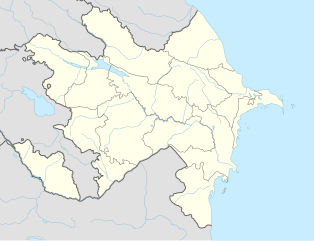
English: Location map of Azerbaijan. Borders of 1994-2020
Equirectangular projection. Strechted by 131.0%. Geographic limits of the map: * N: 42.0° N * S: 38.2° N * W: 44.5° E * E: 51.0° EMade with Natural Earth. Free vector and raster map data @ naturalearthdata.com. |
| 날짜 | |
| 출처 | 자작 |
| 저자 | Uwe Dedering, Don-kun |
| 다른 버전 |
|


라이선스[편집]
나는 아래 작품의 저작권자로서, 이 저작물을 다음과 같은 라이선스로 배포합니다:
이 파일은 크리에이티브 커먼즈 저작자표시-동일조건변경허락 3.0 Unported 라이선스로 배포됩니다.
- 이용자는 다음의 권리를 갖습니다:
- 공유 및 이용 – 저작물의 복제, 배포, 전시, 공연 및 공중송신
- 재창작 – 저작물의 개작, 수정, 2차적저작물 창작
- 다음과 같은 조건을 따라야 합니다:
- 저작자표시 – 적절한 저작자 표시를 제공하고, 라이센스에 대한 링크를 제공하고, 변경사항이 있는지를 표시해야 합니다. 당신은 합리적인 방식으로 표시할 수 있지만, 어떤 방식으로든 사용권 허가자가 당신 또는 당신의 사용을 지지하는 방식으로 표시할 수 없습니다.
- 동일조건변경허락 – 만약 당신이 이 저작물을 리믹스 또는 변형하거나 이 저작물을 기반으로 제작하는 경우, 당신은 당신의 기여물을 원저작물과 동일하거나 호환 가능한 라이선스에 따라 배포하여야 합니다.

|
GNU 자유 문서 사용 허가서 1.2판 또는 자유 소프트웨어 재단에서 발행한 이후 판의 규정에 따라 본 문서를 복제하거나 개작 및 배포할 수 있습니다. 본 문서에는 변경 불가 부분이 없으며, 앞 표지 구절과 뒷 표지 구절도 없습니다. 본 사용 허가서의 전체 내용은 GNU 자유 문서 사용 허가서 부분에 포함되어 있습니다. |
이 라이선스 중에서 목적에 맞는 것을 선택하여 사용할 수 있습니다.
파일 역사
날짜/시간 링크를 클릭하면 해당 시간의 파일을 볼 수 있습니다.
| 날짜/시간 | 섬네일 | 크기 | 사용자 | 설명 | |
|---|---|---|---|---|---|
| 현재 | 2024년 1월 10일 (수) 16:48 | | 512 × 392 (156 KB) | Janitoalevic (토론 | 기여) | Economic Regions |
| 2016년 5월 5일 (목) 08:09 |  | 1,200 × 919 (227 KB) | Rs4815 (토론 | 기여) | Reverted to version as of 16:20, 21 April 2016 (UTC) | |
| 2016년 5월 3일 (화) 22:22 |  | 1,200 × 919 (217 KB) | Taron Saharyan (토론 | 기여) | нет достоверных данных, вы переместили границу на 1 км. чуть ли не по всей линии, это бред | |
| 2016년 4월 21일 (목) 16:20 |  | 1,200 × 919 (227 KB) | Don-kun (토론 | 기여) | fix karabakh border | |
| 2016년 4월 17일 (일) 09:46 |  | 1,200 × 919 (227 KB) | Don-kun (토론 | 기여) | fix border to karabakh | |
| 2016년 4월 13일 (수) 16:46 |  | 1,200 × 919 (217 KB) | Don-kun (토론 | 기여) | Jojug Marjanli now to Azerbaijan (region seemed to be a bit wrong before ...) and tried to fix some other parts of NKR-AZ-Border | |
| 2010년 6월 7일 (월) 19:43 |  | 1,200 × 919 (217 KB) | Don-kun (토론 | 기여) | correct borders of rayons; hole area under karabakh control, not the former Nagorno-Karabakh Autonomous Oblast | |
| 2010년 2월 19일 (금) 13:11 |  | 1,200 × 919 (244 KB) | Uwe Dedering (토론 | 기여) | Nagorno-Karabakh not grey, but visible | |
| 2010년 2월 18일 (목) 17:58 |  | 1,200 × 919 (244 KB) | Uwe Dedering (토론 | 기여) | but really with dagestan | |
| 2010년 2월 18일 (목) 17:42 |  | 1,200 × 919 (233 KB) | Uwe Dedering (토론 | 기여) | Dagestan and parts of Armenia saved from drowning, Nagorno-Karabakh now under the region-borders. |
이 파일을 덮어쓸 수 없습니다.
이 파일을 사용하는 문서
100개 이상의 문서가 이 파일을 사용하고 있습니다. 다음 목록은 이 파일을 사용하는 처음 문서 100개만 보여주고 있습니다. 이 파일을 사용하는 모든 문서 목록을 볼 수 있습니다.
- File:Abkhazia in Europe (de-facto).svg
- File:Abkhazia in Europe (de-facto) (-rivers -mini map).svg
- File:Akrotiri and Dhekelia in Europe.svg
- File:Akrotiri and Dhekelia in Europe (-rivers -mini map).svg
- File:Aland in Europe.svg
- File:Aland in Europe (-rivers -mini map).svg
- File:Albania in Europe.svg
- File:Albania in Europe (-rivers -mini map).svg
- File:Andorra in Europe.svg
- File:Andorra in Europe (-rivers -mini map).svg
- File:Armenia in Europe.svg
- File:Armenia in Europe (-rivers -mini map).svg
- File:Artsakh in Europe.svg
- File:Austria in Europe.svg
- File:Austria in Europe (-rivers -mini map).svg
- File:Austria in European Union.svg
- File:Azerbaijan in Europe.svg
- File:Azerbaijan in Europe (-rivers -mini map).svg
- File:Azerbaijan relief location map.jpg
- File:Belarus in Europe.svg
- File:Belarus in Europe (-rivers -mini map).svg
- File:Belgium in Europe.svg
- File:Belgium in Europe (-rivers -mini map).svg
- File:Bosnia and Herzegovina in Europe.svg
- File:Bosnia and Herzegovina in Europe (-rivers -mini map).svg
- File:Bulgaria in Europe.svg
- File:Bulgaria in Europe (-rivers -mini map).svg
- File:Croatia in Europe.svg
- File:Croatia in Europe (-rivers -mini map).svg
- File:Cyprus in Europe.svg
- File:Cyprus in Europe (-rivers -mini map).svg
- File:Cyprus in Europe (de-facto).svg
- File:Cyprus in Europe (de-facto) (-rivers -mini map).svg
- File:Czech Republic in Europe.svg
- File:Czech Republic in Europe (-rivers -mini map).svg
- File:Denmark in Europe.svg
- File:Denmark in Europe (-rivers -mini map).svg
- File:Estonia in Europe.svg
- File:Estonia in Europe (-rivers -mini map).svg
- File:Faroe Islands in Europe.svg
- File:Faroe Islands in Europe (-rivers -mini map).svg
- File:Finland in Europe.svg
- File:Finland in Europe (-rivers -mini map).svg
- File:France in Europe.svg
- File:France in Europe (-rivers -mini map).svg
- File:France in Europe (relief).svg
- File:Georgia in Europe.svg
- File:Georgia in Europe (-rivers -mini map).svg
- File:Georgia in Europe (de-facto).svg
- File:Georgia in Europe (de-facto) (-rivers -mini map).svg
- File:Germany in Europe.svg
- File:Germany in Europe (-rivers -mini map).svg
- File:Gibraltar in Europe.svg
- File:Gibraltar in Europe (-rivers -mini map).svg
- File:Greece in Europe.svg
- File:Greece in Europe (-rivers -mini map).svg
- File:Guernsey in Europe.svg
- File:Guernsey in Europe (-rivers -mini map).svg
- File:Hungary in Europe.svg
- File:Hungary in Europe (-rivers -mini map).svg
- File:Iceland in Europe.svg
- File:Ireland in Europe.svg
- File:Isle of Man in Europe.svg
- File:Italy in Europe.svg
- File:Jersey in Europe.svg
- File:Kazakhstan in Europe.svg
- File:Kingdom of Denmark in Europe.svg
- File:Kosovo in Europe (de-facto).svg
- File:Latvia in Europe.svg
- File:Liechtenstein in Europe.svg
- File:Lithuania in Europe.svg
- File:Luxembourg in Europe.svg
- File:Luxembourg in Europe (special marker).svg
- File:Macedonia in Europe.svg
- File:Malta in Europe.svg
- File:Moldova in Europe.svg
- File:Monaco in Europe.svg
- File:Montenegro in Europe.svg
- File:Netherlands in Europe.svg
- File:Northern Cyprus in Europe (de-facto).svg
- File:Norway in Europe.svg
- File:Poland in Europe.svg
- File:Portugal in Europe.svg
- File:Romania in Europe.svg
- File:Russia in Europe.svg
- File:San Marino in Europe.svg
- File:Serbia in Europe.svg
- File:Serbia in Europe (de-facto).svg
- File:Slovakia in Europe.svg
- File:Slovenia in Europe.svg
- File:South Ossetia in Europe (de-facto).svg
- File:Spain in Europe.svg
- File:Sweden in Europe.svg
- File:Switzerland in Europe.svg
- File:Transnistria in Europe.svg
- File:Transnistria in Europe (special marker).svg
- File:Turkey in Europe.svg
- File:Ukraine in Europe.svg
- File:United Kingdom in Europe.svg
- File:United Kingdom in Europe (wo crown dependencies).svg
.svg)
_(-rivers_-mini_map).svg)
.svg)
.svg)
.svg)
.svg)
.svg)
.svg)
.svg)
.svg)
.svg)
.svg)
.svg)
.svg)
.svg)
.svg)
_(-rivers_-mini_map).svg)
.svg)
.svg)
.svg)
.svg)
.svg)
.svg)
.svg)
.svg)
.svg)
_(-rivers_-mini_map).svg)
.svg)
.svg)
.svg)
.svg)
.svg)
.svg)
.svg)
.svg)
.svg)
.svg)
.svg)
.svg)
이 파일이 쓰이고 있는 문서 목록 더 보기.
이 파일을 사용하고 있는 모든 위키의 문서 목록
다음 위키에서 이 파일을 사용하고 있습니다:
- bn.wikipedia.org에서 이 파일을 사용하고 있는 문서 목록
- ckb.wikipedia.org에서 이 파일을 사용하고 있는 문서 목록
- de.wikipedia.org에서 이 파일을 사용하고 있는 문서 목록
- fy.wikipedia.org에서 이 파일을 사용하고 있는 문서 목록
- he.wikipedia.org에서 이 파일을 사용하고 있는 문서 목록