File:Barcelona - planol ciutat vella 1860.jpg
קפיצה לניווט
קפיצה לחיפוש
גודל התצוגה המקדימה הזאת: 800 × 533 פיקסלים. רזולוציות אחרות: 320 × 213 פיקסלים | 640 × 427 פיקסלים | 1,024 × 683 פיקסלים | 1,280 × 853 פיקסלים | 1,536 × 1,024 פיקסלים.
לקובץ המקורי (1,536 × 1,024 פיקסלים, גודל הקובץ: 841 ק"ב, סוג MIME: image/jpeg)
כיתובים
כיתובים
נא להוסיף משפט שמסביר מה הקובץ מייצג
|
יצירה זו נמצאת בנחלת הכלל במדינת המקור ובמדינות אחרות בהם תקופת זכויות היוצרים היא משך חיי היוצר ו-100 שנה (או פחות) מפטירתו.
This work is in the public domain in the United States because it was published (or registered with the U.S. Copyright Office) before January 1, 1929. | |
| הקובץ הזה זוהה כקובץ חופשי מכל מגבלה ידועה תחת חוק זכויות היוצרים, כולל כל הזכויות הקשורות והסמוכות. | |
היסטוריית הקובץ
ניתן ללחוץ על תאריך/שעה כדי לראות את הקובץ כפי שנראה באותו זמן.
| תאריך/שעה | תמונה ממוזערת | ממדים | משתמש | הערה | |
|---|---|---|---|---|---|
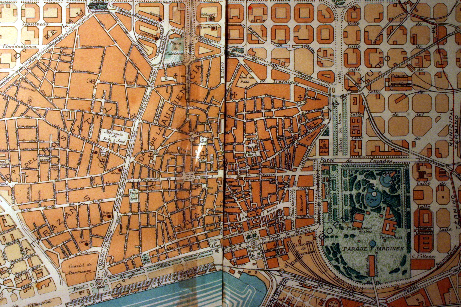
| נוכחית | 05:57, 15 במרץ 2008 | | 1,024 × 1,536 (841 ק"ב) | Amadalvarez (שיחה | תרומות) | {{Information |Description=Plànol del Ciutat Vella (Barcelona). 1860 |Source=Barcelona original map, 1860. |Date=2006 |Author= Amadalvarez |Permission=see below |other_versions= }} Category:Maps of Barcelona |
אין באפשרותך לדרוס את הקובץ הזה.
שימוש בקובץ
אין דפים המשתמשים בקובץ זה.
שימוש גלובלי בקובץ
אתרי הוויקי השונים הבאים משתמשים בקובץ זה:
- שימוש באתר ca.wikipedia.org
- שימוש באתר en.wikipedia.org
- שימוש באתר es.wikipedia.org
- שימוש באתר fr.wikipedia.org
- שימוש באתר he.wikipedia.org
- שימוש באתר pl.wikipedia.org
- שימוש באתר zh.wikipedia.org