File:Bernardino Olivieri, Carte generale dell'Africa 05-Congo (FL155322810 2497726).jpg
קפיצה לניווט
קפיצה לחיפוש

גודל התצוגה המקדימה הזאת: 734 × 600 פיקסלים. רזולוציות אחרות: 294 × 240 פיקסלים | 588 × 480 פיקסלים | 940 × 768 פיקסלים | 1,253 × 1,024 פיקסלים | 2,507 × 2,048 פיקסלים | 4,312 × 3,523 פיקסלים.
לקובץ המקורי (4,312 × 3,523 פיקסלים, גודל הקובץ: 8.5 מ"ב, סוג MIME: image/jpeg)
כיתובים
כיתובים
נא להוסיף משפט שמסביר מה הקובץ מייצג
תקציר
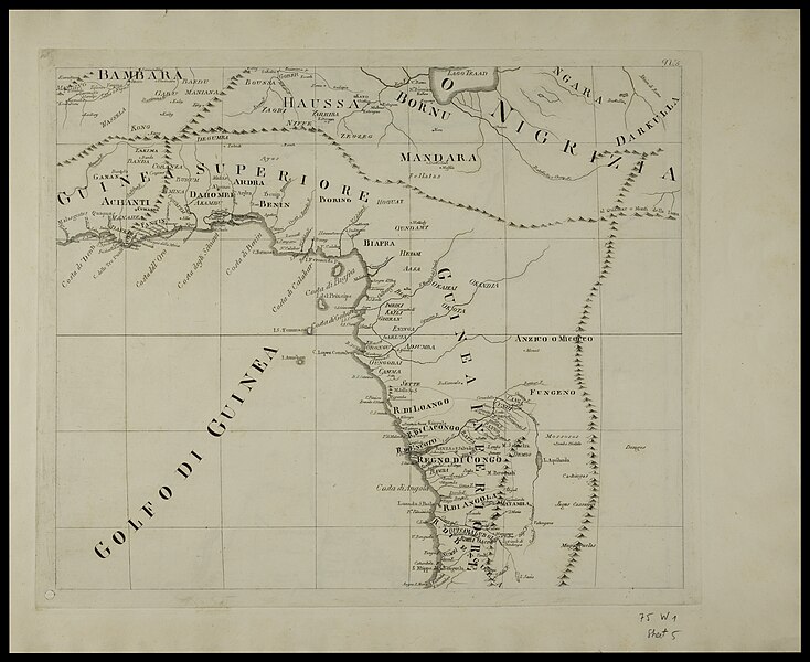
[עריכה]| Bernardino Olivieri: Carte generale dell'Africa
( |
||||||||||||||||||||||||
|---|---|---|---|---|---|---|---|---|---|---|---|---|---|---|---|---|---|---|---|---|---|---|---|---|
| אומן |
|
|||||||||||||||||||||||
| כותרת |
Carte generale dell'Africa |
|||||||||||||||||||||||
| מפרסם |
Presso la Calcografia Camerale |
|||||||||||||||||||||||
| תיאור |
Carte generale dell'Africa. delineata sulle ultime osservazioni e dietro le piu' recenti scoperte . D.Pietro Bonacorsi dire ; Bernardino Olivieri equindi Giovanni suc Figlio incis. |
|||||||||||||||||||||||
| שפה | צרפתית | |||||||||||||||||||||||
| תאריך הוצאה לאור | 1833 | |||||||||||||||||||||||
| טכניקה | 1 map on 9 sheets ; | |||||||||||||||||||||||
| ממדים | גובה: 44 ס"מ; רוחב: 59 ס"מ sheets | |||||||||||||||||||||||
| אוסף |
|
|||||||||||||||||||||||
| מיקום נוכחי |
|
|||||||||||||||||||||||
| מיקום הוצאה | רומא | |||||||||||||||||||||||
| חיפוש בקטלוג מרחב | רומא | |||||||||||||||||||||||
| הערות | Inset Carte particolar del basso e medio Egitto... | |||||||||||||||||||||||
| IE PID | IE155322798 | |||||||||||||||||||||||
| רוזטה שם קובץ | FL155322810 | |||||||||||||||||||||||
| מזהה רשומה בספרייה הלאומית (P3959) | 990024977260205171 | |||||||||||||||||||||||
| חיפוש בקטלוג מרחב | צרפתית, Bernardino Olivieri | |||||||||||||||||||||||
| חיפוש בקטלוג מרחב | Presso la Calcografia Camerale | |||||||||||||||||||||||
| מקור/צלם |
|
|||||||||||||||||||||||
| גרסאות אחרות | ||||||||||||||||||||||||
| Jpg / Tif version |
|
|||||||||||||||||||||||

.jpg)

.jpg&action=edit§ion=1)
רישיון
[עריכה].jpg&action=edit§ion=2)
The copyright situation of this work is theoretically uncertain, because in the country of origin copyright lasts 70 years after the death of the author, and the date of the author's death is unknown. However, the date of creation of the work was over 120 years ago, and it is thus a reasonable assumption that the copyright has expired (see here for the community discussion). Do not use this template if the date of death of the author is known.
| |
| הקובץ הזה זוהה כקובץ חופשי מכל מגבלה ידועה תחת חוק זכויות היוצרים, כולל כל הזכויות הקשורות והסמוכות. | |
היסטוריית הקובץ
ניתן ללחוץ על תאריך/שעה כדי לראות את הקובץ כפי שנראה באותו זמן.
| תאריך/שעה | תמונה ממוזערת | ממדים | משתמש | הערה | |
|---|---|---|---|---|---|
| נוכחית | 07:14, 4 באוגוסט 2023 | | 3,523 × 4,312 (8.5 מ"ב) | Geagea (שיחה | תרומות) | pattypan 22.03 |
אין באפשרותך לדרוס את הקובץ הזה.
שימוש בקובץ
הדפים הבאים משתמשים בקובץ הזה:
.jpg&oldid=822051939)