File:British Isles map showing UK, Republic of Ireland, and historic counties.svg
קפיצה לניווט
קפיצה לחיפוש

גודל התצוגה המקדימה הזאת מסוג PNG של קובץ ה־SVG הזה: 408 × 599 פיקסלים. רזולוציות אחרות: 163 × 240 פיקסלים | 327 × 480 פיקסלים | 523 × 768 פיקסלים | 697 × 1,024 פיקסלים | 1,395 × 2,048 פיקסלים | 1,250 × 1,835 פיקסלים.
לקובץ המקורי (קובץ SVG, הגודל המקורי: 1,250 × 1,835 פיקסלים, גודל הקובץ: 1,003 ק"ב)
כיתובים
כיתובים
נא להוסיף משפט שמסביר מה הקובץ מייצג
תקציר[עריכה]
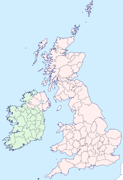
| תיאור | Map of the British Isles with counties |
| תאריך יצירה | |
| מקור | |
| יוצר | Visitor from Wikishire |
| אישורים והיתרים (שימוש חוזר בקובץ זה) |
הקובץ הזה מתפרסם לפי תנאי רישיון קריאייטיב קומונז ייחוס-שיתוף זהה 4.0 בין־לאומי. ייחוס: Wikishire
|
| SVGהתפתחות | . Inkscape עם נוצרה ה W3C-לא תקין גרפיקה וקטורית |
היסטוריית הקובץ
ניתן ללחוץ על תאריך/שעה כדי לראות את הקובץ כפי שנראה באותו זמן.
| תאריך/שעה | תמונה ממוזערת | ממדים | משתמש | הערה | |
|---|---|---|---|---|---|
| נוכחית | 19:35, 13 בספטמבר 2019 | | 1,835 × 1,250 (1,003 ק"ב) | Visitor from Wikishire (שיחה | תרומות) | Conformed colours to Hogweard's improvements |
| 22:32, 29 במאי 2015 |  | 1,835 × 1,250 (1,002 ק"ב) | Visitor from Wikishire (שיחה | תרומות) | Minor refinements & optional Yorkshire Ridings layer | |
| 21:53, 11 בינואר 2015 |  | 1,835 × 1,250 (933 ק"ב) | Visitor from Wikishire (שיחה | תרומות) | {{Information |Description=Map of the British Isles with counties |Source=*[http://wikishire.co.uk/vectormap/GBDefinitionA.svg Wikishire: Vector map GB Definition A] *Ireland and Ulster, counties.svg |Date=201... | |
| 22:30, 17 בנובמבר 2014 |  | 1,830 × 1,250 (910 ק"ב) | Visitor from Wikishire (שיחה | תרומות) | {{Information |Description=Map of the British Isles with counties |Source=*[http://wikishire.co.uk/vectormap/GBDefinitionA.svg] *Ireland and Ulster, counties.svg |Date=2014-11-17 |Author=[[:User:Visitor from W... |
אין באפשרותך לדרוס את הקובץ הזה.
שימוש בקובץ
הדפים הבאים משתמשים בקובץ הזה:
- File:Ayrshire.svg
- File:Banffshire County.svg
- File:Berwickshire County.svg
- File:British Isles in counties.svg (הפניה של קובץ)
- File:Buteshire - Scotland.svg
- File:Cromartyshire - Scotland.svg
- File:Dumfriesshire County.svg
- File:Galloway.svg
- File:Inverness-shire - Scotland.svg
- File:Kincardineshire - Scotland.svg
- File:Kirkcudbrightshire - Scotland.svg
- File:Lanarkshire - Scotland.svg
- File:Lothian County.svg
- File:Map of Oswald distribution in Scotland 1690-1800.jpg
- File:Morayshire - Scotland.svg
- File:Perthshire County.svg
- File:Ross-shire County.svg
- File:Roxburghshire - Scotland.svg
- File:Selkirkshire - Scotland.svg
- File:Stirlingshire - Scotland.svg
- File:Tweeddale.svg
- File:Wales Historic Counties map.svg
- File:Wales Historic Counties map Anglesey.svg
- File:Wales Historic Counties map Brecknockshire.svg
- File:Wales Historic Counties map Caernarfonshire.svg
- File:Wales Historic Counties map Cardiganshire.svg
- File:Wales Historic Counties map Carmarthenshire.svg
- File:Wales Historic Counties map Denbighshire.svg
- File:Wales Historic Counties map Flintshire.svg
- File:Wales Historic Counties map Glamorgan.svg
- File:Wales Historic Counties map Merionethshire.svg
- File:Wales Historic Counties map Monmouthshire.svg
- File:Wales Historic Counties map Montgomeryshire.svg
- File:Wales Historic Counties map Pembrokeshire.svg
- File:Wales Historic Counties map Radnorshire.svg
- File:Wigtownshire - Scotland.svg
שימוש גלובלי בקובץ
אתרי הוויקי השונים הבאים משתמשים בקובץ זה:
- שימוש באתר fr.wikipedia.org
- שימוש באתר ku.wikipedia.org
- Cornwall
- Surrey
- Glamorgan
- Devon
- Somerset
- Dorset
- Yorkshire
- Lancashire
- County Cork
- Cumberland
- Northumberland
- Westmorland
- Kent
- Suffolk
- Norfolk
- Rutland
- Hampshire
- Wiltshire
- Berkshire
- Middlesex
- Hertfordshire
- Buckinghamshire
- Oxfordshire
- Gloucestershire
- Herefordshire
- Worcestershire
- Warwickshire
- Northamptonshire
- Bedfordshire
- Cambridgeshire
- Huntingdonshire
- Leicestershire
- Nottinghamshire
- Derbyshire
- Staffordshire
- Cheshire
- County Durham
- Lincolnshire
- Shropshire
- Şablon:Parêzgehên Giravên Brîtanî
- Angus
- Morayshire
- West Lothian
- East Lothian
- Midlothian
- Anglesey
- Brecknockshire
- Caernarfonshire
- Cardiganshire
צפייה בשימושים גלובליים נוספים של קובץ זה.