File:Central America (orthographic projection).svg
둘러보기로 이동
검색으로 이동

SVG 파일의 PNG 형식의 미리보기 크기: 550 × 550 픽셀. 다른 해상도: 240 × 240 픽셀 | 480 × 480 픽셀 | 768 × 768 픽셀 | 1,024 × 1,024 픽셀 | 2,048 × 2,048 픽셀
원본 파일 (SVG 파일, 실제 크기 550 × 550 픽셀, 파일 크기: 354 KB)
캡션
설명
이 파일이 나타내는 바에 대한 한 줄 설명을 추가합니다
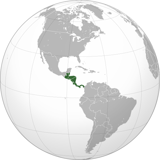
Central America (orthographic projection)
파일 설명[편집]
| 설명 |
English: Central America (orthographic projection) with colonial borders |
||||
| 날짜 | |||||
| 출처 |
자작 (Original text: Own work,)
|
||||
| 저자 | Heraldry | ||||
| 저작권 (이 파일을 인용하기) |
|
||||
| 다른 버전 |
.svg) |
||||
| SVG 발전 | 이 SVG 파일의 소스 코드를 295가지의 실수입니다. |

.svg)
.svg)
.svg)
.svg)
.svg)
.svg)
.svg)
.svg)
.svg)
.svg)
.svg)
.svg)
.svg)
.svg)
.svg)
.svg)
.svg)
.svg)
.svg)
.svg)
.svg)
.svg)
.svg)
.svg)
.svg)
.svg)
.svg)
.svg)
.svg)
.svg)
.svg)
.svg)
.svg)
.svg)
.svg)
.svg)
.svg)
.svg)
.svg)
.svg)
.svg)
.svg)
.svg)
.svg)
.svg)
.svg)
.svg)
.svg)
.svg)
.svg)
.svg)
.svg)
.svg)
.svg)
.svg)
.svg)
.svg)
.svg)
.svg)
.svg)
.svg)
.svg)
.svg)
.svg)
.svg)
.svg)
.svg)
.svg)
.svg)
.svg)
.svg)
.svg)
.svg)

.svg)

.svg)

.svg)
.svg)
.svg)
.svg)
.svg)
.svg)
.svg)


.svg)
.svg)
.svg)
.svg)
.svg)
.svg)
.svg)

.svg)
.svg)
.svg)
.svg)
.svg)
.svg)
.svg)
.svg)
.svg)
.svg)

.svg)
.svg)
.svg)
.svg)
.svg)
.svg)
.svg)
_without_national_boundaries.svg)
.svg)
.svg)
.svg)
.svg)
.svg)
.svg)

.svg)
.svg)
.png)
.svg)
.svg)
.svg)
.svg)

.svg)
.svg)
.svg)
.svg)
.svg)
.svg)
.svg)
.svg)
.svg)
.svg)
.svg)

.svg)
.svg)
.svg)
.svg)
.svg)
.svg)
.svg)
.svg)
.svg)

.svg)
.svg)

.svg)
.svg)
.svg)
.svg)
.svg)
.svg)
.svg)
.svg)
.svg)
.svg)
.svg)
.svg)
.svg)
.svg)
.svg)
.svg)
.svg)
.svg)
.svg)
.svg)
.svg)
.svg)
.svg)
.svg)
.svg)
.svg)
.svg)
_-_Crimea_disputed.svg)
.svg)
.svg)
.svg)
.svg)
.svg)
.svg)
.svg)
.svg)
.svg)
.svg)
.svg)
_political.svg)
.svg)
.svg)
.svg)
.svg)
_-_Crimea_disputed_-_no_borders.svg)
.svg)
.svg)
.svg)
.svg)
.svg)
.svg)
.svg)
.svg)
.svg)
.svg)
.svg)

.svg)
.svg)
.svg)

.png)
.svg)
.svg)
.svg)
.svg)
.svg)
.svg)
.svg)
.svg)
.svg)
.svg)
.svg)
.svg)
.svg)
.svg)
.svg)
.svg)
.svg)
.svg)
.svg)
.svg)
.svg)
.svg)
.svg)
.svg)
.svg)
.svg)
.svg)
.svg)
.svg)
.svg)
.svg)
.svg)
.svg)
.svg)
.png)
.svg)
.svg)
.svg)
_(orthographic_projection).png)
.svg&action=edit§ion=1)
.svg)
.svg)
.svg)
.svg)
라이선스[편집]
.svg&action=edit§ion=2)
나는 아래 작품의 저작권자로서, 이 저작물을 다음과 같은 라이선스로 배포합니다:

|
GNU 자유 문서 사용 허가서 1.2판 또는 자유 소프트웨어 재단에서 발행한 이후 판의 규정에 따라 본 문서를 복제하거나 개작 및 배포할 수 있습니다. 본 문서에는 변경 불가 부분이 없으며, 앞 표지 구절과 뒷 표지 구절도 없습니다. 본 사용 허가서의 전체 내용은 GNU 자유 문서 사용 허가서 부분에 포함되어 있습니다. |
| 이 파일은 크리에이티브 커먼즈 저작자표시-동일조건변경허락 3.0 Unported 라이선스로 배포됩니다. | ||
| ||
| 이 라이선스 틀은 GFDL 라이선스 변경의 일부로 이 파일에 추가되었습니다. |
파일 역사
날짜/시간 링크를 클릭하면 해당 시간의 파일을 볼 수 있습니다.
.svg&uselang=ko&dir=prev)
.svg&uselang=ko&offset=20090710081847)
.svg&uselang=ko&offset=&limit=20)
.svg&uselang=ko&offset=&limit=50)
.svg&uselang=ko&offset=&limit=100)
.svg&uselang=ko&offset=&limit=250)
.svg&uselang=ko&offset=&limit=500)
| 날짜/시간 | 섬네일 | 크기 | 사용자 | 설명 | |
|---|---|---|---|---|---|
| 현재 | 2023년 6월 29일 (목) 02:01 | | 550 × 550 (354 KB) | Avaflyne (토론 | 기여) | Reverted to version as of 05:29, 26 June 2023 (UTC) |
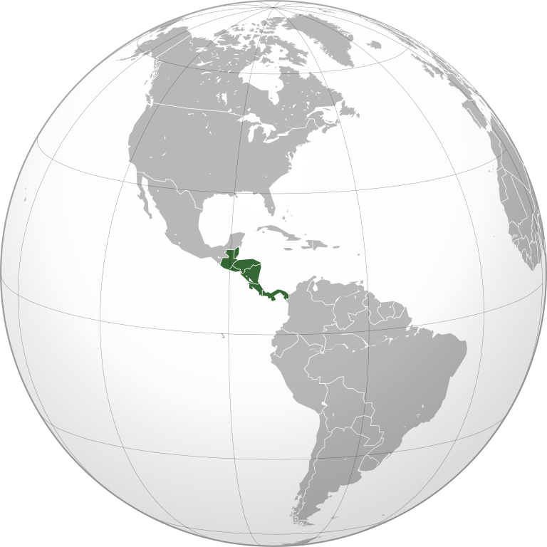
| 2023년 6월 26일 (월) 14:15 |  | 2,048 × 2,048 (391 KB) | HelpfulHens (토론 | 기여) | Mexico is part of Central America according the the United Nations | |
| 2023년 6월 26일 (월) 05:29 |  | 550 × 550 (354 KB) | Treetoes023 (토론 | 기여) | Reverted to version as of 15:04, 25 November 2009 (UTC) | |
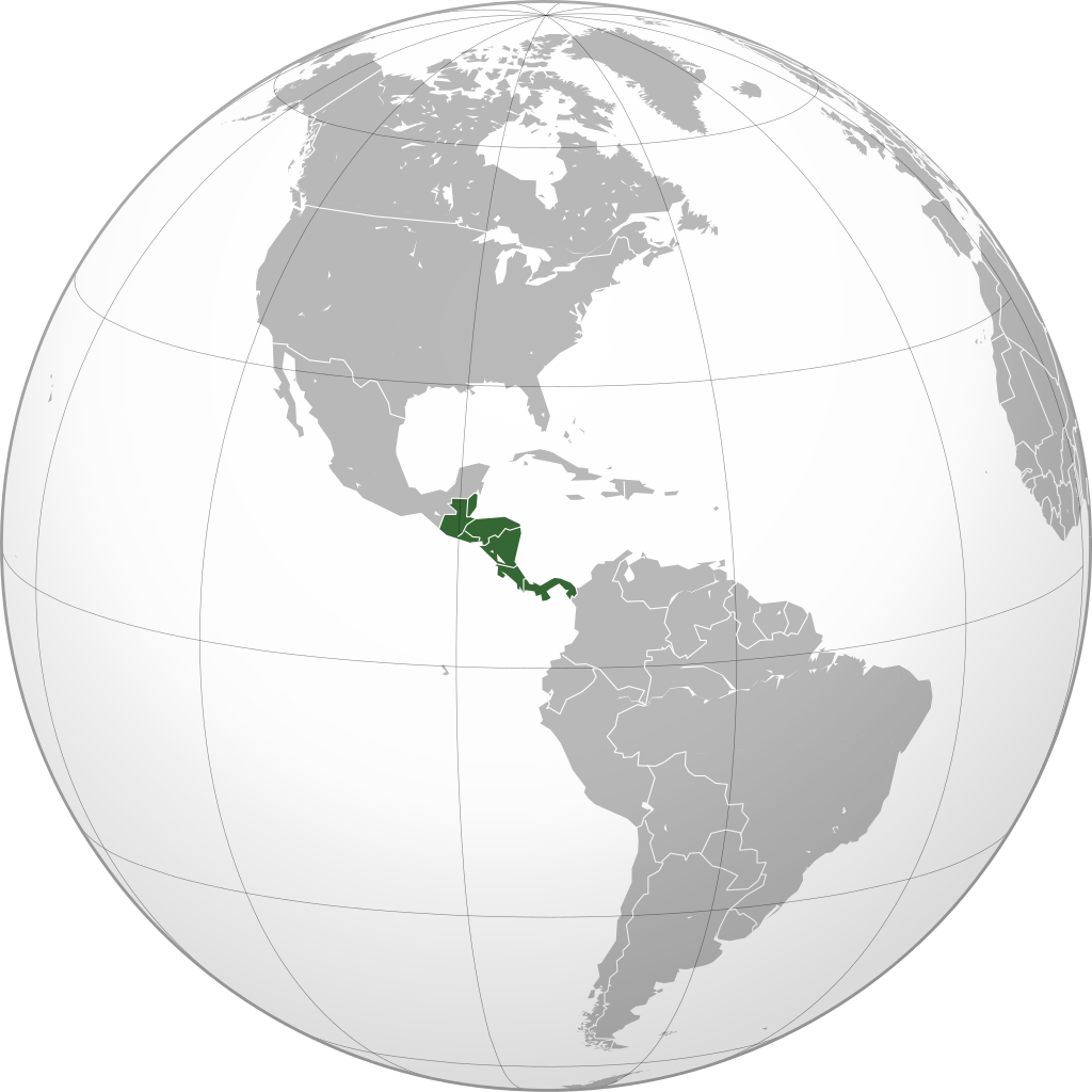
| 2023년 6월 25일 (일) 20:31 |  | 2,048 × 2,048 (391 KB) | HelpfulHens (토론 | 기여) | Removed Colombia and Venezuela | |
| 2023년 3월 13일 (월) 13:11 |  | 550 × 550 (354 KB) | LR0725 (토론 | 기여) | Reverted to version as of 15:04, 25 November 2009 (UTC) | |
| 2023년 3월 9일 (목) 22:26 |  | 600 × 600 (519 KB) | TBAG654321 (토론 | 기여) | Added Mexico | |
| 2009년 11월 25일 (수) 15:04 |  | 550 × 550 (354 KB) | Keepscases (토론 | 기여) | borders should be more intense | |
| 2009년 9월 7일 (월) 16:41 |  | 550 × 550 (354 KB) | TownDown (토론 | 기여) | sized according | |
| 2009년 7월 10일 (금) 08:32 |  | 541 × 541 (353 KB) | TownDown (토론 | 기여) | details | |
| 2009년 7월 10일 (금) 08:18 |  | 541 × 541 (354 KB) | TownDown (토론 | 기여) | focused |
이 파일을 덮어쓸 수 없습니다.
이 파일을 사용하는 문서
100개 이상의 문서가 이 파일을 사용하고 있습니다. 다음 목록은 이 파일을 사용하는 처음 문서 100개만 보여주고 있습니다. 이 파일을 사용하는 모든 문서 목록을 볼 수 있습니다.
.svg)
- Grey–green orthographic projections maps
- User:Heraldry/Central America
- User:Heraldry/Files
- User:Heraldry/Projections
- User:Ssolbergj/orthographic
- User:TownDown/Projections
- User:TownDown/Projections B
- File:ALBA (orthographic projection).png
- File:Africa (orthographic projection).svg
- File:African Union (orthographic projection).svg
- File:Almoravid map.svg
- File:America do Sul (orthographic projection).jpg
- File:Americas (orthographic projection).svg
- File:Andean Community (orthographic projection).svg
- File:Antarctica (orthographic projection).svg
- File:Antillas (orthographic projection).svg
- File:Arctic (orthographic projection).svg
- File:Argentina (orthographic projection).png
- File:Argentina (orthographic projection).svg
- File:Aridoamerica (orthographic projection).svg
- File:Asia (orthographic projection).svg
- File:Association of Southeast Asian Nations (orthographic projection).svg
- File:Australia-New Guinea (orthographic projection).svg
- File:Australia (orthographic projection).svg
- File:Australia map with outlying islands.svg
- File:Brazil (orthographic projection).svg
- File:Canada (orthographic projection).svg
- File:Central America (orthographic projection).svg
- File:Central Asia (orthographic projection).svg
- File:Chile (orthographic projection).svg
- File:Coat of arms of the Federal Republic of Central America.svg
- File:Coat of arms of the United Provinces of Central America.svg
- File:Colombia (orthographic projection).svg
- File:Dominion of Pakistan & Indian Controlled Kashmir (orthographic projection).svg
- File:East Asia (orthographic projection).svg
- File:Ecuador (orthographic projection).svg
- File:Europe (orthographic projection).svg
- File:European Union (orthographic projection).svg
- File:Federal Republic of Central America (orthographic projection).svg
- File:First Brazilian Empire (orthographic projection).svg
- File:First Mexican Empire (orthographic projection).svg
- File:Flag of British Honduras (1919–1981).svg
- File:Flag of Costa Rica (1838-1840).svg
- File:Flag of El Salvador (1839-1865).svg
- File:Flag of Guatemala (1838-1843).svg
- File:Flag of Guatemala (1839-1843).svg
- File:Flag of Honduras (1839-1866).svg
- File:Flag of Los Altos.svg
- File:Flag of Nicaragua (1839-1858).svg
- File:Flag of the Central American Integration System.svg
- File:Flag of the Federal Republic of Central America.svg
- File:Flag of the Province of Chiapas.svg
- File:Flag of the United Provinces of Central America.svg
- File:Georgia (orthographic projection).svg
- File:Global European Union.svg
- File:Great Colombia (orthographic projection).svg
- File:Greater Middle East (orthographic projection).svg
- File:ImagesCABL7B0A.jpg (파일 넘겨주기)
- File:India (orthographic projection).svg
- File:Indonesia (orthographic projection).svg
- File:Iran (orthographic projection).svg
- File:Iraq (orthographic projection).svg
- File:Japan (orthographic projection).svg
- File:Kazakhstan (orthographic projection).svg
- File:Latin America (orthographic projection).svg
- File:Latin Europe (orthographic projection).svg
- File:Logo of the Central American Integration System.svg
- File:Lusophone America (orthographic projection).svg
- File:MERCOSUR (orthographic projection).svg
- File:Madagascar (orthographic projection).svg
- File:Maghreb (orthographic projection).svg
- File:Malaysia (orthographic projection).svg
- File:Mesoamerica (orthographic projection) with borders.svg
- File:Mexico (orthographic projection).svg
- File:Mexico and Central America (orthographic projection).svg
- File:Middle East (orthographic projection).svg
- File:Mongolia (orthographic projection).svg
- File:New Spain (orthographic projection).svg
- File:New Zealand (orthographic projection).svg
- File:North Africa (orthographic projection).svg
- File:North America (orthographic projection).svg
- File:North American Agreement (orthographic projection).svg
- File:North Korea (orthographic projection).svg
- File:Paraguay (orthographic projection).svg
- File:People's Republic of China (orthographic projection).svg
- File:Peru (orthographic projection).svg
- File:Peru–Bolivia Confederation (orthographic projection).svg
- File:Philippines (orthographic projection).svg
- File:Republic of China (orthographic projection).svg
- File:Rio Group (orthographic projection).svg
- File:Roman Empire (orthographic projection).svg
- File:Russian Federation (orthographic projection).svg
- File:Second Mexican Empire (orthographic projection).svg
- File:South Asia (orthographic projection) without national boundaries.svg
- File:South Korea (orthographic projection).svg
- File:Third Reich (orthographic projection).svg
- File:Tunisia (orthographic projection).svg
- File:Turkey (orthographic projection).svg
- File:Union of South American Nations (orthographic projection).svg
- File:Union of Soviet Socialist Republics (orthographic projection).svg
.png)
.jpg)
.svg)
.svg)
.png)
.svg)
.svg)
.svg)
.svg)
.svg)
.svg)
.svg)
.svg)
.svg)
.svg)
.svg)
.svg)
.svg)
.svg)
_with_borders.svg)
.svg)
.svg)
.svg)
이 파일이 쓰이고 있는 문서 목록 더 보기.
이 파일을 사용하고 있는 모든 위키의 문서 목록
다음 위키에서 이 파일을 사용하고 있습니다:
- af.wikipedia.org에서 이 파일을 사용하고 있는 문서 목록
- am.wikipedia.org에서 이 파일을 사용하고 있는 문서 목록
- ar.wikipedia.org에서 이 파일을 사용하고 있는 문서 목록
- ar.wikinews.org에서 이 파일을 사용하고 있는 문서 목록
- be-tarask.wikipedia.org에서 이 파일을 사용하고 있는 문서 목록
- be.wikipedia.org에서 이 파일을 사용하고 있는 문서 목록
- bg.wikipedia.org에서 이 파일을 사용하고 있는 문서 목록
- bi.wikipedia.org에서 이 파일을 사용하고 있는 문서 목록
- bn.wikipedia.org에서 이 파일을 사용하고 있는 문서 목록
- br.wikipedia.org에서 이 파일을 사용하고 있는 문서 목록
- ceb.wikipedia.org에서 이 파일을 사용하고 있는 문서 목록
- co.wikimedia.org에서 이 파일을 사용하고 있는 문서 목록
- cs.wikipedia.org에서 이 파일을 사용하고 있는 문서 목록
- en.wikipedia.org에서 이 파일을 사용하고 있는 문서 목록
- Talk:Central America
- Wikipedia:Userboxes/Location
- Wikipedia:Userboxes/Location/Americas
- User:UdovdM
- San Sombrèro
- User:Buaidh
- Wikipedia:WikiProject Central America
- Template:User WikiProject Central America
- Category:Mammals of Central America
- Category:Birds of Central America
- Template:User WP El Salvador
- Wikipedia:Userboxes/Travel
- Category:WikiProject Central America participants
- Category:Jews and Judaism in Central America
- User:Buaidh/Test4
- Template:User interest Belize
- Template:User interest Belize/doc
- Template:User interest Costa Rica
- Template:User interest Costa Rica/doc
- Template:User interest El Salvador
- Template:User interest El Salvador/doc
- Template:User interest Guatemala
- Template:User interest Guatemala/doc
- Template:User interest Honduras
- Template:User interest Honduras/doc
- Template:User interest Nicaragua
이 파일의 더 많은 사용 내역을 봅니다.
.svg)
.svg&oldid=857979757)