File:Connecticut Presidential Election Results 2016.svg
קפיצה לניווט
קפיצה לחיפוש

גודל התצוגה המקדימה הזאת מסוג PNG של קובץ ה־SVG הזה: 156 × 127 פיקסלים. רזולוציות אחרות: 295 × 240 פיקסלים | 590 × 480 פיקסלים | 943 × 768 פיקסלים | 1,258 × 1,024 פיקסלים | 2,516 × 2,048 פיקסלים.
לקובץ המקורי (קובץ SVG, הגודל המקורי: 156 × 127 פיקסלים, גודל הקובץ: 5 ק"ב)
כיתובים
כיתובים
נא להוסיף משפט שמסביר מה הקובץ מייצג
תקציר
[עריכה]
| תיאור |
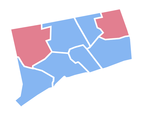
English: Connecticut Presidential Election Results 2016 |
| תאריך יצירה | |
| מקור | נוצר על־ידי מעלה היצירה |
| יוצר | Ali Zifan |
רישיון
[עריכה]
אני, בעל זכויות היוצרים על עבודה זו, מפרסם בזאת את העבודה תחת הרישיון הבא:
הקובץ הזה מתפרסם לפי תנאי רישיון קריאייטיב קומונז ייחוס-שיתוף זהה 4.0 בין־לאומי.
- הנכם רשאים:
- לשתף – להעתיק, להפיץ ולהעביר את העבודה
- לערבב בין עבודות – להתאים את העבודה
- תחת התנאים הבאים:
- ייחוס – יש לתת ייחוס הולם, לתת קישור לרישיון, ולציין אם נעשו שינויים. אפשר לעשות את זה בכל צורה סבירה, אבל לא בשום צורה שמשתמע ממנה שמעניק הרישיון תומך בך או בשימוש שלך.
- שיתוף זהה – אם תיצרו רמיקס, תשנו, או תבנו על החומר, חובה עליכם להפיץ את התרומות שלך לפי תנאי רישיון זהה או תואם למקור.
היסטוריית הקובץ
ניתן ללחוץ על תאריך/שעה כדי לראות את הקובץ כפי שנראה באותו זמן.
| תאריך/שעה | תמונה ממוזערת | ממדים | משתמש | הערה | |
|---|---|---|---|---|---|
| נוכחית | 22:08, 20 בפברואר 2017 | | 127 × 156 (5 ק"ב) | PalmerTheGolfer (שיחה | תרומות) | Reverted to version as of 21:01, 15 January 2017 (UTC) I'm just saying, there is no need for idiosyncratic county lines to be included while this map is : Not inaccurate, conforms to previous maps. |
| 22:08, 20 בפברואר 2017 |  | 127 × 156 (5 ק"ב) | PalmerTheGolfer (שיחה | תרומות) | Reverted to version as of 21:01, 15 January 2017 (UTC) I'm just saying, there is no need for idiosyncratic county lines to be included while this map is : Not inaccurate, conforms to previous maps. | |
| 01:31, 16 בינואר 2017 |  | 127 × 156 (9 ק"ב) | Kingofthedead (שיחה | תרומות) | Yes, however, there is no reason for consistency when this map form outlines the state more accurately than the previous one. | |
| 21:01, 15 בינואר 2017 |  | 127 × 156 (5 ק"ב) | PalmerTheGolfer (שיחה | תרומות) | Reverted to version as of 23:20, 9 November 2016 (UTC) While the current map may describe the idiosyncrasies of CT's counties more accurately, the form of the map does not conform to previous map forms, such as lining, as plenty of other states do not... | |
| 19:37, 28 בדצמבר 2016 |  | 127 × 156 (9 ק"ב) | Kingofthedead (שיחה | תרומות) | Reverted to version as of 05:52, 23 December 2016 (UTC) This map is not "tough to see" and is far more accurate. | |
| 02:42, 27 בדצמבר 2016 |  | 127 × 156 (6 ק"ב) | PalmerTheGolfer (שיחה | תרומות) | Reverted to version as of 03:24, 22 December 2016 (UTC) Why have a more rigid, tough to see map? | |
| 05:52, 23 בדצמבר 2016 |  | 127 × 156 (9 ק"ב) | Kingofthedead (שיחה | תרומות) | Reverted to version as of 18:43, 18 December 2016 (UTC) | |
| 03:24, 22 בדצמבר 2016 |  | 127 × 156 (6 ק"ב) | PalmerTheGolfer (שיחה | תרומות) | Reverted to version as of 19:12, 17 December 2016 (UTC) No need to make State more rigid, as previous elections have different maps | |
| 18:43, 18 בדצמבר 2016 |  | 127 × 156 (9 ק"ב) | WikiBunny2K1 (שיחה | תרומות) | Update shape | |
| 19:12, 17 בדצמבר 2016 |  | 127 × 156 (6 ק"ב) | WikiBunny2K1 (שיחה | תרומות) | Rotate |
אין באפשרותך לדרוס את הקובץ הזה.
שימוש בקובץ
הדפים הבאים משתמשים בקובץ הזה:
- User:Magog the Ogre/Political maps/2016 April 1-10
- User:Magog the Ogre/Political maps/2016 December 11-20
- User:Magog the Ogre/Political maps/2016 December 21-31
- User:Magog the Ogre/Political maps/2016 November 1-10
- User:Magog the Ogre/Political maps/2017 February 19-28
- User:Magog the Ogre/Political maps/2017 January 11-20
- User:Oganesson007/Contributions
- User:OgreBot/Watercraft/2016 December 17
- User:OgreBot/Watercraft/2016 December 18
- User:OgreBot/Watercraft/2016 December 22
- User:OgreBot/Watercraft/2016 December 23
- User:OgreBot/Watercraft/2016 December 27
- User:OgreBot/Watercraft/2016 December 28
- User:OgreBot/Watercraft/2017 January 16
- File:2016 Presidential Election by County.svg
- File:2016 Presidential Election by County (Red-Blue-Purple View).png
- File:2016 Presidential Election by County (Red-Blue-Purple View).svg
- File:2016 Presidential Election by County - Clinton.svg
- File:2016 Presidential Election by County - Trump.svg
- File:2016 Presidential Election by State - Clinton.svg
- File:2016 Presidential Election by State - Trump.svg
- File:2016 Presidential Election by Vote Distribution Among States.svg
- File:2016 United States presidential election - Percentage of votes cast for Gary Johnson by county.svg
- File:2016 United States presidential election results map by county.svg
- File:Cartogram—2016 Electoral Vote.svg
- File:ElectoralCollege2016.svg
- File:Results by state, shaded according to winning candidate's percentage of the vote 2016.svg
- File:U.S. 2012 to 2016 presidential election swing.svg
- File:U.S. 2012 to 2016 presidential election swing (relative).svg
- File:United States presidential election, 2016 Cartogram.png
- Template:United States presidential election maps, 2016
.png)
.svg)
.svg)
שימוש גלובלי בקובץ
אתרי הוויקי השונים הבאים משתמשים בקובץ זה:
- שימוש באתר fr.wikinews.org
- שימוש באתר pt.wikinews.org
- שימוש באתר simple.wikipedia.org