File:Former Yugoslavia Map.png
원본 파일 (3,280 × 2,398 픽셀, 파일 크기: 2.55 MB, MIME 종류: image/png)
캡션
설명
Kosovo is Serbia
I saw michel morpisdkjnfalsdkjvcasd.Ken.
파일 설명
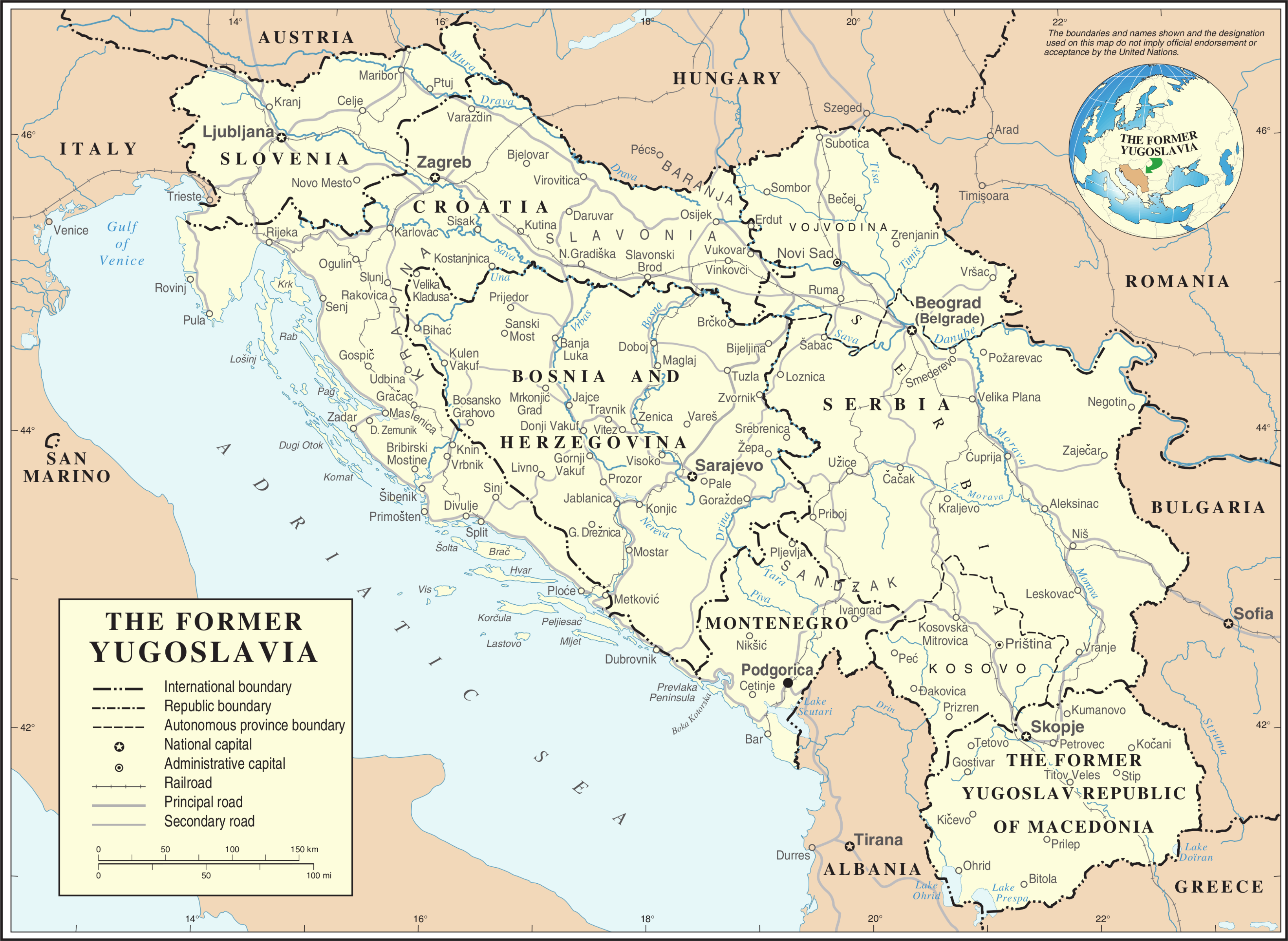
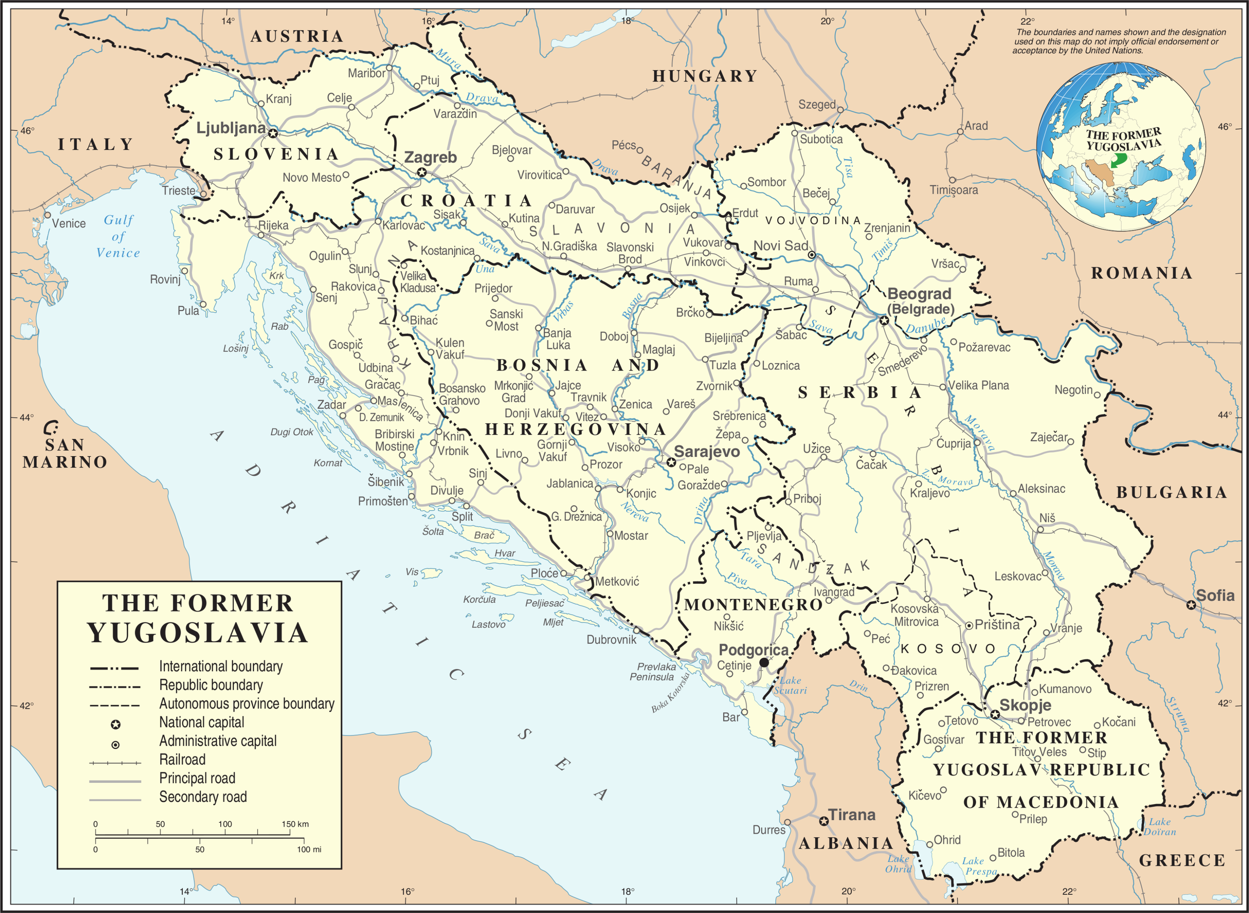
[편집]| 설명 | Map of former Yugoslavia. | |||
| 날짜 | ||||
| 출처 | The Cartographic Section of the United Nations (CSUN) | |||
| 저자 | Cartographer of the United Nations | |||
| 저작권 (이 파일을 인용하기) |
|
|||
| 다른 버전 |
|


파일 역사
날짜/시간 링크를 클릭하면 해당 시간의 파일을 볼 수 있습니다.
| 날짜/시간 | 섬네일 | 크기 | 사용자 | 설명 | |
|---|---|---|---|---|---|
| 현재 | 2007년 10월 21일 (일) 20:39 | | 3,280 × 2,398 (2.55 MB) | Jeroen (토론 | 기여) | Recreated an updated map from the same source, but now incl. Montenegro and Serbia as independent nations. |
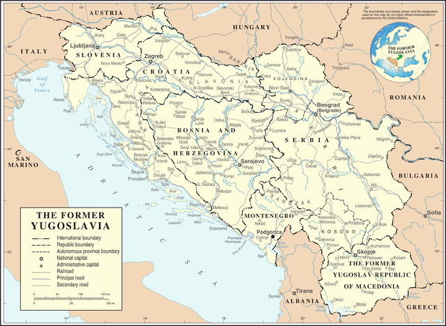
| 2007년 3월월 10일 (토) 17:02 |  | 3,231 × 2,367 (1.6 MB) | Minestrone (토론 | 기여) | Former Yugoslavia Map {{Information |Description=Former Yugoslavia Map |Source=The Cartographic Section of the United Nations (CSUN) |Date=2007-03-10 |Author=Cartographer of the United Nations |Permission={{Template:UN map}} and the cartographer of |
이 파일을 덮어쓸 수 없습니다.
이 파일을 사용하는 문서
다음 문서 7개가 이 파일을 사용하고 있습니다:
이 파일을 사용하고 있는 모든 위키의 문서 목록
다음 위키에서 이 파일을 사용하고 있습니다:
- ar.wikipedia.org에서 이 파일을 사용하고 있는 문서 목록
- az.wikipedia.org에서 이 파일을 사용하고 있는 문서 목록
- bs.wikipedia.org에서 이 파일을 사용하고 있는 문서 목록
- ca.wikipedia.org에서 이 파일을 사용하고 있는 문서 목록
- ckb.wikipedia.org에서 이 파일을 사용하고 있는 문서 목록
- cs.wikipedia.org에서 이 파일을 사용하고 있는 문서 목록
- de.wikipedia.org에서 이 파일을 사용하고 있는 문서 목록
- el.wiktionary.org에서 이 파일을 사용하고 있는 문서 목록
- en.wikipedia.org에서 이 파일을 사용하고 있는 문서 목록
- es.wikipedia.org에서 이 파일을 사용하고 있는 문서 목록
- fa.wikipedia.org에서 이 파일을 사용하고 있는 문서 목록
- fr.wikipedia.org에서 이 파일을 사용하고 있는 문서 목록
- fr.wiktionary.org에서 이 파일을 사용하고 있는 문서 목록
- id.wikipedia.org에서 이 파일을 사용하고 있는 문서 목록
- ja.wikipedia.org에서 이 파일을 사용하고 있는 문서 목록
- ka.wikipedia.org에서 이 파일을 사용하고 있는 문서 목록
- ko.wikipedia.org에서 이 파일을 사용하고 있는 문서 목록
- lb.wikipedia.org에서 이 파일을 사용하고 있는 문서 목록
- mzn.wikipedia.org에서 이 파일을 사용하고 있는 문서 목록
이 파일의 더 많은 사용 내역을 봅니다.