File:Hartmann Schedel, Herbipolis (FL54266117 4108610).jpg
קפיצה לניווט
קפיצה לחיפוש

גודל התצוגה המקדימה הזאת: 800 × 550 פיקסלים. רזולוציות אחרות: 320 × 220 פיקסלים | 640 × 440 פיקסלים | 1,024 × 704 פיקסלים | 1,280 × 880 פיקסלים | 2,560 × 1,760 פיקסלים | 5,528 × 3,800 פיקסלים.
לקובץ המקורי (5,528 × 3,800 פיקסלים, גודל הקובץ: 26.31 מ"ב, סוג MIME: image/jpeg)
כיתובים
כיתובים
נא להוסיף משפט שמסביר מה הקובץ מייצג
תקציר
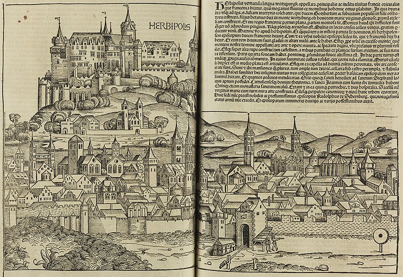
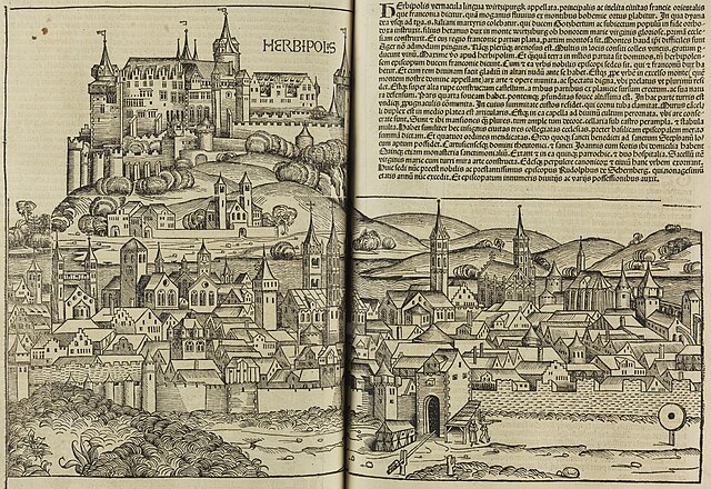
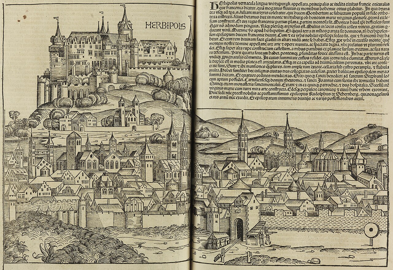
[עריכה]| Hartmann Schedel: Herbipolis
( |
||||||||||||||||||||||||
|---|---|---|---|---|---|---|---|---|---|---|---|---|---|---|---|---|---|---|---|---|---|---|---|---|
| אומן |
|
|||||||||||||||||||||||
| כותרת |
Herbipolis |
|||||||||||||||||||||||
| מפרסם |
A. Koberger |
|||||||||||||||||||||||
| תיאור |
Herbipolis.. |
|||||||||||||||||||||||
| שפה | לטינית | |||||||||||||||||||||||
| תאריך הוצאה לאור | 1493 | |||||||||||||||||||||||
| אוסף |
|
|||||||||||||||||||||||
| מיקום נוכחי |
|
|||||||||||||||||||||||
| מיקום הוצאה | נירנברג | |||||||||||||||||||||||
| חיפוש בקטלוג מרחב | נירנברג | |||||||||||||||||||||||
| הערות | From: Schedel, Hartmann. Liber chronicarum. Nuernberg. Anton Koberger, 1493. The illustrations and the maps are cut in wood by Michael Wolgemut. Fol. CLX.; Map on double spread of text pages.; Imaginary view of the city. | |||||||||||||||||||||||
| IE PID | IE54266113 | |||||||||||||||||||||||
| רוזטה שם קובץ | FL54266117 | |||||||||||||||||||||||
| מזהה רשומה בספרייה הלאומית (P3959) | 990041086100205171 | |||||||||||||||||||||||
| חיפוש בקטלוג מרחב | לטינית, Hartmann Schedel | |||||||||||||||||||||||
| חיפוש בקטלוג מרחב | A. Koberger | |||||||||||||||||||||||
| מקור/צלם |
|
|||||||||||||||||||||||
| גרסאות אחרות | ||||||||||||||||||||||||
| Jpg / Tif version |
|
|||||||||||||||||||||||

.jpg)

.jpg&action=edit§ion=1)
רישיון
[עריכה].jpg&action=edit§ion=2)
The copyright situation of this work is theoretically uncertain, because in the country of origin copyright lasts 70 years after the death of the author, and the date of the author's death is unknown. However, the date of creation of the work was over 120 years ago, and it is thus a reasonable assumption that the copyright has expired (see here for the community discussion). Do not use this template if the date of death of the author is known.
| |
| הקובץ הזה זוהה כקובץ חופשי מכל מגבלה ידועה תחת חוק זכויות היוצרים, כולל כל הזכויות הקשורות והסמוכות. | |
היסטוריית הקובץ
ניתן ללחוץ על תאריך/שעה כדי לראות את הקובץ כפי שנראה באותו זמן.
| תאריך/שעה | תמונה ממוזערת | ממדים | משתמש | הערה | |
|---|---|---|---|---|---|
| נוכחית | 16:00, 4 בספטמבר 2023 | | 3,800 × 5,528 (26.31 מ"ב) | Geagea (שיחה | תרומות) | pattypan 22.03 |
אין באפשרותך לדרוס את הקובץ הזה.
שימוש בקובץ
הדף הבא משתמש בקובץ הזה:
.jpg&oldid=803282070)