File:Highfield Campus aerial view.jpg
둘러보기로 이동
검색으로 이동
미리 보기 크기: 648 × 600 픽셀 다른 해상도: 259 × 240 픽셀 | 519 × 480 픽셀 | 830 × 768 픽셀 | 1,107 × 1,024 픽셀 | 2,370 × 2,193 픽셀
원본 파일 (2,370 × 2,193 픽셀, 파일 크기: 3.4 MB, MIME 종류: image/jpeg)
캡션
설명
이 파일이 나타내는 바에 대한 한 줄 설명을 추가합니다
파일 설명[편집]
| 설명 |
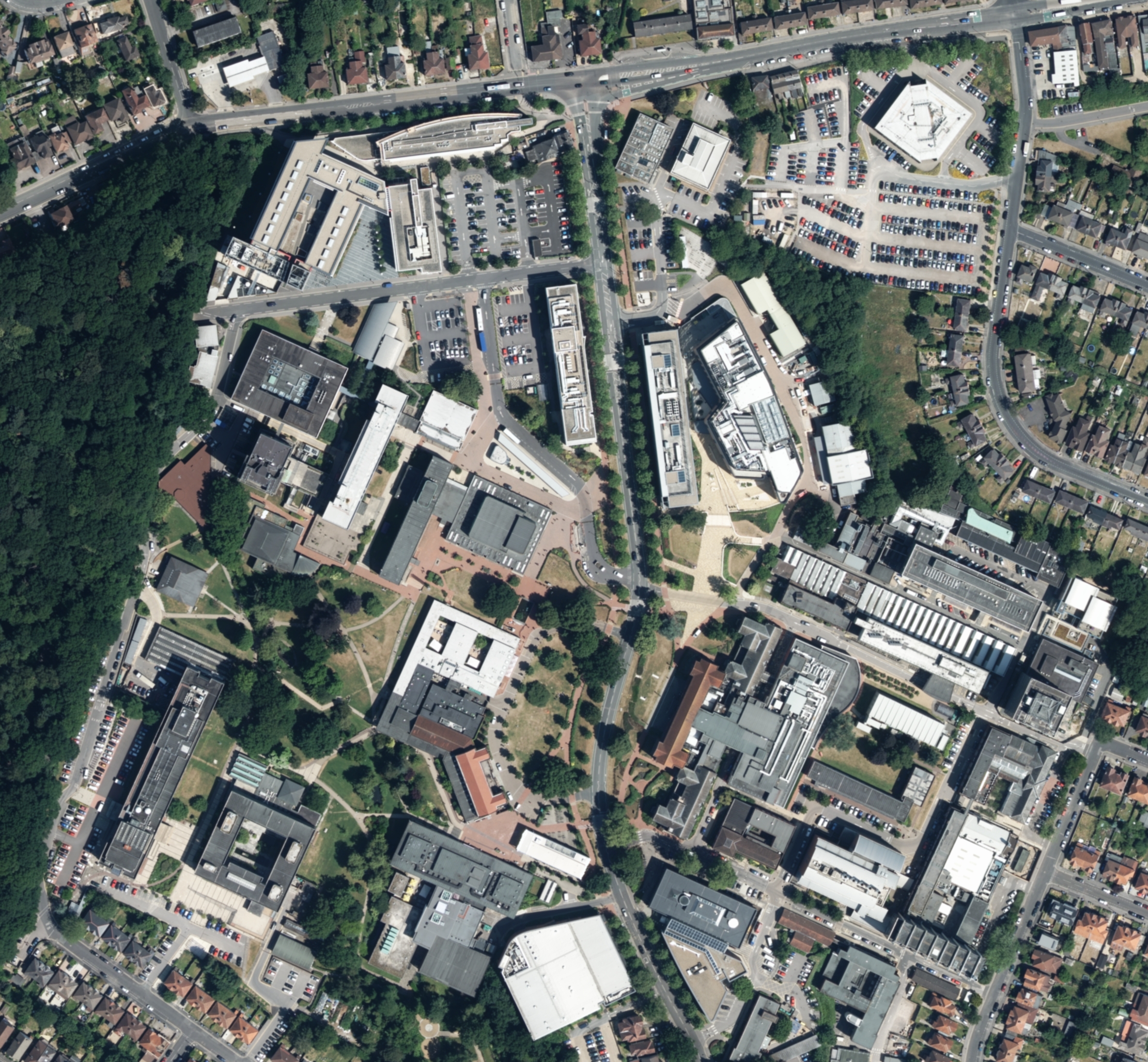
English: This image was released by Hampshire County Council under the Open Government Licence on 9th May 2014 but the picture was likely taken some time before then. It shows OS Grid Square SU4215.
The image is dominated by the University of Southampton's Highfield Campus in the lower middle of the photograph, with part of Southampton Common to the bottom left. Burgess Road runs roughly horizontally through the middle of the picture. Cantell School is visible at the top of the picture, with the green space of Daisy Dip in the top right and Bassett Green School just to the south. |
| 날짜 | |
| 출처 | ftp://www.hants.gov.uk/aerial/hampshire/Jpegs/RGB/SU4215_RGB.jpg |
| 저자 | Hampshire County Council |
라이선스[편집]
_(St_Edwards_Crown).svg)
|
This file is licensed under the United Kingdom Open Government Licence v3.0. |
See also: Meta for information on usage on Wikimedia wikis.
|

파일 역사
날짜/시간 링크를 클릭하면 해당 시간의 파일을 볼 수 있습니다.
| 날짜/시간 | 섬네일 | 크기 | 사용자 | 설명 | |
|---|---|---|---|---|---|
| 현재 | 2016년 4월 19일 (화) 09:37 | | 2,370 × 2,193 (3.4 MB) | Waggers (토론 | 기여) | File:OS Grid Square SU4215 RGB.jpg cropped 41 % horizontally and 45 % vertically using CropTool with lossless mode. |
이 파일을 덮어쓸 수 없습니다.
이 파일을 사용하는 문서
다음 문서 1개가 이 파일을 사용하고 있습니다:
이 파일을 사용하고 있는 모든 위키의 문서 목록
다음 위키에서 이 파일을 사용하고 있습니다:
- azb.wikipedia.org에서 이 파일을 사용하고 있는 문서 목록
- en.wikipedia.org에서 이 파일을 사용하고 있는 문서 목록
- ko.wikipedia.org에서 이 파일을 사용하고 있는 문서 목록