File:Italy northern 1796.jpg
둘러보기로 이동
검색으로 이동
미리 보기 크기: 632 × 599 픽셀 다른 해상도: 253 × 240 픽셀 | 506 × 480 픽셀 | 983 × 932 픽셀
원본 파일 (983 × 932 픽셀, 파일 크기: 451 KB, MIME 종류: image/jpeg)
캡션
설명
이 파일이 나타내는 바에 대한 한 줄 설명을 추가합니다
파일 설명
[편집]
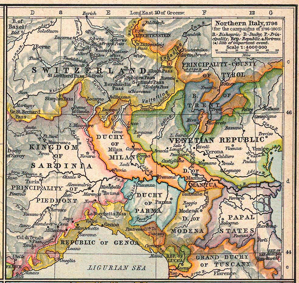
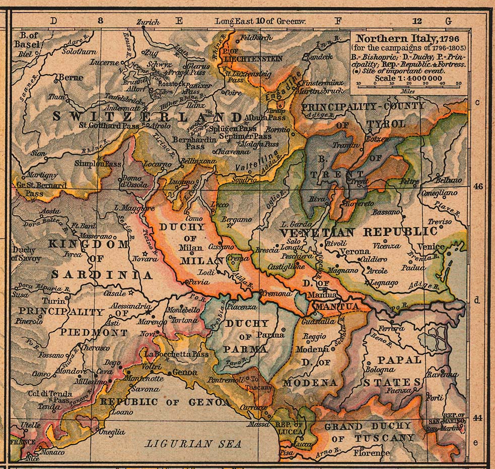
Courtesy of the University of Texas Libraries, The University of Texas at Austin.
| 설명 | Northern Italy, 1796 (for the campaigns of 1796-1805) |
| 날짜 | |
| 출처 | The Historical Atlas by William R. Shepherd, 1926 |
| 저자 | |
| 저작권 (이 파일을 인용하기) |
Copyright expired |
| 다른 버전 | http://www.lib.utexas.edu/maps/historical/shepherd/italy_northern_1796.jpg |
라이선스
[편집]
|
이 작품은 미국, 그리고 저작권 보호 기간이 저작자 사후 70년, 또는 그 이하인 모든 국가에서 퍼블릭 도메인입니다.
| |
| 이 저작물은 모든 저작인접권을 포함한 저작권법하의 규제로부터 자유로운 것으로 확인되었습니다. | |
파일 역사
날짜/시간 링크를 클릭하면 해당 시간의 파일을 볼 수 있습니다.
| 날짜/시간 | 섬네일 | 크기 | 사용자 | 설명 | |
|---|---|---|---|---|---|
| 현재 | 2017년 1월 13일 (금) 15:34 | | 983 × 932 (451 KB) | Afnecors (토론 | 기여) | colour improvement |
| 2006년 4월 8일 (토) 05:35 |  | 983 × 932 (389 KB) | Cave cattum (토론 | 기여) | '''Courtesy of the University of Texas Libraries, The University of Texas at Austin.''' {{Information| |Description = Northern Italy, 1796 (for the campaigns of 1796-1805) |Source = The Historical Atlas by William R. Shepherd, 1926 |Date = 1926 |Author = |
이 파일을 덮어쓸 수 없습니다.
이 파일을 사용하는 문서
다음 문서 8개가 이 파일을 사용하고 있습니다:
이 파일을 사용하고 있는 모든 위키의 문서 목록
다음 위키에서 이 파일을 사용하고 있습니다:
- ar.wikipedia.org에서 이 파일을 사용하고 있는 문서 목록
- ast.wikipedia.org에서 이 파일을 사용하고 있는 문서 목록
- azb.wikipedia.org에서 이 파일을 사용하고 있는 문서 목록
- be.wikipedia.org에서 이 파일을 사용하고 있는 문서 목록
- bg.wikipedia.org에서 이 파일을 사용하고 있는 문서 목록
- br.wikipedia.org에서 이 파일을 사용하고 있는 문서 목록
- ca.wikipedia.org에서 이 파일을 사용하고 있는 문서 목록
- cs.wikipedia.org에서 이 파일을 사용하고 있는 문서 목록
- da.wikipedia.org에서 이 파일을 사용하고 있는 문서 목록
- de.wikipedia.org에서 이 파일을 사용하고 있는 문서 목록
- el.wikipedia.org에서 이 파일을 사용하고 있는 문서 목록
- eml.wikipedia.org에서 이 파일을 사용하고 있는 문서 목록
- en.wikipedia.org에서 이 파일을 사용하고 있는 문서 목록
이 파일의 더 많은 사용 내역을 봅니다.
메타데이터
분류:
- Maps showing history by William R. Shepherd
- Mantuan State
- Maps of the Duchy of Ferrara
- Maps of the Austrian Lombardy
- Old maps of the Republic of Lucca
- Old maps of the Republic of Genoa
- Maps of the Prince-Bishopric of Trent
- Maps of the Kingdom of Sardinia
- Maps of the Republic of Venice
- Maps of 18th-century Italy
- 1926 maps of Italy