File:James Wyld, the elder, Map of the journeyings of the Israelites from Egypt to the Land of Canaan 02-copy2 (FL39695596 2369438).jpg
קפיצה לניווט
קפיצה לחיפוש

גודל התצוגה המקדימה הזאת: 800 × 579 פיקסלים. רזולוציות אחרות: 320 × 232 פיקסלים | 640 × 463 פיקסלים | 1,024 × 741 פיקסלים | 1,280 × 926 פיקסלים | 2,560 × 1,853 פיקסלים | 9,793 × 7,087 פיקסלים.
לקובץ המקורי (9,793 × 7,087 פיקסלים, גודל הקובץ: 96.3 מ"ב, סוג MIME: image/jpeg)
כיתובים
כיתובים
נא להוסיף משפט שמסביר מה הקובץ מייצג
תקציר
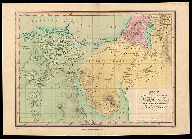
[עריכה]| James Wyld, the elder: Map of the journeyings of the Israelites from Egypt to the Land of Canaan
( |
||||||||||||||||||||||||
|---|---|---|---|---|---|---|---|---|---|---|---|---|---|---|---|---|---|---|---|---|---|---|---|---|
| אומן |
| |||||||||||||||||||||||
| יוצרים נוספים | Hewitt, N. R. | |||||||||||||||||||||||
| כותרת |
Map of the journeyings of the Israelites from Egypt to the Land of Canaan |
|||||||||||||||||||||||
| מפרסם |
Mathews & Leigh |
|||||||||||||||||||||||
| תיאור |
Map of the journeyings of the Israelites from Egypt to the Land of Canaan. Wyld delin. Hewitt Sculp. |
|||||||||||||||||||||||
| שפה | אנגלית | |||||||||||||||||||||||
| תאריך הוצאה לאור | 1812 | |||||||||||||||||||||||
| אוסף |
|
|||||||||||||||||||||||
| מיקום נוכחי |
|
|||||||||||||||||||||||
| מיקום הוצאה | לונדון | |||||||||||||||||||||||
| חיפוש בקטלוג מרחב | לונדון | |||||||||||||||||||||||
| הערות | ||||||||||||||||||||||||
| IE PID | IE39695591 | |||||||||||||||||||||||
| רוזטה שם קובץ | FL39695596 | |||||||||||||||||||||||
| מזהה רשומה בספרייה הלאומית (P3959) | 990023694380205171 | |||||||||||||||||||||||
| חיפוש בקטלוג מרחב | אנגלית, James Wyld, the elder | |||||||||||||||||||||||
| חיפוש בקטלוג מרחב | Exodus, TheMapsMathews & Leigh | |||||||||||||||||||||||
| מקור/צלם |
|
|||||||||||||||||||||||
| גרסאות אחרות | ||||||||||||||||||||||||
| Jpg / Tif version |
|
|||||||||||||||||||||||

.jpg)

.jpg&action=edit§ion=1)
רישיון
[עריכה].jpg&action=edit§ion=2)
The copyright situation of this work is theoretically uncertain, because in the country of origin copyright lasts 70 years after the death of the author, and the date of the author's death is unknown. However, the date of creation of the work was over 120 years ago, and it is thus a reasonable assumption that the copyright has expired (see here for the community discussion). Do not use this template if the date of death of the author is known.
| |
| הקובץ הזה זוהה כקובץ חופשי מכל מגבלה ידועה תחת חוק זכויות היוצרים, כולל כל הזכויות הקשורות והסמוכות. | |
היסטוריית הקובץ
ניתן ללחוץ על תאריך/שעה כדי לראות את הקובץ כפי שנראה באותו זמן.
| תאריך/שעה | תמונה ממוזערת | ממדים | משתמש | הערה | |
|---|---|---|---|---|---|
| נוכחית | 05:59, 29 ביולי 2023 | | 7,087 × 9,793 (96.3 מ"ב) | Geagea (שיחה | תרומות) | pattypan 22.03 |
אין באפשרותך לדרוס את הקובץ הזה.
שימוש בקובץ
הדף הבא משתמש בקובץ הזה:
.jpg&oldid=795163622)