File:Johannes van Keulen (1654-1715), Nieuwe Pascaert Beuattende in sich de Kust van Vlaenderen vande Wielingen tot de Hoofden (FL35073121 2536857).jpg
קפיצה לניווט
קפיצה לחיפוש

גודל התצוגה המקדימה הזאת: 685 × 600 פיקסלים. רזולוציות אחרות: 274 × 240 פיקסלים | 548 × 480 פיקסלים | 877 × 768 פיקסלים | 1,170 × 1,024 פיקסלים | 2,340 × 2,048 פיקסלים | 14,440 × 12,640 פיקסלים.
לקובץ המקורי (14,440 × 12,640 פיקסלים, גודל הקובץ: 236.91 מ"ב, סוג MIME: image/jpeg)
כיתובים
כיתובים
נא להוסיף משפט שמסביר מה הקובץ מייצג
תקציר
[עריכה]| Johannes van Keulen: Nieuwe Pascaert Beuattende in sich de Kust van Vlaenderen vande Wielingen tot de Hoofden
( |
||||||||||||||||||||||||
|---|---|---|---|---|---|---|---|---|---|---|---|---|---|---|---|---|---|---|---|---|---|---|---|---|
| אומן |
|
|||||||||||||||||||||||
| כותרת |
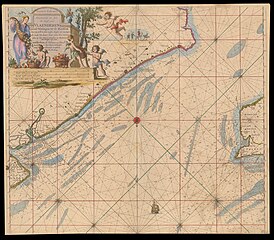
Nieuwe Pascaert Beuattende in sich de Kust van Vlaenderen vande Wielingen tot de Hoofden |
|||||||||||||||||||||||
| מפרסם |
Jahnnis van Keulen |
|||||||||||||||||||||||
| תיאור |
Nieuwe Pascaert Beuattende in sich de Kust van Vlaenderen vande Wielingen tot de Hoofden. Waer in oock te sien is syn diepte en ondiepte als mede hoe haert lant uitter Zee vertoont alles op het Nieuws oversien en Verbetert . Johannis van Keulen. |
|||||||||||||||||||||||
| שפה | הולנדית | |||||||||||||||||||||||
| תאריך הוצאה לאור | בסביבות 1700 | |||||||||||||||||||||||
| טכניקה | 1 map : col ; | |||||||||||||||||||||||
| ממדים | 51 × 57 ס"מ | |||||||||||||||||||||||
| אוסף |
|
|||||||||||||||||||||||
| מיקום נוכחי |
|
|||||||||||||||||||||||
| מיקום הוצאה | אמסטרדם | |||||||||||||||||||||||
| חיפוש בקטלוג מרחב | אמסטרדם | |||||||||||||||||||||||
| הערות | No. 9 | |||||||||||||||||||||||
| IE PID | IE35073119 | |||||||||||||||||||||||
| רוזטה שם קובץ | FL35073121 | |||||||||||||||||||||||
| מזהה רשומה בספרייה הלאומית (P3959) | 990025368570205171 | |||||||||||||||||||||||
| חיפוש בקטלוג מרחב | הולנדית, Johannes van Keulen | |||||||||||||||||||||||
| חיפוש בקטלוג מרחב | Jahnnis van Keulen | |||||||||||||||||||||||
| מקור/צלם |
|
|||||||||||||||||||||||
| גרסאות אחרות | ||||||||||||||||||||||||
| Jpg / Tif version |
|
|||||||||||||||||||||||

,_Nieuwe_Pascaert_Beuattende_in_sich_de_Kust_van_Vlaenderen_vande_Wielingen_tot_de_Hoofden_(FL35073121_2536857).jpg)

,_Nieuwe_Pascaert_Beuattende_in_sich_de_Kust_van_Vlaenderen_vande_Wielingen_tot_de_Hoofden_(FL35073121_2536857).jpg&action=edit§ion=1)
רישיון
[עריכה],_Nieuwe_Pascaert_Beuattende_in_sich_de_Kust_van_Vlaenderen_vande_Wielingen_tot_de_Hoofden_(FL35073121_2536857).jpg&action=edit§ion=2)
The copyright situation of this work is theoretically uncertain, because in the country of origin copyright lasts 70 years after the death of the author, and the date of the author's death is unknown. However, the date of creation of the work was over 120 years ago, and it is thus a reasonable assumption that the copyright has expired (see here for the community discussion). Do not use this template if the date of death of the author is known.
| |
| הקובץ הזה זוהה כקובץ חופשי מכל מגבלה ידועה תחת חוק זכויות היוצרים, כולל כל הזכויות הקשורות והסמוכות. | |
היסטוריית הקובץ
ניתן ללחוץ על תאריך/שעה כדי לראות את הקובץ כפי שנראה באותו זמן.
| תאריך/שעה | תמונה ממוזערת | ממדים | משתמש | הערה | |
|---|---|---|---|---|---|
| נוכחית | 04:59, 20 באוגוסט 2023 | | 12,640 × 14,440 (236.91 מ"ב) | Geagea (שיחה | תרומות) | pattypan 22.03 |
אין באפשרותך לדרוס את הקובץ הזה.
שימוש בקובץ
הדף הבא משתמש בקובץ הזה:
,_Nieuwe_Pascaert_Beuattende_in_sich_de_Kust_van_Vlaenderen_vande_Wielingen_tot_de_Hoofden_(FL35073121_2536857).jpg&oldid=811682973)