File:LondonHarrow.svg
둘러보기로 이동
검색으로 이동

SVG 파일의 PNG 형식의 미리보기 크기: 775 × 599 픽셀. 다른 해상도: 310 × 240 픽셀 | 621 × 480 픽셀 | 993 × 768 픽셀 | 1,280 × 990 픽셀 | 2,560 × 1,980 픽셀 | 962 × 744 픽셀
원본 파일 (SVG 파일, 실제 크기 962 × 744 픽셀, 파일 크기: 19 KB)
캡션
설명
이 파일이 나타내는 바에 대한 한 줄 설명을 추가합니다
파일 설명
[편집]| 설명 |
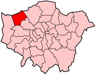
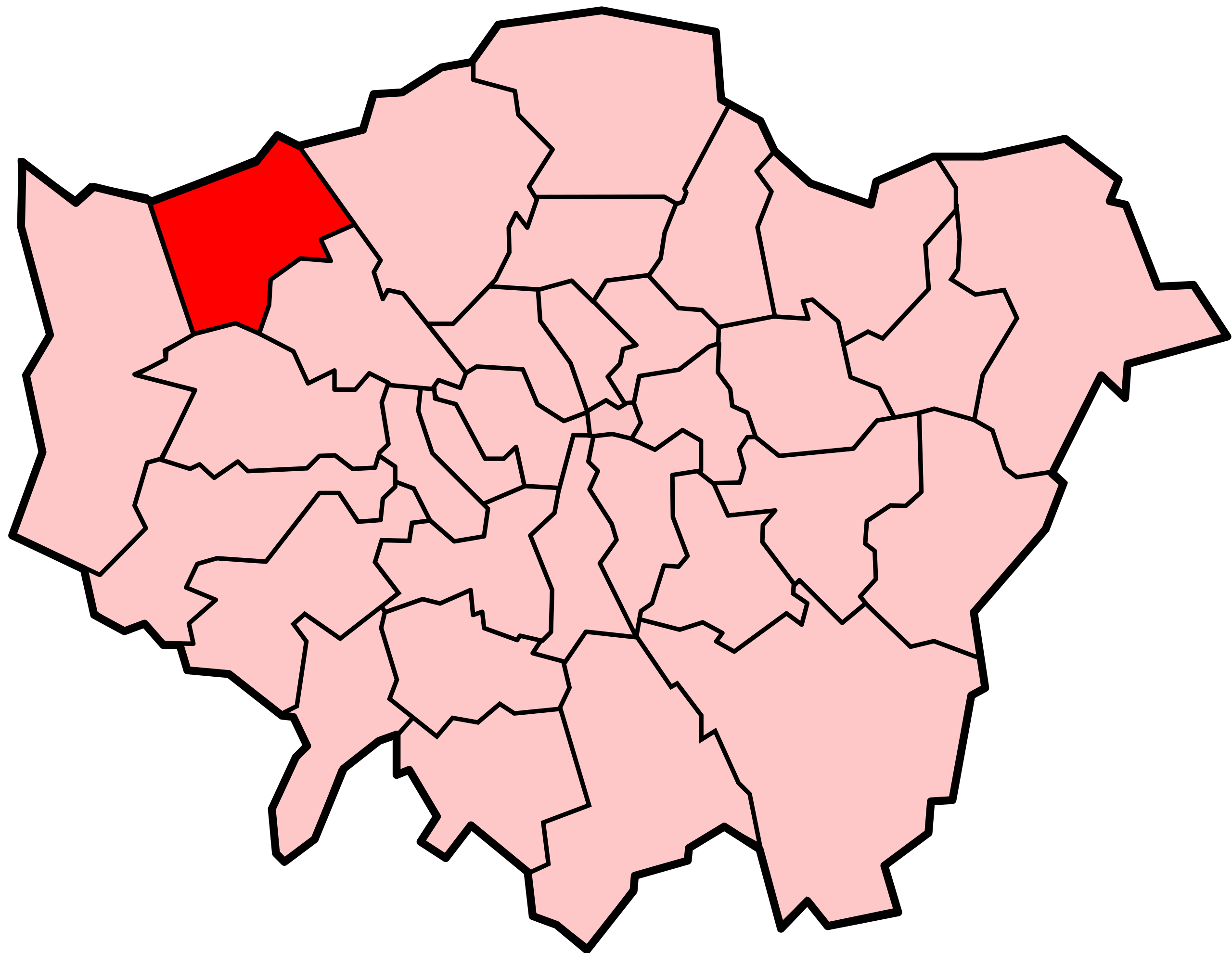
Locator map of the London Borough of Harrow, shown (in red) within Greater London. |
||||||||
| 날짜 | |||||||||
| 출처 | Adapted from Image:LondonHarrow.png and Image:BlankMap-LondonBoroughs.svg. | ||||||||
| 저자 | Image:LondonHarrow.png by Morwen, Image:BlankMap-LondonBoroughs.svg by Richtom80 | ||||||||
| 저작권 (이 파일을 인용하기) |
나는 아래 작품의 저작권자로서, 이 저작물을 다음과 같은 라이선스로 배포합니다:
이 파일은 크리에이티브 커먼즈 저작자표시 2.5 일반 라이선스로 배포됩니다.
이 라이선스 중에서 목적에 맞는 것을 선택하여 사용할 수 있습니다. |
||||||||
| 다른 버전 | PNG version |

파일 역사
날짜/시간 링크를 클릭하면 해당 시간의 파일을 볼 수 있습니다.
| 날짜/시간 | 섬네일 | 크기 | 사용자 | 설명 | |
|---|---|---|---|---|---|
| 현재 | 2007년 12월 7일 (금) 00:02 | | 962 × 744 (19 KB) | Fvasconcellos (토론 | 기여) | == Summary == {{Information |Description= Locator map of the {{w|London Borough of Harrow}}, shown (in red) within {{w|Greater London}}.{{Inkscape}} |Source= Adapted from Image:LondonHarrow.png and Image:BlankMap-LondonBoroughs.svg. |Date= De |
이 파일을 덮어쓸 수 없습니다.
이 파일을 사용하는 문서
다음 문서 7개가 이 파일을 사용하고 있습니다:
- File:LondonHarrow.png
- Category:London Borough of Harrow
- Category:People of the London Borough of Harrow
- Category:Railway stations in the London Borough of Harrow
- Category:Sports in the London Borough of Harrow
- Category:Transport in the London Borough of Harrow
- Category:Views of the London Borough of Harrow
이 파일을 사용하고 있는 모든 위키의 문서 목록
다음 위키에서 이 파일을 사용하고 있습니다:
- ar.wikipedia.org에서 이 파일을 사용하고 있는 문서 목록
- azb.wikipedia.org에서 이 파일을 사용하고 있는 문서 목록
- ca.wikipedia.org에서 이 파일을 사용하고 있는 문서 목록
- cy.wikipedia.org에서 이 파일을 사용하고 있는 문서 목록
- da.wikipedia.org에서 이 파일을 사용하고 있는 문서 목록
- en.wikipedia.org에서 이 파일을 사용하고 있는 문서 목록
- List of places in London
- Hatch End
- Kenton, London
- Pinner
- Stanmore
- Wealdstone
- London Borough of Harrow
- North London
- Harrow, London
- Belmont, Harrow
- North Harrow
- Harrow Weald
- Burnt Oak
- West Harrow
- Harrow on the Hill
- Parks and open spaces in the London Borough of Harrow
- South Harrow
- Canons Park
- St Mary's Church, Harrow on the Hill
- Rayners Lane
- Sudbury, London
- Roxeth
- Headstone, London
- Queensbury, London
- Category:People from Pinner
- Category:People from Kenton, London
- Greenhill, Harrow
- Template:LB Harrow
- Category:People from South Harrow
- Category:People from Harrow on the Hill
- Headstone Manor and Museum
- Category:People from Stanmore
- Little Stanmore
- Category:London Borough of Harrow
- Brockley Hill
- List of people from the London Borough of Harrow
- Sudbury Hill
- List of public art in the London Borough of Harrow
- Category:People from Harrow, London
- Pinner Green
- Grade I and II* listed buildings in the London Borough of Harrow
- Roxbourne
- Wikipedia:WikiProject Navigation templates/Country subdivisions/United Kingdom/England
이 파일의 더 많은 사용 내역을 봅니다.