File:Map of Kentucky highlighting Fayette County.svg
קפיצה לניווט
קפיצה לחיפוש

גודל התצוגה המקדימה הזאת מסוג PNG של קובץ ה־SVG הזה: 800 × 345 פיקסלים. רזולוציות אחרות: 320 × 138 פיקסלים | 640 × 276 פיקסלים | 1,024 × 441 פיקסלים | 1,280 × 551 פיקסלים | 2,560 × 1,103 פיקסלים | 6,770 × 2,916 פיקסלים.
לקובץ המקורי (קובץ SVG, הגודל המקורי: 6,770 × 2,916 פיקסלים, גודל הקובץ: 127 ק"ב)
כיתובים
כיתובים
נא להוסיף משפט שמסביר מה הקובץ מייצג
תקציר[עריכה]
| תיאור |
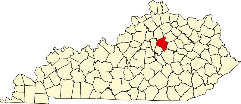
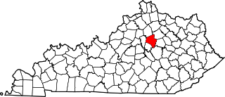
English: This is a locator map showing Fayette County in Kentucky. For more information, see Commons:United States county locator maps. |
| תאריך יצירה | |
| מקור |
נוצר על־ידי מעלה היצירה: English: The maps use data from nationalatlas.gov, specifically countyp020.tar.gz on the Raw Data Download page. The maps also use state outline data from statesp020.tar.gz. The Florida maps use hydrogm020.tar.gz to display Lake Okeechobee. |
| יוצר | David Benbennick |
רישיון[עריכה]
| ברצוני, בעלי זכויות היוצרים על יצירה זו, לשחרר יצירה זו לנחלת הכלל. זה תקף בכל העולם. יש מדינות שבהן הדבר אינו אפשרי על פי חוק, אם כך: אני מעניק לכל אחד את הזכות להשתמש בעבודה זו לכל מטרה שהיא, ללא תנאים כלשהם, אלא אם כן תנאים כאלה נדרשים על פי חוק. |
היסטוריית הקובץ
ניתן ללחוץ על תאריך/שעה כדי לראות את הקובץ כפי שנראה באותו זמן.
| תאריך/שעה | תמונה ממוזערת | ממדים | משתמש | הערה | |
|---|---|---|---|---|---|
| נוכחית | 12:21, 12 בפברואר 2006 | | 2,916 × 6,770 (127 ק"ב) | David Benbennick (שיחה | תרומות) | {{subst:User:Dbenbenn/clm|county=Fayette County|state=Kentucky}} |
אין באפשרותך לדרוס את הקובץ הזה.
שימוש בקובץ
הדפים הבאים משתמשים בקובץ הזה:
- Category:Births in Fayette County, Kentucky
- Category:Births in Lexington, Kentucky
- Category:Deaths in Fayette County, Kentucky
- Category:Deaths in Lexington, Kentucky
- Category:Fayette County, Kentucky
- Category:Fayette County, Kentucky Image by CLight
- Category:Lexington, Kentucky
- Category:People of Fayette County, Kentucky
- Category:Sports in Lexington, Kentucky
שימוש גלובלי בקובץ
אתרי הוויקי השונים הבאים משתמשים בקובץ זה:
- שימוש באתר af.wikipedia.org
- שימוש באתר ang.wikipedia.org
- שימוש באתר ar.wikipedia.org
- שימוש באתר arz.wikipedia.org
- שימוש באתר ast.wikipedia.org
- שימוש באתר bg.wikipedia.org
- שימוש באתר bpy.wikipedia.org
- שימוש באתר br.wikipedia.org
- שימוש באתר ca.wikipedia.org
- שימוש באתר cdo.wikipedia.org
- שימוש באתר ceb.wikipedia.org
- שימוש באתר ce.wikipedia.org
- שימוש באתר cs.wikipedia.org
- שימוש באתר cy.wikipedia.org
- שימוש באתר da.wikipedia.org
- שימוש באתר de.wikipedia.org
- שימוש באתר el.wikipedia.org
- שימוש באתר en.wikipedia.org
- Lexington, Kentucky
- Fayette County, Kentucky
- Kentucky Horse Park Arboretum
- List of counties in Kentucky
- Lexington–Fayette–Richmond–Frankfort combined statistical area
- CenterCourt
- Athens, Kentucky
- National Register of Historic Places listings in Fayette County, Kentucky
- Hilton Lexington/Downtown
- Bryan Station, Lexington, Kentucky
- Bell Court, Lexington
- Fairway, Lexington
- Kenwick, Lexington
- Eastland, Lexington
- Joyland, Lexington
- Winburn, Lexington
- Highland Park, Lexington
- Garden Springs, Lexington
- Beaumont Park, Lexington
- Gardenside, Lexington
- Mount Tabor, Lexington
- Rabbit Run, Lexington
- Speigle Heights, Lexington
- Melrose Park, Lexington
- Stonewall, Lexington
- Picadome, Lexington
- Harrods Hill, Lexington
- Palomar Hills, Lexington
- Firebrook, Lexington
צפייה בשימושים גלובליים נוספים של קובץ זה.