File:Map of Ohio highlighting Gallia County.svg
קפיצה לניווט
קפיצה לחיפוש

גודל התצוגה המקדימה הזאת מסוג PNG של קובץ ה־SVG הזה: 552 × 600 פיקסלים. רזולוציות אחרות: 221 × 240 פיקסלים | 442 × 480 פיקסלים | 707 × 768 פיקסלים | 942 × 1,024 פיקסלים | 1,885 × 2,048 פיקסלים | 1,050 × 1,141 פיקסלים.
לקובץ המקורי (קובץ SVG, הגודל המקורי: 1,050 × 1,141 פיקסלים, גודל הקובץ: 37 ק"ב)
כיתובים
כיתובים
נא להוסיף משפט שמסביר מה הקובץ מייצג
תקציר
[עריכה]
| תיאור |
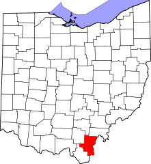
English: This is a locator map showing Gallia County in Ohio. For more information, see Commons:United States county locator maps. |
| תאריך יצירה | |
| מקור |
נוצר על־ידי מעלה היצירה: English: The maps use data from nationalatlas.gov, specifically countyp020.tar.gz on the Raw Data Download page. The maps also use state outline data from statesp020.tar.gz. The Florida maps use hydrogm020.tar.gz to display Lake Okeechobee. |
| יוצר | David Benbennick |
רישיון
[עריכה]
| ברצוני, בעלי זכויות היוצרים על יצירה זו, לשחרר יצירה זו לנחלת הכלל. זה תקף בכל העולם. יש מדינות שבהן הדבר אינו אפשרי על פי חוק, אם כך: אני מעניק לכל אחד את הזכות להשתמש בעבודה זו לכל מטרה שהיא, ללא תנאים כלשהם, אלא אם כן תנאים כאלה נדרשים על פי חוק. |
היסטוריית הקובץ
ניתן ללחוץ על תאריך/שעה כדי לראות את הקובץ כפי שנראה באותו זמן.
| תאריך/שעה | תמונה ממוזערת | ממדים | משתמש | הערה | |
|---|---|---|---|---|---|
| נוכחית | 01:34, 25 ביוני 2024 | | 1,141 × 1,050 (37 ק"ב) | Nux (שיחה | תרומות) | fix rendering (remove clipping) |
| 16:08, 12 בפברואר 2006 |  | 3,995 × 3,675 (58 ק"ב) | David Benbennick (שיחה | תרומות) | {{subst:User:Dbenbenn/clm|county=Gallia County|state=Ohio|type=county}} |
אין באפשרותך לדרוס את הקובץ הזה.
שימוש בקובץ
הדפים הבאים משתמשים בקובץ הזה:
- Category:Births in Gallia County, Ohio
- Category:Gallia County, Ohio
- Category:Geography of Gallia County, Ohio
- Category:Maps of Gallia County, Ohio
- Category:National Register of Historic Places in Gallia County, Ohio
- Category:People of Gallia County, Ohio
- Category:Populated places in Gallia County, Ohio
שימוש גלובלי בקובץ
אתרי הוויקי השונים הבאים משתמשים בקובץ זה:
- שימוש באתר ar.wikipedia.org
- שימוש באתר ast.wikipedia.org
- שימוש באתר azb.wikipedia.org
- שימוש באתר bg.wikipedia.org
- שימוש באתר bpy.wikipedia.org
- שימוש באתר cdo.wikipedia.org
- שימוש באתר ceb.wikipedia.org
- שימוש באתר cy.wikipedia.org
- שימוש באתר da.wikipedia.org
- שימוש באתר de.wikipedia.org
- שימוש באתר en.wikipedia.org
- List of counties in Ohio
- Gallia County, Ohio
- Centerville, Gallia County, Ohio
- Cheshire, Ohio
- Crown City, Ohio
- Gallipolis, Ohio
- Rio Grande, Ohio
- Vinton, Ohio
- Bidwell, Ohio
- Walnut Township, Gallia County, Ohio
- Raccoon Township, Gallia County, Ohio
- Springfield Township, Gallia County, Ohio
- Template:Gallia County, Ohio
- Addison Township, Ohio
- Cheshire Township, Ohio
- Clay Township, Gallia County, Ohio
- Gallipolis Township, Gallia County, Ohio
- Green Township, Gallia County, Ohio
- Greenfield Township, Gallia County, Ohio
- Guyan Township, Gallia County, Ohio
- Harrison Township, Gallia County, Ohio
- Huntington Township, Gallia County, Ohio
- Morgan Township, Gallia County, Ohio
- Perry Township, Gallia County, Ohio
- Ohio Township, Gallia County, Ohio
- Patriot, Ohio
- Kerr, Ohio
- User:Nyttend/County templates/OH/1
- Wikipedia:WikiProject Ohio/County Templates
- National Register of Historic Places listings in Gallia County, Ohio
צפייה בשימושים גלובליים נוספים של קובץ זה.