File:Meyers b14 s0300a.jpg
קפיצה לניווט
קפיצה לחיפוש

גודל התצוגה המקדימה הזאת: 375 × 600 פיקסלים. רזולוציות אחרות: 150 × 240 פיקסלים | 300 × 480 פיקסלים.
לקובץ המקורי (800 × 1,280 פיקסלים, גודל הקובץ: 376 ק"ב, סוג MIME: image/jpeg)
כיתובים
כיתובים
נא להוסיף משפט שמסביר מה הקובץ מייצג
תקציר
[עריכה]
| תיאור |
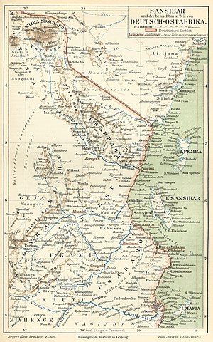
Deutsch: Karte von Sansibar und Deutsch-Ostafrika (Tansania) c. 1890, mit Kilimandscharo ("KILIMA-NDSCHARO"). Auch, Mombasa in Britisch-Ostafrika (Kenya).
English: German map of Zanzibar and German East Africa (Tanzania) c. 1890, with Mount Kilimanjaro ("KILIMA-NDSCHARO"). Also, Mombasa in British East Africa (Kenya). |
|||||
| תאריך יצירה | בין 1885 ו- 1890 | |||||
| מקור | Meyers Konversations-Lexikon, 4th Auflage, Band 14, Seite 300a (4th ed., Vol. 14, p.300a) | |||||
| יוצר | Bibliographisches Institut, in Leipzig | |||||
| אישורים והיתרים (שימוש חוזר בקובץ זה) |
|
|||||
| גרסאות אחרות | Derivative works of this file: Taveta 1890.jpg |
רישיון
[עריכה]
| This image comes from the 4th edition of Meyers Konversationslexikon (1885–90). The copyrights have expired and this image is in the public domain. |
|
יצירה זו נמצאת בנחלת הכלל במדינת המקור ובמדינות אחרות בהם תקופת זכויות היוצרים היא משך חיי היוצר ו-100 שנה (או פחות) מפטירתו.
This work is in the public domain in the United States because it was published (or registered with the U.S. Copyright Office) before January 1, 1929. | |
| הקובץ הזה זוהה כקובץ חופשי מכל מגבלה ידועה תחת חוק זכויות היוצרים, כולל כל הזכויות הקשורות והסמוכות. | |
היסטוריית הקובץ
ניתן ללחוץ על תאריך/שעה כדי לראות את הקובץ כפי שנראה באותו זמן.
| תאריך/שעה | תמונה ממוזערת | ממדים | משתמש | הערה | |
|---|---|---|---|---|---|
| נוכחית | 15:34, 24 באוגוסט 2007 | | 1,280 × 800 (376 ק"ב) | Red Rooster (שיחה | תרומות) | {{Information |Description={{PD-Meyers-pages|14}} |Source=http://susi.e-technik.uni-ulm.de:8080/Meyers2/index/index.html |Date= |Author= |Permission=Author died more than 70 years ago - public domain |other_versions= }} {{PD-old}} |
אין באפשרותך לדרוס את הקובץ הזה.
שימוש בקובץ
הדפים הבאים משתמשים בקובץ הזה:
שימוש גלובלי בקובץ
אתרי הוויקי השונים הבאים משתמשים בקובץ זה:
- שימוש באתר ar.wikipedia.org
- שימוש באתר as.wikipedia.org
- שימוש באתר azb.wikipedia.org
- שימוש באתר ca.wikipedia.org
- שימוש באתר cs.wikipedia.org
- שימוש באתר de.wikipedia.org
- שימוש באתר de.wikisource.org
- שימוש באתר el.wikipedia.org
- שימוש באתר en.wikipedia.org
- שימוש באתר eo.wikipedia.org
- שימוש באתר es.wikipedia.org
- שימוש באתר eu.wikipedia.org
- שימוש באתר fr.wikipedia.org
- שימוש באתר gl.wikipedia.org
- שימוש באתר he.wikipedia.org
- שימוש באתר hi.wikipedia.org
- שימוש באתר hr.wikipedia.org
- שימוש באתר hu.wikipedia.org
- שימוש באתר hy.wikipedia.org
- שימוש באתר id.wikipedia.org
- שימוש באתר ilo.wikipedia.org
- שימוש באתר it.wikipedia.org
צפייה בשימושים גלובליים נוספים של קובץ זה.
מטא־נתונים
קטגוריות:
- MKL - Complete pages: Book 14
- 1890 maps of Africa
- Maps of German East Africa
- Maps of British East Africa
- Old maps of Kenya
- Old maps of Zanzibar
- 19th-century maps of Tanzania
- History of East Africa
- Maps from Meyers Konversationslexikon 4th edition
- Old maps of Mombasa
- Maps with a scale of 1:3,000,000
- 1880s maps of Africa