File:Michigan counties map.gif
קפיצה לניווט
קפיצה לחיפוש

גודל התצוגה המקדימה הזאת: 528 × 599 פיקסלים. רזולוציות אחרות: 211 × 240 פיקסלים | 423 × 480 פיקסלים | 720 × 817 פיקסלים.
לקובץ המקורי (720 × 817 פיקסלים, גודל הקובץ: 51 ק"ב, סוג MIME: image/gif)
כיתובים
כיתובים
נא להוסיף משפט שמסביר מה הקובץ מייצג
תקציר
[עריכה]
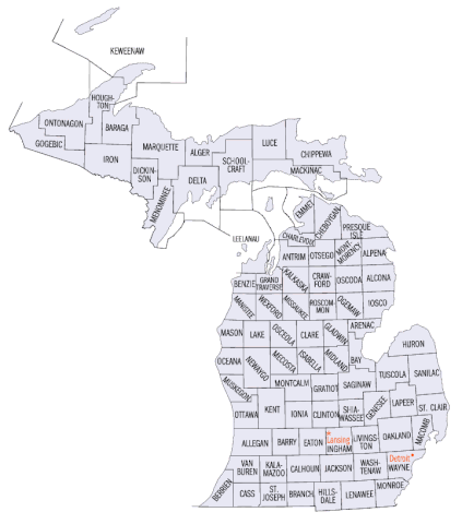
Produced by US Census Bureau, and taken from [1]
רישיון
[עריכה]
This work is in the public domain in the United States because it is a work prepared by an officer or employee of the United States Government as part of that person’s official duties under the terms of Title 17, Chapter 1, Section 105 of the US Code.
Note: This only applies to original works of the Federal Government and not to the work of any individual U.S. state, territory, commonwealth, county, municipality, or any other subdivision. This template also does not apply to postage stamp designs published by the United States Postal Service since 1978. (See § 313.6(C)(1) of Compendium of U.S. Copyright Office Practices). It also does not apply to certain US coins; see The US Mint Terms of Use.
|
 | |
| הקובץ הזה זוהה כקובץ חופשי מכל מגבלה ידועה תחת חוק זכויות היוצרים, כולל כל הזכויות הקשורות והסמוכות. | ||
היסטוריית הקובץ
ניתן ללחוץ על תאריך/שעה כדי לראות את הקובץ כפי שנראה באותו זמן.
| תאריך/שעה | תמונה ממוזערת | ממדים | משתמש | הערה | |
|---|---|---|---|---|---|
| נוכחית | 05:54, 25 באפריל 2010 | | 817 × 720 (51 ק"ב) | AnonMoos (שיחה | תרומות) | fixing mimetype recognition, cropping |
| 16:26, 25 באפריל 2007 | אין תמונה ממוזערת | (52 ק"ב) | Tompw (שיחה | תרומות) | Produced by US Census Bureau, and taken from [http://quickfacts.census.gov/qfd/maps/michigan_map.html] |
אין באפשרותך לדרוס את הקובץ הזה.
שימוש בקובץ
הדף הבא משתמש בקובץ הזה:
שימוש גלובלי בקובץ
אתרי הוויקי השונים הבאים משתמשים בקובץ זה:
- שימוש באתר cy.wikipedia.org
- שימוש באתר fr.wikipedia.org
- שימוש באתר he.wikipedia.org
- שימוש באתר it.wikipedia.org
- שימוש באתר ja.wikipedia.org
- שימוש באתר ko.wikipedia.org
- שימוש באתר nds.wikipedia.org
- שימוש באתר nl.wikipedia.org
- שימוש באתר no.wikipedia.org
- שימוש באתר pt.wikipedia.org
- שימוש באתר ro.wikipedia.org
- שימוש באתר sv.wikipedia.org