File:Mississippi River Lock and Dam number 14.jpg
קפיצה לניווט
קפיצה לחיפוש
גודל התצוגה המקדימה הזאת: 800 × 534 פיקסלים. רזולוציות אחרות: 320 × 214 פיקסלים | 640 × 427 פיקסלים | 1,024 × 683 פיקסלים | 1,500 × 1,001 פיקסלים.
לקובץ המקורי (1,500 × 1,001 פיקסלים, גודל הקובץ: 342 ק"ב, סוג MIME: image/jpeg)
כיתובים
כיתובים
נא להוסיף משפט שמסביר מה הקובץ מייצג
|
This is an image of a place or building that is listed on the National Register of Historic Places in the United States of America. Its reference number is 4000174. |
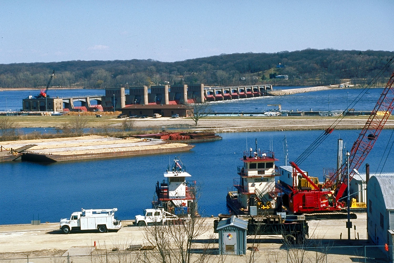
| תיאור | Aerial view of Lock and Dam 14 located on the Mississippi River, Le Claire, Iowa. | |||
| תאריך יצירה | ||||
| מקור |
US Army Corps of Engineers Digital Visual Library (DVL) |
|||
| יוצר | US Army Corps of Engineers, photographer unknown | |||
| אישורים והיתרים (שימוש חוזר בקובץ זה) |
|
| מיקום המצלמה | | תמונה זו ותמונות נוספות במיקום: OpenStreetMap |
|---|
היסטוריית הקובץ
ניתן ללחוץ על תאריך/שעה כדי לראות את הקובץ כפי שנראה באותו זמן.
| תאריך/שעה | תמונה ממוזערת | ממדים | משתמש | הערה | |
|---|---|---|---|---|---|
| נוכחית | 17:21, 16 בפברואר 2007 | | 1,001 × 1,500 (342 ק"ב) | Dual Freq (שיחה | תרומות) | {{Information | Description = Aerial view of Lock and Dam 14 located on the Mississippi River, Le Claire, Iowa. | Source = [http://images.usace.army.mil/main.html US Army Corps of Engineers Digital Visual Library (DVL)]<br /> [http://images.usace.ar |
אין באפשרותך לדרוס את הקובץ הזה.
שימוש בקובץ
הדף הבא משתמש בקובץ הזה:
שימוש גלובלי בקובץ
אתרי הוויקי השונים הבאים משתמשים בקובץ זה:
- שימוש באתר arz.wikipedia.org
- שימוש באתר de.wikipedia.org
- שימוש באתר en.wikipedia.org
- שימוש באתר pt.wikipedia.org
- שימוש באתר www.wikidata.org