File:Mukono District in Uganda.svg
קפיצה לניווט
קפיצה לחיפוש

גודל התצוגה המקדימה הזאת מסוג PNG של קובץ ה־SVG הזה: 589 × 599 פיקסלים. רזולוציות אחרות: 236 × 240 פיקסלים | 472 × 480 פיקסלים | 755 × 768 פיקסלים | 1,007 × 1,024 פיקסלים | 2,013 × 2,048 פיקסלים | 1,441 × 1,466 פיקסלים.
לקובץ המקורי (קובץ SVG, הגודל המקורי: 1,441 × 1,466 פיקסלים, גודל הקובץ: 371 ק"ב)
כיתובים
כיתובים
נא להוסיף משפט שמסביר מה הקובץ מייצג
תקציר[עריכה]
| תיאור |
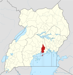
English: The location of Mukono District in Uganda, showing district boundaries as they stood in June 2017. For other districts, see Category:SVG locator maps of Districts in Uganda (location map scheme). This map may be incomplete, and may contain errors. Don't rely solely on it for navigation. In particular, note that this map overlays a spherical pseudo-mercator projection on an equirectangular projection; it is far from technically perfect.
. Inkscape עם נוצרה ה תמונה |
|||||||||
| תאריך יצירה | ||||||||||
| מקור |
Derivative of:
|
|||||||||
| יוצר |
OpenStreetMap contributors, Jarry1250, NordNordWest |
|||||||||
| אישורים והיתרים (שימוש חוזר בקובץ זה) |
הקובץ הזה מתפרסם לפי תנאי רישיון קריאייטיב קומונז ייחוס-שיתוף זהה 3.0 לא מותאם. ייחוס: © OpenStreetMap contributors, Jarry1250, NordNordWest/Wikipedia
|
|||||||||
| Geotemporal data | ||||||||||
| Map location | Mukono District, Uganda | |||||||||
| Spatial reference system | equirectangular | |||||||||
| Bounding box |
|
|||||||||
| Georeferencing | If inappropriate please set warp_status = skip to hide. | |||||||||
היסטוריית הקובץ
ניתן ללחוץ על תאריך/שעה כדי לראות את הקובץ כפי שנראה באותו זמן.
| תאריך/שעה | תמונה ממוזערת | ממדים | משתמש | הערה | |
|---|---|---|---|---|---|
| נוכחית | 21:07, 25 ביוני 2017 | | 1,466 × 1,441 (371 ק"ב) | Jarry1250 (שיחה | תרומות) | pattypan 17.05 |
אין באפשרותך לדרוס את הקובץ הזה.
שימוש בקובץ
אין דפים המשתמשים בקובץ זה.
שימוש גלובלי בקובץ
אתרי הוויקי השונים הבאים משתמשים בקובץ זה:
- שימוש באתר de.wikipedia.org
- שימוש באתר en.wikipedia.org
- Mukono District
- Kisoga, Mukono
- Uganda Christian University
- Roman Catholic Diocese of Lugazi
- Namilyango College
- Mukono Town
- Kalagi, Mukono
- Kampala–Jinja Highway
- Sezibwa River
- Namilyango
- Mount Saint Mary's College Namagunga
- Wikipedia:WikiProject Uganda/District templates
- Template:Mukono District
- Nakifuma
- Naggalama Hospital
- Nagalama
- Namanve
- Namanve Thermal Power Station
- Seeta, Uganda
- David Kato
- Koome Island
- Katosi
- Kasawo
- Namataba
- Lwajjali River
- Kampala–Jinja Expressway
- Mukono–Kyetume–Katosi–Nyenga Road
- Kyetume
- Bukeerere
- Mukono–Kayunga–Njeru Road
- Kampala Outer Beltway
- Damba Island
- Mukono Health Centre IV
- Kampala Cement Company Limited
- Mbalala
- Teacher Mpamire
- Sonde, Uganda
- User:Fsmatovu/sandbox1
- Nagojje
- Tondeka Metro Bus Service
- East African Medical Vitals
- שימוש באתר es.wikipedia.org
- שימוש באתר fa.wikipedia.org
- שימוש באתר fr.wikipedia.org
- שימוש באתר he.wikipedia.org
- שימוש באתר id.wikipedia.org
- שימוש באתר ja.wikipedia.org
- שימוש באתר ml.wikipedia.org
- שימוש באתר nl.wikipedia.org
צפייה בשימושים גלובליים נוספים של קובץ זה.