File:NPS congaree-map.jpg

מתוך Wikimedia Commons
קפיצה לניווט קפיצה לחיפוש

לקובץ המקורי(1,426 × 954 פיקסלים, גודל הקובץ: 289 ק"ב, סוג MIME‏: image/jpeg)

כיתובים

כיתובים

נא להוסיף משפט שמסביר מה הקובץ מייצג

תקציר
[עריכה]

תיאור
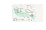
English: Official Congaree National Park map from the brochure, showing the visitor center, trails, roads, and campsites.
תאריך יצירה
מקור U.S. National Park Service (http://npmaps.com/wp-content/uploads/congaree-map.jpg)
יוצר U.S. National Park Service, restoration/cleanup by Matt Holly
גרסאות אחרות
PDF version

רישיון
[עריכה]

Public domain This image or media file contains material based on a work of a National Park Service employee, created as part of that person's official duties. As a work of the U.S. federal government, such work is in the public domain in the United States. See the NPS website and NPS copyright policy for more information.

היסטוריית הקובץ

ניתן ללחוץ על תאריך/שעה כדי לראות את הקובץ כפי שנראה באותו זמן.

תאריך/שעהתמונה ממוזערתממדיםמשתמשהערה
נוכחית20:08, 16 במאי 2017תמונה ממוזערת לגרסה מ־20:08, 16 במאי 2017‪954 × 1,426‬ (289 ק"ב)RKBot (שיחה | תרומות)=={{int:filedesc}}== {{Information |description= {{en|1=Official Congaree National Park map from the brochure, showing the visitor center, trails, roads, and campsites.}} |date= 2016-01-24 |source= U.S. National Park Service (http://npmaps.com/wp-conte...

שימוש גלובלי בקובץ

אתרי הוויקי השונים הבאים משתמשים בקובץ זה: