File:Olfert Dapper, Six maps of the Tribes after Horinus-Adrichom on a reduced scale 05-tribus-simeon (FL37628784 2368510).jpg
קפיצה לניווט
קפיצה לחיפוש
גודל התצוגה המקדימה הזאת: 713 × 600 פיקסלים. רזולוציות אחרות: 285 × 240 פיקסלים | 571 × 480 פיקסלים | 913 × 768 פיקסלים | 1,218 × 1,024 פיקסלים | 2,435 × 2,048 פיקסלים | 4,697 × 3,950 פיקסלים.
לקובץ המקורי (4,697 × 3,950 פיקסלים, גודל הקובץ: 21.42 מ"ב, סוג MIME: image/jpeg)
כיתובים
כיתובים
נא להוסיף משפט שמסביר מה הקובץ מייצג
תקציר
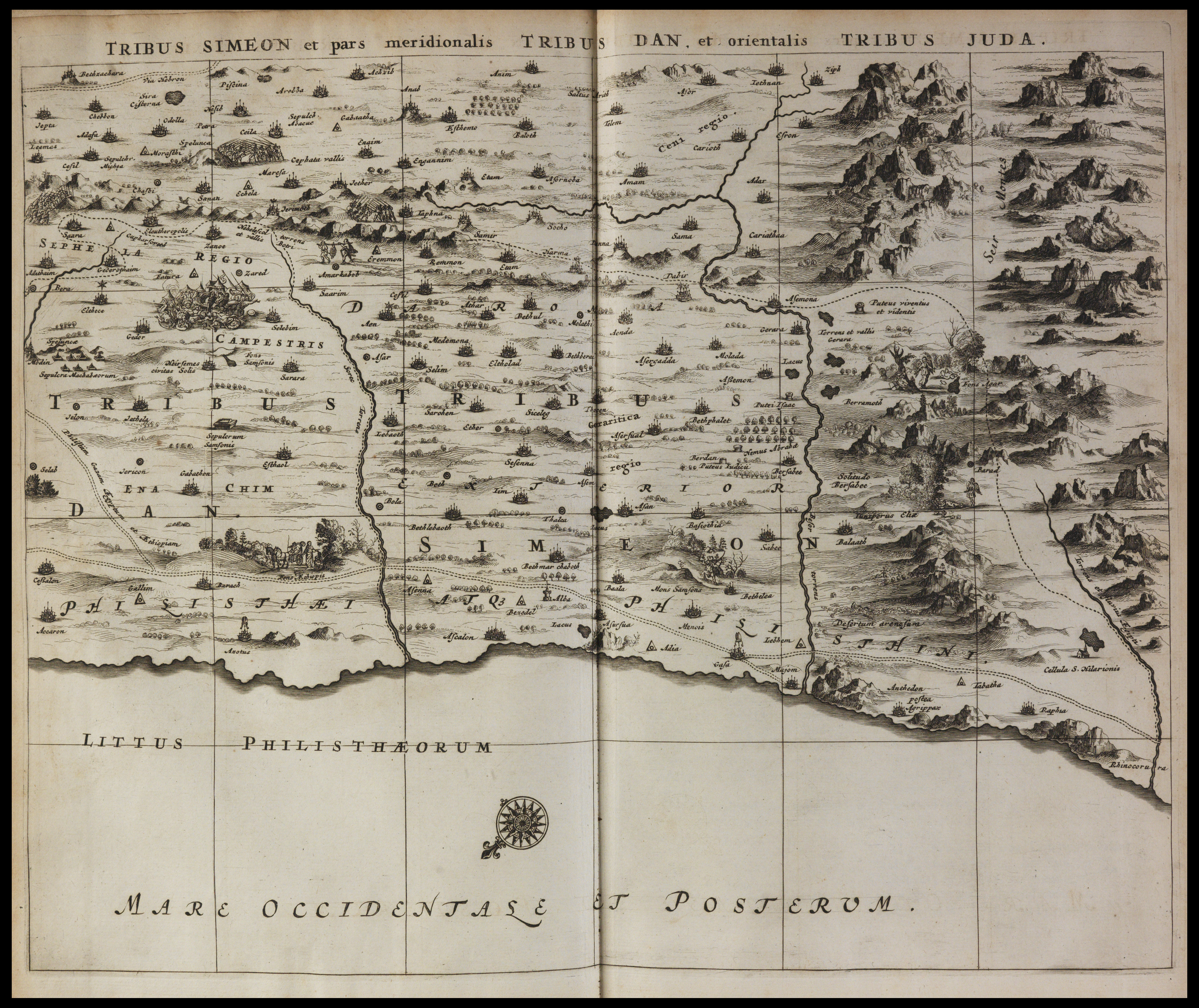
[עריכה]| Six maps of the Tribes after Horinus-Adrichom on a reduced scale
( |
||||||||||||||||||||||||
|---|---|---|---|---|---|---|---|---|---|---|---|---|---|---|---|---|---|---|---|---|---|---|---|---|
| אומן |
| |||||||||||||||||||||||
| יוצרים נוספים | Meurs, Jacob van, 1619-1680 Adrichem, Christiaan van, 1533-1585 Horn, Georg, 1620-1670 | |||||||||||||||||||||||
| כותרת |
Six maps of the Tribes after Horinus-Adrichom on a reduced scale |
|||||||||||||||||||||||
| מפרסם |
Jacob van Meurs |
|||||||||||||||||||||||
| תיאור |
Six maps of the Tribes after Horinus-Adrichom on a reduced scale. |
|||||||||||||||||||||||
| שפה | לטינית | |||||||||||||||||||||||
| תאריך הוצאה לאור | 1677 | |||||||||||||||||||||||
| אוסף |
|
|||||||||||||||||||||||
| מיקום נוכחי |
|
|||||||||||||||||||||||
| מיקום הוצאה | אמסטרדם | |||||||||||||||||||||||
| חיפוש בקטלוג מרחב | אמסטרדם | |||||||||||||||||||||||
| הערות | Copperplates; From: Dapper, Olfert, Naukeurige beschrijving van gantsch Syria en Palestyn . Amsterdam, Jacob van Meurs, 1677. Pt.II, between pp.30-39; Drawn after Visscher | |||||||||||||||||||||||
| IE PID | IE37628738 | |||||||||||||||||||||||
| רוזטה שם קובץ | FL37628784 | |||||||||||||||||||||||
| מזהה רשומה בספרייה הלאומית (P3959) | 990023685100205171 | |||||||||||||||||||||||
| חיפוש בקטלוג מרחב | לטינית, אולפרט דאפר | |||||||||||||||||||||||
| חיפוש בקטלוג מרחב | Twelve tribes of IsraelReuben (Tribe of Israel)Zebulun (Tribe of Israel)MapsJacob van Meurs | |||||||||||||||||||||||
| מקור/צלם |
|
|||||||||||||||||||||||
| גרסאות אחרות | ||||||||||||||||||||||||
| Jpg / Tif version |
|
|||||||||||||||||||||||


.jpg)

.jpg&action=edit§ion=1)
רישיון
[עריכה].jpg&action=edit§ion=2)
The copyright situation of this work is theoretically uncertain, because in the country of origin copyright lasts 70 years after the death of the author, and the date of the author's death is unknown. However, the date of creation of the work was over 120 years ago, and it is thus a reasonable assumption that the copyright has expired (see here for the community discussion). Do not use this template if the date of death of the author is known.
| |
| הקובץ הזה זוהה כקובץ חופשי מכל מגבלה ידועה תחת חוק זכויות היוצרים, כולל כל הזכויות הקשורות והסמוכות. | |
היסטוריית הקובץ
ניתן ללחוץ על תאריך/שעה כדי לראות את הקובץ כפי שנראה באותו זמן.
| תאריך/שעה | תמונה ממוזערת | ממדים | משתמש | הערה | |
|---|---|---|---|---|---|
| נוכחית | 11:22, 28 ביולי 2023 | | 3,950 × 4,697 (21.42 מ"ב) | Geagea (שיחה | תרומות) | pattypan 22.03 |
אין באפשרותך לדרוס את הקובץ הזה.
שימוש בקובץ
הדף הבא משתמש בקובץ הזה:
.jpg&oldid=787579488)