File:Ordnance Survey of Jerusalem - By Captain W. Wilson, R.E. under the direction of Colonel Sir Henry James.1864-5.jpg
לקובץ המקורי (2,020 × 3,065 פיקסלים, גודל הקובץ: 3.38 מ"ב, סוג MIME: image/jpeg)
כיתובים
כיתובים
תקציר
[עריכה]| תיאור |
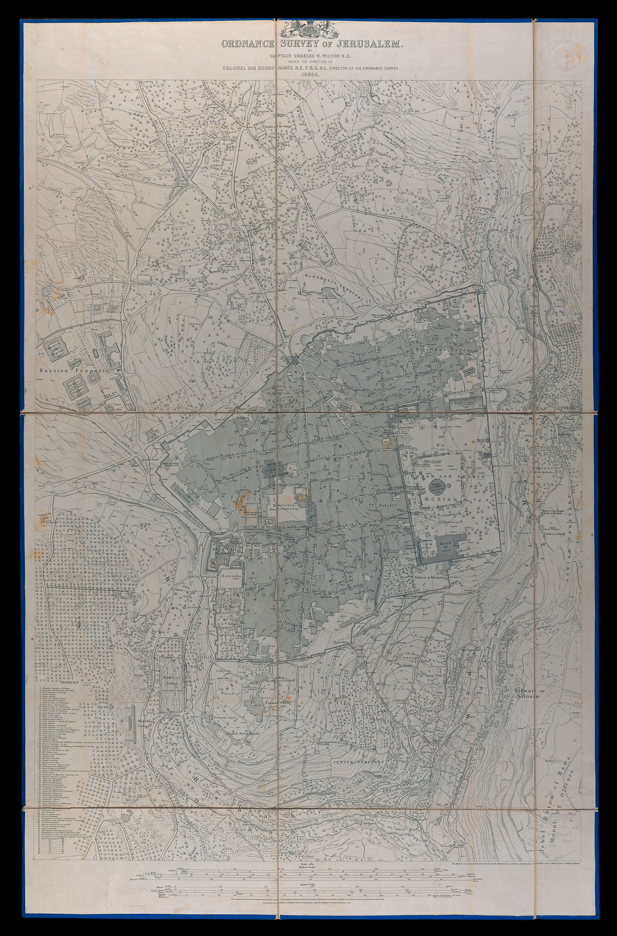
English: A large topographic detailed map of Jerusalem. One of the first measurment maps of the city. Prepared by Charles Wilson, as part of the British Ordnance Survey of Jerusalem, 1864-5.
עברית: מפה טופוגרפית גדולה, מדויקת ומפורטת של ירושלים. אחת ממפות המדידה הראשונות של העיר. הוכנה ע"י צ'רלס וילסון במסגרת הסקר הבריטי של ירושלים, 1864-5.
Dimensions:1005x710 mm Click to enlarge. |
|||
| תאריך יצירה | ||||
| מקור | The Eran Laor Cartographic Collection, National Library of Israel | |||
| יוצר | The National Library of Israel |


רישיון
[עריכה]
|
יצירה זו נמצאת בנחלת הכלל במדינת המקור ובמדינות אחרות בהם תקופת זכויות היוצרים היא משך חיי היוצר ו-70 שנה (או פחות) מפטירתו.
| |
| הקובץ הזה זוהה כקובץ חופשי מכל מגבלה ידועה תחת חוק זכויות היוצרים, כולל כל הזכויות הקשורות והסמוכות. | |
היסטוריית הקובץ
ניתן ללחוץ על תאריך/שעה כדי לראות את הקובץ כפי שנראה באותו זמן.
| תאריך/שעה | תמונה ממוזערת | ממדים | משתמש | הערה | |
|---|---|---|---|---|---|
| נוכחית | 09:01, 13 בדצמבר 2015 | | 3,065 × 2,020 (3.38 מ"ב) | National Library of Israel (שיחה | תרומות) | |
| 09:01, 13 בדצמבר 2015 |  | 3,065 × 2,020 (3.38 מ"ב) | National Library of Israel (שיחה | תרומות) |
אין באפשרותך לדרוס את הקובץ הזה.
שימוש בקובץ
הדפים הבאים משתמשים בקובץ הזה:
שימוש גלובלי בקובץ
אתרי הוויקי השונים הבאים משתמשים בקובץ זה:
- שימוש באתר he.wikipedia.org