File:PIA20871-Ceres-DwarfPlanet-Dawn-4thMapOrbit-LAMO-image149-20160603.jpg
원본 파일 (1,024 × 1,024 픽셀, 파일 크기: 163 KB, MIME 종류: image/jpeg)
캡션
설명
파일 설명[편집]
| 설명 |
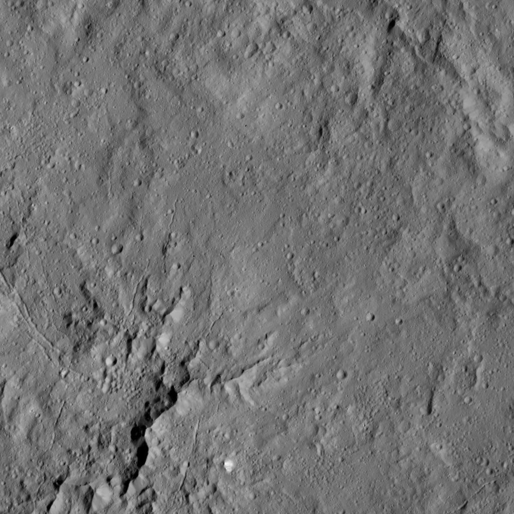
English: PIA20871: Dawn LAMO Image 149
http://photojournal.jpl.nasa.gov/catalog/PIA20871 This view shows peaks in the center of Dantu Crater (78 miles, 125 kilometers) on Ceres. Dantu is named for a Ghanan god associated with the planting of corn. NASA's Dawn spacecraft took this image on June 3, 2016, from its low-altitude mapping orbit, at a distance of about 240 miles (385 kilometers) above the surface. The image resolution is 120 feet (35 meters) per pixel. Dawn's mission is managed by JPL for NASA's Science Mission Directorate in Washington. Dawn is a project of the directorate's Discovery Program, managed by NASA's Marshall Space Flight Center in Huntsville, Alabama. UCLA is responsible for overall Dawn mission science. Orbital ATK, Inc., in Dulles, Virginia, designed and built the spacecraft. The German Aerospace Center, the Max Planck Institute for Solar System Research, the Italian Space Agency and the Italian National Astrophysical Institute are international partners on the mission team. For a complete list of mission participants, see http://dawn.jpl.nasa.gov/mission. For more information about the Dawn mission, visit http://dawn.jpl.nasa.gov. |
| 날짜 | |
| 출처 | http://photojournal.jpl.nasa.gov/jpeg/PIA20871.jpg |
| 저자 | NASA/JPL-Caltech/UCLA/MPS/DLR/IDA |
라이선스[편집]
| 이 파일은 NASA에서 제작하였으므로 퍼블릭 도메인입니다. NASA의 저작권 정책에 따르면 NASA의 자료는 명시하지 않는 이상 저작권의 보호를 받지 않습니다. (Template:PD-USGov, 또는 NASA 저작권 정책 문서, JPL 그림 사용 정책을 참고하세요.) | ||
 |
주의사항:
|
파일 역사
날짜/시간 링크를 클릭하면 해당 시간의 파일을 볼 수 있습니다.
| 날짜/시간 | 섬네일 | 크기 | 사용자 | 설명 | |
|---|---|---|---|---|---|
| 현재 | 2016년 8월 28일 (일) 18:33 | | 1,024 × 1,024 (163 KB) | Drbogdan (토론 | 기여) | User created page with UploadWizard |
이 파일을 덮어쓸 수 없습니다.
이 파일을 사용하는 문서
다음 문서 1개가 이 파일을 사용하고 있습니다: