File:Pieter van der Aa, Rouen, capitale de Normandie (FL147394700 2631142).jpg
קפיצה לניווט
קפיצה לחיפוש

גודל התצוגה המקדימה הזאת: 800 × 294 פיקסלים. רזולוציות אחרות: 320 × 118 פיקסלים | 640 × 235 פיקסלים | 1,024 × 376 פיקסלים | 1,280 × 470 פיקסלים | 2,560 × 940 פיקסלים | 7,841 × 2,880 פיקסלים.
לקובץ המקורי (7,841 × 2,880 פיקסלים, גודל הקובץ: 28.62 מ"ב, סוג MIME: image/jpeg)
כיתובים
כיתובים
נא להוסיף משפט שמסביר מה הקובץ מייצג
תקציר
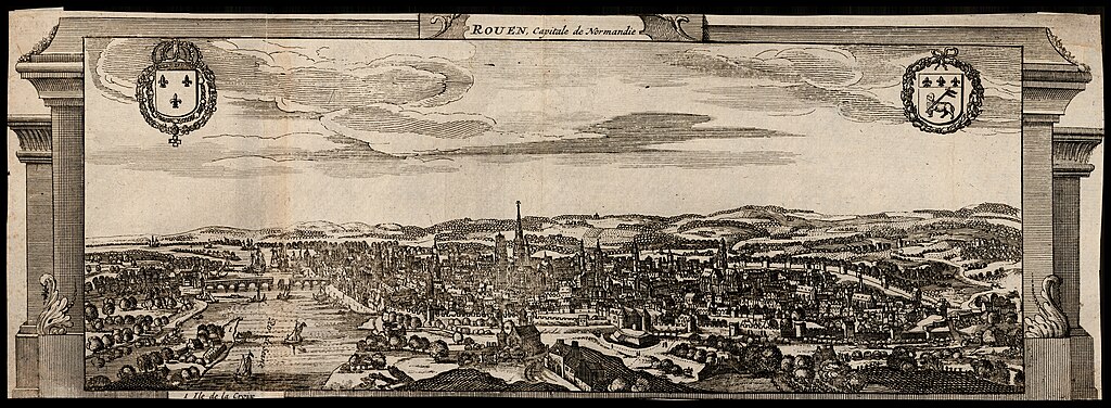
[עריכה]| Pieter van der Aa: Rouen, capitale de Normandie
( |
|||||||||||||||||||||||||||
|---|---|---|---|---|---|---|---|---|---|---|---|---|---|---|---|---|---|---|---|---|---|---|---|---|---|---|---|
| אומן |
|
||||||||||||||||||||||||||
| כותרת |
Rouen, capitale de Normandie |
||||||||||||||||||||||||||
| מפרסם |
Pierre vander Aa |
||||||||||||||||||||||||||
| תיאור |
Rouen, capitale de Normandie. |
||||||||||||||||||||||||||
| שפה | צרפתית | ||||||||||||||||||||||||||
| תאריך הוצאה לאור | 1729 | ||||||||||||||||||||||||||
| טכניקה | 1 sheet ; | ||||||||||||||||||||||||||
| ממדים | גובה: 10 ס"מ; רוחב: 28 ס"מ | ||||||||||||||||||||||||||
| אוסף |
|
||||||||||||||||||||||||||
| מיקום נוכחי |
|
||||||||||||||||||||||||||
| מיקום הוצאה | ליידן | ||||||||||||||||||||||||||
| חיפוש בקטלוג מרחב | ליידן | ||||||||||||||||||||||||||
| הערות | |||||||||||||||||||||||||||
| IE PID | IE147394697 | ||||||||||||||||||||||||||
| רוזטה שם קובץ | FL147394700 | ||||||||||||||||||||||||||
| מזהה רשומה בספרייה הלאומית (P3959) | 990026311420205171 | ||||||||||||||||||||||||||
| חיפוש בקטלוג מרחב | צרפתית, Pieter van der Aa | ||||||||||||||||||||||||||
| חיפוש בקטלוג מרחב | Pierre vander Aa | ||||||||||||||||||||||||||
| מקור/צלם |
|
||||||||||||||||||||||||||
| גרסאות אחרות | |||||||||||||||||||||||||||
| Jpg / Tif version |
|
||||||||||||||||||||||||||


.jpg&action=edit§ion=1)
רישיון
[עריכה].jpg&action=edit§ion=2)
The copyright situation of this work is theoretically uncertain, because in the country of origin copyright lasts 70 years after the death of the author, and the date of the author's death is unknown. However, the date of creation of the work was over 120 years ago, and it is thus a reasonable assumption that the copyright has expired (see here for the community discussion). Do not use this template if the date of death of the author is known.
| |
| הקובץ הזה זוהה כקובץ חופשי מכל מגבלה ידועה תחת חוק זכויות היוצרים, כולל כל הזכויות הקשורות והסמוכות. | |
היסטוריית הקובץ
ניתן ללחוץ על תאריך/שעה כדי לראות את הקובץ כפי שנראה באותו זמן.
| תאריך/שעה | תמונה ממוזערת | ממדים | משתמש | הערה | |
|---|---|---|---|---|---|
| נוכחית | 14:04, 8 באוגוסט 2023 | 2,880 × 7,841 (28.62 מ"ב) | Geagea (שיחה | תרומות) | pattypan 22.03 |
אין באפשרותך לדרוס את הקובץ הזה.
שימוש בקובץ
הדפים הבאים משתמשים בקובץ הזה:
.jpg)
.jpg&oldid=847108733)