File:Sea Gate aerial view.jpg
קפיצה לניווט
קפיצה לחיפוש
גודל התצוגה המקדימה הזאת: 800 × 534 פיקסלים. רזולוציות אחרות: 320 × 214 פיקסלים | 640 × 428 פיקסלים | 1,024 × 684 פיקסלים | 1,500 × 1,002 פיקסלים.
לקובץ המקורי (1,500 × 1,002 פיקסלים, גודל הקובץ: 657 ק"ב, סוג MIME: image/jpeg)
כיתובים
כיתובים
נא להוסיף משפט שמסביר מה הקובץ מייצג
| תיאור |
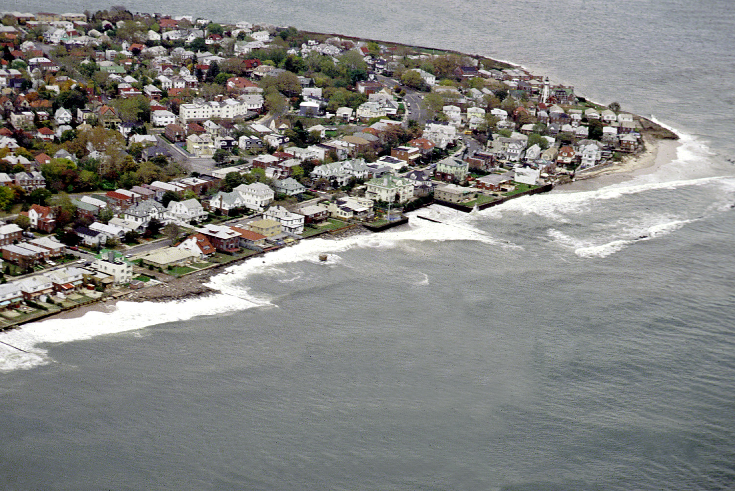
English: Aerial view of the Sea Gate community located on the westernmost extremity of Coney Island, Brooklyn, New York City. |
|||
| תאריך יצירה | ||||
| מקור |
U.S. Army Corps of Engineers Digital Visual Library Image page Image description page Digital Visual Library home page |
|||
| יוצר | U.S. Army Corps of Engineers, photographer not specified or unknown | |||
| אישורים והיתרים (שימוש חוזר בקובץ זה) |
|
|||
| מיקום | Brooklyn, New York City, New York, USA |
| מיקום האובייקט | | תמונה זו ותמונות נוספות במיקום: OpenStreetMap |
|---|
היסטוריית הקובץ
ניתן ללחוץ על תאריך/שעה כדי לראות את הקובץ כפי שנראה באותו זמן.
| תאריך/שעה | תמונה ממוזערת | ממדים | משתמש | הערה | |
|---|---|---|---|---|---|
| נוכחית | 05:01, 9 באפריל 2007 | | 1,002 × 1,500 (657 ק"ב) | DanMS (שיחה | תרומות) | {{Information | Description = {{en|Aerial view of the Sea Gate community located on the westernmost extremity of Coney Island, Brooklyn, New York City.}} | Source = U.S. Army Corps of Engineers Digital Visual Library<br />[http://images.usace.a |
אין באפשרותך לדרוס את הקובץ הזה.
שימוש בקובץ
הדף הבא משתמש בקובץ הזה:
שימוש גלובלי בקובץ
אתרי הוויקי השונים הבאים משתמשים בקובץ זה:
- שימוש באתר de.wikipedia.org
- שימוש באתר en.wikipedia.org
- שימוש באתר es.wikipedia.org
- שימוש באתר et.wikipedia.org
- שימוש באתר he.wikipedia.org
- שימוש באתר ja.wikipedia.org
- שימוש באתר pt.wikipedia.org
- שימוש באתר sv.wikipedia.org
- שימוש באתר vi.wikipedia.org
- שימוש באתר www.wikidata.org
- שימוש באתר yi.wikipedia.org