File:Soldiers, Tomb of Ahmose, Amarna.jpg
לקובץ המקורי (2,560 × 1,920 פיקסלים, גודל הקובץ: 2 מ"ב, סוג MIME: image/jpeg)
כיתובים
כיתובים
תקציר
[עריכה]
| תיאור |
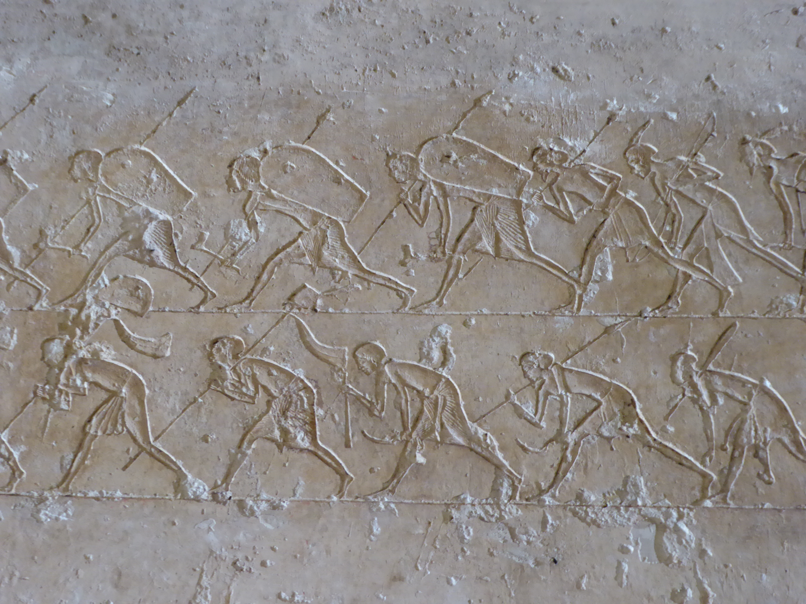
English: Soldiers, Tomb of Ahmose, Amarna
The Nobles' Tombs in the northern cliffs of Amarna are some of the best preserved and most rewarding features surviving at the site of Akhetaten. The decoration is better preserved on the whole and reveals much about life during the Amarnan revolution. Tell el Amarna is the site of something unique in Egypt's history, the brand new capital city by the 'heretic' pharaoh Amenophis IV, better known by the name Akhenaten. Today little remains of the ancient city beyond its foundations (largely hidden amidst the sand dunes), but its significance makes it one of the country's most important archaeological sites. Akhenaten's reign is marked by a radical break with Egypt's ancient religion, the pharaoh abandoned the multitude of traditional gods in favour of a single deity, the Aten, the life giving sun-disc. A new city was built on a desert site, chosen for its proximity to a geographical feature that appeared to enfold the rising sun, and established to cement Egypt's revolution away from the priests and cult centre of Thebes. The city was named 'Akhetaten' and served as the cult centre of the pharoah's new religion with himself as the chief intermediary of the new god. Akhenaten is often celebrated as one of history's earliest monotheistic rulers. The city had a short life, as did Akhenaten's new religion, with the traditional order and power base restored following his death under the reign of his son Tutankhaten (better known as Tutankhamun, the name he adopted after abandoning the Atenist religion). The site was plundered for materials over the following decades and little remains visible beyond the tombs carved into the nearby cliffs. The palaces and the once great temple of Aten have all but disappeared, though two columns of the nearby small temple have been reconstructed in recent years. The desolate nature of the site has however preserved much of the city's layout, since unlike most ancient Egyptian settlements it remained uninhabited over the millennia. For more on this intriguing site see below:- en.wikipedia.org/wiki/Amarna |
| תאריך יצירה | |
| מקור | https://www.flickr.com/photos/amthomson/40079860195/ |
| יוצר | Aidan McRae Thomson |
| מיקום המצלמה | | תמונה זו ותמונות נוספות במיקום: OpenStreetMap |
|---|
רישיון
[עריכה]
- הנכם רשאים:
- לשתף – להעתיק, להפיץ ולהעביר את העבודה
- לערבב בין עבודות – להתאים את העבודה
- תחת התנאים הבאים:
- ייחוס – יש לתת ייחוס הולם, לתת קישור לרישיון, ולציין אם נעשו שינויים. אפשר לעשות את זה בכל צורה סבירה, אבל לא בשום צורה שמשתמע ממנה שמעניק הרישיון תומך בך או בשימוש שלך.
- שיתוף זהה – אם תיצרו רמיקס, תשנו, או תבנו על החומר, חובה עליכם להפיץ את התרומות שלך לפי תנאי רישיון זהה או תואם למקור.
| This image was originally posted to Flickr by Aidan McRae Thomson at https://flickr.com/photos/24141292@N02/40079860195. It was reviewed on 16 ביוני 2020 by FlickreviewR 2 and was confirmed to be licensed under the terms of the cc-by-sa-2.0. |
היסטוריית הקובץ
ניתן ללחוץ על תאריך/שעה כדי לראות את הקובץ כפי שנראה באותו זמן.
| תאריך/שעה | תמונה ממוזערת | ממדים | משתמש | הערה | |
|---|---|---|---|---|---|
| נוכחית | 11:20, 16 ביוני 2020 | | 1,920 × 2,560 (2 מ"ב) | पाटलिपुत्र (שיחה | תרומות) | Uploaded a work by Aidan McRae Thomson from https://www.flickr.com/photos/amthomson/40079860195/ with UploadWizard |
אין באפשרותך לדרוס את הקובץ הזה.
שימוש בקובץ
אין דפים המשתמשים בקובץ זה.
שימוש גלובלי בקובץ
אתרי הוויקי השונים הבאים משתמשים בקובץ זה:
- שימוש באתר he.wikipedia.org