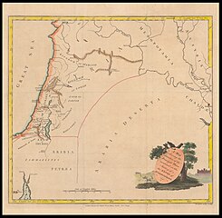
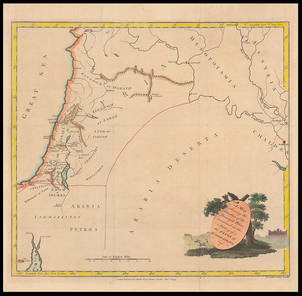
File:Thomas Conder, A map shewing the situation of the principal places mentioned in the history of the kings of Judah & Israel (FL35098545 3892171).jpg
קפיצה לניווט
קפיצה לחיפוש

גודל התצוגה המקדימה הזאת: 612 × 599 פיקסלים. רזולוציות אחרות: 245 × 240 פיקסלים | 490 × 480 פיקסלים | 784 × 768 פיקסלים | 1,046 × 1,024 פיקסלים | 2,092 × 2,048 פיקסלים | 9,347 × 9,151 פיקסלים.
לקובץ המקורי (9,347 × 9,151 פיקסלים, גודל הקובץ: 111.03 מ"ב, סוג MIME: image/jpeg)
כיתובים
כיתובים
נא להוסיף משפט שמסביר מה הקובץ מייצג
תקציר
[עריכה]| Thomas Conder: A map shewing the situation of the principal places mentioned in the history of the kings of Judah & Israel
( |
||||||||||||||||||||||||
|---|---|---|---|---|---|---|---|---|---|---|---|---|---|---|---|---|---|---|---|---|---|---|---|---|
| אומן |
|
|||||||||||||||||||||||
| כותרת |
A map shewing the situation of the principal places mentioned in the history of the kings of Judah & Israel |
|||||||||||||||||||||||
| מפרסם |
C.Taylor |
|||||||||||||||||||||||
| תיאור |
A map shewing the situation of the principal places mentioned in the history of the kings of Judah & Israel. T.Conder delint. Sculpt. |
|||||||||||||||||||||||
| שפה | אנגלית | |||||||||||||||||||||||
| תאריך הוצאה לאור | 1799 | |||||||||||||||||||||||
| טכניקה | 1 online resource (1 map). | |||||||||||||||||||||||
| אוסף |
|
|||||||||||||||||||||||
| מיקום נוכחי |
|
|||||||||||||||||||||||
| מיקום הוצאה | לונדון | |||||||||||||||||||||||
| חיפוש בקטלוג מרחב | לונדון | |||||||||||||||||||||||
| הערות | Digital image of the original in Amir Cahanovitc Collection, Israel. ACC 1991. | |||||||||||||||||||||||
| IE PID | IE35098543 | |||||||||||||||||||||||
| רוזטה שם קובץ | FL35098545 | |||||||||||||||||||||||
| מזהה רשומה בספרייה הלאומית (P3959) | 990038921710205171 | |||||||||||||||||||||||
| חיפוש בקטלוג מרחב | אנגלית, Thomas Conder | |||||||||||||||||||||||
| חיפוש בקטלוג מרחב | C.Taylor | |||||||||||||||||||||||
| מקור/צלם |
|
|||||||||||||||||||||||
| גרסאות אחרות | ||||||||||||||||||||||||
| Jpg / Tif version |
|
|||||||||||||||||||||||

.jpg)

.jpg&action=edit§ion=1)
רישיון
[עריכה].jpg&action=edit§ion=2)
The copyright situation of this work is theoretically uncertain, because in the country of origin copyright lasts 70 years after the death of the author, and the date of the author's death is unknown. However, the date of creation of the work was over 120 years ago, and it is thus a reasonable assumption that the copyright has expired (see here for the community discussion). Do not use this template if the date of death of the author is known.
| |
| הקובץ הזה זוהה כקובץ חופשי מכל מגבלה ידועה תחת חוק זכויות היוצרים, כולל כל הזכויות הקשורות והסמוכות. | |
היסטוריית הקובץ
ניתן ללחוץ על תאריך/שעה כדי לראות את הקובץ כפי שנראה באותו זמן.
| תאריך/שעה | תמונה ממוזערת | ממדים | משתמש | הערה | |
|---|---|---|---|---|---|
| נוכחית | 11:03, 21 באוגוסט 2023 | | 9,151 × 9,347 (111.03 מ"ב) | Geagea (שיחה | תרומות) | pattypan 22.03 |
אין באפשרותך לדרוס את הקובץ הזה.
שימוש בקובץ
הדף הבא משתמש בקובץ הזה:
.jpg&oldid=794855960)