File:Whole world - land and oceans.jpg
둘러보기로 이동
검색으로 이동

미리 보기 크기: 800 × 400 픽셀 다른 해상도: 320 × 160 픽셀 | 640 × 320 픽셀 | 1,024 × 512 픽셀 | 1,280 × 640 픽셀 | 2,560 × 1,280 픽셀 | 8,192 × 4,096 픽셀
원본 파일 (8,192 × 4,096 픽셀, 파일 크기: 5.84 MB, MIME 종류: image/jpeg)
캡션
설명
이 파일이 나타내는 바에 대한 한 줄 설명을 추가합니다
파일 설명
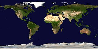
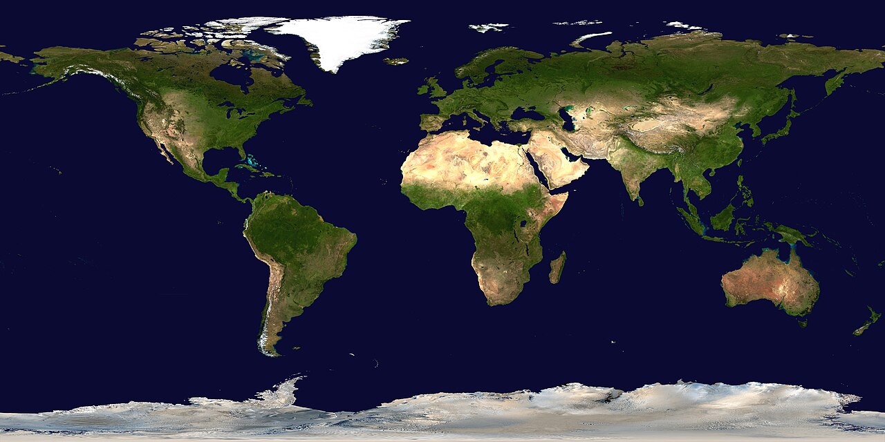
[편집]| 설명 | Satellite composition of the whole Earth's surface. |
| 날짜 | image released 11. Feb. 2002 |
| 출처 |
NASA - Visible Earth, images combined and scaled down by Dbenbenn (8 megabyte upload limit) |
| 저자 | NASA Earth Observatory (NASA Goddard Space Flight Center) |
| 저작권 (이 파일을 인용하기) |
Copyright information from http://visibleearth.nasa.gov/useterms.php - With the exception of images produced by the SeaWiFS, QuickBird, and IKONOS instruments all images on the Visible Earth are governed by NASA's Terms of Use below. [...] For all non-private uses, NASA's Terms Of Use are as follows: 1. The imagery is free of licensing fees 2. NASA requires that they be provided a credit as the owners of the imagery [...] |
| 다른 버전 |
|


| 이 파일은 NASA에서 제작하였으므로 퍼블릭 도메인입니다. NASA의 저작권 정책에 따르면 NASA의 자료는 명시하지 않는 이상 저작권의 보호를 받지 않습니다. (Template:PD-USGov, 또는 NASA 저작권 정책 문서, JPL 그림 사용 정책을 참고하세요.) | ||
 |
주의사항:
|
en:Image:Whole world - land and oceans.jpg
Please note, there is a higher resolution version of this image at Image:Whole world - land and oceans 12000.jpg, which is about 2.45x larger. This image has been left due to the fact that many people are unable to load the larger version at its full size.

파일 역사
날짜/시간 링크를 클릭하면 해당 시간의 파일을 볼 수 있습니다.
| 날짜/시간 | 섬네일 | 크기 | 사용자 | 설명 | |
|---|---|---|---|---|---|
| 현재 | 2014년 9월 15일 (월) 12:10 | | 8,192 × 4,096 (5.84 MB) | Yaviky (토론 | 기여) | Reverted to version as of 15:07, 11 December 2004 : This photo is for the people who cannot load the image, not because of 8MB limit. |
| 2005년 5월 22일 (일) 22:33 |  | 15,306 × 7,653 (8.01 MB) | Dbenbenn (토론 | 기여) | 15306x7653 version, limited by 8MB upload limit | |
| 2004년 12월 11일 (토) 15:07 |  | 8,192 × 4,096 (5.84 MB) | Alfio (토론 | 기여) | Satellite composition of the whole Earth surface |
이 파일을 덮어쓸 수 없습니다.
이 파일을 사용하는 문서
다음 문서 27개가 이 파일을 사용하고 있습니다:
- Commons:WikiProject Aviation/recent uploads/2013 October 23
- File:640px-North Atlantic Basin blank low.jpeg
- File:Africa WV banner.jpg
- File:Africa topic image Satellite image.jpg
- File:Asia WV banner.jpg
- File:Asia topic image Satellite image.jpg
- File:Atlantic hurricane tracks.jpg
- File:Australia and New Zealand topic image Satellite image.jpg
- File:Azerbaijan topic image Satellite image.jpg
- File:Blue Marble 2002.jpg
- File:Blue Marble 2002.png
- File:Blue Marble 2002 (comparison).png
- File:Blue Marble 800px.jpg (파일 넘겨주기)
- File:Caribbean WV banner.jpg
- File:Central America WV banner.jpg
- File:Europe WV banner.jpg
- File:Europe topic image Satellite image.jpg
- File:Europe topic image Satellite image (Ukraine).jpg
- File:Great Lakes Wikivoyage banner.jpg
- File:MODIS Map.jpg
- File:Middle East WV banner.jpg
- File:North America WV banner.jpg
- File:North America topic image Satellite image.jpg
- File:Oceania WV banner.jpg
- File:South America WV banner.jpg
- File:South America topic image Satellite image.jpg
- File:Whole world - land and oceans 12000.jpg
.png)
.jpg)
이 파일을 사용하고 있는 모든 위키의 문서 목록
다음 위키에서 이 파일을 사용하고 있습니다:
- als.wikipedia.org에서 이 파일을 사용하고 있는 문서 목록
- ca.wikipedia.org에서 이 파일을 사용하고 있는 문서 목록
- cs.wikipedia.org에서 이 파일을 사용하고 있는 문서 목록
- de.wikipedia.org에서 이 파일을 사용하고 있는 문서 목록
- en.wikipedia.org에서 이 파일을 사용하고 있는 문서 목록
- en.wikivoyage.org에서 이 파일을 사용하고 있는 문서 목록
- es.wikipedia.org에서 이 파일을 사용하고 있는 문서 목록
- frp.wikipedia.org에서 이 파일을 사용하고 있는 문서 목록
- hi.wikipedia.org에서 이 파일을 사용하고 있는 문서 목록
- hu.wikipedia.org에서 이 파일을 사용하고 있는 문서 목록
- incubator.wikimedia.org에서 이 파일을 사용하고 있는 문서 목록
- ja.wikipedia.org에서 이 파일을 사용하고 있는 문서 목록
- pl.wikipedia.org에서 이 파일을 사용하고 있는 문서 목록
- sk.wikipedia.org에서 이 파일을 사용하고 있는 문서 목록
- tg.wikipedia.org에서 이 파일을 사용하고 있는 문서 목록
- tr.wikipedia.org에서 이 파일을 사용하고 있는 문서 목록
- zh.wikipedia.org에서 이 파일을 사용하고 있는 문서 목록