File:Wilmington North Carolina port aerial view.jpg
קפיצה לניווט
קפיצה לחיפוש
גודל התצוגה המקדימה הזאת: 800 × 534 פיקסלים. רזולוציות אחרות: 320 × 214 פיקסלים | 640 × 427 פיקסלים | 1,024 × 683 פיקסלים | 1,500 × 1,001 פיקסלים.
לקובץ המקורי (1,500 × 1,001 פיקסלים, גודל הקובץ: 589 ק"ב, סוג MIME: image/jpeg)
כיתובים
כיתובים
נא להוסיף משפט שמסביר מה הקובץ מייצג
| תיאור |
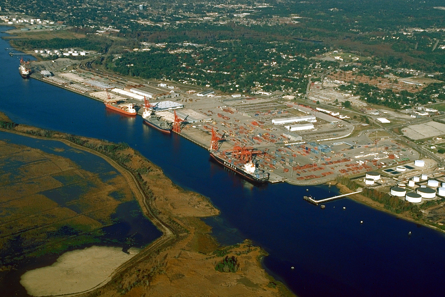
English: Aerial view of the port and city of Wilmington, North Carolina, USA. The port facility is located on the estuary of the Cape Fear River. View is upriver to the north. In this photograph the tide is apparently flowing in quite strongly.
Coordinates: 34°11′48.31″N 77°57′17.51″W / 34.1967528°N 77.9548639°W |
|||
| מיקום | Wilmington, North Carolina, USA | |||
| תאריך יצירה | (Caveat: Dates provided by U.S. Army Corps of Engineers Digital Visual Library are not reliable and are often wrong.) | |||
| מקור |
U.S. Army Corps of Engineers Digital Visual Library Image page Image description page Digital Visual Library home page |
|||
| יוצר | Bud Davis, U.S. Army Corps of Engineers | |||
| אישורים והיתרים (שימוש חוזר בקובץ זה) |
|
היסטוריית הקובץ
ניתן ללחוץ על תאריך/שעה כדי לראות את הקובץ כפי שנראה באותו זמן.
| תאריך/שעה | תמונה ממוזערת | ממדים | משתמש | הערה | |
|---|---|---|---|---|---|
| נוכחית | 04:05, 26 באפריל 2007 | | 1,001 × 1,500 (589 ק"ב) | DanMS (שיחה | תרומות) | {{Information | Description = {{en|Aerial view of the port and city of Wilmington, North Carolina, USA. The port facility is located on the estuary of the Cape Fear River. View is upriver to the north. In this photograph the tide is apparently flowing |
אין באפשרותך לדרוס את הקובץ הזה.
שימוש בקובץ
הדף הבא משתמש בקובץ הזה:
שימוש גלובלי בקובץ
אתרי הוויקי השונים הבאים משתמשים בקובץ זה:
- שימוש באתר de.wikipedia.org
- שימוש באתר en.wikipedia.org
- שימוש באתר fr.wikipedia.org
- שימוש באתר he.wikipedia.org
- שימוש באתר it.wikipedia.org
- שימוש באתר pl.wikipedia.org
- שימוש באתר ru.wikipedia.org
- שימוש באתר uk.wikipedia.org