Struve Geodetic Arc
Hopp til navigering
Hopp til søk
|
Eesti: Struve meridiaankaar on 2820 km pikkune Fr. G. W. Struve poolt läbi viidud maakera ümbermõõdu mõõdistuste triangulatsioonivõrgu ahel, mis ulatub Põhja-Jäämerest Musta mereni; tänapäeval läbib 10 riigi territooriumi.
English: The Struve Geodetic Arc is a chain of survey triangulations stretching from Hammerfest in Norway to the Black Sea, through ten countries and over 2,820 km.
Español: El Arco Geodésico de Struve es un conjunto de triangulaciones geodésicas que se extiende desde el Océano Atlántico hasta el Mar Negro, atravesando diez países en su recorrido de mas de 2.800 kilómetros
Français : L'Arc géodésique de Struve est une chaîne de repères géodésiques de triangulation, qui traverse l'Europe de Hammerfest en Norvège jusqu'à la Mer Noire, traversant dix pays sur plus de 2 800 kilomètres.
日本語: シュトルーヴェの測地弧は黒海からノルウェーのハンメルフェストにわたる三角測量点群である。その範囲は、10カ国、総延長2,800kmに及ぶ。
Norsk bokmål: Struvemeridianen er ei rad av 34 geodetiske målepunkt. Målepunkta går frå Hammerfest i Noreg til Svartehavet, gjennom ti ulike land og over 2 820 kilometer.
Suomi: Struven ketju on yhdeksän maan läpi kulkeva 2 800 kilometrin mittainen kolmiomittausketju välillä Jäämeri–Mustameri.
Svenska: Struves meridianbåge var astronomen Friedrich Georg Wilhelm von Struves projekt för att mäta upp jordklotets rundning.
Português: O Arco Geodésico de Struve é um conjunto de triangulações geodésicas que se estende do Oceano Árctico até ao Mar Negro, atravessando 10 países e com cerca de 2820 km de comprimento.
|
Portrait[rediger]
- Friedrich Wilhelm von Struve (1793-1864)


- Christopher Hansteen (1784-1873)


Map[rediger]
-
 Overview
 -
 Overview
 -
 Sweden, Finland
 -
 Finland


Measurement points by country[rediger]
Norway[rediger]


- Tyven


- Haajen

- Lille-Raipas
.jpg)


- Lodiken

- Bäljatz-vaara

Sweden[rediger]
- Jupukka


Finland[rediger]
Struve Geodetic Arc in Finland


_p210_AAVASAKSA.jpg)


Russia[rediger]
- Gogland (island in the Gulf of Finland)

Estonia[rediger]
Struve Geodetic Arc in Estonia
- Tartu Old Observatory was the first point of the arc.


- "Haljall" (Haljala church), point was the top of the church tower, new spire has changed the location.

- "Helmet" (Helme church), now in ruins, was destroyed in WWII.


- "Marien-Magdalen" (Koeru church), point was the top of the church tower, new spire has changed the location.

- "Oberpahlen" (Põltsamaa Castle), point was the top of the tower which was destroyed in the WWII.


- "Katko" (Simuna)


Latvia[rediger]
- Sestu-Kalns


- Jacobstadt

- Gaissa-kalns

Lithuania[rediger]
Struve Geodetic Arc in Lithuania
- Meškonys


- Beresnäki


- Karischki

Belarus[rediger]
Struve Geodetic Arc in Belarus
- Deibissi
.jpg)
.jpg)
.jpg)

- Ivatsevichy

- Loitzi
.jpg)
- Iwje

- Other points


Ukraine[rediger]
Struve Geodetic Arc in Ukraine
- Golobi (Holoby)

- Gurniki

- Basalia (Bazalija)


.jpg)
.jpg)
.jpg)

- Staronekrasivka Struve Arc. (The southern point of the Struve Geodetic Arc (Odesa region) Самый южный из сохранившихся пунктов дуги Струве в селе Старая Некрасовка (Одесская область))

Moldova[rediger]
Struve Geodetic Arc in Moldova
- Rudi

.jpg)
.jpg)
.jpg)
.jpg)
.jpg)
.jpg)
.jpg)
Others[rediger]
Numismatic[rediger]
-
 Belarus - front (2006)
 -
 Belarus - rear (2006)
 -
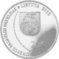 Lituania - front (2015)
 -
 Lituania - rear (2015)
 -
 Moldova (2009)
 -
 Russia (2018)
 -
 Ukraine (2016)


Philately[rediger]
-
 Belarus (2007)
 -
 Belarus (2017)
 -
 Latvia (2011)
 -
 Lituania (2009)
 -
 Lituania (2009)
 -
 Moldova (2008)
 -
 Moldova (2016)
 -
 USSR (1954)
 -
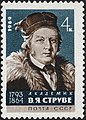 USSR (1964)


,_Baltic_German_astronomer_and_geodesist,_founded_Pulkovo_Observatory).jpg)