User:Chumwa/Gallery
Jump to navigation
Jump to search

-
 2235th file - 75.94 MB - 13254x14867
12.01.2018 .. 12.01.2018 (3 versions)
upload 4648 .. 4650
Neue Spezial- und Verkehrskarte für den Regierungsbezirk Magdeburg.jpg -
 2234th file - 2.86 MB - 3548x4341
07.01.2018
upload 4645
Tramway and trolleybus map of Athens.png -
 2233rd file - 268 KB - 1437x1438
06.01.2018
upload 4637
RGTR(195).jpg -
 2232nd file - 227 KB - 1437x1438
06.01.2018
upload 4636
RGTR(167).jpg -
 2231st file - 294 KB - 1439x1438
06.01.2018
upload 4635
RGTR(125).jpg -
 2230th file - 3 KB - x
06.01.2018
upload 4634
RGTR(102).svg -
 2229th file - 3 KB - x
06.01.2018
upload 4633
RGTR(100).svg -
 2228th file - 3.25 MB - 2316x1904
05.01.2018 .. 06.01.2018 (2 versions)
upload 4632 .. 4644
Public transport map of Athens.png -
 2227th file - 497 KB - 1882x1933
02.01.2018 .. 03.01.2018 (3 versions)
upload 4629 .. 4631
Map of the Paraguayan War 1864-1870.png -
 2226th file - 12 KB - x
02.01.2018
upload by Lpxl
Istanbul M1 Line Symbol.png -
 2225th file - 11 KB - x
02.01.2018
upload by Lpxl
Istanbul TF2 Line Symbol.png -
 2224th file - 10 KB - x
02.01.2018
upload by Lpxl
Istanbul T1 Line Symbol.png -
 2223rd file - 11 KB - x
02.01.2018
upload by Lpxl
Istanbul T5 Line Symbol.png -
 2222nd file - 10 KB - x
02.01.2018
upload by Lpxl
Istanbul TF1 Line Symbol.png -
 2221st file - 12 KB - x
02.01.2018
upload by Lpxl
Istanbul T3 Line Symbol.png -
 2220th file - 10 KB - x
02.01.2018
upload by Lpxl
Istanbul T4 Line Symbol.png -
 2219th file - 11 KB - x
02.01.2018
upload by Lpxl
Istanbul T2 Line Symbol.png -
 2218th file - 13 KB - x
02.01.2018
upload by Lpxl
Istanbul M12 Line Symbol.png -
 2217th file - 11 KB - x
02.01.2018
upload by Lpxl
Istanbul F2 Line Symbol.png -
 2216th file - 14 KB - x
02.01.2018
upload by Lpxl
Istanbul M10 Line Symbol.png -
 2215th file - 12 KB - x
02.01.2018
upload by Lpxl
Istanbul M11 Line Symbol.png -
 2214th file - 10 KB - x
02.01.2018
upload by Lpxl
Istanbul F4 Line Symbol.png -
 2213th file - 10 KB - x
02.01.2018
upload by Lpxl
Istanbul F1 Line Symbol.png -
 2212th file - 12 KB - x
02.01.2018
upload by Lpxl
Istanbul F3 Line Symbol.png -
 2211th file - 14 KB - x
02.01.2018
upload by Lpxl
Istanbul M13 Line Symbol.png -
 2210th file - 13 KB - x
02.01.2018
upload by Lpxl
Istanbul M9 Line Symbol.png -
 2209th file - 14 KB - x
02.01.2018
upload by Lpxl
Istanbul M3 Line Symbol.png -
 2208th file - 14 KB - x
02.01.2018
upload by Lpxl
Istanbul M8 Line Symbol.png -
 2207th file - 13 KB - x
02.01.2018
upload by Lpxl
Istanbul M6 Line Symbol.png -
 2206th file - 12 KB - x
02.01.2018
upload by Lpxl
Istanbul M4 Line Symbol.png -
 2205th file - 12 KB - x
02.01.2018
upload by Lpxl
Istanbul M7 Line Symbol.png -
 2204th file - 13 KB - x
02.01.2018
upload by Lpxl
Istanbul M5 Line Symbol.png -
 2203rd file - 13 KB - x
02.01.2018
upload by Lpxl
Istanbul M2 Line Symbol.png -
 2202nd file - 13 KB - x
02.01.2018
upload by Lpxl
Istanbul M1B Line Symbol.png -
 2201st file - 13 KB - x
02.01.2018 .. 02.01.2018 (2 versions)
upload by Lpxl
Istanbul M1A Line Symbol.png -
 2200th file - 36 KB - 125x105
02.01.2018 .. 02.01.2018 (2 versions)
upload 4624 .. 4628
Istanbul public transport icons.svg -
 2199th file - 4 MB - 11295x5540
27.12.2017
upload 4623
Map Levadas de Madeira.svg -
 2198th file - 279 KB - 1958x1115
24.12.2017
upload 4612
ICE-Linien in Österreich.png -
 2197th file - 377 KB - 1024x774
13.12.2017
upload 4604
Bahnstrecken-Coburger-Land-2017.png -
 2196th file - 2.13 MB - 1181x1669
04.12.2017
upload 4594
Administrative map of the municipalities and districts of Greenland.svg -
 2195th file - 4.95 MB - 2460x3477
04.12.2017 .. 04.12.2017 (2 versions)
upload 4593 .. 4595
Map of the municipalities and districts of Greenland.jpg -
 2194th file - 1.32 MB - 2853x1747
03.12.2017
upload 4591
Carte Distribution des villages d'Empire.png -
 2193rd file - 1.31 MB - 2853x1747
26.11.2017 .. 03.12.2017 (10 versions)
upload 4582 .. 4592
Karte Verteilung der Reichsdörfer.png -
 2192nd file - 809 KB - x
25.11.2017
upload 4581
Map of sinitic languages-de.svg -
 2191st file - 5.1 MB - 4150x3553
20.11.2017 .. 21.11.2017 (3 versions)
upload 4574 .. 4576
Karte der Gemeinde- und Ortsteile der Stadt Kempten (Allgäu).png -
 2190th file - 5.89 MB - 4857x4255
20.11.2017
upload 4573
Positionskarte Kempten.png -
 2189th file - 4.98 MB - 2925x2913
19.11.2017
upload 4572
Guide Michelin trois étoiles.jpg -
 2188th file - 3.27 MB - x
11.11.2017
upload 4568
WritingSystemsOfTheWorld de.svg -
 2187th file - 108 KB - 2838x1062
10.11.2017
upload 4567
Phone number setup.png -
 2186th file - 217 KB - 2837x2026
10.11.2017
upload 4566
Telefonnummernaufbau.png -
 2185th file - 644 KB - 977x843
09.11.2017 .. 13.11.2017 (5 versions)
upload 4562 .. 4570
Map of the municipalities in the Emirate of Sharjah (UAE).svg -
 2184th file - 124 KB - 706x767
09.11.2017 .. 13.11.2017 (2 versions)
upload 4561 .. 4569
Lagekarte Grafschaft Henneberg um 1350.png -
 2183rd file - 127 KB - 691x611
09.11.2017
upload 4560
Lagekarte Grafschaft Henneberg um 1350 differenziert nach heutigen Bundesländern.png -
 2182nd file - 2.02 MB - 2470x1674
04.11.2017
upload 4556
Map Treblinka extermination camp.jpg -
 2181st file - 578 KB - 1251x879
03.11.2017
upload 4553
Stuttgart, Stadtplan, Ausschnitt Güterbahnhof, 1896.jpg -
 2180th file - 1.39 MB - 1027x1019
29.10.2017 .. 07.11.2017 (3 versions)
upload 4547 .. 4558
Karte Eifelkalkmulden in der Kalkeifel.png -
 2179th file - 5.14 MB - 2341x1329
29.10.2017 .. 30.10.2017 (3 versions)
upload 4546 .. 4549
Karte Geologische Strukturen des Rheinischen Schiefergebirges.png -
 2178th file - 702 KB - 836x694
29.10.2017
upload 4545
Lagekarte Kleiner Zab und Großer Zab.png -
 2177th file - 12.09 MB - 6573x4933
29.10.2017
upload 4544
Basiskarte Heidelberg (ohne Bahnlinien).png -
 2176th file - 12.44 MB - 6573x4933
29.10.2017
upload 4543
Basiskarte Heidelberg.png -
 2175th file - 2.24 MB - 1551x2750
29.10.2017 .. 29.10.2017 (3 versions)
upload 4538 .. 4541
Karte der Häfen in Bremerhaven.png -
 2174th file - 572 KB - 1401x1266
27.10.2017 .. 03.11.2017 (4 versions)
upload 4536 .. 4551
Map of Lews Castle.png -
 2173rd file - 402 KB - 1770x1435
26.10.2017 .. 29.10.2017 (3 versions)
upload 4533 .. 4542
Karte Öffentliche Versicherer in Deutschland.png -
 2172nd file - 275 KB - 1658x1449
25.10.2017 .. 06.01.2018 (2 versions)
upload 4532 .. 4643
Karte Große Orientreise von Friedrich August III.png -
 2171st file - 225 KB - 1236x908
24.10.2017
upload 4531
Karte der Wirkungsstätten von Martin Kröncke.png -
 2170th file - 1,017 KB - 1870x1154
24.10.2017 .. 24.10.2017 (2 versions)
upload 4529 .. 4530
Mapa Menorca - Camí de Cavalls.png -
 2169th file - 909 KB - 800x1480
23.10.2017 .. 24.10.2017 (2 versions)
upload 4527 .. 4528
Nordfries-inseln.png -
 2168th file - 481 KB - 926x801
22.10.2017 .. 09.11.2017 (3 versions)
upload 4525 .. 4559
Lageplan Flugplatz Kaditz.png -
 2167th file - 2.34 MB - x
22.10.2017
upload 4524
Ehemalige Bahnstrecken Heidelberg (mit Hintergrund).svg -
 2166th file - 473 KB - 527x365
22.10.2017 .. 22.10.2017 (4 versions)
upload 4520 .. 4523
Karte Stadtgliederung Coburg.svg -
 2165th file - 11.17 MB - 4241x2978
21.10.2017
upload 4519
ÖBB-Nahverkehr Wien und Umgebung.jpg -
 2164th file - 17.32 MB - 6476x6696
21.10.2017
upload 4518
Basiskarte Gent.png -
 2163rd file - 9.48 MB - 4229x4161
21.10.2017
upload 4517
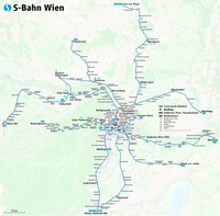
Karte S-Bahn Wien.png -
 2162nd file - 584 KB - 1865x1475
19.10.2017 .. 20.10.2017 (4 versions)
upload 4504 .. 4513
Map Teams and Structure of the NHL.png -
 2161st file - 1.37 MB - 5414x5467
16.10.2017
upload 4501
Route map Tour de Timor 2017.png -
 2160th file - 469 KB - 1152x1152
16.10.2017 .. 20.10.2017 (6 versions)
upload 4500 .. 4512
Karte Nordwestpassage und Nordostpassage.png -
 2159th file - 10.24 MB - 5472x3648
15.10.2017 .. 15.10.2017 (2 versions)
upload 4495 .. 4496
Map of Vienna ca. 1790.jpg -
 2158th file - 644 KB - 4671x2521
14.10.2017
upload 4494
Map of Timor-Leste - administrative (since 2015) - Município of Viqueque.png -
 2157th file - 215 KB - 3133x2558
14.10.2017 .. 19.10.2017 (2 versions)
upload 4493 .. 4509
Map of Timor-Leste - administrative (since 2015) - Município of Oecusse.png -
 2156th file - 640 KB - 3229x3296
14.10.2017
upload 4492
Map of Timor-Leste - administrative (since 2015) - Município of Manufahi.png -
 2155th file - 780 KB - 3061x4019
14.10.2017
upload 4491
Map of Timor-Leste - administrative (since 2015) - Município of Manatuto.png -
 2154th file - 327 KB - 3057x1456
14.10.2017
upload 4490
Map of Timor-Leste - administrative (since 2015) - Município of Liquiçá.png -
 2153rd file - 497 KB - 4380x3017
14.10.2017
upload 4489
Map of Timor-Leste - administrative (since 2015) - Município of Lautém.png -
 2152nd file - 460 KB - 2303x2419
14.10.2017
upload 4488
Map of Timor-Leste - administrative (since 2015) - Município of Ermera.png -
 2151st file - 341 KB - 2565x3419
14.10.2017
upload 4487
Map of Timor-Leste - administrative (since 2015) - Município of Dili.png -
 2150th file - 617 KB - 3800x3083
14.10.2017
upload 4486
Map of Timor-Leste - administrative (since 2015) - Município of Covalima.png -
 2149th file - 601 KB - 4492x2117
14.10.2017
upload 4485
Map of Timor-Leste - administrative (since 2015) - Município of Baucau.png -
 2148th file - 427 KB - 1956x3208
14.10.2017
upload 4484
Map of Timor-Leste - administrative (since 2015) - Município of Ainaro.png -
 2147th file - 684 KB - 3401x3260
14.10.2017
upload 4483
Map of Timor-Leste - administrative (since 2015) - Município of Bobonaro.png -
 2146th file - 393 KB - 2500x2006
14.10.2017
upload 4482
Map of Timor-Leste - administrative (since 2015) - Município of Aileu.png -
 2145th file - 998 KB - 7328x3151
14.10.2017 .. 19.10.2017 (2 versions)
upload 4481 .. 4508
Map of Timor-Leste - administrative (since 2015) - Municípios, Subdistritos and Postos Administrativo.png -
 2144th file - 1.11 MB - 7328x3151
14.10.2017 .. 19.10.2017 (2 versions)
upload 4480 .. 4507
Map of Timor-Leste - administrative (since 2015) - Municípios and Posto Administrativos (with names).png -
 2143rd file - 1.4 MB - 2110x2006
08.10.2017 .. 09.10.2017 (2 versions)
upload 4474 .. 4475
Karte U-Bahn Frankfurt.png -
 2142nd file - 4.16 MB - 2032x1791
06.10.2017 .. 20.10.2017 (6 versions)
upload 4468 .. 4516
Karte Berliner Dampfstraßenbahn-Konsortium.png -
 2141st file - 25.58 MB - 4387x3694
06.10.2017 .. 03.11.2017 (7 versions)
upload 4466 .. 4552
Karte Westliche Berliner Vorortbahn.png -
 2140th file - 4.82 MB - 4095x3513
26.09.2017 .. 26.09.2017 (2 versions)
upload 4449 .. 4450
Karte Prater Wien.jpg -
 2139th file - 2.92 MB - 3323x3478
23.09.2017 .. 04.10.2017 (5 versions)
upload 4448 .. 4461
Frankfurt am Main - Streckenführung der geplanten Regionaltangente West.png -
 2138th file - 546 KB - x
16.08.2017 .. 18.08.2017 (4 versions)
upload 4424 .. 4427
Bedeutende Volksfeste Deutschland.svg -
 2137th file - 1.02 MB - 1702x1086
15.08.2017 .. 15.08.2017 (2 versions)
upload 4422 .. 4423
Mappa di Soleto.png -
 2136th file - 1.48 MB - 4134x2362
13.08.2017 .. 15.08.2017 (4 versions)
upload 4415 .. 4418
Railway Map of Kazakhstan (kk).png -
 2135th file - 5.92 MB - 3353x4676
29.07.2017
upload 4411
Basiskarte Kiel.png -
 2134th file - 9.17 MB - x
25.07.2017
upload 4408
Erogene Zonen des Menschen 2.svg -
 2133rd file - 9.3 MB - x
25.07.2017
upload 4407
Erogene Zonen des Menschen 1.svg -
 2132nd file - 33.4 MB - 7319x5445
23.07.2017
upload 4406
London public transport system map (without stations).png -
 2131st file - 173 KB - 1063x1730
20.07.2017 .. 06.10.2017 (2 versions)
upload 4405 .. 4467
Karte Transrapid-Teststrecke Emsland.png -
 2130th file - 1.54 MB - 729x708
19.07.2017
upload 4402
Karte Landkommissariat Zweibrücken 1818-1862.svg -
 2129th file - 1.54 MB - 729x708
19.07.2017
upload 4401
Karte Landkommissariat Speyer 1818-1862.svg -
 2128th file - 1.54 MB - 729x708
19.07.2017
upload 4400
Karte Landkommissariat Pirmasens 1818-1862.svg -
 2127th file - 1.54 MB - 729x708
19.07.2017
upload 4399
Karte Landkommissariat Neustadt 1818-1862.svg -
 2126th file - 1.54 MB - 729x708
19.07.2017
upload 4398
Karte Landkommissariat Landau 1818-1862.svg -
 2125th file - 1.54 MB - 729x708
19.07.2017
upload 4397
Karte Landkommissariat Kusel 1818-1862.svg -
 2124th file - 1.54 MB - 729x708
19.07.2017
upload 4396
Karte Landkommissariat Kirchheim 1818-1862.svg -
 2123rd file - 1.54 MB - 729x708
19.07.2017
upload 4395
Karte Landkommissariat Kaiserslautern 1818-1862.svg -
 2122nd file - 1.54 MB - 729x708
19.07.2017
upload 4394
Karte Landkommissariat Homburg 1818-1862.svg -
 2121st file - 1.54 MB - 729x708
19.07.2017
upload 4393
Karte Landkommissariat Germersheim 1818-1862.svg -
 2120th file - 1.54 MB - 729x708
19.07.2017
upload 4392
Karte Landkommissariat Frankenthal 1818-1862.svg -
 2119th file - 1.54 MB - 729x708
19.07.2017
upload 4391
Karte Landkommissariat Bergzabern 1818-1862.svg -
 2118th file - 499 KB - 729x708
18.07.2017 .. 19.07.2017 (3 versions)
upload 4388 .. 4390
Verwaltungskarte Rheinkreis bzw. Pfalz 1818-1862.svg -
 2117th file - 794 KB - 2000x1755
18.07.2017
upload 4387
Handkarte der Pfalz für Schulen 1844.jpg -
 2116th file - 412 KB - x
01.07.2017
upload by Furfur
Topographic map of the districts of Socotra (de).svg -
 2115th file - 133 KB - x
23.06.2017
upload 4371
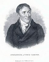
Tiedge 1.jpg -
 2114th file - 310 KB - 1303x1830
18.06.2017
upload 4353
Karte S-Bahn und Regionalbahn Rostock.png -
 2113th file - 245 KB - 1483x1210
08.06.2017
upload 4343
خريطة سكك الحديد السعودية.png -
 2112th file - 1.1 MB - 1586x1233
27.05.2017
upload 4333
Genève - Trolleybus network map.png -
 2111th file - 89.58 MB - 8860x25748
26.05.2017 .. 26.05.2017 (2 versions)
upload 4321 .. 4323
Myanmar Railways stations map (composite).jpg -
 2110th file - 1.38 MB - 1748x1805
26.05.2017 .. 26.05.2017 (2 versions)
upload 4320 .. 4322
Yangon Circular Railway Map (cropped).jpg -
 2109th file - 353 KB - 1620x2175
26.05.2017 .. 31.05.2017 (5 versions)
upload 4318 .. 4335
Yangon Circular Railway and Suburban Rail.png -
 2108th file - 319 KB - 1249x1846
25.05.2017
upload 4317
Circular train 02.jpg -
 2107th file - 525 KB - 1547x2360
25.05.2017
upload 4316
Railway map of Myanmar.png -
 2106th file - 1.28 MB - 3150x1907
22.05.2017 .. 23.11.2017 (4 versions)
upload 4314 .. 4578
Railway map of Hungary.png -
 2105th file - 1.62 MB - 4346x2980
16.05.2017 .. 16.11.2017 (5 versions)
upload 4312 .. 4571
Railway map of Romania.png -
 2104th file - 314 KB - 1571x1011
15.05.2017 .. 22.06.2017 (2 versions)
upload 4311 .. 4369
Railway map of Slovenia.png -
 2103rd file - 712 KB - 2900x1954
09.05.2017 .. 22.06.2017 (2 versions)
upload 4308 .. 4363
Railway map of Bulgaria.png -
 2102nd file - 235 KB - 1204x2137
09.05.2017 .. 22.06.2017 (2 versions)
upload 4307 .. 4362
Railway map of Albania.png -
 2101st file - 4.83 MB - 5405x5290
08.05.2017 .. 23.11.2017 (8 versions)
upload 4306 .. 4577
Railway map of South East Europe.png -
 2100th file - 162 KB - 819x638
04.05.2017
upload 4301
Metro Map Sofia (German).svg -
 2099th file - 203 KB - 1405x1209
02.05.2017 .. 03.05.2017 (2 versions)
upload 4297 .. 4298
Karte Brent-Ölfeld.png -
 2098th file - 452 KB - 1790x2122
01.05.2017 .. 06.01.2018 (3 versions)
upload 4296 .. 4638
Railway map of Moldova.png -
 2097th file - 1.04 MB - 3392x3507
29.04.2017 .. 22.06.2017 (2 versions)
upload 4293 .. 4365
Railway map of Greece.png -
 2096th file - 815 KB - 1959x2844
21.04.2017 .. 22.06.2017 (7 versions)
upload 4277 .. 4368
Railway map of Serbia and Kosovo.png -
 2095th file - 1.14 MB - 2795x2710
17.04.2017 .. 03.11.2017 (9 versions)
upload 4274 .. 4555
Railway map of Croatia and Bosnia and Herzegovina.png -
 2094th file - 7.52 MB - 3638x4567
15.04.2017 .. 15.04.2017 (2 versions)
upload 4272 .. 4273
1834 S.D.U.K. Comparative Map or Chart of the World's Great Rivers - Geographicus - ComparativeRivers-sduk-1834.jpg -
 2093rd file - 2.53 MB - 4342x3483
15.04.2017 .. 06.01.2018 (5 versions)
upload 4270 .. 4640
Map of the offshore wind power farms in the German Bight.png -
 2092nd file - 366 KB - 3005x1694
12.04.2017 .. 24.12.2017 (5 versions)
upload 4261 .. 4611
Straßenbahn-Linienplan München.png -
 2091st file - 904 KB - 548x811
18.03.2017
upload 4259
Dogenwahl.svg -
 2090th file - 99.54 MB - 22829x15502
12.03.2017 .. 12.03.2017 (2 versions)
upload 4256 .. 4257
LgTelephoneMap.jpg -
 2089th file - 86.61 MB - 19018x12408
12.03.2017
upload 4255
Map of Wroclaw 1947.jpg -
 2088th file - 9.51 MB - 2737x2475
12.03.2017
upload 4254
Rio de Janeiro Tramway Map 1906.jpeg -
 2087th file - 30.63 MB - 6064x4416
12.03.2017
upload 4253
Mexico City Tramway Map 1910.jpg -
 2086th file - 6.91 MB - 3750x4143
05.03.2017 .. 05.03.2017 (3 versions)
upload 4247 .. 4249
Map of Mosul.svg -
 2085th file - 2.67 MB - 2621x2792
02.03.2017
upload 4236
Plauen public transport system map.png -
 2084th file - 711 KB - x
01.03.2017 .. 01.03.2017 (2 versions)
upload 4231 .. 4232
Stuttgart Subdivisions Grünes U.svg -
 2083rd file - 407 KB - 1796x1797
01.03.2017
upload 4230
Carte du pays de droit coutumier et du pays de droit écrit (fr).png -
 2082nd file - 1.8 MB - 750x1580
24.02.2017
upload 4223
Mt Tom RR Map.png -
 2081st file - 367 KB - 731x888
24.02.2017
upload 4222
Схема СЖД.jpg -
 2080th file - 10.67 MB - 1904x5663
23.02.2017 .. 06.03.2017 (5 versions)
upload 4221 .. 4250
Karte Spandau-West–Hennigsdorfer Kleinbahn.jpg -
 2079th file - 65.68 MB - 12859x17508
22.02.2017
upload 4220
San Francisco and San Jose public transport system map (with stations).png -
 2078th file - 80.28 MB - 18024x17939
22.02.2017
upload 4219
Amsterdam, Den Haag, Rotterdam and Utrecht public transport system map (with stations).jpg -
 2077th file - 46.75 MB - 14545x11664
19.02.2017
upload 4216
Leipzig and Halle public transport system map (with stations).png -
 2076th file - 43.68 MB - 10208x8706
19.02.2017
upload 4215
Stuttgart public transport system map (with stations).png -
 2075th file - 39.31 MB - 10732x8478
19.02.2017
upload 4214
Mannheim, Ludwigshafen and Heidelberg public transport system map (with stations).png -
 2074th file - 66.05 MB - 14670x13115
19.02.2017
upload 4213
Hamburg public transport system map (with stations).png -
 2073rd file - 20.36 MB - 7998x6202
19.02.2017
upload 4212
Strasbourg public transport system map (with stations).png -
 2072nd file - 193 KB - 932x1046
17.02.2017 .. 17.02.2017 (2 versions)
upload 4210 .. 4211
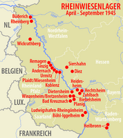
Karte Rheinwiesenlager.png -
 2071st file - 425 KB - 1796x1797
17.02.2017
upload 4209
Carte du pays de droit coutumier et du pays de droit écrit.png -
 2070th file - 84.31 MB - 17670x11900
17.02.2017
upload 4208
Köln and Bonn public transport system map (with stations).png -
 2069th file - 10.18 MB - 4580x4445
17.02.2017
upload 4207
Linz public transport system map (with stations).png -
 2068th file - 31.1 MB - 9730x8939
17.02.2017
upload 4206
Budapest public transport system map (with stations).png -
 2067th file - 22.92 MB - 9639x6817
17.02.2017
upload 4205
Oslo public transport system map (with stations).png -
 2066th file - 581 KB - 3333x2500
16.02.2017
upload 4204
Neubau Oeynhausen.png -
 2065th file - 12.76 MB - 5527x4553
15.02.2017
upload 4203
Minsk public transport system map (with stations).png -
 2064th file - 26.65 MB - 10461x8179
15.02.2017
upload 4202
Kiev public transport system map (with stations).png -
 2063rd file - 8.87 MB - 4658x4399
15.02.2017
upload 4201
Montpellier public transport system map (with stations).png -
 2062nd file - 94.73 MB - 20834x14554
15.02.2017
upload 4200
Ruhrgebiet public transport system map (with stations).jpg -
 2061st file - 93.16 MB - 26318x25974
15.02.2017
upload 4199
Donbass public transport system map (with stations).jpg -
 2060th file - 41.93 MB - 10357x9249
13.02.2017
upload 4198
Upper Silesia public transport system map (with stations).png -
 2059th file - 33.68 MB - 10847x11303
13.02.2017
upload 4197
Gdańsk public transport system map (with stations).png -
 2058th file - 67.59 MB - 16014x12089
13.02.2017
upload 4196
Berlin public transport system map (with stations).png -
 2057th file - 66.66 MB - 13665x14278
11.02.2017
upload 4195
Munich public transport system map (with stations).png -
 2056th file - 2.76 MB - 3319x2802
11.02.2017
upload 4194
Timisoara public transport system map (with stations).png -
 2055th file - 8.72 MB - 4343x5017
11.02.2017
upload 4193
Bucuresti public transport system map (with stations).png -
 2054th file - 66.56 MB - 26084x14961
11.02.2017
upload 4192
Shanghai public transport system map (with stations).png -
 2053rd file - 71.17 MB - 14300x10573
11.02.2017
upload 4191
London public transport system map (with stations).png -
 2052nd file - 42.27 MB - 7964x7145
11.02.2017
upload 4190
Paris public transport system map (with stations).png -
 2051st file - 14.98 MB - 6388x5355
11.02.2017
upload 4189
Génève public transport system map (with stations).png -
 2050th file - 4.68 MB - 4086x2498
11.02.2017
upload 4188
Lausanne public transport system map (with stations).png -
 2049th file - 8.22 MB - 3866x4810
11.02.2017
upload 4187
Bern public transport system map (with stations).png -
 2048th file - 24.81 MB - 7252x6066
11.02.2017
upload 4186
Zürich public transport system map (with stations).png -
 2047th file - 28.53 MB - 10491x11251
11.02.2017
upload 4185
Beijing public transport system map (with stations).png -
 2046th file - 7.45 MB - 4823x3428
11.02.2017
upload 4184
Marseille public transport system map (with stations).png -
 2045th file - 20.47 MB - 7401x5319
11.02.2017
upload 4183
Lyon public transport system map (with stations).png -
 2044th file - 10.28 MB - 3751x2946
08.02.2017 .. 08.02.2017 (2 versions)
upload 4177 .. 4178
1835 Malte-Brun Map of the German Confederation.jpg -
 2043rd file - 25.4 MB - 10859x10735
07.02.2017 .. 08.02.2017 (2 versions)
upload 4175 .. 4176
Hong Kong and Shenzhen public transport system map (with stations).png -
 2042nd file - 18.82 MB - 9896x7593
07.02.2017
upload 4174
Rostov-on-Don public transport system map (with stations).png -
 2041st file - 26.24 MB - 10642x10363
07.02.2017
upload 4173
Chelyabinsk public transport system map (with stations).png -
 2040th file - 17.11 MB - 8433x8665
07.02.2017
upload 4172
Kazan public transport system map (with stations).png -
 2039th file - 16.1 MB - 8064x8192
07.02.2017
upload 4171
Omsk public transport system map (with stations).png -
 2038th file - 12.12 MB - 10310x7972
07.02.2017
upload 4170
Samara public transport system map (with stations).png -
 2037th file - 30.34 MB - 13391x9843
07.02.2017
upload 4169
Nizhny Novgorod public transport system map (with stations).png -
 2036th file - 19.13 MB - 6919x7967
07.02.2017
upload 4168
Yekaterinburg public transport system map (with stations).png -
 2035th file - 21.81 MB - 9604x7573
07.02.2017
upload 4167
Novosibirsk public transport system map (with stations).png -
 2034th file - 383 KB - 1843x1612
07.02.2017
upload 4161
Map of Gaya confederacy in Korea .png -
 2033rd file - 469 KB - 3079x2623
06.02.2017 .. 20.10.2017 (6 versions)
upload 4160 .. 4514
Karte Auschwitz.svg -
 2032nd file - 37.58 MB - 7670x11149
06.02.2017
upload 4156
Saint Petersburg public transport system map (with stations).png -
 2031st file - 51.05 MB - 8886x10471
04.02.2017
upload 4155
Moscow public transport system map (without stations).png -
 2030th file - 51.4 MB - 8886x10471
04.02.2017
upload 4154
Moscow public transport system map (with stations).png -
 2029th file - 2.77 MB - 4169x3259
01.02.2017 .. 02.02.2017 (3 versions)
upload 4151 .. 4153
Positionskarte München.png -
 2028th file - 1.06 MB - 6248x1521
29.01.2017 .. 29.01.2017 (2 versions)
upload 4149 .. 4150
Straßenbahn München Linie 25 - Linienband.png -
 2027th file - 16.81 MB - 4519x4877
21.01.2017
upload 4148
Karte Rennweg Hassberge.jpg -
 2026th file - 2.25 MB - 2003x1924
21.01.2017
upload 4147
France Midi 45° Latitude.jpg -
 2025th file - 160 KB - 1594x1620
21.01.2017
upload 4146
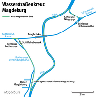
Karte Wasserstraßenkreuz Magdeburg.png -
 2024th file - 593 KB - 1867x1917
21.01.2017
upload 4145
Itbayat map.png -
 2023rd file - 202 KB - 1346x1156
21.01.2017 .. 21.01.2017 (2 versions)
upload 4141 .. 4142
Dutch Caribbean maritime boundaries with island names.svg -
 2022nd file - 2.57 MB - 1516x3988
18.01.2017
upload 4140
Geistbeck 1885 - Königssee Tiefenkarten.png -
 2021st file - 335 KB - 2624x1408
15.01.2017 .. 16.01.2017 (2 versions)
upload 4136 .. 4137
Karte Alliierte Besatzungszonen in Österreich von 1945 bis 1955.png -
 2020th file - 2.51 MB - 2116x2704
15.01.2017
upload 4135
Karte Dampfer Helgoland Spitzbergen 1898.jpg -
 2019th file - 970 KB - 1565x1259
15.01.2017
upload 4134
Karte Autobahnen um Braunschweig.png -
 2018th file - 22.91 MB - 7256x5986
09.01.2017
upload 4126
München - Basiskarte farbig - mit Nachbargemeinden.png -
 2017th file - 65.94 MB - 17078x17847
09.01.2017
upload 4125
Karte München Basiskarte.jpg -
 2016th file - 5.01 MB - 2673x2073
01.01.2017 .. 15.03.2017 (2 versions)
upload 4117 .. 4258
Karte der U-Bahnlinie U7 in Berlin.png -
 2015th file - 3.21 MB - 3027x3195
18.12.2016 .. 23.12.2016 (8 versions)
upload 4090 .. 4100
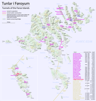
Map of the tunnels of the Faroe Islands.png -
 2014th file - 51.76 MB - 8192x6907
16.12.2016
upload 4089
Flözkarte von Kliver im Bereich Ruhbachtal.jpg -
 2013th file - 3.77 MB - 6375x4447
16.12.2016
upload 4088
Atlas des concessions du terrain houiller de la Sarre (feuille 37).jpg -
 2012th file - 1.81 MB - x
09.12.2016
upload 4079
France, administrative divisions - de (+overseas) - colored 2016.svg -
 2011th file - 6.09 MB - 3123x1849
28.11.2016 .. 31.12.2016 (4 versions)
upload 4071 .. 4116
Map of the Caracas metro.png -
 2010th file - 179 KB - 1619x1137
04.11.2016
upload 4061
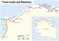
Tram-train La Réunion de.png -
 2009th file - 203 KB - 1266x1332
23.10.2016
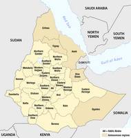
upload 4057
Ethiopia - Administrative regions 1987-1991.png -
 2008th file - 277 KB - 3302x2011
09.10.2016 .. 20.07.2017 (6 versions)
upload 4050 .. 4404
Category tree 'Maps of Munich'.png -
 2007th file - 1.21 MB - 1181x1669
09.10.2016
upload 4049
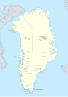
Administrative map of the municipalities and districts of Greenland 2009-2017.svg -
 2006th file - 373 KB - 3524x2296
09.10.2016 .. 24.11.2017 (6 versions)
upload 4047 .. 4580
Railjet-Strecken (schematisch).png -
 2005th file - 4.94 MB - 2460x3477
29.09.2016 .. 01.10.2016 (2 versions)
upload 4039 .. 4040
Map of the municipalities and districts of Greenland 2009-2017.jpg -
 2004th file - 326 KB - x
26.09.2016
upload 4037
Munich City Center.svg -
 2003rd file - 1.21 MB - 1156x1532
24.09.2016
upload 4036
Grundriss der Residenz München (Bayerische Schlösserverwaltung).jpg -
 2002nd file - 4.12 MB - 2595x2684
23.09.2016
upload 4035
Hänsel-und-Gretel-Heim-bjs120911-06.jpg -
 2001st file - 11.09 MB - 9509x7602
23.09.2016
upload 4034
1895 Stranahan Map of Ohio.jpg -
 2000th file - 5.71 MB - 4156x2502
20.09.2016
upload 4031
Map of classic Neandertal fossil sites (hr-at).jpg -
 1999th file - 11.39 MB - 5472x3648
19.09.2016
upload 4030
Luftbild Bad Tölz.jpg -
 1998th file - 11.49 MB - 5013x3138
18.09.2016
upload 4029
Luftbild Neuperlach in München.jpg -
 1997th file - 6.54 MB - 3379x2082
18.09.2016
upload 4028
Luftbild Haidhausen in München.jpg -
 1996th file - 590 KB - 800x799
15.09.2016
upload 4027
Fotothek df n-10 0000312.jpg -
 1995th file - 2.17 MB - 1348x1667
10.09.2016 .. 11.12.2016 (5 versions)
upload 4024 .. 4085
Karte Streetlife München.png -
 1994th file - 160 KB - 1282x680
10.09.2016
upload 4023
Karte der Verkehrsverbünde und Tarifverbünde in Österreich.png -
 1993rd file - 15.79 MB - 5472x3648
04.09.2016
upload 4007
Luftbild München Innenstadt.jpg -
 1992nd file - 615 KB - 1529x2137
02.09.2016 .. 04.09.2016 (2 versions)
upload 4006 .. 4008
Karte PSD Bankengruppe.png -
 1991st file - 609 KB - 1451x1403
26.08.2016
upload 3997
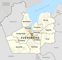
Vestlig Høj -- Bydel i Flensborg -- Beliggenhed.png -
 1990th file - 607 KB - 1451x1403
26.08.2016
upload 3996
Tarup -- Bydel i Flensborg -- Beliggenhed.png -
 1989th file - 608 KB - 1451x1403
26.08.2016
upload 3995
Sydstaden -- Bydel i Flensborg -- Beliggenhed.png -
 1988th file - 606 KB - 1451x1403
26.08.2016
upload 3994
Sporskifte -- Bydel i Flensborg -- Beliggenhed.png -
 1987th file - 606 KB - 1451x1403
26.08.2016
upload 3993
Sandbjerg -- Bydel i Flensborg -- Beliggenhed.png -
 1986th file - 603 KB - 1451x1403
26.08.2016
upload 3992
Nystaden -- Bydel i Flensborg -- Beliggenhed.png -
 1985th file - 606 KB - 1451x1403
26.08.2016
upload 3991
Nordstaden -- Bydel i Flensborg -- Beliggenhed.png -
 1984th file - 606 KB - 1451x1403
26.08.2016
upload 3990
Mørvig -- Bydel i Flensborg -- Beliggenhed.png -
 1983rd file - 607 KB - 1451x1403
26.08.2016
upload 3989
Jørgensby -- Bydel i Flensborg -- Beliggenhed.png -
 1982nd file - 603 KB - 1451x1403
26.08.2016
upload 3988
Indre By -- Bydel i Flensborg -- Beliggenhed.png -
 1981st file - 605 KB - 1451x1403
26.08.2016
upload 3987
Fruerlund -- Bydel i Flensborg -- Beliggenhed.png -
 1980th file - 607 KB - 1451x1403
26.08.2016
upload 3986
Friserbjerg -- Bydel i Flensborg -- Beliggenhed.png -
 1979th file - 606 KB - 1451x1403
26.08.2016
upload 3985
Engelsby -- Bydel i Flensborg -- Beliggenhed.png -
 1978th file - 4.27 MB - 2469x2444
24.08.2016 .. 19.12.2016 (4 versions)
upload 3977 .. 4095
Plan du réseau des tramways de Bordeaux.png -
 1977th file - 1.5 MB - 1961x1964
13.08.2016 .. 13.08.2016 (2 versions)
upload 3973 .. 3974
Plan der Ordensburg Marienburg.png -
 1976th file - 2.61 MB - 4000x3000
30.07.2016
upload 3962
Chinesischer Turm München - Turmspitze.jpg -
 1975th file - 597 KB - 941x1489
26.07.2016
upload 3961
Stadtplan Frankfurt U-Bahnstrecke D Planung (FNP2005).png -
 1974th file - 14.08 MB - 4926x6240
25.07.2016
upload 3957
Oslo, "Pernille" med Slottet - no-nb digifoto 20160713 00197 NB MIT FNR 17505.jpg -
 1973rd file - 8.04 MB - 8113x7854
24.07.2016
upload 3956
Städtisches Hochhaus in München.jpg -
 1972nd file - 20.15 MB - 5144x3496
23.07.2016 .. 24.07.2016 (2 versions)
upload 3953 .. 3954
Übersichtsplan Viktualienmarkt München.jpg -
 1971st file - 5.21 MB - 5472x3648
23.07.2016
upload 3952
Öffentliche Verkehrsmittel in der Corneliusstraße in München.JPG -
 1970th file - 3.74 MB - 3648x5472
23.07.2016
upload 3951
Weiss-Ferdl-Brunnen auf dem Viktualienmarkt in München.JPG -
 1969th file - 5.87 MB - 5472x3648
23.07.2016
upload 3950
U-Bahn-Notausgang am Rindermarkt in München.JPG -
 1968th file - 3.69 MB - 5472x3648
23.07.2016
upload 3949
Münchner Stadtansicht mit Türmen.jpg -
 1967th file - 4.51 MB - 5472x3648
23.07.2016
upload 3948
Südwestende der Schrannenhalle in München.JPG -
 1966th file - 4.52 MB - 5472x3648
23.07.2016
upload 3947
Straßenzug Rindermarkt in München.JPG -
 1965th file - 4.89 MB - 5472x3648
23.07.2016
upload 3946
Straßenszene in der Westermühlstraße in München.JPG -
 1964th file - 4.26 MB - 3648x5472
23.07.2016
upload 3945
Straßenszene in der Müllerstraße in München.JPG -
 1963rd file - 4.15 MB - 3648x5472
23.07.2016
upload 3944
Straßenszene in der Hans-Sachs-Straße in München.JPG -
 1962nd file - 5.16 MB - 5472x3648
23.07.2016
upload 3943
Straßenpoller am Rindermarkt in München.JPG -
 1961st file - 5.11 MB - 5472x3648
23.07.2016
upload 3942
Stadtmuseum München.JPG -
 1960th file - 5 MB - 5472x3648
23.07.2016
upload 3941
Skulptur am Ignaz-Günther-Haus in München.JPG -
 1959th file - 6.21 MB - 5472x3648
23.07.2016
upload 3940
Sitzgruppe an der Schrannenhalle in München.JPG -
 1958th file - 5.42 MB - 5472x3648
23.07.2016
upload 3939
Sitzgruppe am Sebastiansplatz in München.JPG -
 1957th file - 5.35 MB - 5472x3648
23.07.2016
upload 3938
Sendlinger Straße in München.JPG -
 1956th file - 5.3 MB - 5472x3648
23.07.2016
upload 3937
Sebastiansplatz in München.JPG -
 1955th file - 3.99 MB - 5472x3648
23.07.2016
upload 3936
Schweinsköpfe auf dem Viktualienmarkt in München.JPG -
 1954th file - 5.37 MB - 5472x3648
23.07.2016
upload 3935
Schlagzeilen am Tag nach dem Amoklauf in München am 22. Juli 2016.JPG -
 1953rd file - 5.56 MB - 5472x3648
23.07.2016
upload 3934
Schild des Kommunalreferats am Rindermarkt in München.JPG -
 1952nd file - 4.09 MB - 3648x5472
23.07.2016
upload 3933
Rindermarkt mit Blick auf die St-Peterskirche in München.JPG -
 1951st file - 4.03 MB - 5472x3648
23.07.2016
upload 3932
Pferdeskulpturen am Rindermarkt in München.jpg -
 1950th file - 6.03 MB - 5472x3648
23.07.2016
upload 3931
Münchener Flagge mit Trauerflor wegen des Amoklaufs in München am 22. Juli 2016.JPG -
 1949th file - 4.32 MB - 5472x3648
23.07.2016
upload 3930
Mauerstruktur der Hauptsynagoge München.JPG -
 1948th file - 3.22 MB - 3648x5472
23.07.2016
upload 3929
Maibaum auf dem Viktualienmarkt, Alter Peter und Rathausturm in München.JPG -
 1947th file - 3.44 MB - 1743x1921
23.07.2016
upload 3928
Logo Viktualienmarkt München.jpg -
 1946th file - 4.59 MB - 5472x3648
23.07.2016
upload 3927
Käsestand auf dem Viktualienmarkt in München.JPG -
 1945th file - 5.54 MB - 5472x3648
23.07.2016
upload 3926
Kreuzung Müllerstraße und Fraunhoferstraße in München.JPG -
 1944th file - 5.36 MB - 5472x3648
23.07.2016
upload 3925
Kondolenzen wegen des Amoklaufs in München am 22. Juli 2016.JPG -
 1943rd file - 4.5 MB - 3648x5472
23.07.2016
upload 3924
Karl-Valentin-Brunnen in München.JPG -
 1942nd file - 5.16 MB - 5472x3648
23.07.2016
upload 3923
Hinweis auf das ehemalige Gighanbad am Orag-Hauses am St.-Jakobs-Platz in München.JPG -
 1941st file - 4 MB - 5472x3648
23.07.2016
upload 3922
Hinweis am Karl-Valentin-Brunnen in München.JPG -
 1940th file - 6.69 MB - 5472x3648
23.07.2016
upload 3921
Hausschild von 'The Seven' in der Müllerstraße 7 in München.JPG -
 1939th file - 5.86 MB - 3648x5472
23.07.2016
upload 3920
Hausnummernschild an der Hauptsynagoge München.JPG -
 1938th file - 7.11 MB - 5472x3648
23.07.2016
upload 3919
Graffitis an der Mauer Glockenbachwerkstatt in München.JPG -
 1937th file - 6.83 MB - 5472x3648
23.07.2016
upload 3918
Graffitis am Rückgebäude der Glockenbachwerkstatt in München.JPG -
 1936th file - 5.71 MB - 3648x5472
23.07.2016
upload 3917
Gedenktafel für Carl Spitzweg am Stadtmuseum München.JPG -
 1935th file - 4.71 MB - 3648x5472
23.07.2016
upload 3916
Gebäude Corneliusstraße 6 in München.JPG -
 1934th file - 5.64 MB - 5472x3648
23.07.2016
upload 3915
Gaststätte 'Faun' in der Westermühlstraße in München.JPG -
 1933rd file - 4.37 MB - 3648x5472
23.07.2016
upload 3914
Feuerwache München.JPG -
 1932nd file - 5.67 MB - 5472x3648
23.07.2016
upload 3913
Feuermelder an der Feuerwache München.JPG -
 1931st file - 3.46 MB - 3648x5472
23.07.2016
upload 3912
Fassade von 'The Seven' in der Müllerstraße 7 in München.JPG -
 1930th file - 6.91 MB - 5472x3648
23.07.2016
upload 3911
Fahrräder vor dem Gebäude Corneliusstraße 6 in München.JPG -
 1929th file - 4.98 MB - 5472x3648
23.07.2016
upload 3910
Eingang der Gaststätte 'Faun' in der Westermühlstraße in München.JPG -
 1928th file - 6.22 MB - 5472x3648
23.07.2016
upload 3909
Deutsche Flagge mit Trauerflor wegen des Amoklaufs in München am 22. Juli 2016.JPG -
 1927th file - 4.19 MB - 5472x3648
23.07.2016
upload 3908
Detail eines Standes auf dem Viktualienmarkt in München.JPG -
 1926th file - 5.81 MB - 5472x3648
23.07.2016
upload 3907
Detail des Orag-Hauses am St.-Jakobs-Platz in München.JPG -
 1925th file - 5.56 MB - 5472x3648
23.07.2016
upload 3906
Der Obstfreimarkt auf dem Viktualienmarkt in München.JPG -
 1924th file - 5.58 MB - 5472x3648
23.07.2016
upload 3905
Der Gänserlmarkt auf dem Viktualienmarkt in München.JPG -
 1923rd file - 6.21 MB - 5472x3648
23.07.2016
upload 3904
Brunnen auf dem St.-Jakobs-Platz in München.JPG -
 1922nd file - 5.13 MB - 5472x3648
23.07.2016
upload 3903
Blumenstraße mit Blick auf das Städtische Hochhaus in München.JPG -
 1921st file - 6.82 MB - 5472x3648
23.07.2016
upload 3902
Blumenstraße in München mit Blickrichtung Sendlinger Tor.JPG -
 1920th file - 4.48 MB - 5472x3648
23.07.2016
upload 3901
Blumenstraße am Angerkloster in München.JPG -
 1919th file - 5.26 MB - 5472x3648
23.07.2016
upload 3900
Blick von der Prälat-Zistl-Straße auf die Schrannenhalle in München.JPG -
 1918th file - 3.55 MB - 3648x5472
23.07.2016
upload 3899
Blick vom Viktualienmarkt auf den Alten Peter in München.JPG -
 1917th file - 5.11 MB - 5472x3648
23.07.2016
upload 3898
Blick vom Rosental auf den Viktualienmarkt in München.JPG -
 1916th file - 4.72 MB - 5472x3648
23.07.2016
upload 3897
Blick vom Petersplatz auf den Viktualienmarkt in München.JPG -
 1915th file - 3.66 MB - 3648x5472
23.07.2016
upload 3896
Blick vom Petersplatz auf den Alten Peter in München.JPG -
 1914th file - 4.28 MB - 3648x5472
23.07.2016
upload 3895
Blick ins Rosental in München.JPG -
 1913th file - 5.52 MB - 5472x3648
23.07.2016
upload 3894
Blick ins Innere der Schrannenhalle in München.JPG -
 1912th file - 4.93 MB - 5472x3648
23.07.2016
upload 3893
Blick in die Müllerstraße in München.JPG -
 1911th file - 5.55 MB - 5472x3648
23.07.2016
upload 3892
Blick in die Fraunhoferstraße in München.JPG -
 1910th file - 4.25 MB - 5472x3648
23.07.2016
upload 3891
Blick in das Filmmuseum München am St.-Jakobs-Platz.jpg -
 1909th file - 7.92 MB - 5472x3648
23.07.2016
upload 3890
Blick aus der Westenriederstraße auf die Frauenstraße in München.jpg -
 1908th file - 5.19 MB - 5472x3648
23.07.2016
upload 3889
Blick auf einen Teil des Viktualienmarkts in München.JPG -
 1907th file - 34.09 MB - 11205x5300
23.07.2016 .. 24.07.2016 (2 versions)
upload 3888 .. 3955
Blick auf den Viktualienmarkt in München.jpg -
 1906th file - 5.12 MB - 5472x3648
23.07.2016
upload 3887
Blick auf den St.-Jakobs-Platz und die Hauptsynagoge in München.JPG -
 1905th file - 5.36 MB - 5472x3648
23.07.2016
upload 3886
Befahrene Kreuzung von Müllerstraße und Fraunhoferstraße in München.JPG -
 1904th file - 4.46 MB - 3648x5472
23.07.2016
upload 3885
Baustellenampel an der Hermann-Sack-Straße in München.JPG -
 1903rd file - 6.27 MB - 3648x5472
23.07.2016
upload 3884
Ampelmännchen in der Reichenbachstraße in München.jpg -
 1902nd file - 2.95 MB - 3648x5472
23.07.2016
upload 3883
Ampelmännchen für Rot in der Reichenbachstraße in München.JPG -
 1901st file - 2.89 MB - 3648x5472
23.07.2016
upload 3882
Ampelmännchen für Grün in der Reichenbachstraße in München.JPG -
 1900th file - 3.18 MB - 3648x5472
23.07.2016
upload 3881
Alter Peter, Rathausturm und Maibaum auf dem Viktualienmarkt in München.JPG -
 1899th file - 4.51 MB - 3648x5472
23.07.2016
upload 3880
'The Seven' in der Müllerstraße 7 in München.JPG -
 1898th file - 829 KB - 1112x934
10.07.2016
upload 3873
Deutsches Museum Heinzelmannradio Senderliste Gehäuse.jpg -
 1897th file - 1.2 MB - 1540x1041
06.07.2016 .. 06.07.2016 (2 versions)
upload 3871 .. 3872
Karte Landschaftspark Hachinger Tal.png -
 1896th file - 2.24 MB - 3000x4000
03.07.2016
upload 3870
St. Willibrord - Hinweistafel.jpg -
 1895th file - 2.21 MB - 4000x3000
03.07.2016
upload 3869
Hauptfeuerwache München - Hinweisschild.jpg -
 1894th file - 2.34 MB - 4000x3000
03.07.2016
upload 3868
Hauptfeuerwache München mit einrückendem Rettungsfahrzeug.jpg -
 1893rd file - 5.06 MB - 4336x3127
03.07.2016
upload 3867
Fassade der Hauptfeuerwache München 2.jpg -
 1892nd file - 8.5 MB - 5697x2951
03.07.2016
upload 3865
Fassade der Hauptfeuerwache München.jpg -
 1891st file - 4.81 MB - 4000x3000
02.07.2016
upload 3864
Marionettentheater München - Informationstafel.jpg -
 1890th file - 2.59 MB - 2142x2488
02.07.2016
upload 3863
Ignaz von Döllinger - Porträt.jpg -
 1889th file - 2.22 MB - 3000x4000
02.07.2016
upload 3861
Städtisches Hochhaus München.jpg -
 1888th file - 2.25 MB - 4000x3000
02.07.2016
upload 3860
Gedenktafel für Franz Graf von Pocci.jpg -
 1887th file - 2.27 MB - 4000x3000
02.07.2016
upload 3859
Marionettentheater München.jpg -
 1886th file - 2.24 MB - 4000x3000
02.07.2016
upload 3858
St. Willibrord München.jpg -
 1885th file - 2.26 MB - 4000x3000
02.07.2016
upload 3857
Blumenschule in München.jpg -
 1884th file - 733 KB - 1224x2014
27.06.2016 .. 29.06.2016 (5 versions)
upload 3847 .. 3856
Karte Parkstadt Solln.png -
 1883rd file - 415 KB - 1365x740
14.06.2016
upload 3831
Map of the VLT Carioca - Rio de Janeiro Light Rail.png -
 1882nd file - 15.03 MB - 8777x5996
12.06.2016 .. 12.01.2017 (16 versions)
upload 3827 .. 4128
Public transport map of Rio de Janeiro.png -
 1881st file - 1.44 MB - 4000x3000
11.06.2016
upload 3826
WikiMUC Tramstop.JPG -
 1880th file - 431 KB - x
11.06.2016
upload 3825
Trambesòs.svg -
 1879th file - 2 KB - 77x77
10.06.2016
upload 3824
Istanbul public transport - M9 line symbol.png -
 1878th file - 2 KB - 77x77
10.06.2016
upload 3823
Istanbul public transport - M8 line symbol.png -
 1877th file - 1.08 MB - 1054x1833
09.06.2016
upload 3819
Ulster Transport Museum, Cultra, historic drawings 01.jpg -
 1876th file - 4.76 MB - 5400x3600
06.06.2016
upload 3818
1899 Bird's Eye View of Boston.jpg -
 1875th file - 236 KB - 2397x1792
05.06.2016 .. 10.06.2016 (3 versions)
upload 3817 .. 3821
WikiMUC Lageplan einfach.png -
 1874th file - 1.06 MB - 3287x2713
04.06.2016 .. 03.07.2016 (4 versions)
upload 3812 .. 3866
WikiMUC Lageplan.png -
 1873rd file - 232 KB - 2302x1127
31.05.2016
upload 3809
Karte Kirchenprovinzen und Diözesen in Ozeanien - es.png -
 1872nd file - 1.57 MB - 3035x2185
27.05.2016 .. 29.05.2016 (3 versions)
upload 3795 .. 3806
Karte Kirchenprovinzen und Diözesen der Karibik - es.png -
 1871st file - 1.33 MB - 1582x1531
26.05.2016
upload 3793
Römerstraßen rund um Rom.jpg -
 1870th file - 4.03 MB - 2472x3104
22.05.2016
upload 3786
North Sea map-de.png -
 1869th file - 300 KB - 3656x1750
09.05.2016 .. 17.06.2017 (2 versions)
upload 3779 .. 4350
Karte ÖPNV-Systeme in der Türkei.png -
 1868th file - 686 KB - 3656x1750
09.05.2016 .. 17.06.2017 (4 versions)
upload 3777 .. 4351
Rail transport map of Turkey.png -
 1867th file - 68 KB - 1777x497
06.05.2016
upload 3776
WikiMUC-Banner-6.png -
 1866th file - 102 KB - 1510x399
06.05.2016
upload 3775
WikiMUC-Banner-5.png -
 1865th file - 101 KB - 1510x405
06.05.2016
upload 3774
WikiMUC-Banner-4.png -
 1864th file - 95 KB - 1276x406
05.05.2016 .. 05.05.2016 (2 versions)
upload 3766 .. 3768
WikiMUC-Banner-3.png -
 1863rd file - 15 KB - 287x238
03.05.2016 .. 05.05.2016 (2 versions)
upload 3765 .. 3767
WikiMUC-Logo-3.png -
 1862nd file - 106 KB - 1212x406
03.05.2016
upload 3764
WikiMUC-Banner-2.png -
 1861st file - 106 KB - 1143x407
03.05.2016
upload 3763
WikiMUC-Banner-1.png -
 1860th file - 2.49 MB - 1793x1082
28.04.2016 .. 21.11.2016 (2 versions)
upload 3759 .. 4069
Karte Bahnstrecke Förtha–Gerstungen.png -
 1859th file - 4.65 MB - 1736x2326
26.04.2016 .. 28.06.2016 (2 versions)
upload 3756 .. 3855
Karte Metro-, Tram- und Obussysteme.svg -
 1858th file - 4.65 MB - 1736x2326
26.04.2016 .. 28.06.2016 (4 versions)
upload 3754 .. 3854
Karte ÖPNV-Netze Deutschland.svg -
 1857th file - 713 KB - 1861x2228
25.04.2016 .. 20.02.2017 (7 versions)
upload 3749 .. 4217
Kort 2. Slesvigske Krig Militære begivenheder.png -
 1856th file - 1.63 MB - 1726x2416
21.04.2016 .. 25.07.2016 (6 versions)
upload 3732 .. 3958
Karte S-Bahnnetze in Deutschland.svg -
 1855th file - 4.77 MB - 1975x1877
08.04.2016 .. 26.04.2016 (10 versions)
upload 3729 .. 3753
Karte Sinai Exodus.png -
 1854th file - 708 KB - 1861x2228
06.04.2016 .. 20.02.2017 (10 versions)
upload 3726 .. 4218
Karte Deutsch-Dänischer Krieg Militärereignisse.png -
 1853rd file - 5.05 MB - 4915x4155
06.04.2016
upload 3725
Berhaus Atlas der Hydrographie 9.jpg -
 1852nd file - 165 KB - 932x594
06.04.2016 .. 08.04.2016 (2 versions)
upload 3723 .. 3727
Karte Naturräume Westerwald.png -
 1851st file - 1.52 MB - 3096x1543
06.04.2016
upload 3722
Meyers b11 s0691a.jpg -
 1850th file - 133 KB - x
06.04.2016
upload 3721
Dtl sbahn.svg -
 1849th file - 963 KB - 1249x1111
06.04.2016 .. 06.04.2016 (2 versions)
upload 3720 .. 3724
Karte Spielstätten der Salzburger Festspiele.png -
 1848th file - 4.49 MB - 1551x2032
05.04.2016
upload 3718
Karte Regionaltangente West.png -
 1847th file - 1.69 MB - 2040x1675
05.04.2016 .. 09.10.2017 (3 versions)
upload 3717 .. 4476
Karte Grundstrecken U-Bahn Frankfurt.png -
 1846th file - 1.69 MB - 2040x1675
05.04.2016 .. 08.10.2017 (5 versions)
upload 3716 .. 4473
Karte Eröffnungsjahre U-Bahn Frankfurt.png -
 1845th file - 607 KB - 1200x962
30.03.2016 .. 01.04.2016 (2 versions)
upload 3708 .. 3710
Karte Mark Brandenburg 1320.png -
 1844th file - 246 KB - 983x1821
29.03.2016 .. 05.05.2016 (5 versions)
upload 3706 .. 3770
Grundriss WikiMUC.svg -
 1843rd file - 247 KB - 1243x2018
29.03.2016
upload 3705
Israel Railway Map.png -
 1842nd file - 1.2 MB - 940x477
29.03.2016
upload 3704
International Telecommunication Union regions with dividing lines.svg -
 1841st file - 501 KB - 1740x2476
29.03.2016
upload 3702
Old Uyghur alphabet.jpg -
 1840th file - 2.54 MB - 2779x1989
29.03.2016
upload 3701
Karte Konsulate in München.png -
 1839th file - 25 KB - x
25.03.2016 .. 25.03.2016 (2 versions)
upload 3694 .. 3695
Thalys map 2016.svg -
 1838th file - 262 KB - 2166x2341
23.03.2016 .. 24.03.2016 (3 versions)
upload 3691 .. 3693
OBusLeitungsplanChieti2016.png -
 1837th file - 1.21 MB - 2383x2969
08.03.2016 .. 07.02.2017 (15 versions)
upload 3675 .. 4166
Karte IC-, EC- und ICE-Strecken Deutschland.png -
 1836th file - 229 KB - 2950x3299
02.03.2016 .. 05.08.2016 (3 versions)
upload 3669 .. 3965
Netzspinne Lindentunnel 1938.png -
 1835th file - 3.99 MB - 2374x1533
02.03.2016
upload 3664
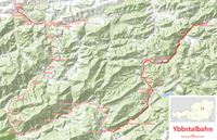
Karte Ybbstalbahn.png -
 1834th file - 1.24 MB - 1169x2030
01.03.2016
upload 3663
Lindentunnel - Ausführungsplan.jpg -
 1833rd file - 805 KB - 1244x1275
01.03.2016
upload 3662
Lindentunnel - Vorentwürfe.jpg -
 1832nd file - 1.55 MB - 4448x1070
01.03.2016
upload 3661
Tunnelentwürfe der GBS - Südtunnel.jpg -
 1831st file - 1.06 MB - 1752x1308
01.03.2016
upload 3660
Tunnelentwürfe der GBS - Lageplan.jpg -
 1830th file - 1.64 MB - 2175x1397
28.02.2016
upload 3658
Karte der NBS Erfurt–Leipzig-Halle.png -
 1829th file - 757 KB - 1862x2753
28.02.2016 .. 03.04.2016 (3 versions)
upload 3656 .. 3714
Karte Suezkanal mit ehemaligen Militärzonen.png -
 1828th file - 173 KB - 1171x1349
28.02.2016
upload 3655
Map of Thera before the Minoan eruption (Druitt, Francaviglia).png -
 1827th file - 199 KB - 956x806
28.02.2016 .. 02.03.2016 (3 versions)
upload 3653 .. 3665
Map of Apataki Atoll.png -
 1826th file - 759 KB - 2999x2175
27.02.2016 .. 01.03.2016 (2 versions)
upload 3652 .. 3659
Map Districts (Kecamatan) of Jayapura.png -
 1825th file - 73.23 MB - 25577x21723
27.02.2016 .. 27.02.2016 (2 versions)
upload 3650 .. 3651
Straube-Plan Berlin 1910.jpg -
 1824th file - 81 KB - 2950x3299
24.02.2016 .. 05.08.2016 (4 versions)
upload 3647 .. 3966
Netzspinne Lindentunnel 1950.png -
 1823rd file - 287 KB - 2950x3299
23.02.2016 .. 05.08.2016 (4 versions)
upload 3643 .. 3964
Netzspinne Lindentunnel 1916.png -
 1822nd file - 1.06 MB - 1406x944
21.02.2016
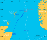
upload 3642
Karte Besitz der Herren von Waldeck.png -
 1821st file - 232 KB - 2950x3299
20.02.2016 .. 05.08.2016 (5 versions)
upload 3641 .. 3963
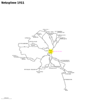
Netzspinne Lindentunnel 1911.png -
 1820th file - 504 KB - 1186x2455
18.02.2016 .. 20.02.2016 (4 versions)
upload 3634 .. 3640
Karte Suezkanal.png -
 1819th file - 179 KB - 1171x1349
15.02.2016 .. 20.02.2016 (3 versions)
upload 3629 .. 3639
Map of Thera before the Minoan eruption.png -
 1818th file - 1.48 MB - 3057x2533
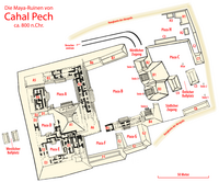
15.02.2016 .. 19.02.2016 (4 versions)
upload 3626 .. 3638
Cahal Pech Site Map.png -
 1817th file - 183 KB - 1228x1108
14.02.2016
upload 3625
Karte Positionen der Alliierten zum Ende des Zweiten Weltkrieges am 10. Mai 1945.png -
 1816th file - 40 KB - 430x479
11.02.2016
upload 3620
Denmark numbered by old ISO-3166-2-01.png -
 1815th file - 1.26 MB - 1700x2120
10.02.2016 .. 12.02.2016 (3 versions)
upload 3617 .. 3622
Map of the Nunavut regions.png -
 1814th file - 694 KB - 431x442
09.02.2016 .. 10.02.2016 (2 versions)
upload 3616 .. 3618
Karte Europas größte Inseln.svg -
 1813th file - 7.03 MB - 2746x2115
07.02.2016 .. 09.02.2016 (3 versions)
upload 3613 .. 3615
Map of the RER Bruxelles - GEN Brussels.png -
 1812th file - 570 KB - 2585x2103
03.02.2016 .. 14.03.2016 (4 versions)
upload 3602 .. 3679
Map of the annual average discharge of Rhine and Maas 2000-2011 (NL).png -
 1811th file - 570 KB - 2585x2103
03.02.2016 .. 05.03.2016 (5 versions)
upload 3601 .. 3672
Map of the annual average discharge of Rhine and Maas 2000-2011 (FR).png -
 1810th file - 574 KB - 2585x2103
03.02.2016 .. 05.03.2016 (3 versions)
upload 3600 .. 3673
Map of the annual average discharge of Rhine and Maas 2000-2011 (EN).png -
 1809th file - 5.81 MB - 4245x4292
02.02.2016 .. 03.02.2016 (2 versions)
upload 3599 .. 3603
Map of the Cairo and Helwan tramways with topography.png -
 1808th file - 575 KB - 2585x2103
31.01.2016 .. 05.03.2016 (8 versions)
upload 3592 .. 3674
Map of the annual average discharge of Rhine and Maas 2000-2011 (DE).png -
 1807th file - 1.23 MB - 4245x4292
25.01.2016 .. 03.02.2016 (4 versions)
upload 3581 .. 3604
Map of the Cairo and Helwan tramways.png -
 1806th file - 9.62 MB - 11237x3938
23.01.2016
upload 3580
Alexandria Tramway Map 1959.jpg -
 1805th file - 15 KB - 1075x574
16.01.2016
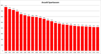
upload 3573
Diagramm Entwicklung Anzahl Sparkassen seit 1990.png -
 1804th file - 2.19 MB - 2390x1565
11.01.2016
upload 3571
Map of the Addis Ababa Light Rail.png -
 1803rd file - 277 KB - 3550x874
01.01.2016 .. 04.03.2017 (9 versions)
upload 3560 .. 4241
Manchester Metrolink - Schemaplan.png -
 1802nd file - 11.03 MB - 4226x2886
22.12.2015 .. 12.08.2016 (6 versions)
upload 3548 .. 3972
Karte der Berlin-Charlottenburger Straßenbahn (BCS).jpg -
 1801st file - 58.42 MB - 12671x8785
20.12.2015
upload 3547
Reichstags-Wahlkarte 1898.jpg -
 1800th file - 5.06 MB - 1818x2018
10.12.2015 .. 15.12.2015 (5 versions)
upload 3534 .. 3540
Karte Südliche Berliner Vorortbahn (SBV).jpg -
 1799th file - 1.48 MB - 3728x2535
09.12.2015 .. 09.12.2015 (2 versions)
upload 3532 .. 3533
Electric railway journal (1921) (14573034850).jpg -
 1798th file - 2.29 MB - 4000x3000
04.12.2015
upload 3529
Zeigerschreibmaschine Mignon, Modell 3 (Bild 3).jpg -
 1797th file - 2.28 MB - 4000x3000
04.12.2015
upload 3528
Zeigerschreibmaschine Mignon, Modell 3 (Bild 2).jpg -
 1796th file - 2.28 MB - 4000x3000
04.12.2015
upload 3527
Zeigerschreibmaschine Mignon, Modell 3 (Bild 1).jpg -
 1795th file - 2.29 MB - 4000x3000
04.12.2015
upload 3526
Panhard 06.jpg -
 1794th file - 2.3 MB - 4000x3000
04.12.2015
upload 3525
Panhard 05.jpg -
 1793rd file - 2.28 MB - 4000x3000
04.12.2015
upload 3524
Panhard 04.jpg -
 1792nd file - 2.24 MB - 4000x3000
04.12.2015
upload 3523
Panhard 03.jpg -
 1791st file - 2.28 MB - 4000x3000
04.12.2015
upload 3522
Panhard 02.jpg -
 1790th file - 2.3 MB - 4000x3000
04.12.2015
upload 3521
Panhard 01.jpg -
 1789th file - 598 KB - 2858x1696
01.12.2015 .. 04.12.2015 (3 versions)
upload 3516 .. 3520
Mediterranean at 218 BC-de.png -
 1788th file - 1.06 MB - 2052x1215
01.12.2015
upload 3515
218BCMAPMEDITERRANEAN.jpg -
 1787th file - 8.43 MB - 3122x3367
17.11.2015 .. 04.02.2016 (4 versions)
upload 3512 .. 3611
Karte der Straßenbahn Hagen.png -
 1786th file - 894 KB - 1300x1591
17.11.2015
upload 3510
Map of the frontlines in the Iran-Iraq War.jpg -
 1785th file - 3.12 MB - 7659x5682
15.11.2015
upload 3509
Handzeichnung Netzplan Straßenbahn Hagen.jpg -
 1784th file - 2.41 MB - 1524x1678
14.11.2015 .. 03.12.2015 (9 versions)
upload 3502 .. 3518
Karte der Terroranschläge vom 13. November 2015 in Paris.jpg -
 1783rd file - 2.95 MB - 3579x4235
09.11.2015 .. 02.01.2018 (11 versions)
upload 3497 .. 4627
Karte Sparkassen in Deutschland.png -
 1782nd file - 3.2 MB - 3579x4235
09.11.2015 .. 02.01.2018 (13 versions)
upload 3495 .. 4626
Karte Sparkassen und Sparkassenverbände in Deutschland.png -
 1781st file - 4.2 MB - 3579x4235
09.11.2015 .. 02.01.2018 (16 versions)
upload 3494 .. 4625
Karte Geschäftsgebiete der Sparkassen und Sparkassenverbände in Deutschland.png -
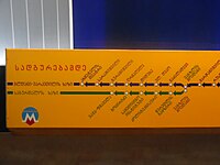 1780th file - 3.63 MB - 4608x3456
25.10.2015
upload 3493
Metro Map Tbilisi.JPG -
 1779th file - 35 KB - 1357x628
21.10.2015
upload 3491
Ww2 allied axis 1945 sep.png -
 1778th file - 35 KB - 1357x628
21.10.2015
upload 3490
Ww2 allied axis 1945 aug.png -
 1777th file - 35 KB - 1357x628
21.10.2015
upload 3489
Ww2 allied axis 1945 may.png -
 1776th file - 36 KB - 1480x628
21.10.2015
upload 3488
Ww2 allied axis 1944 dec.png -
 1775th file - 1.96 MB - 1726x909
21.10.2015
upload 3487
Karte Waldeisenbahn Welschbruch.jpg -
 1774th file - 1.34 MB - 2702x2618
18.10.2015
upload 3485
Wappen und Flaggen des Deutschen Reichs und der Preußischen Provinzen.png -
 1773rd file - 9.44 MB - 4500x3402
11.10.2015
upload 3483
Carta itineraria europae 1520 waldseemueller watermarked.jpg -
 1772nd file - 1.78 MB - 3863x3329
05.10.2015 .. 21.04.2016 (2 versions)
upload 3477 .. 3733
Karte Kulturhauptstadt Europas.png -
 1771st file - 616 KB - 2271x1552
01.10.2015
upload 3474
Upper Lusatia location map.png -
 1770th file - 552 KB - 2549x1646
01.10.2015
upload 3473
Lower Lusatia location map.png -
 1769th file - 1.15 MB - 2619x2932
01.10.2015
upload 3472
Lusatia location map.png -
 1768th file - 3.07 MB - 2238x3381
29.09.2015
upload 3471
2015-07-18 FahrradmitnahmeDeutschland.jpg -
 1767th file - 696 KB - 2519x1539
19.09.2015 .. 02.10.2015 (3 versions)
upload 3463 .. 3476
Map of the European Migrant Crisis 2015 - Asylum applicants' countries of origin.png -
 1766th file - 697 KB - 2519x1539
19.09.2015 .. 02.10.2015 (4 versions)
upload 3459 .. 3475
Karte Flüchtlingskrise in Europa 2015 - Herkunftsländer der Asylsuchenden.png -
 1765th file - 803 KB - 2192x2040
15.09.2015 .. 08.10.2015 (4 versions)
upload 3455 .. 3482
Map of the European Migrant Crisis 2015.png -
 1764th file - 418 KB - 1208x952
15.09.2015
upload 3454
The Street railway journal (1907) (14761156372).jpg -
 1763rd file - 160 KB - 1096x958
15.09.2015
upload 3453
Distribution map of the French language in Europe (with Occitan).png -
 1762nd file - 117 KB - 2046x2598
13.09.2015 .. 14.09.2015 (2 versions)
upload 3447 .. 3450
Flüchtlingskrise in Europa 2015 - Herkunfts- und Zielländer.png -
 1761st file - 809 KB - 2192x2040
13.09.2015 .. 19.09.2015 (6 versions)
upload 3446 .. 3461
Karte Flüchtlingskrise in Europa 2015.png -
 1760th file - 25.58 MB - 6384x6379
24.08.2015
upload 3440
Karte München und Vororte um 1910.jpg -
 1759th file - 28.9 MB - 7129x6346
23.08.2015 .. 23.08.2015 (2 versions)
upload 3434 .. 3437
Karte Straßenbahn München - Generallinienplan 1928.jpg -
 1758th file - 3.58 MB - 2415x2021
22.08.2015
upload 3432
Karte Wuppertal - Teststrecke für autonom fahrende Autos.png -
 1757th file - 17.34 MB - 3701x5307
20.08.2015
upload 3431
Karte Straßenbahn München - Generallinienplan 1928.png -
 1756th file - 530 KB - 1499x1392
16.08.2015 .. 17.08.2015 (2 versions)
upload 3426 .. 3427
Karte Mittlerer Ring München.png -
 1755th file - 4.1 MB - 1986x2736
10.08.2015 .. 18.03.2017 (8 versions)
upload 3420 .. 4260
Map of Manchester Metrolink.png -
 1754th file - 3.6 MB - 2526x3367
25.07.2015 .. 25.07.2015 (2 versions)
upload 3418 .. 3419
Map of railway lines in the Cagliari region.png -
 1753rd file - 693 KB - 2664x2152
25.07.2015 .. 06.08.2016 (4 versions)
upload 3413 .. 3971
Karte Chemnitzer Modell.png -
 1752nd file - 796 KB - 2486x2090
21.07.2015 .. 15.08.2017 (2 versions)
upload 3403 .. 4421
Karte Deutsches Reich, Gliederung der oberen Verwaltungsebenen 1900-01-01.png -
 1751st file - 5.38 MB - 5013x6654
21.07.2015 .. 15.08.2017 (9 versions)
upload 3402 .. 4420
Karte Deutsches Reich, Verwaltungsgliederung 1900-01-01.png -
 1750th file - 512 KB - 1845x2715
10.07.2015
upload 3399
ÖPNV-Systeme auf den Britischen Inseln.png -
 1749th file - 935 KB - 1930x1950
03.07.2015 .. 12.07.2015 (3 versions)
upload 3396 .. 3401
Anerberecht gemäß Reichserbhofgesetz I.jpg -
 1748th file - 12.27 MB - 1321x1350
14.06.2015
upload 3391
Map of the European long distance paths.svg -
 1747th file - 2.64 MB - 1835x1875
14.06.2015
upload 3390
Map of the European Long Distance Path E9.png -
 1746th file - 2.6 MB - 1835x1875
14.06.2015 .. 24.12.2017 (2 versions)
upload 3389 .. 4614
Map of the European Long Distance Path E8.png -
 1745th file - 2.64 MB - 1835x1875
14.06.2015
upload 3388
Map of the European Long Distance Path E7.png -
 1744th file - 2.65 MB - 1835x1875
14.06.2015
upload 3387
Map of the European Long Distance Path E6.png -
 1743rd file - 2.63 MB - 1835x1875
14.06.2015
upload 3386
Map of the European Long Distance Path E5.png -
 1742nd file - 2.64 MB - 1835x1875
14.06.2015
upload 3385
Map of the European Long Distance Path E4.png -
 1741st file - 2.64 MB - 1835x1875
14.06.2015
upload 3384
Map of the European Long Distance Path E3.png -
 1740th file - 2.63 MB - 1835x1875
14.06.2015
upload 3383
Map of the European Long Distance Path E2.png -
 1739th file - 2.64 MB - 1835x1875
14.06.2015 .. 13.02.2016 (2 versions)
upload 3382 .. 3624
Map of the European Long Distance Path E12.png -
 1738th file - 2.63 MB - 1835x1875
14.06.2015
upload 3381
Map of the European Long Distance Path E11.png -
 1737th file - 2.63 MB - 1835x1875
14.06.2015
upload 3380
Map of the European Long Distance Path E10.png -
 1736th file - 2.63 MB - 1835x1875
14.06.2015
upload 3379
Map of the European Long Distance Path E1.png -
 1735th file - 3.73 MB - 2753x2813
14.06.2015 .. 24.12.2017 (5 versions)
upload 3378 .. 4615
Map of the European Long Distance Paths.png -
 1734th file - 1.95 MB - 612x620
11.06.2015 .. 12.06.2015 (2 versions)
upload 3372 .. 3374
D-F location map.svg -
 1733rd file - 2.32 MB - 2130x3012
10.06.2015
upload 3370
Wikipedia-Wimpel im Augustiner-Keller.JPG -
 1732nd file - 1.95 MB - 1461x1022
10.06.2015 .. 10.06.2015 (2 versions)
upload 3369 .. 3371
Karte des Naturparks Elbhöhen-Wendland.png -
 1731st file - 13.67 MB - 2844x3008
06.06.2015 .. 10.06.2015 (3 versions)
upload 3364 .. 3368
Karte Herzogtum Bayern im 10. Jahrhundert.png -
 1730th file - 2.75 MB - 3088x1552
04.06.2015
upload 3363
Meyers b12 s0582a.jpg -
 1729th file - 2.77 MB - 2048x1680
04.06.2015
upload 3362
Meyers b11 s0873a.jpg -
 1728th file - 1.25 MB - 2048x1744
04.06.2015
upload 3361
Meyers b12 s0497a.jpg -
 1727th file - 859 KB - 2710x2271
03.06.2015 .. 16.08.2015 (2 versions)
upload 3360 .. 3424
Karte Divisionsstandorte des Deutschen Heers 1914.png -
 1726th file - 907 KB - 2710x2271
03.06.2015
upload 3359
Karte Brigadestandorte des Deutschen Heers 1914.png -
 1725th file - 300 KB - x
01.06.2015
upload 3358
France South West location map.svg -
 1724th file - 471 KB - 860x839
01.06.2015
upload 3357
France South West relief location map.jpg -
 1723rd file - 4.11 MB - 5064x3495
31.05.2015
upload 3356
Karte des ehemaligen Truppenübungsplatz Wittstock (Bombodrom).png -
 1722nd file - 272 KB - 2802x2539
29.05.2015 .. 03.07.2015 (3 versions)
upload 3348 .. 3397
Map of the Dry Creek explosives magazines in Adelaide.png -
 1721st file - 1.87 MB - 2333x1513
29.05.2015 .. 06.06.2015 (3 versions)
upload 3345 .. 3366
Karte Lewis-und-Clark-Expedition.jpg -
 1720th file - 250 KB - 969x865
23.05.2015
upload 3342
Karte Weichsel-Nogat-Linie.png -
 1719th file - 2.85 MB - 1997x1315
23.05.2015 .. 14.01.2017 (2 versions)
upload 3340 .. 4130
Karte der ungefähren Lage des Hochstifts Eichstätt.jpg -
 1718th file - 297 KB - x
22.05.2015
upload 3339
EU28-candidate countries only map.svg -
 1717th file - 262 KB - x
22.05.2015
upload 3338
Beitrittskandidaten.svg -
 1716th file - 696 KB - 1860x2227
21.05.2015 .. 24.12.2016 (9 versions)
upload 3336 .. 4109
Karte Deutsch-Dänischer Krieg Gebietsveränderungen.svg -
 1715th file - 3.43 MB - 1946x1357
19.05.2015
upload 3335
Karte ehemaliger Vorstädte von Wien und deren Lage in den heutigen Bezirken Wieden und Margareten.png -
 1714th file - 927 KB - 980x820
18.05.2015
upload 3334
Karte von Wieden, ehem. Vorstadt von Wien und dessen Lage in den heutigen Bezirken.png -
 1713th file - 878 KB - 980x820
18.05.2015
upload 3333
Karte von Schaumburgergrund, ehem. Vorstadt von Wien und dessen Lage in den heutigen Bezirken.png -
 1712th file - 871 KB - 980x820
18.05.2015
upload 3332
Karte von Reinprechtsdorf, ehem. Vorstadt von Wien und dessen Lage in den heutigen Bezirken.png -
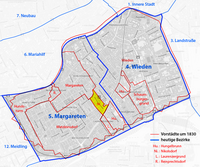 1711th file - 872 KB - 980x820
18.05.2015
upload 3331
Karte von Nikolsdorf, ehem. Vorstadt von Wien und dessen Lage in den heutigen Bezirken.png -
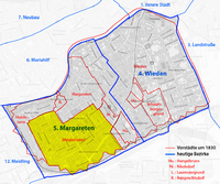 1710th file - 900 KB - 980x820
18.05.2015
upload 3330
Karte von Matzleinsdorf, ehem. Vorstadt von Wien und dessen Lage in den heutigen Bezirken.png -
 1709th file - 890 KB - 980x820
18.05.2015
upload 3329
Karte von Margareten, ehem. Vorstadt von Wien und dessen Lage in den heutigen Bezirken.png -
 1708th file - 871 KB - 980x820
18.05.2015
upload 3328
Karte von Laurenzergrund, ehem. Vorstadt von Wien und dessen Lage in den heutigen Bezirken.png -
 1707th file - 876 KB - 980x820
18.05.2015
upload 3327
Karte von Hungelbrunn, ehem. Vorstadt von Wien und dessen Lage in den heutigen Bezirken.png -
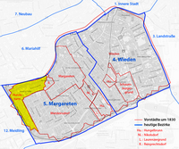 1706th file - 884 KB - 980x820
18.05.2015
upload 3326
Karte von Hundsturm, ehem. Vorstadt von Wien und dessen Lage in den heutigen Bezirken.png -
 1705th file - 870 KB - 980x820
18.05.2015
upload 3325
Karte ehemaliger Vorstädte von Wien.png -
 1704th file - 796 KB - 2806x2571
17.05.2015
upload 3324
Map of the dioceses of the Brazilian ecclesiastical province Norte 1.png -
 1703rd file - 131 KB - 935x1369
13.05.2015
upload 3318
Lagekarte Bistum Rrëshen.png -
 1702nd file - 133 KB - 935x1369
13.05.2015
upload 3317
Lagekarte Apostolische Administratur Südalbanien.png -
 1701st file - 446 KB - 2460x1523
13.05.2015
upload 3315
Lagekarte Eparchie Saint Peter the Apostle of San Diego.png -
 1700th file - 451 KB - 2460x1523
13.05.2015 .. 14.05.2015 (3 versions)
upload 3314 .. 3319
Lagekarte Eparchie Saint Thomas the Apostle of Detroit.png -
 1699th file - 91 KB - 821x764
13.05.2015
upload 3313
Lagekarte IL-JO-PS.png -
 1698th file - 255 KB - 1712x870
13.05.2015
upload 3312
Lagekarte EG-SD-SS.png -
 1697th file - 169 KB - 1063x889
13.05.2015
upload 3311
Lagekarte DE-DK-FI-NO-SE.png -
 1696th file - 264 KB - 1712x870
13.05.2015
upload 3310
Lagekarte CA-US.png -
 1695th file - 257 KB - 1712x870
13.05.2015
upload 3309
Lagekarte BR-MX-UY.png -
 1694th file - 163 KB - 1063x889
13.05.2015
upload 3308
Lagekarte BE-CH-FR-LU-NL.png -
 1693rd file - 207 KB - 1814x714
13.05.2015
upload 3307
Lagekarte AM-GE-RU-UA.png -
 1692nd file - 522 KB - 1219x1031
13.05.2015
upload 3306
Location map of the Royal Palm Hotel in Miami.png -
 1691st file - 315 KB - 1000x1171
13.05.2015
upload 3305
Karte Düppeler Schanzen im Deutsch-Dänischen Krieg.png -
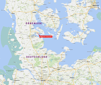 1690th file - 2.35 MB - 1800x1524
13.05.2015
upload 3304
Lagekarte der Düppeler Schanzen.png -
 1689th file - 3.42 MB - 2315x2597
13.05.2015 .. 30.05.2015 (3 versions)
upload 3303 .. 3355
Karte Stadtbefestigung Speyer.png -
 1688th file - 635 KB - 1404x1141
13.05.2015 .. 14.09.2015 (2 versions)
upload 3302 .. 3452
Karte Sendeanlagen in Mainflingen.png -
 1687th file - 1.69 MB - 2445x1757
12.05.2015
upload 3301
2009-11-22-seelower-hoehen-by-Ralf-68-V2.jpg -
 1686th file - 874 KB - 3564x1870
12.05.2015 .. 28.04.2017 (6 versions)
upload 3298 .. 4289
Map of the Legal systems of the world (en).png -
 1685th file - 158 KB - 998x634
12.05.2015
upload 3297
Bora Bora without Tupai topographic map - with communes associées.png -
 1684th file - 332 KB - 714x830
12.05.2015
upload 3296
Huahine topographic map - with communes associées.svg -
 1683rd file - 333 KB - 714x1143
12.05.2015
upload 3295
Tahaa and Raiatea topographic map - with communes et communes associées.svg -
 1682nd file - 350 KB - 995x911
12.05.2015
upload 3294
Raiatea topographic map - with communes et communes associées.png -
 1681st file - 438 KB - 1709x1404
11.05.2015 .. 19.12.2015 (2 versions)
upload 3293 .. 3545
Map of Portuguese India.png -
 1680th file - 177 KB - 688x656
11.05.2015
upload 3290
Map Barrios de Tijarafe.png -
 1679th file - 531 KB - 1480x1996
11.05.2015 .. 17.05.2015 (5 versions)
upload 3289 .. 3322
Karte Umfahrung der Schiersteiner Brücke.png -
 1678th file - 844 KB - 888x820
09.05.2015 .. 09.05.2015 (2 versions)
upload 3284 .. 3285
Route of Bug River in German.png -
 1677th file - 678 KB - 2788x1623
09.05.2015
upload 3283
Eurasian Economic Union member states map.png -
 1676th file - 922 KB - 3564x1870
07.05.2015 .. 14.04.2017 (6 versions)
upload 3281 .. 4265
Map of the Legal systems of the world (de).png -
 1675th file - 362 KB - 2340x1199
05.05.2015 .. 02.09.2015 (2 versions)
upload 3278 .. 3443
Map of the South–North Water Transfer Project in China (blank).png -
 1674th file - 646 KB - 2340x1199
04.05.2015 .. 02.09.2015 (5 versions)
upload 3276 .. 3442
Map of the South–North Water Transfer Project in China (de).png -
 1673rd file - 453 KB - 3524x2296
03.05.2015 .. 24.11.2017 (11 versions)
upload 3275 .. 4579
Karte Railjet-Strecken.png -
 1672nd file - 1.03 MB - 1250x1588
02.05.2015 .. 02.05.2015 (2 versions)
upload 3270 .. 3271
Antwerpen Districts.png -
 1671st file - 1.39 MB - 4511x3114
28.04.2015 .. 12.05.2015 (9 versions)
upload 3259 .. 3300
Tramway map of Antwerpen (without background).png -
 1670th file - 4.23 MB - 4511x3114
28.04.2015 .. 11.05.2015 (7 versions)
upload 3258 .. 3287
Tramway map of Antwerpen.png -
 1669th file - 9.65 MB - 4390x4820
26.04.2015
upload 3256
Sequoyah map.jpg -
 1668th file - 2.16 MB - 3014x2188
22.04.2015
upload 3254
Karte der Ortschaften und Ortsteile der Gemeinde Nienburg (Saale).png -
 1667th file - 949 KB - 2282x2188
19.04.2015 .. 03.02.2016 (7 versions)
upload 3249 .. 3610
Netzentwicklungsplan des Oberleitungsbus Timișoara.png -
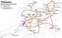 1666th file - 824 KB - 2520x1539
11.04.2015 .. 09.01.2016 (9 versions)
upload 3245 .. 3568
Netzentwicklungsplan der Straßenbahn Timișoara.png -
 1665th file - 1.02 MB - 2473x2211
31.03.2015 .. 03.04.2015 (3 versions)
upload 3241 .. 3244
Karte Fernstraßen München.png -
 1664th file - 358 KB - 3177x1226
08.03.2015
upload 3229
Baku Subway logo.jpg -
 1663rd file - 592 KB - x
02.03.2015
upload 3222
Liniennetz Stadtbahn Bielefeld mit Stationsnamen.svg -
 1662nd file - 304 KB - 2118x2122
19.02.2015 .. 26.06.2016 (8 versions)
upload 3214 .. 3845
Montpellier tramway map.png -
 1661st file - 156 KB - 1755x1362
15.02.2015 .. 17.02.2015 (5 versions)
upload 3208 .. 3213
Karte der Regio-S-Bahn Bremen-Niedersachsen.png -
 1660th file - 116 KB - x
15.02.2015
upload 3207
Federal subjects of Russia (by type).svg -
 1659th file - 848 KB - 3564x2004
15.02.2015
upload 3206
Karte der Auslandsreisen von Bundeskanzlerin Angela Merkel.png -
 1658th file - 457 KB - 2136x1489
03.01.2015 .. 26.05.2016 (3 versions)
upload 3196 .. 3792
Panoramafreiheit in Europa (Karte).png -
 1657th file - 251 KB - 1298x1551
27.12.2014 .. 02.01.2016 (3 versions)
upload 3195 .. 3563
Public transport systems of Italy.png -
 1656th file - 1.28 MB - 2537x1820
17.12.2014 .. 05.10.2017 (4 versions)
upload 3190 .. 4463
Frankfurt am Main - Streckenführung der geplanten Ringstraßenbahn.png -
 1655th file - 302 KB - 837x759
14.12.2014 .. 17.12.2014 (3 versions)
upload 3179 .. 3188
FFM-Ringstraßenbahn.png -
 1654th file - 130 KB - 1513x1060
14.12.2014 .. 15.12.2014 (2 versions)
upload 3178 .. 3181
Strab-frankfurt.png -
 1653rd file - 1.03 MB - x
10.12.2014
upload by Tuvalkin
StrassenbahnGleisplanLisboa1995(angeschlossen).png -
 1652nd file - 635 KB - 1638x2644
07.12.2014 .. 02.01.2016 (2 versions)
upload 3166 .. 3566
ÖPNV-Systeme in Korea.png -
 1651st file - 469 KB - 1645x1369
30.11.2014 .. 30.11.2014 (2 versions)
upload 3160 .. 3161
Map of Cercania systems in Spain.png -
 1650th file - 439 KB - 2204x1353
27.11.2014 .. 16.12.2017 (4 versions)
upload 3151 .. 4605
Public transport system map of the USA.png -
 1649th file - 523 KB - x
24.11.2014 .. 15.07.2016 (3 versions)
upload by Giorgi Balakhadze
Levels of Freedom of Panorama of Europe (large).svg -
 1648th file - 887 KB - 2593x1701
16.11.2014
upload 3146
ZSM 2014 04.jpg -
 1647th file - 827 KB - 2382x2100
16.11.2014 .. 08.01.2018 (19 versions)
upload 3144 .. 4646
ÖPNV-Systeme in China.png -
 1646th file - 145 KB - 961x1253
11.11.2014
upload 3143
ÖPNV-System in den Benelux-Staaten.png -
 1645th file - 751 KB - 1882x1933
07.10.2014 .. 21.06.2017 (3 versions)
upload 3139 .. 4359
Karte Chaco-Krieg.png -
 1644th file - 738 KB - 1882x1933
07.10.2014 .. 30.05.2015 (2 versions)
upload 3138 .. 3353
Karte Tripel-Allianz-Krieg - nach dem Krieg.png -
 1643rd file - 812 KB - 1882x1933
07.10.2014 .. 30.05.2015 (3 versions)
upload 3137 .. 3352
Karte Tripel-Allianz-Krieg - während des Krieges.png -
 1642nd file - 775 KB - 1882x1933
07.10.2014 .. 30.05.2015 (2 versions)
upload 3136 .. 3351
Karte Tripel-Allianz-Krieg - vor dem Krieg.png -
 1641st file - 5.17 MB - 2956x3628
28.09.2014
upload 3133
Basispyramide Unterföhring 08.JPG -
 1640th file - 4.99 MB - 3804x2439
28.09.2014
upload 3132
Basispyramide Unterföhring 07.JPG -
 1639th file - 4.61 MB - 3518x3000
28.09.2014
upload 3131
Basispyramide Unterföhring 06.JPG -
 1638th file - 804 KB - 895x859
03.09.2014
upload 3112
Karte Schloss Wickrath - Grafenkrone.png -
 1637th file - 36.48 MB - 8322x9249
01.09.2014
upload 3111
Karte München Basiskarte.png -
 1636th file - 30.65 MB - 8322x9249
01.09.2014
upload 3110
Karte München Übersichtsplan.png -
 1635th file - 22.32 MB - 8322x9249
01.09.2014
upload 3109
Karte München Landnutzung.png -
 1634th file - 10.34 MB - 8322x9249
01.09.2014
upload 3108
Karte München Schwarzplan.png -
 1633rd file - 6.36 MB - 8322x9249
01.09.2014
upload 3107
Karte München ÖPNV.png -
 1632nd file - 33.82 MB - 10361x8336
31.08.2014
upload 3106
Karte Berlin Übersichtsplan.png -
 1631st file - 21.98 MB - 10361x8336
31.08.2014
upload 3105
Karte Berlin Landnutzung.png -
 1630th file - 11.34 MB - 10361x8336
31.08.2014
upload 3104
Karte Berlin Schwarzplan.png -
 1629th file - 651 KB - 2263x2955
30.08.2014
upload 3101
Karte DB-Ergänzungsstrecken 1970.png -
 1628th file - 458 KB - 1525x1441
28.08.2014 .. 30.08.2014 (2 versions)
upload 3100 .. 3102
Karte der Einzugsgebiete der großen Gewässer Afrikas.png -
 1627th file - 246 KB - 465x550
28.08.2014
upload 3099
Locator map of Trekantområdet.svg -
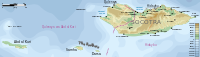 1626th file - 412 KB - 1309x375
27.08.2014 .. 28.08.2014 (3 versions)
upload 3095 .. 3097
Topographic map of the districts of Socotra (en).svg -
 1625th file - 1.02 MB - 1010x1004
27.08.2014
upload 3094
Karte Schloss Wickrath.png -
 1624th file - 1.39 MB - 1417x1233
26.08.2014
upload 3093
Philipp Apian - Bairische Landtafeln von 1568 - Ausschnitt München.jpg -
 1623rd file - 1.31 MB - 1417x1233
26.08.2014
upload 3092
Philipp Apian - Bairische Landtafeln von 1568 - Ausschnitt München (Gegenüberstellung).jpg -
 1622nd file - 2.25 MB - 4000x3000
23.08.2014
upload 3091
Spuren auf verdrecktem Auto 3.jpg -
 1621st file - 2.27 MB - 4000x3000
23.08.2014
upload 3090
Spuren auf verdrecktem Auto 2.jpg -
 1620th file - 2.28 MB - 4000x3000
23.08.2014
upload 3089
Spuren auf verdrecktem Auto 1.jpg -
 1619th file - 601 KB - 1451x1403
22.08.2014 .. 26.08.2016 (3 versions)
upload 3088 .. 3984
Karte Stadtteile Flensburg (da).png -
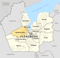 1618th file - 608 KB - 1451x1403
22.08.2014
upload 3086
Westliche Höhe -- Stadtteil in Flensburg -- Lagekarte.png -
 1617th file - 605 KB - 1451x1403
22.08.2014
upload 3085
Weiche -- Stadtteil in Flensburg -- Lagekarte.png -
 1616th file - 607 KB - 1451x1403
22.08.2014
upload 3084
Tarup -- Stadtteil in Flensburg -- Lagekarte.png -
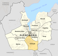 1615th file - 608 KB - 1451x1403
22.08.2014
upload 3083
Südstadt -- Stadtteil in Flensburg -- Lagekarte.png -
 1614th file - 605 KB - 1451x1403
22.08.2014
upload 3082
Sandberg -- Stadtteil in Flensburg -- Lagekarte.png -
 1613th file - 605 KB - 1451x1403
22.08.2014
upload 3081
Nordstadt -- Stadtteil in Flensburg -- Lagekarte.png -
 1612th file - 603 KB - 1451x1403
22.08.2014
upload 3080
Neustadt -- Stadtteil in Flensburg -- Lagekarte.png -
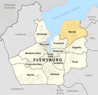 1611th file - 607 KB - 1451x1403
22.08.2014
upload 3079
Mürwik -- Stadtteil in Flensburg -- Lagekarte.png -
 1610th file - 605 KB - 1451x1403
22.08.2014
upload 3078
Jürgensby -- Stadtteil in Flensburg -- Lagekarte.png -
 1609th file - 604 KB - 1451x1403
22.08.2014
upload 3077
Innenstadt -- Stadtteil in Flensburg -- Lagekarte.png -
 1608th file - 605 KB - 1451x1403
22.08.2014
upload 3076
Fruerlund -- Stadtteil in Flensburg -- Lagekarte.png -
 1607th file - 605 KB - 1451x1403
22.08.2014
upload 3075
Friesischer Berg -- Stadtteil in Flensburg -- Lagekarte.png -
 1606th file - 605 KB - 1451x1403
22.08.2014
upload 3074
Engelsby -- Stadtteil in Flensburg -- Lagekarte.png -
 1605th file - 601 KB - 1451x1403
21.08.2014 .. 22.08.2014 (2 versions)
upload 3073 .. 3087
Karte Stadtteile Flensburg.png -
 1604th file - 398 KB - 1280x836
19.08.2014 .. 20.08.2014 (2 versions)
upload 3067 .. 3069
Central Asian trade routes V2.jpg -
 1603rd file - 2.89 MB - 7127x4008
12.08.2014 .. 13.12.2017 (5 versions)
upload 3064 .. 4603
Map of UNESCO Intangible cultural heritage (en).png -
 1602nd file - 2.89 MB - 7127x4008
12.08.2014 .. 25.06.2017 (6 versions)
upload 3062 .. 4374
Map of UNESCO Intangible cultural heritage (de).png -
 1601st file - 1.54 MB - x
11.08.2014 .. 11.08.2014 (3 versions)
upload 3059 .. 3061
IntangibleCulturalHeritageConvention.svg -
 1600th file - 184 KB - 458x220
10.08.2014
upload 3055
Map of UNESCO Intangible cultural heritage (English map key).svg -
 1599th file - 184 KB - 458x220
10.08.2014
upload 3054
Map of UNESCO Intangible cultural heritage (map key).svg -
 1598th file - 2.03 MB - 1713x964
10.08.2014 .. 10.08.2014 (3 versions)
upload 3053 .. 3057
Map of UNESCO Intangible cultural heritage.svg -
 1597th file - 3.74 MB - 3458x2058
08.08.2014 .. 08.08.2014 (2 versions)
upload 3049 .. 3051
Map of the Waldseemüller globe in nearly rectangular projection 2.jpg -
 1596th file - 649 KB - 1188x1635
08.08.2014
upload 3046
Wilten -- Katastralgemeinde in Innsbruck -- Lagekarte.png -
 1595th file - 637 KB - 1188x1635
08.08.2014
upload 3045
Vill -- Katastralgemeinde in Innsbruck -- Lagekarte.png -
 1594th file - 655 KB - 1188x1635
08.08.2014
upload 3044
Pradl -- Katastralgemeinde in Innsbruck -- Lagekarte.png -
 1593rd file - 648 KB - 1188x1635
08.08.2014
upload 3043
Mühlau -- Katastralgemeinde in Innsbruck -- Lagekarte.png -
 1592nd file - 651 KB - 1188x1635
08.08.2014
upload 3042
Innsbruck -- Katastralgemeinde in Innsbruck -- Lagekarte.png -
 1591st file - 642 KB - 1188x1635
08.08.2014
upload 3041
Igls -- Katastralgemeinde in Innsbruck -- Lagekarte.png -
 1590th file - 674 KB - 1188x1635
08.08.2014
upload 3040
Hötting -- Katastralgemeinde in Innsbruck -- Lagekarte.png -
 1589th file - 650 KB - 1188x1635
08.08.2014
upload 3039
Arzl -- Katastralgemeinde in Innsbruck -- Lagekarte.png -
 1588th file - 649 KB - 1188x1635
08.08.2014
upload 3038
Amras -- Katastralgemeinde in Innsbruck -- Lagekarte.png -
 1587th file - 634 KB - 1188x1635
08.08.2014
upload 3037
Wilten -- Statistischer Stadtteil in Innsbruck -- Lagekarte.png -
 1586th file - 628 KB - 1188x1635
08.08.2014
upload 3036
Vill -- Statistischer Stadtteil in Innsbruck -- Lagekarte.png -
 1585th file - 626 KB - 1188x1635
08.08.2014
upload 3035
Sieglanger - Mentlberg -- Statistischer Stadtteil in Innsbruck -- Lagekarte.png -
 1584th file - 630 KB - 1188x1635
08.08.2014
upload 3034
Saggen -- Statistischer Stadtteil in Innsbruck -- Lagekarte.png -
 1583rd file - 631 KB - 1188x1635
08.08.2014
upload 3033
Reichenau -- Statistischer Stadtteil in Innsbruck -- Lagekarte.png -
 1582nd file - 638 KB - 1188x1635
08.08.2014
upload 3032
Pradl -- Statistischer Stadtteil in Innsbruck -- Lagekarte.png -
 1581st file - 628 KB - 1188x1635
08.08.2014
upload 3031
Olympisches Dorf -- Statistischer Stadtteil in Innsbruck -- Lagekarte.png -
 1580th file - 629 KB - 1188x1635
08.08.2014
upload 3030
Mühlau -- Statistischer Stadtteil in Innsbruck -- Lagekarte.png -
 1579th file - 628 KB - 1188x1635
08.08.2014
upload 3029
Mariahilf - St. Nikolaus -- Statistischer Stadtteil in Innsbruck -- Lagekarte.png -
 1578th file - 630 KB - 1188x1635
08.08.2014
upload 3028
Innenstadt -- Statistischer Stadtteil in Innsbruck -- Lagekarte.png -
 1577th file - 630 KB - 1188x1635
08.08.2014
upload 3027
Igls -- Statistischer Stadtteil in Innsbruck -- Lagekarte.png -
 1576th file - 637 KB - 1188x1635
08.08.2014
upload 3026
Höttinger Au -- Statistischer Stadtteil in Innsbruck -- Lagekarte.png -
 1575th file - 637 KB - 1188x1635
08.08.2014
upload 3025
Hötting West -- Statistischer Stadtteil in Innsbruck -- Lagekarte.png -
 1574th file - 634 KB - 1188x1635
08.08.2014
upload 3024
Hötting -- Statistischer Stadtteil in Innsbruck -- Lagekarte.png -
 1573rd file - 630 KB - 1188x1635
08.08.2014
upload 3023
Hungerburg -- Statistischer Stadtteil in Innsbruck -- Lagekarte.png -
 1572nd file - 632 KB - 1188x1635
08.08.2014
upload 3022
Gewerbegebiet Roßau -- Statistischer Stadtteil in Innsbruck -- Lagekarte.png -
 1571st file - 628 KB - 1188x1635
08.08.2014
upload 3021
Gewerbegebiet Mühlau - Arzl -- Statistischer Stadtteil in Innsbruck -- Lagekarte.png -
 1570th file - 627 KB - 1188x1635
08.08.2014
upload 3020
Dreiheiligen - Schlachthof -- Statistischer Stadtteil in Innsbruck -- Lagekarte.png -
 1569th file - 633 KB - 1188x1635
08.08.2014
upload 3019
Arzl -- Statistischer Stadtteil in Innsbruck -- Lagekarte.png -
 1568th file - 632 KB - 1188x1635
08.08.2014
upload 3018
Amras -- Statistischer Stadtteil in Innsbruck -- Lagekarte.png -
 1567th file - 690 KB - 1188x1635
07.08.2014 .. 03.09.2014 (4 versions)
upload 3016 .. 3113
Karte Innsbruck - Katastralgemeinden und Statistische Stadtteile.png -
 1566th file - 855 KB - 3209x2492
06.08.2014 .. 08.08.2014 (2 versions)
upload 3015 .. 3052
Peta Timor Barat - Kabupaten dan Kecamatan.png -
 1565th file - 142 KB - 295x454
04.08.2014 .. 20.08.2014 (2 versions)
upload 3010 .. 3068
Levels of Freedom of Panorama in Europe (legend).svg -
 1564th file - 1.05 MB - 1053x1477
04.08.2014
upload 3008
Karte Flaucher München.png -
 1563rd file - 212 KB - 702x725
03.08.2014 .. 04.08.2014 (4 versions)
upload 3005 .. 3011
Levels of Freedom of Panorama in Europe.svg -
 1562nd file - 7.27 MB - 2963x2153
03.08.2014
upload 3004
Straßenbahn Bremen - Karte.png -
 1561st file - 226 KB - 1574x1577
03.08.2014 .. 15.02.2015 (4 versions)
upload 3003 .. 3211
Straßenbahn Bremen - Liniennetz.png -
 1560th file - 425 KB - 2623x2629
03.08.2014
upload 3002
Straßenbahn Bremen - Streckennetz.png -
 1559th file - 391 KB - 936x741
29.07.2014 .. 30.07.2014 (2 versions)
upload 2996 .. 2998
Karte Dnister.png -
 1558th file - 808 KB - 2234x2205
28.07.2014 .. 01.08.2014 (3 versions)
upload 2991 .. 2999
Karte Friedhof I Plauen.png -
 1557th file - 230 KB - 2302x1127
27.07.2014 .. 28.07.2014 (3 versions)
upload 2989 .. 2995
Karte Kirchenprovinzen und Diözesen in Ozeanien.png -
 1556th file - 2.82 MB - 2412x2446
24.07.2014 .. 02.08.2014 (5 versions)
upload 2984 .. 3001
Karte Stilllegungen im Streckennetz der BESTAG.png -
 1555th file - 606 KB - 5739x2912
23.07.2014
upload 2980
Fahrordnung weltweit doppel.png -
 1554th file - 389 KB - 1000x852
21.07.2014
upload 2977
Michel de Montaigne Italienreise.png -
 1553rd file - 297 KB - 1576x1461
21.07.2014
upload 2975
Plan der Festung Ehrenbreitstein.png -
 1552nd file - 1.77 MB - 1804x1567
21.07.2014 .. 21.07.2014 (3 versions)
upload 2974 .. 2979
Plan der Festung Ehrenbreitstein.jpg -
 1551st file - 2.67 MB - 1469x1530
20.07.2014 .. 27.07.2014 (3 versions)
upload 2973 .. 2988
Karte der ABS u. NBS Hannover – Hamburg u. Bremen (Y-Trasse).png -
 1550th file - 2.22 MB - 1233x1151
20.07.2014 .. 02.03.2015 (8 versions)
upload 2969 .. 3221
Karte Hunsrück.png -
 1549th file - 949 KB - 1030x703
20.07.2014 .. 28.07.2014 (3 versions)
upload 2968 .. 2994
Karte Tatorte des Serienmörders Wolfgang Schmidt.png -
 1548th file - 2.54 MB - 4342x3483
15.07.2014 .. 06.01.2018 (25 versions)
upload 2960 .. 4639
Karte Offshore-Windkraftanlagen in der Deutschen Bucht.png -
 1547th file - 107 KB - 1581x1768
13.07.2014
upload 2959
Chagos map2y.PNG -
 1546th file - 57 KB - 1581x1768
13.07.2014
upload 2958
B.I.O.T location map.svg -
 1545th file - 224 KB - 874x1172
12.07.2014
upload 2957
Karte Nordhessen.png -
 1544th file - 3.24 MB - 2013x1037
12.07.2014
upload 2956
Karte Freiburg i.B. - Stadttunnel.png -
 1543rd file - 355 KB - 1855x2057
12.07.2014
upload 2954
Karte Augsburg – Planungsräume und Stadtbezirke.png -
 1542nd file - 1.64 MB - 2121x1193
10.07.2014 .. 12.07.2014 (3 versions)
upload 2952 .. 2955
Karte Alpenüberquerung Langobardenfeldzug.png -
 1541st file - 404 KB - 2672x1692
09.07.2014 .. 09.07.2014 (2 versions)
upload 2950 .. 2951
Karte der Wirtschaftssonderzone ZEESM in Oecusse, Osttimor.png -
 1540th file - 314 KB - 899x1262
08.07.2014
upload 2949
Karte La Palma-01.jpg -
 1539th file - 262 KB - 950x2081
08.07.2014
upload 2948
International Date Line.png -
 1538th file - 524 KB - 1886x1933
03.07.2014
upload 2944
Administrative map of Andhra Pradesh with RTO codes for vehicle registration.png -
 1537th file - 143 KB - 1059x1045
03.07.2014 .. 05.07.2014 (3 versions)
upload 2943 .. 2946
Administrative map of Delhi with RTO codes for vehicle registration.png -
 1536th file - 231 KB - 1260x1104
30.06.2014
upload 2942
Administrative map of Rajasthan with RTO codes for vehicle registration.png -
 1535th file - 709 KB - 3014x2391
29.06.2014
upload 2939
Administrative map of Gujarat with RTO codes for vehicle registration.png -
 1534th file - 321 KB - 1409x1682
29.06.2014 .. 05.07.2014 (3 versions)
upload 2936 .. 2947
Administrative map of Haryana with RTO codes for vehicle registration.png -
 1533rd file - 368 KB - 1487x1735
27.06.2014 .. 20.11.2016 (2 versions)
upload 2935 .. 4066
India - administrative map.png -
 1532nd file - 163 KB - 808x1298
23.06.2014
upload 2932
Administrative map of Goa.png -
 1531st file - 295 KB - 945x643
15.06.2014 .. 15.06.2014 (2 versions)
upload 2930 .. 2931
Karte Unfallort der Yacht 'Taube'.png -
 1530th file - 311 KB - 1487x1735
15.06.2014 .. 20.11.2016 (2 versions)
upload 2929 .. 4067
Indien Verwaltungsgliederung.png -
 1529th file - 1.93 MB - 3822x5006
12.06.2014
upload 2927
Interregioexpress in Deutschland.jpg -
 1528th file - 531 KB - 2260x1580
07.06.2014
upload 2925
Karte der geplanten U9-Spange der U-Bahn München.png -
 1527th file - 1.04 MB - x
01.06.2014
upload 2913
Potsdam Strassenbahn.svg -
 1526th file - 1.53 MB - 3035x2185
31.05.2014 .. 24.06.2014 (4 versions)
upload 2911 .. 2933
Karte Kirchenprovinzen und Diözesen der Karibik.png -
 1525th file - 1.04 MB - 85x91
30.05.2014
upload 2909
Locator map - Indonesia - Bengkulu - Seluma.svg -
 1524th file - 1.04 MB - 85x91
30.05.2014
upload 2908
Locator map - Indonesia - Bengkulu - Rejang Lebong.svg -
 1523rd file - 1.04 MB - 85x91
30.05.2014
upload 2907
Locator map - Indonesia - Bengkulu - Pulau Enggano.svg -
 1522nd file - 1.04 MB - 85x91
30.05.2014
upload 2906
Locator map - Indonesia - Bengkulu - Mukomuko.svg -
 1521st file - 1.04 MB - 85x91
30.05.2014
upload 2905
Locator map - Indonesia - Bengkulu - Lebong.svg -
 1520th file - 1.04 MB - 85x91
30.05.2014
upload 2904
Locator map - Indonesia - Bengkulu - Kepahiang.svg -
 1519th file - 1.04 MB - 85x91
30.05.2014
upload 2903
Locator map - Indonesia - Bengkulu - Kaur.svg -
 1518th file - 1.04 MB - 85x91
30.05.2014
upload 2902
Locator map - Indonesia - Bengkulu - Bengkulu Utara.svg -
 1517th file - 1.04 MB - 85x91
30.05.2014
upload 2901
Locator map - Indonesia - Bengkulu - Bengkulu Tengah.svg -
 1516th file - 1.04 MB - 85x91
30.05.2014
upload 2900
Locator map - Indonesia - Bengkulu - Bengkulu Selatan.svg -
 1515th file - 1.04 MB - 85x91
30.05.2014
upload 2899
Locator map - Indonesia - Bengkulu - Bengkulu (Kota).svg -
 1514th file - 1.47 MB - 1571x3027
23.04.2014 .. 21.08.2016 (3 versions)
upload 2893 .. 3976
Karte der ÖPNV-Systeme in den Staaten der ehemaligen Sowjetunion.png -
 1513th file - 2.26 MB - 1526x1585
21.04.2014
upload 2892
JADIZ and CADIZ and KADIZ in East China Sea (blank map).png -
 1512th file - 477 KB - 2147x1442
18.04.2014 .. 31.05.2014 (7 versions)
upload 2886 .. 2910
Map pro-Ukrainean and pro-Russian protests in the Ukraine 2014.png -
 1511th file - 109 KB - 1133x727
14.04.2014
upload 2884
Karte der ersten baptistischen Auswanderergemeinden in Illinois.png -
 1510th file - 4.2 MB - 3458x2058
08.04.2014 .. 08.08.2014 (5 versions)
upload 2881 .. 3050
Map of the Waldseemüller globe in nearly rectangular projection.jpg -
 1509th file - 391 KB - 1142x1528
01.04.2014
upload 2874
Karte Liliental.png -
 1508th file - 112 KB - 1020x775
31.03.2014 .. 31.03.2014 (2 versions)
upload 2872 .. 2873
Karte Stadtteile Leinfelden-Echterdingen.png -
 1507th file - 1.14 MB - x
31.03.2014 .. 11.02.2016 (5 versions)
upload 2870 .. 3619
Auslandseinsätze der Bundeswehr.svg -
 1506th file - 247 KB - 1133x959
31.03.2014 .. 31.03.2014 (2 versions)
upload 2868 .. 2869
Map of the Mura di Erice.png -
 1505th file - 664 KB - 1412x1061
29.03.2014
upload 2864
Karte Gemarkungsgrenzen Klein-Umstadt.jpg -
 1504th file - 270 KB - 1173x1558
28.03.2014 .. 30.03.2014 (2 versions)
upload 2862 .. 2866
Karte der Erzbistümer und Bistümer in Deutschland.png -
 1503rd file - 308 KB - 1439x1439
27.03.2014 .. 28.03.2014 (2 versions)
upload 2860 .. 2861
Hamburger Hochbahn - Plan der Linie U2 bis 2009.png -
 1502nd file - 358 KB - 2055x1119
27.03.2014
upload 2859
Hamburger Hochbahn - Plan der Linie U3 bis 2009.png -
 1501st file - 389 KB - 1484x1238
26.03.2014 .. 30.03.2014 (3 versions)
upload 2858 .. 2865
Karte Dekanate des Bistums Würzburg.png -
 1500th file - 75 KB - 2477x2333
26.03.2014
upload 2853
Karte Straßenbahnnetz Hannover 1920 and 1957.svg -
 1499th file - 1 MB - 2283x1485
24.03.2014 .. 24.03.2014 (2 versions)
upload 2846 .. 2847
Map of the Crimea - RU.png -
 1498th file - 4.51 MB - 3289x2139
24.03.2014 .. 27.05.2017 (3 versions)
upload 2845 .. 4326
Physical map of the Crimea - RU.jpg -
 1497th file - 2.28 MB - 3289x2139
22.03.2014 .. 22.03.2014 (2 versions)
upload 2840 .. 2841
Physical map of the Crimea.jpg -
 1496th file - 4.36 MB - 3289x2139
22.03.2014 .. 01.12.2016 (8 versions)
upload 2839 .. 4078
Physische Karte der Krim.jpg -
 1495th file - 984 KB - 2283x1485
22.03.2014
upload 2838
Map of the Crimea.png -
 1494th file - 2.3 MB - 2645x3629
16.03.2014
upload 2836
2014-03-10 - Yevpatoria military base - 0017.JPG -
 1493rd file - 1,014 KB - 2283x1485
09.03.2014 .. 01.12.2016 (12 versions)
upload 2831 .. 4077
Karte der Krim.png -
 1492nd file - 1.23 MB - 1685x1787
20.01.2014
upload 2821
Karte Amt Mittelangeln.png -
 1491st file - 88 KB - 1053x812
19.01.2014
upload 2820
Sakarya districts.png -
 1490th file - 4.49 MB - 2275x3590
14.01.2014
upload 2819
Karte der Südbahn in Österreich.jpg -
 1489th file - 47 KB - 971x781
14.01.2014
upload 2818
Water Oak Range.gif -
 1488th file - 824 KB - 1525x1440
07.01.2014
upload 2810
Distribution map Spirostachys africana.jpg -
 1487th file - 1.85 MB - 1998x983
07.01.2014 .. 11.01.2014 (2 versions)
upload 2809 .. 2811
Karte der Bahnstrecke Türkismühle–Kusel.png -
 1486th file - 1.72 MB - 1851x907
07.01.2014
upload 2808
Streckenkarte Bachbahn.png -
 1485th file - 242 KB - 1931x1001
07.01.2014 .. 07.01.2014 (2 versions)
upload 2803 .. 2804
France DOM map-de.png -
 1484th file - 127 KB - 800x725
07.01.2014
upload 2801
Blank map of Sunda and Sahul.png -
 1483rd file - 7.57 MB - 1879x1447
06.01.2014
upload 2800
Philipp Apian-Landtafeln-Blattschnitt.png -
 1482nd file - 33.32 MB - 9809x10000
05.01.2014
upload 2799
Philipp Apian - Bairische Landtafeln von 1568 - Zusammensetzung aller 24 Tafeln.jpg -
 1481st file - 7.59 MB - 6264x4768
05.01.2014
upload 2798
Philipp Apian - Bairische Landtafeln von 1568 - Tafel 24.jpg -
 1480th file - 8.32 MB - 6264x4768
05.01.2014
upload 2797
Philipp Apian - Bairische Landtafeln von 1568 - Tafel 23.jpg -
 1479th file - 7.97 MB - 6264x4768
05.01.2014
upload 2796
Philipp Apian - Bairische Landtafeln von 1568 - Tafel 22.jpg -
 1478th file - 7 MB - 6264x4768
05.01.2014
upload 2795
Philipp Apian - Bairische Landtafeln von 1568 - Tafel 21.jpg -
 1477th file - 7.61 MB - 6264x4768
05.01.2014
upload 2794
Philipp Apian - Bairische Landtafeln von 1568 - Tafel 20.jpg -
 1476th file - 7.29 MB - 6264x4768
05.01.2014
upload 2793
Philipp Apian - Bairische Landtafeln von 1568 - Tafel 19.jpg -
 1475th file - 7.2 MB - 6264x4768
05.01.2014
upload 2792
Philipp Apian - Bairische Landtafeln von 1568 - Tafel 18.jpg -
 1474th file - 6.61 MB - 6264x4768
05.01.2014
upload 2791
Philipp Apian - Bairische Landtafeln von 1568 - Tafel 17.jpg -
 1473rd file - 7.37 MB - 6264x4768
05.01.2014
upload 2790
Philipp Apian - Bairische Landtafeln von 1568 - Tafel 16.jpg -
 1472nd file - 7.33 MB - 6264x4768
05.01.2014
upload 2789
Philipp Apian - Bairische Landtafeln von 1568 - Tafel 15.jpg -
 1471st file - 7.15 MB - 6264x4768
05.01.2014
upload 2788
Philipp Apian - Bairische Landtafeln von 1568 - Tafel 14.jpg -
 1470th file - 6.69 MB - 6264x4768
05.01.2014
upload 2787
Philipp Apian - Bairische Landtafeln von 1568 - Tafel 13.jpg -
 1469th file - 7.23 MB - 6264x4768
05.01.2014
upload 2786
Philipp Apian - Bairische Landtafeln von 1568 - Tafel 12.jpg -
 1468th file - 6.76 MB - 6264x4768
05.01.2014
upload 2785
Philipp Apian - Bairische Landtafeln von 1568 - Tafel 11.jpg -
 1467th file - 7.13 MB - 6264x4768
05.01.2014
upload 2784
Philipp Apian - Bairische Landtafeln von 1568 - Tafel 10.jpg -
 1466th file - 6.66 MB - 6264x4768
05.01.2014
upload 2783
Philipp Apian - Bairische Landtafeln von 1568 - Tafel 09.jpg -
 1465th file - 7.35 MB - 6264x4768
05.01.2014
upload 2782
Philipp Apian - Bairische Landtafeln von 1568 - Tafel 08.jpg -
 1464th file - 6.47 MB - 6264x4768
05.01.2014
upload 2781
Philipp Apian - Bairische Landtafeln von 1568 - Tafel 07.jpg -
 1463rd file - 6.35 MB - 6264x4768
05.01.2014
upload 2780
Philipp Apian - Bairische Landtafeln von 1568 - Tafel 06.jpg -
 1462nd file - 7.19 MB - 6264x4768
05.01.2014
upload 2779
Philipp Apian - Bairische Landtafeln von 1568 - Tafel 05.jpg -
 1461st file - 6.63 MB - 6264x4768
05.01.2014
upload 2778
Philipp Apian - Bairische Landtafeln von 1568 - Tafel 03-04.jpg -
 1460th file - 6.92 MB - 6264x4768
05.01.2014
upload 2777
Philipp Apian - Bairische Landtafeln von 1568 - Tafel 01-02.jpg -
 1459th file - 173 KB - 2478x2334
02.01.2014 .. 26.03.2014 (6 versions)
upload 2771 .. 2855
Karte Straßenbahnnetz Hannover 1957.png -
 1458th file - 240 KB - 2478x2334
02.01.2014 .. 30.03.2014 (7 versions)
upload 2770 .. 2867
Karte Straßenbahnnetz Hannover 1920.png -
 1457th file - 752 KB - 1165x1200
01.01.2014 .. 03.01.2014 (2 versions)
upload 2764 .. 2772
European union emu map de.png -
 1456th file - 40 KB - x
31.12.2013
upload 2761
Palaestina1920.png -
 1455th file - 680 KB - 2034x1140
31.12.2013 .. 31.12.2013 (2 versions)
upload 2757 .. 2758
Karte Fossilfundstellen der Santa-Cruz-Formation.jpg -
 1454th file - 2.8 MB - 1747x2711
30.12.2013 .. 01.01.2014 (3 versions)
upload 2756 .. 2767
Karte Pferdebahn der Gemeinde Französisch-Buchholz.jpg -
 1453rd file - 2.04 MB - 2457x1062
28.12.2013 .. 21.01.2014 (3 versions)
upload 2751 .. 2823
Karte der Bahnstrecke Liberec–Kořenov.png -
 1452nd file - 247 KB - 602x947
28.12.2013 .. 21.01.2014 (2 versions)
upload 2750 .. 2824
Karte der Isergebirgsbahn.jpg -
 1451st file - 525 KB - 1881x928
28.12.2013 .. 21.01.2014 (3 versions)
upload 2748 .. 2822
Karte der Bahnstrecke Královec–Žacléř.jpg -
 1450th file - 436 KB - 595x842
27.12.2013
upload 2747
Grundlage für Karte zur Liste der Wappen mit hanauischen Sparren.svg -
 1449th file - 2.35 MB - 1636x1789
27.12.2013 .. 03.01.2014 (6 versions)
upload 2743 .. 2774
Karte Berliner Elektrische Straßenbahnen (BESTAG).jpg -
 1448th file - 164 KB - 622x514
23.12.2013
upload 2742
MittelhessenExpress Netz.svg -
 1447th file - 2.54 MB - 4037x1388
23.12.2013
upload 2740
Streckenkarte Tecklenburger Nordbahn.png -
 1446th file - 610 KB - 1298x1462
22.12.2013 .. 27.12.2013 (5 versions)
upload 2737 .. 2745
Map - Arrondissements and Quartiers in the agglomeration of Bangui.png -
 1445th file - 3.96 MB - 2275x2524
21.12.2013 .. 21.12.2013 (2 versions)
upload 2735 .. 2736
Karte Schloss und Park Altenstein.jpg -
 1444th file - 8.5 MB - 4156x2502
21.12.2013
upload 2734
Map of classic Neandertal fossil sites.jpg -
 1443rd file - 8.08 MB - 4156x2502
21.12.2013
upload 2733
Map of pre-Neandertal fossil sites.jpg -
 1442nd file - 515 KB - 2095x1586
19.12.2013 .. 21.12.2013 (2 versions)
upload 2718 .. 2732
Karte Niger - Nationalsprachen.png -
 1441st file - 72 KB - 956x734
19.12.2013
upload 2717
Karte Niger - Nationalsprache Tubu.png -
 1440th file - 69 KB - 956x734
19.12.2013 .. 19.12.2013 (2 versions)
upload 2716 .. 2723
Karte Niger - Nationalsprache Tasawaq, Tagdal.png -
 1439th file - 75 KB - 956x734
19.12.2013
upload 2715
Karte Niger - Nationalsprache Tamasheq.png -
 1438th file - 71 KB - 956x734
19.12.2013
upload 2714
Karte Niger - Nationalsprache Songhai-Zarma.png -
 1437th file - 72 KB - 956x734
19.12.2013
upload 2713
Karte Niger - Nationalsprache Kanuri.png -
 1436th file - 72 KB - 956x734
19.12.2013
upload 2712
Karte Niger - Nationalsprache Hausa.png -
 1435th file - 69 KB - 956x734
19.12.2013
upload 2711
Karte Niger - Nationalsprache Gourmanchéma.png -
 1434th file - 73 KB - 956x734
19.12.2013
upload 2710
Karte Niger - Nationalsprache Fulfulde.png -
 1433rd file - 68 KB - 956x734
19.12.2013
upload 2709
Karte Niger - Nationalsprache Buduma.png -
 1432nd file - 75 KB - 956x734
19.12.2013
upload 2708
Karte Niger - Nationalsprache Arabisch.png -
 1431st file - 5.93 MB - 2401x2712
18.12.2013 .. 31.08.2016 (5 versions)
upload 2705 .. 4001
Scotland map of whisky distilleries-de.png -
 1430th file - 552 KB - 1415x1789
18.12.2013
upload 2703
Course map of the CAC cycling 2013 in Sharm el Sheikh.png -
 1429th file - 67 KB - 1126x739
18.12.2013 .. 18.12.2013 (2 versions)
upload 2702 .. 2704
Distilleries Islay.png -
 1428th file - 3.86 MB - 1255x2129
17.12.2013 .. 05.03.2017 (3 versions)
upload 2701 .. 4242
Karte Bahnstrecke Karlovy Vary - Johanngeorgenstadt.png -
 1427th file - 357 KB - 1392x1199
16.12.2013 .. 26.03.2015 (5 versions)
upload 2699 .. 3233
Karte EU-Erweiterungen.png -
 1426th file - 181 KB - 823x821
16.12.2013 .. 07.01.2014 (4 versions)
upload 2698 .. 2807
Karte Böhmen unter Ottokar II.png -
 1425th file - 178 KB - 823x821
16.12.2013
upload 2697
Karte Böhmen unter Karl IV.png -
 1424th file - 2.93 MB - 1794x1506
16.12.2013
upload 2696
Karte Naturpark Schlei-da.png -
 1423rd file - 454 KB - 3106x3463
16.12.2013
upload 2693
Entwicklung der Berliner Straßenbahngesellschaften.png -
 1422nd file - 44 KB - 950x772
15.12.2013 .. 19.12.2013 (2 versions)
upload 2691 .. 2721
Eskişehir districts.png -
 1421st file - 1.64 MB - 1526x1585
26.11.2013 .. 15.12.2013 (2 versions)
upload 2681 .. 2692
JADIZ and CADIZ and KADIZ in East China Sea.jpg -
 1420th file - 208 KB - 683x507
24.11.2013 .. 25.11.2013 (3 versions)
upload 2671 .. 2678
Verbreitungskarte Ybyrapora.jpg -
 1419th file - 13.11 MB - 5650x4881
24.11.2013 .. 29.12.2013 (8 versions)
upload 2670 .. 2753
Karte der Straßenbahnen der Stadt Berlin.jpg -
 1418th file - 2.04 MB - 2004x1601
23.11.2013 .. 27.11.2013 (2 versions)
upload 2669 .. 2683
Karte Alzkanal.png -
 1417th file - 442 KB - 1024x1018
23.11.2013 .. 25.11.2013 (4 versions)
upload 2668 .. 2677
Karte Winterstein in der Sächsischen Schweiz.jpg -
 1416th file - 107 KB - 1253x750
23.11.2013
upload 2667
Karte Winterstein (Sächsische Schweiz).png -
 1415th file - 106 KB - 889x1339
22.11.2013
upload 2666
Karte Sweta Anastasia.png -
 1414th file - 1.38 MB - 2564x1477
22.11.2013 .. 25.11.2013 (2 versions)
upload 2665 .. 2679
Karte zur Medizinisch-demographischen Deutsch-Neuguinea-Expedition.jpg -
 1413th file - 1.97 MB - 2826x1759
22.11.2013 .. 25.11.2013 (2 versions)
upload 2664 .. 2676
Map of the grassland ecoregions of the United States.jpg -
 1412th file - 2.13 MB - 2065x1614
21.11.2013
upload 2661
Karte Neuendorfer See im Spreewald.png -
 1411th file - 194 KB - 1536x1144
21.11.2013
upload 2658
Linguistic map of the Tungusic languages (en).png -
 1410th file - 35 KB - x
19.11.2013
upload 2657
CAN.png -
 1409th file - 1.68 MB - 2298x1901
19.11.2013
upload 2656
Karte der Festung Rothenberg.png -
 1408th file - 660 KB - 3014x2391
19.11.2013
upload 2654
Administrative map of Gujarat.png -
 1407th file - 362 KB - 2170x1722
19.11.2013
upload 2653
India Gujarat location map (until 2013-08-15).svg -
 1406th file - 4 MB - 1679x3319
18.11.2013 .. 18.11.2013 (2 versions)
upload 2648 .. 2650
Karte City-Tunnel Leipzig.png -
 1405th file - 159 KB - 1120x1156
18.11.2013 .. 18.11.2013 (2 versions)
upload 2647 .. 2649
Karte Freisinger Bischofkonferenz.png -
 1404th file - 203 KB - 1266x1332
17.11.2013 .. 23.10.2016 (2 versions)
upload 2646 .. 4056
Karte Verwaltungsgliederung Äthiopien 1987-1991.png -
 1403rd file - 2.72 MB - 1666x1854
15.11.2013
upload 2645
Karte Bahnstrecke Berlin–Halle.png -
 1402nd file - 3.43 MB - 3735x2929
14.11.2013
upload 2641
Verbreitungskarte Bluthänfling.jpg -
 1401st file - 19.16 MB - 12709x9591
12.11.2013
upload 2634
MV Übersichtskarte 1-250.000 - Gewässer (jpg).jpg -
 1400th file - 14.81 MB - 12709x9591
12.11.2013
upload 2633
MV Übersichtskarte 1-250.000 - Gewässer.tif -
 1399th file - 386 KB - 1127x773
12.11.2013 .. 14.11.2013 (3 versions)
upload 2632 .. 2640
Karte der wichtigsten Flüsse in Mecklenburg-Vorpommern.svg -
 1398th file - 533 KB - 3076x1285
11.11.2013
upload 2630
Map of the Boroughs of New York City and the counties of Long Island.png -
 1397th file - 887 KB - 2203x2883
11.11.2013 .. 13.11.2013 (2 versions)
upload 2628 .. 2635
Karte Römischer Gutshof Büßlingen.png -
 1396th file - 504 KB - 1882x1933
10.11.2013 .. 30.05.2015 (11 versions)
upload 2626 .. 3350
Karte Tripel-Allianz-Krieg.png -
 1395th file - 317 KB - 2220x1145
10.11.2013 .. 01.06.2017 (7 versions)
upload 2624 .. 4337
Countries with space launcher programs.png -
 1394th file - 3.1 MB - 2562x2210
10.11.2013 .. 21.11.2013 (5 versions)
upload 2623 .. 2660
Karte Flachbahn Berlin.png -
 1393rd file - 1.4 MB - 3242x3388
09.11.2013 .. 06.01.2018 (4 versions)
upload 2621 .. 4642
Karte der Ämter in Brandenburg.png -
 1392nd file - 399 KB - 584x610
09.11.2013
upload 2620
Karte der Ämter in Brandenburg (svg).svg -
 1391st file - 802 KB - 1735x1991
07.11.2013
upload 2618
Gemeindekarte Bezirk Südoststeiermark.svg -
 1390th file - 760 KB - 4384x1992
07.11.2013
upload 2617
Karte Bezirk Südoststeiermark.png -
 1389th file - 773 KB - 1524x889
06.11.2013
upload 2616
Plan Grazer Burg.png -
 1388th file - 682 KB - 1234x1687
06.11.2013 .. 11.11.2013 (3 versions)
upload 2615 .. 2629
Karte Südharz-Eisenbahn-Gesellschaft.jpg -
 1387th file - 5.7 MB - 2946x1643
06.11.2013 .. 06.11.2013 (2 versions)
upload 2613 .. 2614
Verbreitungskarte Zaunkönig.jpg -
 1386th file - 10.8 MB - 3131x3559
05.11.2013
upload 2610
Physical map of the Philippines.png -
 1385th file - 521 KB - 1481x2031
05.11.2013
upload 2609
Map of Luzon Island.svg -
 1384th file - 639 KB - 940x477
05.11.2013 .. 08.01.2018 (4 versions)
upload 2607 .. 4647
Map of SEATO member countries - de.svg -
 1383rd file - 92 KB - x
05.11.2013 .. 05.11.2013 (2 versions)
upload 2605 .. 2606
Municipalities in BM.svg -
 1382nd file - 273 KB - x
05.11.2013
upload 2604
Bedburg in BM.svg -
 1381st file - 273 KB - x
05.11.2013
upload 2603
Bergheim in BM.svg -
 1380th file - 273 KB - x
05.11.2013
upload 2602
Brühl in BM.svg -
 1379th file - 273 KB - x
05.11.2013
upload 2601
Elsdorf in BM.svg -
 1378th file - 273 KB - x
05.11.2013
upload 2600
Erftstadt in BM.svg -
 1377th file - 273 KB - x
05.11.2013
upload 2599
Frechen in BM.svg -
 1376th file - 273 KB - x
05.11.2013
upload 2598
Hürth in BM.svg -
 1375th file - 273 KB - x
05.11.2013
upload 2597
Kerpen in BM.svg -
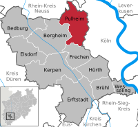 1374th file - 273 KB - x
05.11.2013
upload 2596
Pulheim in BM.svg -
 1373rd file - 274 KB - x
05.11.2013
upload 2595
Wesseling in BM.svg -
 1372nd file - 231 KB - 1286x938
05.11.2013 .. 05.11.2013 (2 versions)
upload 2593 .. 2611
Via Regia und Via Imperii - hsb.png -
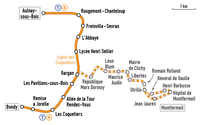 1371st file - 63 KB - 951x593
05.11.2013
upload 2591
Plan T4 Paris.png -
 1370th file - 2.94 MB - 1794x1506
04.11.2013 .. 16.12.2013 (4 versions)
upload 2590 .. 2695
Karte Naturpark Schlei.png -
 1369th file - 1.13 MB - 2494x2498
04.11.2013 .. 19.12.2013 (6 versions)
upload 2587 .. 2719
Gartenplan der Xiyang Lou.png -
 1368th file - 510 KB - 735x833
03.11.2013
upload 2579
Charleroi TEPCE.png -
 1367th file - 2.12 MB - 2065x1614
02.11.2013 .. 03.11.2013 (4 versions)
upload 2574 .. 2583
Karte Spreewald.png -
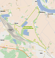 1366th file - 685 KB - 1040x1104
01.11.2013 .. 02.11.2013 (2 versions)
upload 2572 .. 2577
Karte des NSG Untere Seeveniederung.png -
 1365th file - 83 KB - 1092x1507
01.11.2013 .. 27.09.2015 (6 versions)
upload 2571 .. 3470
Tranz Metro network map.png -
 1364th file - 591 KB - 1136x1186
01.11.2013
upload 2570
Übersichtskarte Arboretum Freiburg-Günterstal.jpg -
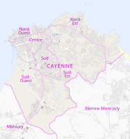 1363rd file - 5.72 MB - 1552x1665
31.10.2013
upload 2569
Cantons de Cayenne (svg).svg -
 1362nd file - 267 KB - 620x863
31.10.2013
upload 2567
Karte der Hünenburg in Meschede.png -
 1361st file - 113 KB - 1297x992
30.10.2013
upload 2566
Plan des communes du canton de Saint-Gervais-d'Auvergne.png -
 1360th file - 313 KB - 982x941
30.10.2013
upload 2565
Karte Kordigast.jpg -
 1359th file - 162 KB - 1134x993
30.10.2013 .. 30.10.2013 (2 versions)
upload 2562 .. 2563
Bestellungen und Lieferungen der Heinkel He 112.png -
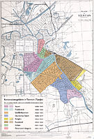 1358th file - 9.55 MB - 4117x6081
30.10.2013 .. 30.10.2013 (2 versions)
upload 2559 .. 2564
Karte der Konzessionsgebiete in Tientsin.jpg -
 1357th file - 128 KB - 975x611
28.10.2013 .. 18.12.2013 (4 versions)
upload 2553 .. 2707
Karte von Oberschwaben.png -
 1356th file - 3.59 MB - 2435x2446
28.10.2013 .. 09.06.2015 (4 versions)
upload 2552 .. 3367
Karte der Feuerwehr in Frankfurt am Main.png -
 1355th file - 1.52 MB - 970x1176
28.10.2013 .. 30.10.2013 (4 versions)
upload 2548 .. 2561
Übersichtskarte Rheinanlagen Koblenz OSM.png -
 1354th file - 1.48 MB - 1087x1229
27.10.2013 .. 02.11.2013 (4 versions)
upload 2546 .. 2575
Karte der Bucht von Vlora.png -
 1353rd file - 131 KB - 805x1113
27.10.2013
upload 2545
Lage des Dekanats Weilheim-Schongau im Bistum Augsburg.png -
 1352nd file - 130 KB - 805x1113
27.10.2013
upload 2544
Lage des Dekanats Starnberg im Bistum Augsburg.png -
 1351st file - 130 KB - 805x1113
27.10.2013
upload 2543
Lage des Dekanats Sonthofen im Bistum Augsburg.png -
 1350th file - 130 KB - 805x1113
27.10.2013
upload 2542
Lage des Dekanats Schwabmünchen im Bistum Augsburg.png -
 1349th file - 130 KB - 805x1113
27.10.2013
upload 2541
Lage des Dekanats Pfaffenhofen im Bistum Augsburg.png -
 1348th file - 131 KB - 805x1113
27.10.2013
upload 2540
Lage des Dekanats Nördlingen im Bistum Augsburg.png -
 1347th file - 130 KB - 805x1113
27.10.2013
upload 2539
Lage des Dekanats Neu-Ulm im Bistum Augsburg.png -
 1346th file - 131 KB - 805x1113
27.10.2013
upload 2538
Lage des Dekanats Neuburg-Schrobenhausen im Bistum Augsburg.png -
 1345th file - 131 KB - 805x1113
27.10.2013
upload 2537
Lage des Dekanats Mindelheim im Bistum Augsburg.png -
 1344th file - 130 KB - 805x1113
27.10.2013
upload 2536
Lage des Dekanats Memmingen im Bistum Augsburg.png -
 1343rd file - 131 KB - 805x1113
27.10.2013
upload 2535
Lage des Dekanats Marktoberdorf im Bistum Augsburg.png -
 1342nd file - 130 KB - 805x1113
27.10.2013
upload 2534
Lage des Dekanats Lindau im Bistum Augsburg.png -
 1341st file - 131 KB - 805x1113
27.10.2013
upload 2533
Lage des Dekanats Landsberg im Bistum Augsburg.png -
 1340th file - 131 KB - 805x1113
27.10.2013
upload 2532
Lage des Dekanats Kempten im Bistum Augsburg.png -
 1339th file - 131 KB - 805x1113
27.10.2013
upload 2531
Lage des Dekanats Kaufbeuren im Bistum Augsburg.png -
 1338th file - 131 KB - 805x1113
27.10.2013
upload 2530
Lage des Dekanats Günzburg im Bistum Augsburg.png -
 1337th file - 131 KB - 805x1113
27.10.2013
upload 2529
Lage des Dekanats Donauwörth im Bistum Augsburg.png -
 1336th file - 131 KB - 805x1113
27.10.2013
upload 2528
Lage des Dekanats Dillingen im Bistum Augsburg.png -
 1335th file - 131 KB - 805x1113
27.10.2013
upload 2527
Lage des Dekanats Benediktbeuren im Bistum Augsburg.png -
 1334th file - 131 KB - 805x1113
27.10.2013
upload 2526
Lage des Dekanats Augsburg-Land im Bistum Augsburg.png -
 1333rd file - 130 KB - 805x1113
27.10.2013
upload 2525
Lage des Dekanats Augsburg II im Bistum Augsburg.png -
 1332nd file - 130 KB - 805x1113
27.10.2013
upload 2524
Lage des Dekanats Augsburg I im Bistum Augsburg.png -
 1331st file - 131 KB - 805x1113
27.10.2013
upload 2523
Lage des Dekanats Aichach-Friedberg im Bistum Augsburg.png -
 1330th file - 210 KB - 805x1113
27.10.2013
upload 2522
Karte des Bistums Augsburg und seiner Dekanate.png -
 1329th file - 63 KB - 795x997
26.10.2013
upload 2521
Amadora - Fregueisa Venteira.png -
 1328th file - 63 KB - 795x997
26.10.2013
upload 2520
Amadora - Fregueisa Mina de Água.png -
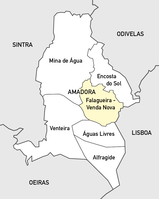 1327th file - 63 KB - 795x997
26.10.2013
upload 2519
Amadora - Fregueisa Falagueira - Venda Nova.png -
 1326th file - 63 KB - 795x997
26.10.2013
upload 2518
Amadora - Fregueisa Encosta do Sol.png -
 1325th file - 63 KB - 795x997
26.10.2013
upload 2517
Amadora - Fregueisa Alfragide.png -
 1324th file - 62 KB - 795x997
26.10.2013
upload 2516
Amadora - Fregueisa Águas Livres.png -
 1323rd file - 4.63 MB - 2271x2955
26.10.2013 .. 28.10.2013 (2 versions)
upload 2515 .. 2547
Übersichtskarte Rheinanlagen Koblenz.jpg -
 1322nd file - 40 KB - x
26.10.2013 .. 26.10.2013 (2 versions)
upload 2513 .. 2514
Lennestadt-Ortsteile-2.svg -
 1321st file - 62 KB - 795x997
26.10.2013
upload 2512
Map of the Freguesias of Amadora.png -
 1320th file - 834 KB - 1208x996
25.10.2013
upload 2511
Plainberg - Übersichtskarte.png -
 1319th file - 6.05 MB - 4059x4246
25.10.2013
upload 2510
Verbreitungskarte Rebhuhn.jpg -
 1318th file - 235 KB - 2054x2800
24.10.2013
upload 2508
Karte der DDR-Bezirks- und Kreisgliederung.svg -
 1317th file - 2.84 MB - 4360x2288
23.10.2013 .. 24.10.2013 (2 versions)
upload 2507 .. 2509
Karte der Lokalisierungshypothesen zu Atlantis.jpg -
 1316th file - 231 KB - 1871x991
22.10.2013 .. 05.11.2013 (7 versions)
upload 2504 .. 2608
Karte Hochkulturen.png -
 1315th file - 3.86 MB - 4408x2566
21.10.2013
upload 2503
Verbreitungskarte Rotkehlchen.jpg -
 1314th file - 1.16 MB - 1552x1665
21.10.2013 .. 31.10.2013 (2 versions)
upload 2502 .. 2568
Cantons de Cayenne.png -
 1313th file - 8 KB - x
20.10.2013
upload 2501
Elegant Water Shrew area-2.png -
 1312th file - 1.06 MB - 1967x1443
20.10.2013
upload 2500
Quellgebiet des Jangtsekiang (Karte).jpg -
 1311th file - 657 KB - 1077x1536
19.10.2013
upload 2499
Neotropic vegetation 2.png -
 1310th file - 502 KB - 1311x583
19.10.2013
upload 2498
Karte der Perm-Bahn.jpg -
 1309th file - 1.28 MB - 1100x1017
17.10.2013
upload 2494
Karte der Ortsteile von Babenhausen (Hessen).png -
 1308th file - 1.19 MB - x
16.10.2013 .. 19.10.2013 (2 versions)
upload 2492 .. 2496
FAIR members map.svg -
 1307th file - 578 KB - 2263x2824
15.10.2013 .. 19.10.2013 (5 versions)
upload 2490 .. 2497
Karte zur Einführung der Telefonkarte in Deutschland.png -
 1306th file - 662 KB - 970x849
14.10.2013 .. 30.10.2013 (2 versions)
upload 2489 .. 2560
Hafod map.jpg -
 1305th file - 357 KB - 1446x1496
13.10.2013 .. 14.10.2013 (2 versions)
upload 2487 .. 2488
Maji Maji rebellion - de.png -
 1304th file - 211 KB - 1844x1820
12.10.2013
upload 2485
Dehio 10 Dome of the Rock Floor plan-drilled.jpg -
 1303rd file - 79 KB - 749x686
12.10.2013
upload 2484
Operationsgebiet der Seehund-U-Boote.png -
 1302nd file - 334 KB - 1075x1273
12.10.2013 .. 29.05.2014 (3 versions)
upload 2483 .. 2897
Gebiete mit Schiefergaspotenzialen in Deutschland (Karte).png -
 1301st file - 367 KB - 1343x1227
12.10.2013
upload 2482
Operation Little Saturn-de.png -
 1300th file - 711 KB - 986x854
11.10.2013
upload 2481
Pfannenstiel (Berg).png -
 1299th file - 65 KB - 754x641
11.10.2013
upload 2480
Bistum Karolinen.png -
 1298th file - 73 KB - 986x641
11.10.2013
upload 2479
Karte der Kirchenprovinz Agaña.png -
 1297th file - 218 KB - 1414x1123
11.10.2013
upload 2478
UAE en-map-2.png -
 1296th file - 16 KB - 602x492
11.10.2013
upload 2477
MapEmirateAbuDhabi-2.PNG -
 1295th file - 508 KB - 1366x1563
11.10.2013 .. 11.10.2013 (3 versions)
upload 2474 .. 2476
Administrative map of Reykjavík.png -
 1294th file - 419 KB - 2481x1579
09.10.2013 .. 10.10.2013 (2 versions)
upload 2472 .. 2473
Burg Niesten-01.png -
 1293rd file - 720 KB - 1491x1540
08.10.2013
upload 2471
Einzugsbereich des Geschwister-Scholl-Gymnasiums in Daun.jpg -
 1292nd file - 130 KB - 1466x1853
07.10.2013
upload 2470
Karte der Landesteile Somalias.png -
 1291st file - 105 KB - 542x696
07.10.2013 .. 07.10.2013 (4 versions)
upload 2466 .. 2469
DOC-Weinanbaugebiet Etna.jpg -
 1290th file - 558 KB - 1138x1135
07.10.2013
upload 2465
Maas Memel Etsch Belt (svg).svg -
 1289th file - 232 KB - 1359x2206
28.09.2013 .. 28.09.2013 (2 versions)
upload 2461 .. 2462
Liechtenstein - Gemeinden mit Exklaven.png -
 1288th file - 7.38 MB - 2916x3229
10.09.2013 .. 16.09.2017 (10 versions)
upload 2447 .. 4441
TransMilenio Bogota Map.png -
 1287th file - 7.5 MB - 4452x3257
07.09.2013
upload 2445
Map of the Charleroi premetro network with background.png -
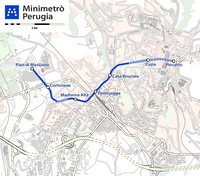 1286th file - 1.18 MB - 1480x1306
22.08.2013
upload 2444
Minimetrò Perugia map.png -
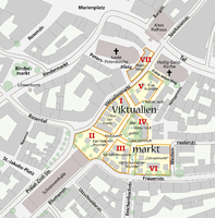 1285th file - 667 KB - 1512x1538
30.07.2013 .. 31.07.2013 (3 versions)
upload 2441 .. 2443
Karte Viktualienmarkt München.png -
 1284th file - 962 KB - 3248x1318
27.07.2013
upload 2440
Stadtbahn Charleroi, Gleisplan 2012.png -
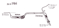 1283rd file - 1,017 KB - 3313x1564
27.07.2013
upload 2439
Stadtbahn Charleroi, Gleisplan 1986.png -
 1282nd file - 1.71 MB - 3512x2342
27.07.2013
upload 2438
Stadtbahn Charleroi, Gleisplan 1985.png -
 1281st file - 1.32 MB - 3529x2079
27.07.2013
upload 2437
Stadtbahn Charleroi, Gleisplan 1982.png -
 1280th file - 33.69 MB - 11447x8854
09.07.2013
upload 2426
Karte der Denkmalschutzensembles in München.jpg -
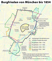 1279th file - 1.38 MB - 1434x1678
27.05.2013 .. 29.05.2014 (10 versions)
upload 2419 .. 2896
Karte der Burgfrieden von München.png -
 1278th file - 9.62 MB - 5675x6488
21.05.2013
upload 2415
Parkstadt Bogenhausen in München - Blick aus Hochhaus.jpg -
 1277th file - 2.27 MB - 4000x3000
21.05.2013
upload 2414
Parkstadt Bogenhausen - Wohngebäude Beblostraße 16-22.jpg -
 1276th file - 18.74 MB - 12274x3716
21.05.2013
upload 2413
Parkstadt Bogenhausen - Zentrale Grünfläche.jpg -
 1275th file - 2.2 MB - 4000x3000
21.05.2013
upload 2412
Parkstadt Bogenhausen - Rialtobrücke.jpg -
 1274th file - 8.09 MB - 8340x2415
21.05.2013
upload 2411
Baudenkmal Buschingstraße 2-6 in München (mit Rialtobrücke).jpg -
 1273rd file - 281 KB - 2400x3057
11.05.2013
upload 2407
StadtbahnGleisplanBielefeldMaerz1999.png -
 1272nd file - 64 KB - 888x465
09.05.2013
upload 2405
Carriage-Logo.png -
 1271st file - 401 KB - 1187x1641
01.05.2013
upload 2404
Blaise Pascal Versailles-cropped.jpg -
 1270th file - 744 KB - 1702x2134
06.04.2013
upload 2393
Réseau Distribus Saint-Louis 25032013.png -
 1269th file - 2.83 MB - 2044x1713
01.04.2013 .. 09.04.2013 (8 versions)
upload 2387 .. 2395
Les carrosses à cinq sols - network map.jpg -
 1268th file - 2.7 MB - 2944x2055
10.03.2013
upload 2384
Extends of the Tabula Peutingeria.png -
 1267th file - 114 KB - x
06.02.2013
upload by Tuvalkin
Ramal de Alfarelos.png -
 1266th file - 3.46 MB - 5002x2296
24.01.2013 .. 25.09.2013 (2 versions)
upload 2377 .. 2459
Map of the Istanbul Metrobüs.png -
 1265th file - 1 KB - 76x76
13.01.2013
upload 2371
Istanbul public transport - MM line symbol.png -
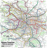 1264th file - 8.54 MB - 3109x3170
10.12.2012 .. 25.12.2017 (4 versions)
upload 2369 .. 4620
Transilien Paris region map.jpg -
 1263rd file - 35.37 MB - 8084x7196
10.12.2012 .. 25.12.2017 (3 versions)
upload 2368 .. 4619
Transilien Île-de-France map.jpg -
 1262nd file - 3.76 MB - 4000x3404
15.10.2012
upload 2345
München - Diamalt-Kesselhaus.jpg -
 1261st file - 7.99 MB - 17740x2583
01.10.2012
upload 2340
Baudenkmal Buschingstraße 2-6 in München.jpg -
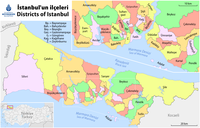 1260th file - 531 KB - 2177x1394
27.09.2012 .. 09.10.2012 (3 versions)
upload 2338 .. 2341
Map of the Districts of Istanbul.png -
 1259th file - 1.43 MB - 2592x1944
12.09.2012
upload 2332
FulyaGirişi-2.JPG -
1258th file - 328 KB - x
12.09.2012
upload 2331
Aksaray station-2.jpg -
 1257th file - 26 KB - 272x1033
12.09.2012
upload 2330
Istanbul M4 Linienband.png -
 1256th file - 38 KB - 460x904
12.09.2012 .. 13.01.2013 (4 versions)
upload 2329 .. 2370
Istanbul M3 Linienband.png -
 1255th file - 53 KB - 768x1076
12.09.2012
upload 2328
Istanbul M1 Linienband.png -
 1254th file - 36 KB - 431x818
12.09.2012
upload 2327
Istanbul M2 Linienband.png -
 1253rd file - 97 KB - x
30.08.2012
upload 2313
Autobus Citymobil rotated.jpg -
 1252nd file - 900 KB - 1675x1244
30.08.2012
upload 2312
Mecidiyeköy Metrobüs Durağı Turnstyle.jpg -
 1251st file - 176 KB - 2086x1382
29.08.2012
upload 2311
Metrobüs - Fahrtenangebot.png -
 1250th file - 3.78 MB - 4000x3000
28.08.2012
upload 2310
Zwetschgendatschibelag vor dem Backen.jpg -
 1249th file - 33.33 MB - 1909x1525
27.08.2012
upload 2309
Karte der naturräumlichen Untereinheiten der Donau-Iller-Lech-Platte.svg -
 1248th file - 78 KB - 2938x584
26.08.2012 .. 07.09.2012 (3 versions)
upload 2307 .. 2317
Metrobus Istanbul de.png -
 1247th file - 443 KB - 3751x1316
25.08.2012 .. 27.09.2015 (13 versions)
upload 2304 .. 3467
Istanbul Metrobüs Lines.png -
 1246th file - 1.41 MB - 2072x1749
24.08.2012
upload 2303
Lagekarte des Fernsehturms in Berlin.png -
 1245th file - 479 KB - 974x819
24.08.2012
upload 2302
Mecidiyeköy Metrobüs Durağı cropped.jpg -
 1244th file - 246 KB - 2493x1287
22.08.2012 .. 28.06.2016 (3 versions)
upload 2301 .. 3851
Karte der ÖPNV-Systeme in Nordafrika.png -
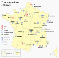 1243rd file - 310 KB - 1580x1556
19.08.2012 .. 13.09.2014 (2 versions)
upload 2300 .. 3121
Carte des transports urbains en France.png -
 1242nd file - 5.09 MB - 3335x2782
14.08.2012 .. 01.03.2017 (4 versions)
upload 2289 .. 4233
Karte der Stadtbezirksteile in München.png -
 1241st file - 236 KB - 1204x1445
14.08.2012
upload 2288
OePNVSystemeFrankreich-fr.png -
 1240th file - 553 KB - 1406x1324
08.08.2012 .. 10.08.2012 (2 versions)
upload 2281 .. 2282
Administrative boundaries of the borough of Solln in Munich.png -
 1239th file - 241 KB - 2122x1458
02.08.2012
upload 2279
Districts of Assam with RTO Codes for Vehicle Registration-01.png -
 1238th file - 195 KB - 1595x798
30.07.2012 .. 03.08.2017 (5 versions)
upload 2267 .. 4412
Hamburger Hochbahn - Plan der Linie U4.png -
 1237th file - 941 KB - 3245x2036
09.06.2012 .. 26.02.2017 (2 versions)
upload 2255 .. 4225
Linguistic map of the Altaic, Turkic and Uralic languages (en).png -
 1236th file - 2.44 MB - 4146x5057
03.06.2012 .. 26.05.2013 (13 versions)
upload 2247 .. 2418
Karte der Parkstadt Bogenhausen in München.png -
 1235th file - 46.46 MB - 16885x13030
25.05.2012
upload 2243
Postleitzahlenkarte München (kleiner Maßstab).jpg -
 1234th file - 15.68 MB - 8442x6515
25.05.2012
upload 2242
Postleitzahlenkarte München (mittlerer Maßstab).jpg -
 1233rd file - 4.7 MB - 4221x3257
25.05.2012
upload 2241
Postleitzahlenkarte München (großer Maßstab).jpg -
 1232nd file - 592 KB - 1600x1298
25.05.2012
upload 2240
Map of Munich 1844.jpg -
 1231st file - 5.3 MB - 3335x2782
24.05.2012 .. 21.10.2016 (7 versions)
upload 2238 .. 4054
Karte der Ortsbezeichnungen in München.png -
 1230th file - 1.49 MB - 2002x1670
20.05.2012 .. 20.05.2012 (2 versions)
upload 2236 .. 2237
Karte der Stadtbezirke in München in der bis 1992 gültigen Gliederung.png -
 1229th file - 4.01 MB - 4000x3000
18.05.2012
upload 2235
München - Flaucher - Floß auf dem Ländkanal 08.jpg -
 1228th file - 8.42 MB - 4000x3000
18.05.2012
upload 2234
München - Flaucher - Floß auf dem Ländkanal 07.jpg -
 1227th file - 5.09 MB - 2964x2049
18.05.2012
upload 2233
München - Flaucher - Floß auf dem Ländkanal 07 (cropped).jpg -
 1226th file - 4.2 MB - 4000x3000
18.05.2012
upload 2232
München - Flaucher - Floß auf dem Ländkanal 06.jpg -
 1225th file - 4.66 MB - 4000x3000
18.05.2012
upload 2231
München - Flaucher - Floß auf dem Ländkanal 05.jpg -
 1224th file - 4.35 MB - 4000x3000
18.05.2012
upload 2230
München - Flaucher - Floß auf dem Ländkanal 04.jpg -
 1223rd file - 4.4 MB - 4000x3000
18.05.2012
upload 2229
München - Flaucher - Floß auf dem Ländkanal 03.jpg -
 1222nd file - 4.8 MB - 4000x3000
18.05.2012
upload 2228
München - Flaucher - Floß auf dem Ländkanal 02.jpg -
 1221st file - 3.7 MB - 4000x3000
18.05.2012
upload 2227
München - Flaucher - Floß auf dem Ländkanal 01.jpg -
 1220th file - 1.99 MB - 4452x3257
12.05.2012 .. 27.03.2015 (13 versions)
upload 2222 .. 3237
Map of the Charleroi premetro network.png -
 1219th file - 655 KB - 3316x2771
10.05.2012 .. 11.05.2012 (3 versions)
upload 2219 .. 2221
Japanische Dialekte.png -
 1218th file - 729 KB - 1692x1740
25.04.2012 .. 26.08.2016 (4 versions)
upload 2216 .. 3983
Geschäftsgebiete der Bayerischen Sparkassen (Karte).png -
 1217th file - 368 KB - 1664x622
29.03.2012 .. 28.04.2017 (3 versions)
upload 2212 .. 4291
Karte berlin u u5.jpg -
 1216th file - 132 KB - 1346x863
29.03.2012
upload 2211
Übersichtskarte der Schweiz.svg -
 1215th file - 302 KB - x
29.03.2012 .. 29.03.2012 (3 versions)
upload 2208 .. 2210
Eurozone.svg -
 1214th file - 578 KB - 775x600
28.03.2012 .. 30.03.2012 (2 versions)
upload 2206 .. 2213
Distribution map of the Albanian language.jpg -
 1213th file - 455 KB - 2272x1402
27.03.2012 .. 26.03.2016 (4 versions)
upload 2204 .. 3700
WritingSystemsOfTheWorld-de.png -
 1212th file - 216 KB - 1576x1271
27.03.2012 .. 13.09.2014 (2 versions)
upload 2203 .. 3120
Karte der Baptistengemeinden in Ostfriesland.png -
 1211th file - 2.14 MB - 1579x2160
26.03.2012 .. 26.03.2012 (2 versions)
upload 2200 .. 2201
Bahnkarte Isartalbahn.jpg -
 1210th file - 533 KB - 1640x1752
15.03.2012 .. 29.03.2012 (4 versions)
upload 2190 .. 2207
Augsburg - Straßenbahn - Netzplan zum Königsplatz-Umbau.png -
 1209th file - 16 KB - 182x197
11.03.2012
upload 2189
Coat of Arms of Unterföhring.svg -
 1208th file - 523 KB - 1432x2246
09.03.2012 .. 10.03.2012 (2 versions)
upload 2183 .. 2184
ÖPNV-Tarifsysteme in Deutschland.png -
 1207th file - 74 KB - 872x495
29.02.2012 .. 09.03.2012 (2 versions)
upload 2177 .. 2182
München Hauptbahnhof Lageplan.png -
 1206th file - 515 KB - 1217x825
13.02.2012 .. 15.02.2012 (3 versions)
upload 2174 .. 2176
Plan du Parc Monceau.jpg -
 1205th file - 134 KB - 1122x1515
12.02.2012 .. 12.02.2012 (2 versions)
upload 2172 .. 2173
Bundesautobahn 39 map (with planned completion).png -
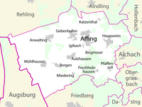 1204th file - 174 KB - 1166x872
12.02.2012
upload 2171
Gemeindekarte Affing.png -
 1203rd file - 1.96 MB - 2661x3640
10.02.2012 .. 12.02.2012 (5 versions)
upload 2166 .. 2170
Map of the Hagar Qim temple complex.png -
 1202nd file - 11.53 MB - 10105x4993
06.02.2012 .. 06.02.2012 (2 versions)
upload 2164 .. 2165
Map of the Sum of Mogolia.jpg -
 1201st file - 252 KB - 1869x1446
05.02.2012
upload 2161
RandenEidenMap.png -
 1200th file - 2.93 MB - 2200x2198
28.01.2012
upload 2155
Landvermessung in Bayern - Urpositionsblatt 692 (München).jpg -
 1199th file - 1.47 MB - 2002x1670
24.01.2012 .. 14.08.2012 (4 versions)
upload 2151 .. 2291
Karte der Stadtbezirke in München.png -
 1198th file - 1.52 MB - 2001x1669
23.01.2012 .. 28.01.2012 (3 versions)
upload 2150 .. 2158
Karte der Gemarkungen und Stadtbezirke in München.png -
 1197th file - 1.32 MB - 2001x1669
22.01.2012 .. 28.01.2012 (3 versions)
upload 2149 .. 2156
Karte der Gemarkungen in München.png -
 1196th file - 220 KB - 940x1123
19.01.2012
upload 2148
Karte Skagerrak.png -
 1195th file - 235 KB - 940x1123
19.01.2012 .. 24.12.2017 (2 versions)
upload 2147 .. 4613
Karte Kattegat.png -
 1194th file - 227 KB - 940x1123
17.01.2012 .. 18.01.2012 (2 versions)
upload 2143 .. 2146
Karte Skagerrak -Kattegat.png -
 1193rd file - 25.96 MB - 9706x6145
16.01.2012
upload 2142
Kahoolawe - Map of the Administrative Divisions.jpg -
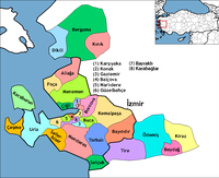 1192nd file - 45 KB - 950x772
16.01.2012 .. 18.01.2012 (3 versions)
upload 2140 .. 2145
İzmir districts.png -
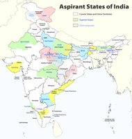 1191st file - 332 KB - 1456x1535
02.01.2012 .. 05.06.2014 (6 versions)
upload 2135 .. 2920
Proposed states and territories of India.png -
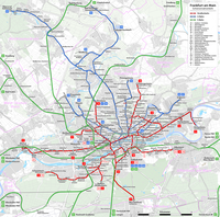 1190th file - 5.53 MB - 3017x2994
25.12.2011 .. 05.10.2017 (5 versions)
upload 2133 .. 4465
Frankfurt am Main - Netzplan Schienennahverkehr.png -
 1189th file - 1.26 MB - 2537x1820
25.12.2011 .. 05.10.2017 (6 versions)
upload 2132 .. 4464
Frankfurt am Main - Netzplan Schienennahverkehr (einfach).png -
 1188th file - 84 KB - 860x597
15.12.2011 .. 15.12.2014 (3 versions)
upload 2130 .. 3183
Mk Frankfurt Tram.png -
 1187th file - 425 KB - 1977x1614
13.12.2011 .. 10.06.2017 (6 versions)
upload 2127 .. 4348
Rail transport map of Saudi Arabia - DE.png -
 1186th file - 2.43 MB - 2556x1815
20.11.2011 .. 24.12.2017 (4 versions)
upload 2110 .. 4617
Lausanne - Public transport map.png -
 1185th file - 688 KB - 1696x1964
19.11.2011 .. 16.01.2012 (2 versions)
upload 2109 .. 2139
Réseau Distribus Saint-Louis 26092011.png -
 1184th file - 1.06 MB - 1586x1233
17.11.2011 .. 17.11.2011 (3 versions)
upload 2106 .. 2108
Genève - Trolleybus network map 2012.png -
 1183rd file - 943 KB - 3245x2036
04.10.2011 .. 26.02.2017 (3 versions)
upload 2096 .. 4226
Linguistic map of the Altaic, Turkic and Uralic languages (tr).png -
 1182nd file - 980 KB - 1485x1253
23.09.2011 .. 08.10.2011 (4 versions)
upload 2092 .. 2100
Karte der Straßenbahn Jerusalem (topographisch).png -
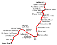 1181st file - 245 KB - 3204x2509
23.09.2011
upload 2091
Übersichtskarte der Straßenbahn Jerusalem.png -
 1180th file - 405 KB - 1729x2500
20.09.2011 .. 08.10.2011 (2 versions)
upload 2088 .. 2099
Karte der Straßenbahn Jerusalem.png -
 1179th file - 278 KB - 1453x1004
15.09.2011 .. 16.09.2011 (2 versions)
upload 2084 .. 2086
Kreisreform Mecklenburg-Vorpommern 2011 (Karte).png -
 1178th file - 9.01 MB - 1121x1494
15.09.2011
upload 2081
WikiCon - Kartenwerkstatt.pdf -
 1177th file - 1.69 MB - 1814x1407
14.09.2011
upload 2077
Map of the Kiel Canal.png -
 1176th file - 17.77 MB - 11999x6933
06.09.2011
upload 2074
Chicago Station (stitched).jpg -
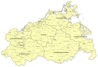 1175th file - 775 KB - 2906x2009
05.09.2011 .. 16.09.2011 (3 versions)
upload 2073 .. 2087
Mecklenburg-Vorpommern - Karte der Ämter und der amtsfreien Gemeinden 2011.png -
 1174th file - 1.37 MB - 4000x3000
25.08.2011
upload 2072
Masked hunter (Reduvius personatus) nymph, Middle Franconia, Germany - 20110820-04.jpg -
 1173rd file - 1.21 MB - 3676x2757
25.08.2011
upload 2071
Masked hunter (Reduvius personatus) nymph, Middle Franconia, Germany - 20110820-03.jpg -
 1172nd file - 5.83 MB - 6733x6099
22.08.2011 .. 22.08.2011 (2 versions)
upload 2067 .. 2068
Lechfall Füssen.jpg -
 1171st file - 2.12 MB - 2467x1771
21.08.2011
upload 2063
Landesgartenschau Rosenheim 2010 - Leuchtenwald.jpg -
 1170th file - 2.15 MB - 2467x1771
21.08.2011
upload 2062
Landesgartenschau Rosenheim 2010 - Leuchtenwald (mit Erläuterung).jpg -
 1169th file - 3.66 MB - 3971x10176
16.08.2011 .. 16.08.2011 (2 versions)
upload 2056 .. 2057
Stadtkirche Neuenbürg.jpg -
 1168th file - 118 KB - x
15.08.2011
upload 2055
Torre de Monsanto (Miraflores, Oeiras).jpg -
 1167th file - 340 KB - x
14.08.2011 .. 14.08.2011 (2 versions)
upload 2053 .. 2054
Burghof Beeskow-1.jpg -
 1166th file - 770 KB - 1394x950
14.08.2011 .. 22.08.2011 (3 versions)
upload 2052 .. 2069
Incunabula distribution by region.png -
 1165th file - 771 KB - 1394x950
14.08.2011 .. 17.08.2011 (2 versions)
upload 2051 .. 2061
Verteilung der Inkunabeln nach Regionen.png -
 1164th file - 771 KB - 1394x950
14.08.2011 .. 14.08.2011 (2 versions)
upload 2047 .. 2050
Verteilung der Inkunabeln nach Sprachen.png -
 1163rd file - 2.13 MB - 2448x3264
13.08.2011
upload 2045
Weißes Dinner-1.jpg -
 1162nd file - 448 KB - 1721x1917
10.08.2011 .. 23.08.2015 (5 versions)
upload 2044 .. 3435
ÖPNV-Systeme in Südosteuropa.png -
 1161st file - 1.93 MB - 2569x1354
08.08.2011 .. 21.01.2014 (4 versions)
upload 2041 .. 2826
Westpark München zur IGA 1983 (Karte).png -
 1160th file - 764 KB - 1394x950
06.08.2011 .. 14.08.2011 (4 versions)
upload 2040 .. 2049
Incunabula distribution by language.png -
 1159th file - 47 KB - x
03.08.2011
upload 2038
Pierce O'Mahony-1.jpg -
 1158th file - 3.22 MB - 3677x2925
29.07.2011 .. 29.07.2011 (2 versions)
upload 2032 .. 2033
Westpark (München) - Chinagarten - Station 'Herbst'-4.jpg -
 1157th file - 47 KB - 2600x2091
26.07.2011
upload 2031
LineaD.gif -
 1156th file - 368 KB - 1230x634
24.07.2011 .. 23.07.2015 (6 versions)
upload 2023 .. 3405
Karte der Straßenbahn Gmunden.png -
 1155th file - 1.15 MB - 1692x1767
23.07.2011 .. 23.07.2015 (7 versions)
upload 2020 .. 3406
Verkehrslinienplan Gmunden.png -
 1154th file - 217 KB - 1704x1188
19.07.2011
upload 2019
Gleisplan der Flughafenbahn Köln-Bonn.png -
 1153rd file - 684 KB - 1696x1964
13.07.2011
upload 2017
Réseau Distribus Saint-Louis 04072011.png -
 1152nd file - 3.84 MB - 4000x3000
10.07.2011
upload 2010
Westpark (München) - Yoga-Übungen 3.jpg -
 1151st file - 4.25 MB - 4000x3000
10.07.2011
upload 2009
Westpark (München) - Yoga-Übungen 2.jpg -
 1150th file - 845 KB - 2592x1395
10.07.2011
upload 2008
Westpark (München) - Yoga-Übungen 1.jpg -
 1149th file - 3.7 MB - 4000x3000
10.07.2011
upload 2007
Westpark (München) - Wasserstufe.jpg -
 1148th file - 4.2 MB - 3000x4000
10.07.2011
upload 2006
Westpark (München) - Wasserspielplatz.jpg -
 1147th file - 4.56 MB - 4000x3000
10.07.2011
upload 2005
Westpark (München) - Wasserkugel 2.jpg -
 1146th file - 3.71 MB - 4000x3000
10.07.2011
upload 2004
Westpark (München) - Wasserkugel 1.jpg -
 1145th file - 1.92 MB - 4000x3000
10.07.2011 .. 13.07.2011 (2 versions)
upload 2003 .. 2018
Westpark (München) - Vierer-Tischtennis.jpg -
 1144th file - 3.94 MB - 4000x3000
10.07.2011
upload 2002
Westpark (München) - Tisch im Bürgergarten 2.jpg -
 1143rd file - 2.8 MB - 3579x2868
10.07.2011
upload 2001
Westpark (München) - Tisch im Bürgergarten 1.jpg -
 1142nd file - 3.62 MB - 4000x3000
10.07.2011
upload 2000
Westpark (München) - Spiellandschaft am Wasserzulauf zum See.jpg -
 1141st file - 3.94 MB - 4000x3000
10.07.2011
upload 1999
Westpark (München) - Seniorengarten.jpg -
 1140th file - 4.21 MB - 4000x3000
10.07.2011
upload 1998
Westpark (München) - Seecafé.jpg -
 1139th file - 3.82 MB - 4000x3000
10.07.2011
upload 1997
Westpark (München) - Seebühne.jpg -
 1138th file - 4.15 MB - 3000x4000
10.07.2011
upload 1996
Westpark (München) - Sardischer Krieger.jpg -
 1137th file - 3.94 MB - 4000x3000
10.07.2011
upload 1995
Westpark (München) - Sardenhaus.jpg -
 1136th file - 4.07 MB - 4000x3000
10.07.2011
upload 1994
Westpark (München) - Sardenhaus - Kunstobjekte am Gartentor.jpg -
 1135th file - 2.72 MB - 4000x3000
10.07.2011
upload 1993
Westpark (München) - Rutschbahnen.jpg -
 1134th file - 3.86 MB - 4000x3000
10.07.2011
upload 1992
Westpark (München) - Rosengarten.jpg -
 1133rd file - 4.62 MB - 4000x3000
10.07.2011
upload 1991
Westpark (München) - Parklandschaft im Ostteil.jpg -
 1132nd file - 2.04 MB - 3722x2757
10.07.2011
upload 1990
Westpark (München) - Panoramablick in den Westteil.jpg -
 1131st file - 1.59 MB - 3715x2539
10.07.2011
upload 1989
Westpark (München) - Panoramablick in den Ostteil.jpg -
 1130th file - 4.22 MB - 4000x3000
10.07.2011
upload 1988
Westpark (München) - Mollsee.jpg -
 1129th file - 4.67 MB - 3000x4000
10.07.2011
upload 1987
Westpark (München) - Japangarten - Wasserlaterne.jpg -
 1128th file - 3.9 MB - 3000x4000
10.07.2011
upload 1986
Westpark (München) - Japangarten - Vierfenstrige Laterne.jpg -
 1127th file - 3.96 MB - 4000x3000
10.07.2011
upload 1985
Westpark (München) - Japangarten - Steg.jpg -
 1126th file - 4.13 MB - 4000x3000
10.07.2011
upload 1984
Westpark (München) - Japangarten - Steg mit Wartehalle.jpg -
 1125th file - 4.73 MB - 4000x3000
10.07.2011
upload 1983
Westpark (München) - Japangarten - Setzsteine.jpg -
 1124th file - 3.94 MB - 4000x3000
10.07.2011
upload 1982
Westpark (München) - Japangarten - Seeblick.jpg -
 1123rd file - 4.33 MB - 4000x3000
10.07.2011
upload 1981
Westpark (München) - Japangarten - Achtfenstrige Laterne.jpg -
 1122nd file - 2.61 MB - 3846x2948
10.07.2011
upload 1980
Westpark (München) - Grillen am See.jpg -
 1121st file - 4.32 MB - 4000x3000
10.07.2011
upload 1979
Westpark (München) - Farntal 2.jpg -
 1120th file - 4.24 MB - 3000x4000
10.07.2011
upload 1978
Westpark (München) - Farntal 1.jpg -
 1119th file - 3.94 MB - 4000x3000
10.07.2011
upload 1977
Westpark (München) - Chinagarten - Station 'Winter'.jpg -
 1118th file - 4.05 MB - 4000x3000
10.07.2011
upload 1976
Westpark (München) - Chinagarten - Station 'Herbst'.jpg -
 1117th file - 4.78 MB - 4000x3000
10.07.2011
upload 1975
Westpark (München) - Bäume am Seeufer.jpg -
 1116th file - 4.61 MB - 4000x3000
10.07.2011
upload 1974
Westpark (München) - Buddhistische Mönche auf dem Weg zum Khao Phansa-Fest an der Thai-Sala.jpg -
 1115th file - 2.56 MB - 2802x3927
10.07.2011
upload 1973
Westpark (München) - Buddha in der Thai-Sala 2.jpg -
 1114th file - 2.67 MB - 2877x3942
10.07.2011
upload 1972
Westpark (München) - Buddha in der Thai-Sala 1.jpg -
 1113th file - 3.65 MB - 4000x3000
10.07.2011
upload 1971
Westpark (München) - Biotop.jpg -
 1112th file - 1.22 MB - 3000x2151
10.07.2011
upload 1970
Westpark (München) - Alte Eichen.jpg -
 1111th file - 4.73 MB - 4000x3000
08.07.2011
upload 1969
Einbahnstraße - historisches Schild (München nähe Ratzingerplatz).jpg -
 1110th file - 785 KB - 2226x2415
08.07.2011
upload 1968
Maier-Leibnitz-Laboratorium 25.jpg -
 1109th file - 1.34 MB - 2493x3743
08.07.2011
upload 1967
Maier-Leibnitz-Laboratorium 24.jpg -
 1108th file - 1.9 MB - 4000x3000
08.07.2011
upload 1966
Maier-Leibnitz-Laboratorium 23.jpg -
 1107th file - 2.24 MB - 4000x3000
08.07.2011
upload 1965
Maier-Leibnitz-Laboratorium 22.jpg -
 1106th file - 1.51 MB - 2043x4000
08.07.2011
upload 1964
Maier-Leibnitz-Laboratorium 21.jpg -
 1105th file - 1.48 MB - 3186x3000
08.07.2011
upload 1963
Maier-Leibnitz-Laboratorium 20.jpg -
 1104th file - 2 MB - 4000x3000
08.07.2011
upload 1962
Maier-Leibnitz-Laboratorium 19.jpg -
 1103rd file - 1.74 MB - 4000x3000
08.07.2011
upload 1961
Maier-Leibnitz-Laboratorium 18.jpg -
 1102nd file - 1.88 MB - 3959x2553
08.07.2011
upload 1960
Maier-Leibnitz-Laboratorium 17.jpg -
 1101st file - 1.7 MB - 4000x3000
08.07.2011
upload 1959
Maier-Leibnitz-Laboratorium 16.jpg -
 1100th file - 1.74 MB - 4000x3000
08.07.2011
upload 1958
Maier-Leibnitz-Laboratorium 15.jpg -
 1099th file - 1.6 MB - 2769x3605
08.07.2011
upload 1957
Maier-Leibnitz-Laboratorium 14.jpg -
 1098th file - 1.74 MB - 3476x3000
08.07.2011
upload 1956
Maier-Leibnitz-Laboratorium 13.jpg -
 1097th file - 1.88 MB - 4000x3000
08.07.2011
upload 1955
Maier-Leibnitz-Laboratorium 12.jpg -
 1096th file - 2.07 MB - 4000x3000
08.07.2011
upload 1954
Maier-Leibnitz-Laboratorium 11.jpg -
 1095th file - 1.4 MB - 3345x2823
08.07.2011
upload 1953
Maier-Leibnitz-Laboratorium 10.jpg -
 1094th file - 1.21 MB - 3545x2355
08.07.2011
upload 1952
Maier-Leibnitz-Laboratorium 09.jpg -
 1093rd file - 1.69 MB - 4000x3000
08.07.2011
upload 1951
Maier-Leibnitz-Laboratorium 08.jpg -
 1092nd file - 1.37 MB - 3687x2376
08.07.2011
upload 1950
Maier-Leibnitz-Laboratorium 07.jpg -
 1091st file - 1.58 MB - 4000x3000
08.07.2011
upload 1949
Maier-Leibnitz-Laboratorium 06.jpg -
 1090th file - 1.64 MB - 3000x4000
08.07.2011
upload 1948
Maier-Leibnitz-Laboratorium 05.jpg -
 1089th file - 832 KB - 2490x2256
08.07.2011
upload 1947
Maier-Leibnitz-Laboratorium 04.jpg -
 1088th file - 2.45 MB - 3833x2835
08.07.2011
upload 1946
Maier-Leibnitz-Laboratorium 01.jpg -
 1087th file - 1.36 MB - 3000x4000
08.07.2011
upload 1945
Maier-Leibnitz-Laboratorium 02.jpg -
 1086th file - 326 KB - 1422x1758
08.07.2011
upload 1944
Maier-Leibnitz-Laboratorium 03.jpg -
 1085th file - 182 KB - 1644x1346
05.07.2011 .. 11.07.2011 (3 versions)
upload 1942 .. 2012
Map of the Bucharest Metro.png -
 1084th file - 921 KB - 1765x1739
03.07.2011 .. 21.08.2014 (5 versions)
upload 1935 .. 3072
BayernLB - Gebäudeplan.png -
 1083rd file - 281 KB - 1691x1251
03.06.2011 .. 07.06.2011 (3 versions)
upload 1930 .. 1934
ROC Administrative and Claims-de.png -
 1082nd file - 600 KB - 1305x821
02.06.2011 .. 02.06.2011 (2 versions)
upload 1928 .. 1929
Latvia relief location map.svg -
 1081st file - 230 KB - 1097x2001
31.05.2011 .. 01.06.2011 (2 versions)
upload 1925 .. 1927
Zigeunerlager im KZ Auschwitz-Birkenau.png -
 1080th file - 302 KB - x
30.05.2011
upload 1924
Kingdom of Mann and the Isles-de.svg -
 1079th file - 36 KB - 1028x789
28.05.2011
upload 1922
Mersin districts.png -
 1078th file - 390 KB - 3283x2530
25.05.2011
upload 1921
TransJakarta Network 2011.gif -
 1077th file - 568 KB - 1280x1467
24.05.2011
upload 1920
Map of the Navajo Volcanic Fields.jpg -
 1076th file - 565 KB - 1280x1467
23.05.2011 .. 24.05.2011 (3 versions)
upload 1917 .. 1919
Karte der Navajo Volcanic Fields.jpg -
 1075th file - 303 KB - x
14.05.2011 .. 15.05.2011 (2 versions)
upload 1914 .. 1915
Schengenzone.svg -
 1074th file - 26 KB - 1001x792
14.05.2011 .. 14.05.2011 (2 versions)
upload 1912 .. 1913
Diyarbakır districts.png -
 1073rd file - 648 KB - 2026x2258
13.05.2011
upload 1911
Coalition action against Libya de.png -
 1072nd file - 219 KB - 1529x1733
09.05.2011
upload 1910
Mongolia Khentii sum map-mn-de.png -
 1071st file - 193 KB - 1536x1144
03.05.2011 .. 03.05.2011 (2 versions)
upload 1907 .. 1908
Linguistic map of the Tungusic languages.png -
 1070th file - 400 KB - 2102x1325
01.05.2011 .. 01.05.2011 (2 versions)
upload 1905 .. 1906
Linguistic map of the Mongolic languages.png -
 1069th file - 297 KB - 1509x1484
18.04.2011 .. 21.04.2011 (2 versions)
upload 1900 .. 1902
Watson Brake Mounds - Map.png -
 1068th file - 613 KB - 2478x1872
17.04.2011 .. 21.04.2011 (2 versions)
upload 1899 .. 1903
Watson Brake - Map.png -
 1067th file - 557 KB - 2869x1556
16.04.2011 .. 16.05.2011 (2 versions)
upload 1895 .. 1916
Linguistic map of the Uralic languages.png -
 1066th file - 2 KB - 76x76
03.04.2011
upload 1884
Istanbul public transport - M7 line symbol.png -
 1065th file - 210 KB - 1867x1100
28.03.2011 .. 29.05.2011 (2 versions)
upload 1883 .. 1923
Landtagswahl Baden-Württemberg 2011 - Sitzverteilung-01.png -
 1064th file - 5 MB - 2117x2793
27.03.2011
upload 1882
Streckenkarte der Pfälzischen Nordbahn.png -
 1063rd file - 493 KB - 1683x474
27.03.2011 .. 27.03.2011 (2 versions)
upload 1880 .. 1881
Streckenkarte der Südpfalzbahn.png -
 1062nd file - 175 KB - 1241x1502
27.03.2011
upload 1878
Distribution Map of Erythrodiplax Unimaculata.png -
 1061st file - 179 KB - 1241x1502
27.03.2011
upload 1877
Distribution Map of Erythrodiplax Umbrata.png -
 1060th file - 174 KB - 1241x1502
27.03.2011
upload 1876
Distribution Map of Erythrodiplax Nigricans.png -
 1059th file - 178 KB - 1241x1502
27.03.2011
upload 1875
Distribution Map of Erythrodiplax Longitudinalis.png -
 1058th file - 180 KB - 1241x1502
27.03.2011
upload 1874
Distribution Map of Erythrodiplax Juliana.png -
 1057th file - 175 KB - 1241x1502
27.03.2011
upload 1873
Distribution Map of Erythrodiplax Funera.png -
 1056th file - 175 KB - 1241x1502
27.03.2011
upload 1872
Distribution Map of Erythrodiplax Famula.png -
 1055th file - 174 KB - 1241x1502
27.03.2011
upload 1871
Distribution Map of Erythrodiplax Connata.png -
 1054th file - 178 KB - 1241x1502
27.03.2011
upload 1870
Distribution Map of Erythrodiplax Castanea.png -
 1053rd file - 179 KB - 1241x1502
27.03.2011
upload 1869
Distribution Map of Erythrodiplax Basalis.png -
 1052nd file - 177 KB - 1241x1502
27.03.2011
upload 1868
Distribution Map of Erythrodiplax Attenuata.png -
 1051st file - 169 KB - 1241x1502
27.03.2011
upload 1867
Distribution Map of Erythrodiplax Acantha.png -
 1050th file - 652 KB - 1337x1649
27.03.2011
upload 1866
Ausbreitungsgebiete Erythrodiplax-Gruppen (mit Einzelkarten).png -
 1049th file - 363 KB - 1508x1178
25.03.2011 .. 26.03.2011 (2 versions)
upload 1863 .. 1864
Kunsteisbahn Bob-Rodel Igls (Karte).png -
 1048th file - 453 KB - 1248x1393
24.03.2011 .. 27.03.2011 (3 versions)
upload 1861 .. 1879
Ausbreitungsgebiete Erythrodiplax-Gruppen.png -
 1047th file - 299 KB - 1241x1767
24.03.2011
upload 1860
Ausbreitungsgebiete Erythrodiplax (Connata- und der Longitudinalis-Gruppe).png -
 1046th file - 2.62 MB - 3113x3314
23.03.2011 .. 04.10.2017 (11 versions)
upload 1858 .. 4457
Strassenbahn Frankfurt am Main Netzkarte.png -
 1045th file - 1.69 MB - 1814x1407
23.03.2011 .. 09.05.2011 (10 versions)
upload 1856 .. 1909
Karte Nord-Ostsee-Kanal.png -
 1044th file - 783 KB - 2992x2441
22.03.2011 .. 22.03.2011 (2 versions)
upload 1854 .. 1855
Basisplan Ohrid.png -
 1043rd file - 745 KB - 2497x2256
22.03.2011
upload 1852
Japan natural location map with side map of the Ryukyu Islands.jpg -
 1042nd file - 878 KB - 2497x2256
22.03.2011
upload 1851
Japan bluemarble location map with side map of the Ryukyu Islands.jpg -
 1041st file - 2 KB - 76x76
20.03.2011 .. 20.03.2011 (2 versions)
upload 1842 .. 1843
Istanbul public transport - M3 line symbol.png -
 1040th file - 390 KB - 1184x1135
20.03.2011 .. 26.03.2015 (3 versions)
upload 1841 .. 3234
Verbreitung der Täuferbewegung 1525-1550.png -
 1039th file - 428 KB - 2349x2947
18.03.2011
upload 1833
Flüsse und Seen in Albanien.png -
 1038th file - 662 KB - 1921x1750
18.03.2011 .. 19.06.2016 (15 versions)
upload 1832 .. 3840
Eisenbahnknoten Wien.png -
 1037th file - 87 KB - 1352x611
16.03.2011
upload 1831
Hispaniola 1936-today.png -
 1036th file - 77 KB - 1352x611
16.03.2011
upload 1830
Hispaniola 1822-1844.png -
 1035th file - 85 KB - 1352x611
16.03.2011
upload 1829
Hispaniola 1820-1822.png -
 1034th file - 101 KB - 1352x611
16.03.2011
upload 1828
Hispaniola 1808-1820.png -
 1033rd file - 88 KB - 1352x611
16.03.2011
upload 1827
Hispaniola 1806-1808.png -
 1032nd file - 87 KB - 1352x611
16.03.2011
upload 1826
Hispaniola 1795-1806.png -
 1031st file - 94 KB - 1352x611
16.03.2011
upload 1825
Hispaniola 1697-1795.png -
 1030th file - 75 KB - 1352x611
16.03.2011
upload 1824
Hispaniola 1492-1697.png -
 1029th file - 243 KB - 676x453
14.03.2011 .. 15.03.2011 (2 versions)
upload 1815 .. 1816
Bulgarian motorway network en.svg -
 1028th file - 1.39 MB - 2171x1612
13.03.2011
upload 1812
Karte Rosenheimer See.jpg -
 1027th file - 621 KB - 1893x2647
13.03.2011 .. 16.03.2011 (4 versions)
upload 1811 .. 1823
Haiti und Dominikanische Republik - Gebietsentwicklung (mit Gebietszuständen).png -
 1026th file - 1.47 MB - 2569x1148
13.03.2011 .. 21.01.2014 (7 versions)
upload 1808 .. 2825
Westpark München (Karte).png -
 1025th file - 93 KB - 628x850
13.03.2011 .. 14.03.2011 (4 versions)
upload 1805 .. 1814
Okhotsk Plate map - de.png -
 1024th file - 391 KB - 1184x1135
12.03.2011 .. 09.01.2016 (9 versions)
upload 1804 .. 3569
Spread of the Anabaptists 1525-1550.png -
 1023rd file - 496 KB - 1047x1499
12.03.2011
upload 1803
Topographic-map-of-Montserrat-de.png -
 1022nd file - 228 KB - 1891x868
12.03.2011 .. 16.03.2011 (2 versions)
upload 1801 .. 1822
Haiti und Dominikanische Republik - Gebietsentwicklung.png -
 1021st file - 154 KB - 1154x591
10.03.2011 .. 12.03.2011 (2 versions)
upload 1794 .. 1802
Kelp forest distribution map.png -
 1020th file - 84 KB - 551x590
09.03.2011 .. 12.03.2011 (3 versions)
upload 1793 .. 1800
Nile monitor (varanus niloticus) distribution map.png -
 1019th file - 119 KB - 1112x837
09.03.2011 .. 12.03.2011 (3 versions)
upload 1792 .. 1799
West Mediterranean Areas 279 BC-de.png -
 1018th file - 1.69 MB - x
08.03.2011 .. 08.03.2011 (2 versions)
upload 1788 .. 1791
Islam by country.svg -
 1017th file - 436 KB - 945x733
06.03.2011 .. 08.03.2011 (3 versions)
upload 1786 .. 1790
Lagekarte Dschibal.jpg -
 1016th file - 6 KB - 309x419
06.03.2011
upload 1785
Nordglocke.png -
 1015th file - 226 KB - 1286x938
06.03.2011 .. 05.11.2013 (2 versions)
upload 1784 .. 2592
Via Imperii und Via Regia.png -
 1014th file - 251 KB - 1800x1021
06.03.2011
upload 1783
Carte du Léman (avec ses subdivisions).png -
 1013th file - 175 KB - 2449x1368
05.03.2011 .. 08.03.2011 (4 versions)
upload 1780 .. 1787
Map of the Santa Cruz Islands (Solomon Islands).png -
 1012th file - 563 KB - 1488x1807
05.03.2011
upload 1779
Etruscan civilization map-de.png -
1011th file - 3 KB - 77x77
19.02.2011
upload 1769
Istanbul public transport - Ferry line symbol.png -
 1010th file - 1 KB - 77x77
19.02.2011
upload 1768
Istanbul public transport - Teleferik line symbol.png -
 1009th file - 1 KB - 66x65
19.02.2011
upload 1767
Istanbul public transport - Metrobüs line symbol.png -
 1008th file - 1 KB - 77x77
19.02.2011
upload 1766
Istanbul public transport - Nostaljik Tramvay symbol.png -
 1007th file - 1 KB - 77x77
19.02.2011
upload 1765
Istanbul public transport - F1 line symbol.png -
 1006th file - 995 bytes - 77x77
19.02.2011
upload 1764
Istanbul public transport - Tünel line symbol.png -
 1005th file - 1 KB - 77x77
19.02.2011
upload 1763
Istanbul public transport - T4 line symbol.png -
 1004th file - 2 KB - 77x77
19.02.2011
upload 1762
Istanbul public transport - T3 line symbol.png -
 1003rd file - 1 KB - 77x77
19.02.2011
upload 1761
Istanbul public transport - T1 line symbol.png -
 1002nd file - 2 KB - 77x77
19.02.2011 .. 10.06.2016 (3 versions)
upload 1760 .. 3822
Istanbul public transport - M6 line symbol.png -
 1001st file - 2 KB - 76x76
19.02.2011 .. 20.03.2011 (2 versions)
upload 1759 .. 1846
Istanbul public transport - M5 line symbol.png -
 1000th file - 1 KB - 76x76
19.02.2011 .. 20.03.2011 (3 versions)
upload 1758 .. 1845
Istanbul public transport - M4 line symbol.png -
 999th file - 2 KB - 77x77
19.02.2011
upload 1757
Istanbul public transport - M2 line symbol.png -
 998th file - 1 KB - 77x77
19.02.2011
upload 1756
Istanbul public transport - M1 line symbol.png -
 997th file - 1 KB - 77x77
19.02.2011
upload 1755
Istanbul public transport - Banliyö Treni line symbol.png -
 996th file - 452 KB - 566x825
03.02.2011
upload 1746
Louisiana - Poverty Point - Karte.svg -
 995th file - 680 KB - 1696x1964
28.01.2011 .. 13.07.2011 (9 versions)
upload 1740 .. 2016
Réseau Distribus Saint-Louis.png -
 994th file - 272 KB - 1138x1135
27.01.2011
upload 1739
Maas Memel Etsch Belt.png -
 993rd file - 1.07 MB - 3645x1798
27.01.2011 .. 26.12.2017 (61 versions)
upload 1735 .. 4621
Istanbul Rapid Transit Map with Metrobüs (schematic).png -
 992nd file - 621 KB - 1721x1471
25.01.2011
upload 1733
Karte der Aufgabenträger des Schienenperonennahverkehrs (SPNV) in Deutschland.png -
 991st file - 133 KB - 777x599
16.01.2011 .. 28.07.2017 (7 versions)
upload 1722 .. 4410
Karte der Verkehrsverbünde und Tarifverbünde in der Schweiz.png -
 990th file - 1.81 MB - 2956x2396
16.01.2011 .. 15.09.2017 (21 versions)
upload 1721 .. 4440
Karte der Verkehrsverbünde und Tarifverbünde in Deutschland, Österreich und der Schweiz.png -
 989th file - 6.15 MB - 2993x2894
26.12.2010 .. 11.12.2017 (18 versions)
upload 1709 .. 4602
Karte der Stadtbahn Stuttgart und des O-Bus Esslingen.png -
 988th file - 1.42 MB - 1727x1464
22.12.2010 .. 24.12.2010 (3 versions)
upload 1705 .. 1707
Karte des Oberleitungsbus Esslingen.png -
 987th file - 3.35 MB - 3456x2592
19.12.2010
upload 1701
Timisoara - Tramway 31.jpg -
 986th file - 3.31 MB - 3456x2592
19.12.2010
upload 1700
Timisoara - Trolleybus 4.jpg -
 985th file - 3.28 MB - 3456x2592
19.12.2010
upload 1699
Timisoara - Trolleybus 3.jpg -
 984th file - 3.24 MB - 2592x3456
19.12.2010
upload 1698
Timisoara - Trolleybus 2.jpg -
 983rd file - 3.2 MB - 3456x2592
19.12.2010
upload 1697
Timisoara - Trolleybus 1.jpg -
 982nd file - 3.25 MB - 3456x2592
19.12.2010
upload 1696
Timişoara - Tramway 01.jpg -
 981st file - 3.14 MB - 3456x2592
19.12.2010
upload 1695
Timisoara - Tramway 30.jpg -
 980th file - 3.26 MB - 3456x2592
19.12.2010
upload 1694
Timisoara - Tramway 29.jpg -
 979th file - 3.24 MB - 3456x2592
19.12.2010
upload 1693
Timisoara - Tramway 28.jpg -
 978th file - 3.31 MB - 3456x2592
19.12.2010
upload 1692
Timisoara - Tramway 27.jpg -
 977th file - 3.27 MB - 3456x2592
19.12.2010
upload 1691
Timisoara - Tramway 26.jpg -
 976th file - 3.24 MB - 3456x2592
19.12.2010
upload 1690
Timisoara - Tramway 25.jpg -
 975th file - 3.23 MB - 3456x2592
19.12.2010
upload 1689
Timisoara - Tramway 24.jpg -
 974th file - 3.23 MB - 3456x2592
19.12.2010
upload 1688
Timisoara - Tramway 23.jpg -
 973rd file - 3.35 MB - 3456x2592
19.12.2010
upload 1687
Timisoara - Tramway 22.jpg -
 972nd file - 3.33 MB - 3456x2592
19.12.2010
upload 1686
Timisoara - Tramway 21.jpg -
 971st file - 3.24 MB - 3456x2592
19.12.2010
upload 1685
Timisoara - Tramway 20.jpg -
 970th file - 3.23 MB - 2592x3456
19.12.2010
upload 1684
Timisoara - Tramway 19.jpg -
 969th file - 3.39 MB - 2592x3456
19.12.2010
upload 1683
Timisoara - Tramway 18.jpg -
 968th file - 3.29 MB - 3456x2592
19.12.2010
upload 1682
Timisoara - Tramway 17.jpg -
 967th file - 3.29 MB - 3456x2592
19.12.2010
upload 1681
Timisoara - Tramway 16.jpg -
 966th file - 3.36 MB - 3456x2592
19.12.2010
upload 1680
Timisoara - Tramway 15.jpg -
 965th file - 3.35 MB - 3456x2592
19.12.2010
upload 1679
Timisoara - Tramway 14.jpg -
 964th file - 3.34 MB - 3456x2592
19.12.2010
upload 1678
Timisoara - Tramway 13.jpg -
 963rd file - 5.82 MB - 3456x2592
19.12.2010 .. 19.12.2010 (2 versions)
upload 1677 .. 1703
Timisoara - Tramway 12.jpg -
 962nd file - 3.22 MB - 3456x2592
19.12.2010
upload 1675
Timisoara - Tramway 11.jpg -
 961st file - 5.07 MB - 3456x2592
19.12.2010 .. 19.12.2010 (2 versions)
upload 1674 .. 1702
Timisoara - Tramway 10.jpg -
 960th file - 3.11 MB - 2529x2691
19.12.2010 .. 11.05.2015 (2 versions)
upload 1673 .. 3292
Timisoara - Tramway 09.jpg -
 959th file - 3.24 MB - 3456x2592
19.12.2010
upload 1672
Timisoara - Tramway 08.jpg -
 958th file - 3.36 MB - 3456x2592
19.12.2010
upload 1671
Timisoara - Tramway 07.jpg -
 957th file - 3.34 MB - 3456x2592
19.12.2010
upload 1670
Timisoara - Tramway 06.jpg -
 956th file - 3.38 MB - 3456x2592
19.12.2010
upload 1669
Timisoara - Tramway 05.jpg -
 955th file - 3.21 MB - 3456x2592
19.12.2010
upload 1668
Timisoara - Tramway 04.jpg -
 954th file - 6.44 MB - 3456x2592
19.12.2010 .. 19.12.2010 (2 versions)
upload 1667 .. 1704
Timisoara - Tramway 03.jpg -
 953rd file - 3.22 MB - 3456x2592
19.12.2010
upload 1666
Timisoara - Tramway 02.jpg -
 952nd file - 3.24 MB - 3456x2592
14.12.2010
upload 1660
München - St. Pius (Südseite).jpg -
 951st file - 3.08 MB - 3456x2592
14.12.2010
upload 1659
München - St. Pius (Ostseite).jpg -
 950th file - 3.27 MB - 3456x2592
14.12.2010
upload 1658
München - Kriegersiedlung.jpg -
 949th file - 6.31 MB - 3456x2592
14.12.2010
upload 1657
München - Luise-Kiesselbach-Platz - Baustellenplan.jpg -
 948th file - 3.88 MB - 3108x2574
12.12.2010 .. 23.09.2017 (26 versions)
upload 1646 .. 4444
Map of the Timișoara tramway and trolleybus routes.png -
 947th file - 6.11 MB - 2357x2368
06.12.2010 .. 24.12.2017 (12 versions)
upload 1632 .. 4616
Map of the Salzburg trolleybus.png -
 946th file - 40 KB - 329x696
14.11.2010 .. 14.11.2010 (3 versions)
upload 1629 .. 1631
München - Stadtbezirk 22 (Karte) - Aubing - Lochhausen - Langwied (nach Stadtteilen).png -
 945th file - 47 KB - 457x690
11.11.2010 .. 12.11.2010 (3 versions)
upload 1625 .. 1627
Mojave & Sonoran.png -
 944th file - 451 KB - 1349x1135
10.11.2010 .. 25.07.2015 (2 versions)
upload 1624 .. 3412
Umgriffe Kurdistans-pl.png -
 943rd file - 3.76 MB - 1939x1995
01.11.2010 .. 15.09.2017 (9 versions)
upload 1616 .. 4435
Netzplan Oberleitungsbus Solingen.png -
 942nd file - 8.68 MB - 5335x4793
11.10.2010
upload 1601
Kreisgrenzen in der Region München auf Satellietenbild.jpg -
 941st file - 459 KB - 2168x1704
05.10.2010 .. 05.02.2011 (4 versions)
upload 1596 .. 1748
Tramway and trolleybus map of Szeged.png -
 940th file - 587 KB - 1640x1738
13.09.2010 .. 16.09.2010 (5 versions)
upload 1585 .. 1591
Île-de-France - plan des tramways et des bus en site propre (document de travail).png -
 939th file - 462 KB - 2229x1638
02.09.2010 .. 24.01.2011 (3 versions)
upload 1584 .. 1728
Istanbul Rapid Transit Map (schematic).png -
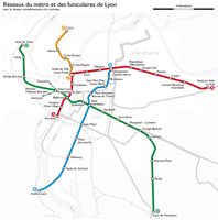 938th file - 474 KB - 1972x1996
28.08.2010 .. 15.12.2013 (2 versions)
upload 1583 .. 2689
Lyon - Metro network map.png -
 937th file - 2.65 MB - 2977x2072
27.08.2010 .. 27.05.2017 (8 versions)
upload 1580 .. 4332
Genève - Tramway network map.png -
 936th file - 425 KB - 3157x2177
17.08.2010
upload 1577
Montpellier - Map of the future tramway network.png -
 935th file - 10.83 MB - 4254x4936
17.08.2010 .. 03.01.2017 (8 versions)
upload 1576 .. 4118
Montpellier - Tramway network map 2012.png -
 934th file - 1.51 MB - 1690x1482
17.08.2010 .. 09.01.2011 (2 versions)
upload 1575 .. 1715
Montpellier - Tramway network map 2010.png -
 933rd file - 14.24 MB - 10375x9088
19.06.2010
upload 1572
München - Basiskarte farbig - mit Nachbargemeinden.jpg -
 932nd file - 16.76 MB - 12962x6841
17.06.2010
upload 1571
Map of the Hala'ib triangle.jpg -
 931st file - 914 KB - 1847x1112
10.06.2010
upload 1569
Noch lange nicht überflutetes Überflutungsgebiet des Sylvensteinspeichers.jpg -
 930th file - 754 KB - 2277x1246
09.06.2010
upload 1568
Karte des Gebiets des heutigen Sylvensteinspeichers.jpg -
 929th file - 916 KB - 1847x1112
09.06.2010
upload 1567
Überflutungsgebiet des Sylvensteinspeichers.jpg -
 928th file - 846 KB - 2736x4116
08.06.2010
upload 1566
Map of the British postcode areas.png -
 927th file - 4.69 MB - 3703x4450
08.06.2010 .. 08.10.2015 (4 versions)
upload 1565 .. 3481
Map of the administrative geography of the British Isles with postcode areas.jpg -
 926th file - 2.41 MB - 1692x2139
07.06.2010
upload 1564
München - Basiskarte farbig - Flaucher bis Englischer Garten.png -
 925th file - 4.13 MB - 3703x4450
30.05.2010 .. 08.10.2015 (8 versions)
upload 1557 .. 3480
Map of the administrative geography of the British Isles.jpg -
 924th file - 1.78 MB - 2806x4179
24.05.2010 .. 08.10.2015 (8 versions)
upload 1553 .. 3479
Map of the administrative geography of the United Kingdom.png -
 923rd file - 25 KB - 44x46
13.04.2010
upload 1552
Tranvía de Tenerife - L2 route symbol.svg -
 922nd file - 25 KB - 44x46
13.04.2010
upload 1551
Tranvía de Tenerife - L1 route symbol.svg -
 921st file - 386 KB - 2170x1722
11.04.2010 .. 19.11.2013 (2 versions)
upload 1546 .. 2652
India Gujarat location map.svg -
 920th file - 370 KB - 2168x1671
11.04.2010
upload 1545
India Maharashtra location map.svg -
 919th file - 75 KB - x
09.04.2010
upload 1544
Parcs naturels français.svg -
 918th file - 1.25 MB - 2109x886
07.04.2010 .. 03.11.2010 (4 versions)
upload 1542 .. 1622
Streckenkarte der Pfälzischen Ludwigsbahn.png -
 917th file - 578 KB - 512x636
06.04.2010
upload 1541
India Tamil Nadu location map.svg -
 916th file - 1.36 MB - 1726x1403
06.04.2010
upload 1536
Travels of Marco Polo (on William R. Shepherd map).jpg -
 915th file - 1.87 MB - 1732x1936
05.04.2010 .. 13.04.2010 (3 versions)
upload 1534 .. 1550
Streckenkarte der Stettiner Bahn.png -
 914th file - 460 KB - 1298x1016
04.04.2010
upload 1533
China Hong Kong location map.svg -
 913th file - 541 KB - 1355x692
03.04.2010 .. 05.04.2010 (2 versions)
upload 1532 .. 1535
Travels of Marco Polo.jpg -
 912th file - 384 KB - 828x3352
03.04.2010 .. 03.04.2010 (2 versions)
upload 1530 .. 1531
Map of the Krasnoyarsk Krai (upright).png -
 911th file - 554 KB - 2006x1802
03.04.2010 .. 03.04.2010 (3 versions)
upload 1526 .. 1528
Map of the Krasnoyarsk Krai (with index).png -
 910th file - 390 KB - 1545x1802
02.04.2010 .. 03.04.2010 (2 versions)
upload 1525 .. 1529
Map of the Krasnoyarsk Krai.png -
 909th file - 90 KB - 1314x1352
28.03.2010
upload 1520
Alterspyramide München 2009-12.png -
 908th file - 341 KB - 1323x1501
27.03.2010
upload 1519
Karte der Amtssprachen und Nationalsprachen in Afrika.png -
 907th file - 844 KB - 1901x1291
27.03.2010
upload 1518
Die Ostural-Spur infolge des Kyschtym-Unfalls.jpg -
 906th file - 71 KB - 1367x1118
24.03.2010
upload 1517
Kiribati Kiritimati location map.svg -
 905th file - 172 KB - 1206x941
21.03.2010 .. 24.03.2010 (2 versions)
upload 1514 .. 1516
Map of the sectors of the Bolama Region, Guinea-Bissau.png -
 904th file - 1.52 MB - 413x373
20.03.2010 .. 21.03.2010 (3 versions)
upload 1509 .. 1513
Japan location map with side map of the Ryukyu Islands.svg -
 903rd file - 558 KB - 1509x2054
18.03.2010
upload 1508
Portland, Maine - Map of the Rail Road System 1909.png -
 902nd file - 725 KB - 1117x1386
14.03.2010
upload 1505
Map of the Strait of Malacca-de.jpg -
 901st file - 809 KB - 1126x1464
13.03.2010 .. 16.03.2010 (6 versions)
upload 1501 .. 1507
Thai Canal map-de.jpg -
 900th file - 15.26 MB - 220x328
11.03.2010 .. 13.03.2010 (2 versions)
upload 1499 .. 1500
Karte der Indochinesischen Halbinsel-de.svg -
 899th file - 689 KB - 916x1368
10.03.2010
upload 1498
Karte der Indochinesischen Halbinsel-de.jpg -
 898th file - 675 KB - 916x1368
09.03.2010
upload 1496
Karte der Indochinesischen Halbinsel-en.jpg -
 897th file - 189 KB - 662x611
09.03.2010 .. 09.03.2010 (2 versions)
upload 1495 .. 1497
Karte der Straßenbahn Heiligensee.png -
 896th file - 713 KB - 2139x2050
08.03.2010 .. 08.03.2010 (3 versions)
upload 1492 .. 1494
Portland, Maine - Electric railways route map 1916.png -
 895th file - 8.12 MB - 4362x3398
05.03.2010
upload 1491
Portland, Maine - Map of the Electric Railway Lines 1891-1914.jpg -
 894th file - 413 KB - 1383x1543
03.03.2010 .. 11.07.2011 (3 versions)
upload 1489 .. 2014
Uruguayan railway network map-de.png -
 893rd file - 10.22 MB - 5095x3019
02.03.2010
upload 1488
Portland, Maine - Map of the Horse Rail Lines 1876.jpg -
 892nd file - 591 KB - 1016x820
02.03.2010 .. 02.03.2010 (2 versions)
upload 1486 .. 1487
Portland, Maine - Map of the Horse Rail Lines 1883-1896.jpg -
 891st file - 406 KB - 1383x1543
28.02.2010 .. 11.07.2011 (5 versions)
upload 1482 .. 2013
Uruguayan railway network map-es.png -
 890th file - 90 KB - 837x749
21.02.2010 .. 22.02.2010 (3 versions)
upload 1478 .. 1481
Lageplan der Post-U-Bahn München.png -
 889th file - 587 KB - 2260x1580
15.02.2010 .. 05.08.2014 (9 versions)
upload 1471 .. 3012
U-Bahn-Plan München.png -
 888th file - 898 KB - 1840x1594
14.02.2010 .. 17.02.2010 (3 versions)
upload 1469 .. 1473
Map of the Terceira Travessia do Tejo.png -
 887th file - 2.44 MB - 2140x1834
13.02.2010 .. 13.12.2014 (7 versions)
upload 1468 .. 3167
Karte der S-Bahn München.png -
 886th file - 1.52 MB - 2652x2133
27.01.2010
upload 1467
Die Chinesische Mauer - blank-01.jpg -
 885th file - 4.85 MB - 3682x2272
09.01.2010 .. 29.05.2016 (6 versions)
upload 1466 .. 3805
Metro, suburban train and tramway map of Algiers.png -
 884th file - 1.21 MB - 4296x2369
02.01.2010
upload 1462
Dschabal Sindschar - Höhenkarte.jpg -
 883rd file - 405 KB - 698x482
02.01.2010
upload 1461
Mecklenburg-Vorpommern - Karte der Ämter und der amtsfreien Gemeinden.svg -
 882nd file - 1.4 MB - 2459x2110
25.12.2009 .. 15.09.2017 (27 versions)
upload 1449 .. 4439
Karte der Verkehrsverbünde und Tarifverbünde in Deutschland (inkl. Legende).png -
 881st file - 171 KB - 1619x1137
05.12.2009
upload 1433
Tram-train de la Réunion-01.png -
 880th file - 2.14 MB - 2155x1870
04.11.2009 .. 06.11.2009 (3 versions)
upload 1417 .. 1419
Karte Chiemgau.png -
 879th file - 4.35 MB - 3655x2950
02.11.2009
upload 1416
Basiskarte Dresden.png -
 878th file - 234 KB - 1856x1250
02.11.2009
upload 1415
Karte der Afroasiatischen Sprachen.png -
 877th file - 128 KB - 831x1334
01.11.2009 .. 01.11.2009 (2 versions)
upload 1411 .. 1414
Railway map of Madagascar.png -
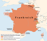 876th file - 144 KB - 1096x958
31.10.2009 .. 01.11.2009 (3 versions)
upload 1410 .. 1413
Distribution map of the French language in Europe.png -
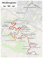 875th file - 1.27 MB - 1505x2040
31.10.2009 .. 28.02.2010 (5 versions)
upload 1409 .. 1483
Karte der Windbergbahn.png -
 874th file - 7.85 MB - 3655x2949
31.10.2009
upload 1408
Basiskarte Dresden.pdf -
 873rd file - 166 KB - 1316x1231
24.10.2009 .. 27.05.2016 (4 versions)
upload 1403 .. 3797
Metro Lisboa Route Map (only with routes in operation).png -
 872nd file - 107 KB - x
22.10.2009
upload 1400
Kloster Dobbertin Grundriss.PNG -
 871st file - 467 KB - 1349x1135
15.10.2009 .. 24.10.2009 (6 versions)
upload 1392 .. 1401
Umgriffe Kurdistans.png -
 870th file - 213 KB - 1012x922
08.10.2009
upload 1391
Karte von Türkmeneli.png -
 869th file - 57 KB - 1297x1035
07.10.2009
upload 1390
Türkmeneli blank map.jpg -
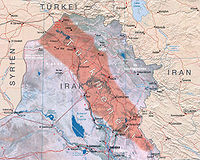 868th file - 478 KB - 1297x1035
07.10.2009
upload 1389
Karte von Türkmeneli.jpg -
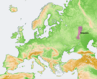 867th file - 2.96 MB - 2046x1664
07.10.2009
upload 1388
Lagekarte Wolgaplatte.png -
 866th file - 2.97 MB - 2046x1664
07.10.2009
upload 1387
Lagekarte Weißrussischer Höhenrücken.png -
 865th file - 2.97 MB - 2046x1664
07.10.2009
upload 1386
Lagekarte Waldaihöhen.png -
 864th file - 2.97 MB - 2046x1664
07.10.2009
upload 1385
Lagekarte Timanrücken.png -
 863rd file - 2.97 MB - 2046x1664
07.10.2009
upload 1384
Lagekarte Smolensker Höhen.png -
 862nd file - 2.96 MB - 2046x1664
07.10.2009
upload 1383
Lagekarte Podolische Platte.png -
 861st file - 2.97 MB - 2046x1664
07.10.2009
upload 1382
Lagekarte Palessje.png -
 860th file - 2.97 MB - 2046x1664
07.10.2009
upload 1381
Lagekarte Nordrussisches Tiefland.png -
 859th file - 2.97 MB - 2046x1664
07.10.2009
upload 1380
Lagekarte Nordrussischer Landrücken.png -
 858th file - 2.97 MB - 2046x1664
07.10.2009
upload 1379
Lagekarte Moskauer Höhenrücken.png -
 857th file - 2.97 MB - 2046x1664
07.10.2009
upload 1378
Lagekarte Mittelrussische Platte.png -
 856th file - 2.97 MB - 2046x1664
07.10.2009
upload 1377
Lagekarte Manytschniederung.png -
 855th file - 2.98 MB - 2046x1664
07.10.2009
upload 1376
Lagekarte Kaspische Senke.png -
 854th file - 2.96 MB - 2046x1664
07.10.2009
upload 1375
Lagekarte Jergenihügel.png -
 853rd file - 2.96 MB - 2046x1664
07.10.2009
upload 1374
Lagekarte Finnische Seenplatte.png -
 852nd file - 2.96 MB - 2046x1664
07.10.2009
upload 1373
Lagekarte Donezplatte.png -
 851st file - 1.58 MB - 1473x1198
07.10.2009 .. 03.01.2016 (2 versions)
upload 1372 .. 3567
Lagekarte Dnepr-Becken.png -
 850th file - 2.97 MB - 2046x1664
07.10.2009
upload 1371
Lagekarte Baltischer Landrücken.png -
 849th file - 1,001 KB - 1579x676
06.10.2009
upload 1369
Verbreitungskarte der türkischen Volkstänze.svg -
 848th file - 311 KB - 2194x939
06.10.2009 .. 06.10.2009 (2 versions)
upload 1368 .. 1370
Verbreitungskarte der türkischen Volkstänze.png -
 847th file - 3.17 MB - 2046x1664
05.10.2009 .. 06.10.2009 (2 versions)
upload 1366 .. 1367
Karte der Landschaften der Osteuropäischen Ebene.png -
 846th file - 3.1 MB - 2046x1664
05.10.2009
upload 1365
Europa voll flach.png -
 845th file - 261 KB - 1611x1149
04.10.2009 .. 04.10.2009 (2 versions)
upload 1363 .. 1364
Romanian license plate codes.png -
 844th file - 227 KB - 1486x2143
30.09.2009 .. 30.09.2009 (2 versions)
upload 1356 .. 1357
Map of the Corn Islands (Nicaragua).png -
 843rd file - 1,014 KB - 525x698
29.09.2009
upload 1355
Karte der Kreise und Bundesländer Deutschlands 2009.svg -
 842nd file - 229 KB - 1677x1426
28.09.2009
upload 1353
Northern Ireland - Counties.png -
 841st file - 1.13 MB - 1671x1396
27.09.2009 .. 21.07.2016 (4 versions)
upload 1349 .. 3878
Map of the McMurdo-South Pole highway.jpg -
 840th file - 3.45 MB - 2868x2233
27.09.2009 .. 21.08.2017 (11 versions)
upload 1348 .. 4432
Topographischer Netzplan der S-Bahn Berlin.png -
 839th file - 851 KB - 2049x1524
22.09.2009 .. 23.09.2009 (2 versions)
upload 1345 .. 1346
Ruanda deutsch UNO-Karte mit Neuer Gliederung.jpg -
 838th file - 345 KB - 1280x948
22.09.2009
upload 1344
Lough Neagh with administrative boundaries.jpg -
 837th file - 264 KB - 1677x1426
22.09.2009 .. 22.09.2009 (2 versions)
upload 1342 .. 1343
Northern Ireland - Local Government Districts.png -
 836th file - 881 KB - 2049x1523
22.09.2009
upload 1341
Ruanda deutsch UNO-Karte.jpg -
 835th file - 5.58 MB - 178x145
22.09.2009
upload 1340
Blank map of Saudi Arabia.svg -
 834th file - 5.34 MB - 990x765
21.09.2009
upload 1333
Ruanda deutsch UNO-Karte.svg -
 833rd file - 419 KB - 1977x1614
20.09.2009 .. 10.06.2017 (7 versions)
upload 1332 .. 4347
Rail transport map of Saudi Arabia.png -
 832nd file - 202 KB - 1483x1210
20.09.2009 .. 21.09.2009 (2 versions)
upload 1331 .. 1334
Karte der Städte und Provinzen von Saudi-Arabien.png -
 831st file - 162 KB - 1652x818
19.09.2009
upload 1330
Administrative map of the Liquiçá district of East Timor.png -
 830th file - 381 KB - 1827x1772
19.09.2009
upload 1329
Administrative map of the Manufahi district of East Timor.png -
 829th file - 459 KB - 1692x2204
19.09.2009
upload 1328
Administrative map of the Manatuto district of East Timor.png -
 828th file - 362 KB - 2495x1180
19.09.2009
upload 1327
Administrative map of the Baucau district of East Timor 2004-2015.png -
 827th file - 331 KB - 1381x1406
19.09.2009
upload 1326
Administrative map of the Ermera district of East Timor.png -
 826th file - 181 KB - 1441x1928
19.09.2009 .. 22.09.2009 (2 versions)
upload 1325 .. 1339
Administrative map of the Dilli district of East Timor.png -
 825th file - 276 KB - 1215x1782
19.09.2009
upload 1324
Administrative map of the Ainaro district of East Timor.png -
 824th file - 267 KB - 1431x1185
19.09.2009
upload 1323
Administrative map of the Aileu muncipality of East Timor.png -
 823rd file - 433 KB - 1908x1837
19.09.2009
upload 1322
Administrative map of the Bobonaro district of East Timor.png -
 822nd file - 429 KB - 2600x1531
19.09.2009
upload 1321
Administrative map of the Viqueque district of East Timor.png -
 821st file - 149 KB - 1855x1345
19.09.2009 .. 03.06.2010 (4 versions)
upload 1320 .. 1562
Administrative map of the Oecussi district of East Timor.png -
 820th file - 3.71 MB - 12608x6108
18.09.2009
upload 1319
Administrative map of East Timor 2003-2015.jpg -
 819th file - 288 KB - 2405x1637
18.09.2009 .. 22.09.2009 (2 versions)
upload 1318 .. 1337
Administrative map of the Lautem district of East Timor.png -
 818th file - 343 KB - 2154x1732
17.09.2009 .. 22.09.2009 (2 versions)
upload 1317 .. 1336
Administrative map of the Covalima district of East Timor.png -
 817th file - 256 KB - 1732x1335
15.09.2009 .. 16.09.2009 (2 versions)
upload 1310 .. 1312
Railway map of Macedonia.png -
 816th file - 717 KB - x
27.08.2009
upload by San Jose
Karte vom Flughafen München (inkl. geplanter Erweiterung).svg -
 815th file - 1.41 MB - 1214x2076
25.08.2009 .. 16.09.2009 (4 versions)
upload 1306 .. 1313
Karte vom Weinbaugebiet Pfalz.png -
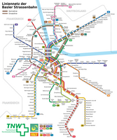 814th file - 1.2 MB - 2973x3564
25.08.2009 .. 06.01.2018 (7 versions)
upload 1305 .. 4641
Basel - Straßenbahnnetzplan.png -
 813th file - 1.54 MB - 1469x1620
23.08.2009
upload 1304
Map of the Wards and Suburbs of Darwin, Northern Territory.svg -
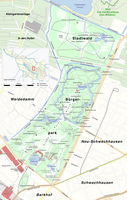 812th file - 1.99 MB - 1850x2915
23.08.2009 .. 20.10.2009 (5 versions)
upload 1302 .. 1398
Karte des Bürgerparks und des Stadtwalds in Bremen.png -
 811th file - 1.2 MB - 1858x2279
18.08.2009 .. 19.08.2009 (3 versions)
upload 1298 .. 1300
Karte der Werrabahn.jpg -
 810th file - 1.57 MB - 2691x2365
17.08.2009
upload 1297
Karte der naturräumlichen Untereinheiten der Donau-Iller-Lech-Platte.jpg -
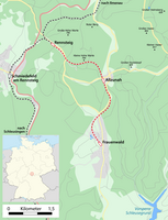 809th file - 447 KB - 1203x1575
16.08.2009
upload 1295
Karte der Kleinbahn Rennsteig – Frauenwald.png -
 808th file - 1.58 MB - 1599x2146
16.08.2009
upload 1294
Karte der Bahnstrecke Plaue - Themar.png -
 807th file - 290 KB - 972x788
16.08.2009
upload 1293
Karte der Friedbergbahn (Suhl - Schleusingen).png -
 806th file - 497 KB - 558x514
15.08.2009
upload 1286
Lage von Savoien in Europa (Karte).svg -
 805th file - 119 KB - x
14.08.2009
upload 1283
Zugspitztunnel.svg -
 804th file - 2.37 MB - 1914x3974
13.08.2009 .. 25.08.2009 (9 versions)
upload 1274 .. 1307
Karte von Tiefwerder in Berlin.png -
 803rd file - 1,005 KB - 3177x1059
11.08.2009 .. 28.02.2010 (9 versions)
upload 1269 .. 1484
Ostfriesische Inseln (Karte).png -
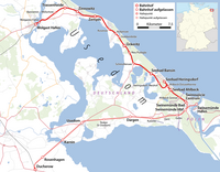 802nd file - 638 KB - 1769x1381
11.08.2009 .. 31.07.2012 (4 versions)
upload 1268 .. 2275
Karte der Bahnstrecke Wolgast–Heringsdorf–Ducherow.png -
 801st file - 1.41 MB - 2072x1749
11.08.2009
upload 1267
Karte des Südteils der Karl-Liebknecht-Straße in Berlin.png -
 800th file - 384 KB - 1188x1423
10.08.2009
upload 1264
Map of the Suburbs of Palmerston, Northern Territory.png -
 799th file - 716 KB - 1768x1786
10.08.2009 .. 10.08.2009 (3 versions)
upload 1263 .. 1266
Bahnstrecken auf der Insel Usedom (Karte).png -
 798th file - 843 KB - 1779x1233
10.08.2009 .. 14.08.2009 (2 versions)
upload 1262 .. 1282
Karte des Städtischen Centralvieh- und Schlachthofs in Berlin.png -
 797th file - 520 KB - 1200x858
10.08.2009 .. 13.08.2009 (2 versions)
upload 1261 .. 1276
Karte ubahn berlin entwicklung.png -
 796th file - 429 KB - 1200x964
09.08.2009 .. 09.08.2009 (2 versions)
upload 1259 .. 1260
Karte ubahn berlin.png -
 795th file - 1.71 MB - 3060x3375
07.08.2009 .. 08.08.2009 (6 versions)
upload 1246 .. 1258
Map of the Wards and Suburbs of Darwin, Northern Territory.png -
 794th file - 84 KB - 554x735
06.08.2009 .. 07.08.2009 (2 versions)
upload 1245 .. 1247
FranconianSwitzerland.png -
 793rd file - 609 KB - 1840x1569
06.08.2009 .. 01.11.2012 (9 versions)
upload 1241 .. 2351
Die Erweiterung Berlins durch das Groß-Berlin-Gesetz von 1920 (Karte).png -
 792nd file - 4.06 MB - 3431x2659
04.08.2009
upload 1240
Karte der Provinz Brandenburg (Brockhaus 1894).jpg -
 791st file - 1.31 MB - 1476x811
03.08.2009
upload 1239
Verlauf der Bahnstrecke Plaue–Themar durch die Thüringer Kleinstaaten.png -
 790th file - 211 KB - 693x740
02.08.2009 .. 08.08.2009 (2 versions)
upload 1238 .. 1257
Karte der Bahnstrecke Dannenberg - Salzwedel.png -
 789th file - 266 KB - 1050x562
02.08.2009 .. 08.08.2009 (2 versions)
upload 1237 .. 1255
Karte der Bahnstrecke Uelzen - Dannenberg.png -
 788th file - 747 KB - 2172x1022
02.08.2009 .. 08.08.2009 (2 versions)
upload 1236 .. 1253
Karte der Bahnstrecke Uelzen - Stendal.png -
 787th file - 617 KB - 591x1876
02.08.2009
upload 1235
Karte der Bahnstrecke Uelzen - Braunschweig.png -
 786th file - 397 KB - 2131x461
02.08.2009 .. 05.02.2012 (2 versions)
upload 1234 .. 2162
Karte der Bahnstrecke Langwedel - Uelzen.png -
 785th file - 1.77 MB - 4790x1400
02.08.2009 .. 05.02.2012 (4 versions)
upload 1233 .. 2163
Karte der Amerikalinie (Bahnstrecke).png -
 784th file - 859 KB - 3400x914
02.08.2009 .. 08.08.2009 (2 versions)
upload 1232 .. 1256
Karte der Bahnstrecke Buchholz - Wittenberge.png -
 783rd file - 956 KB - 865x2467
02.08.2009 .. 13.11.2010 (2 versions)
upload 1231 .. 1628
Karte der Bahnstrecke Buchholz - Hannover.png -
 782nd file - 2.86 MB - 2340x1693
02.08.2009
upload 1230
Bahnstrecken in Niedersachsen - Gesamtbearbeitung.png -
 781st file - 48 KB - 743x613
01.08.2009
upload 1229
District map of Saint Helena.png -
 780th file - 734 KB - 2906x2009
01.08.2009
upload 1228
Mecklenburg-Vorpommern - Karte der Ämter und der amtsfreien Gemeinden.png -
 779th file - 225 KB - 1453x1004
01.08.2009 .. 15.09.2011 (3 versions)
upload 1227 .. 2083
Karte der Änderungen infolge der Kreisreform in Mecklenburg-Vorpommern 2011.png -
 778th file - 1.12 MB - 2644x1675
01.08.2009 .. 20.08.2009 (6 versions)
upload 1224 .. 1301
Karte vom Flughafen München (inkl. geplanter Erweiterung).png -
 777th file - 118 KB - 811x937
30.07.2009
upload 1220
Karte von Ostelbien.png -
 776th file - 338 KB - 1456x1324
28.07.2009 .. 01.08.2009 (6 versions)
upload 1215 .. 1225
Flüsse in Polen (Karte).png -
 775th file - 367 KB - 1650x1275
28.07.2009
upload 1214
Un-poland.pdf -
 774th file - 175 KB - 878x886
28.07.2009 .. 30.07.2009 (2 versions)
upload 1212 .. 1223
Die Teilung Württembergs durch den Nürtinger Vertrag 1442 (Karte).png -
 773rd file - 284 KB - 1480x2689
27.07.2009 .. 28.07.2009 (2 versions)
upload 1210 .. 1216
Karte der Moselstaustufen.png -
 772nd file - 208 KB - 1111x1007
25.07.2009 .. 05.03.2017 (3 versions)
upload 1201 .. 4244
Map of Sunda and Sahul.png -
 771st file - 208 KB - 1111x1007
25.07.2009 .. 05.03.2017 (3 versions)
upload 1200 .. 4246
Carte de Sunda et Sahul.png -
 770th file - 208 KB - 1111x1007
25.07.2009 .. 05.03.2017 (2 versions)
upload 1199 .. 4245
Karte von Sunda und Sahul.png -
 769th file - 100 KB - 949x508
24.07.2009
upload 1198
Map of the CDC Districts of Singapore.png -
 768th file - 356 KB - 746x577
24.07.2009
upload 1197
München - Stadtbezirke und Stadtbezirksteile (Karte).svg -
 767th file - 1,006 KB - 2010x1410
24.07.2009 .. 28.07.2009 (7 versions)
upload 1196 .. 1213
Karte vom Naturpark Niederlausitzer Heidelandschaft.png -
 766th file - 1.99 MB - 1968x1726
21.07.2009 .. 01.05.2016 (10 versions)
upload 1187 .. 3762
Karte vom Lausitzer Seenland.png -
 765th file - 179 KB - 436x465
19.07.2009
upload 1182
Karte der Gemeinde Dautphetal.svg -
 764th file - 91 KB - 908x968
19.07.2009
upload 1178
Lage des Ortsteils Buchenau in der Gemeinde Dautphetal (Karte).png -
 763rd file - 269 KB - 1384x987
18.07.2009 .. 21.06.2017 (2 versions)
upload 1177 .. 4358
Hamburger Hochbahn - Plan der Linie U3.png -
 762nd file - 685 KB - 971x607
17.07.2009 .. 18.07.2009 (4 versions)
upload 1171 .. 1176
Großglockner (Umgebungskarte).png -
 761st file - 6.34 MB - 2732x2633
14.07.2009
upload 1167
Mittlerer Teil der Hohen Tauern (Karte).png -
 760th file - 3.28 MB - 3456x2592
12.07.2009
upload 1162
Richard-Strauss-Tunnel (im Zweigtunnel zum Vogelweideplatz mit Blick in Richtung Haupttunnel).jpg -
 759th file - 3.34 MB - 3456x2592
12.07.2009
upload 1161
Richard-Strauss-Tunnel (an der Ausfahrt zur Denninger Straße mit Blick nach Süden).jpg -
 758th file - 3.27 MB - 3456x2592
12.07.2009
upload 1159
Richard-Strauss-Tunnel (an der Abzweigung des Seitentunnels zum Vogelweideplatz).jpg -
 757th file - 1.19 MB - 3438x2364
12.07.2009
upload 1157
Entwicklung des Straßenbahn-Streckennetzes in Matsuyama.jpg -
 756th file - 1.13 MB - 4964x3480
12.07.2009
upload 1156
Straßenbahn-Gleisplan Genf 1945.jpg -
 755th file - 1,009 KB - 3420x2430
12.07.2009
upload 1155
Gleisplan der Straßenbahn Essen 1965 (Zentralbereich).jpg -
 754th file - 1.3 MB - 3454x2440
12.07.2009
upload 1154
Entwicklung des Straßenbahn-Streckennetzes im Stadtzentrum von Kassel.jpg -
 753rd file - 336 KB - 2438x1167
12.07.2009 .. 09.05.2016 (3 versions)
upload 1151 .. 3778
Highway map of Turkey.png -
 752nd file - 38 KB - 2000x1414
12.07.2009
upload 1150
Stadtbahn Charleroi, Gleisplan 1997.png -
 751st file - 34 KB - 2000x1414
12.07.2009
upload 1149
Stadtbahn Charleroi, Gleisplan 1992.png -
 750th file - 1.95 MB - 3460x1734
12.07.2009 .. 27.07.2013 (2 versions)
upload 1148 .. 2436
Stadtbahn Charleroi, Gleisplan 1983.png -
 749th file - 2.05 MB - 2471x3155
12.07.2009 .. 27.07.2013 (2 versions)
upload 1147 .. 2435
Stadtbahn Charleroi, Gleisplan 1980.png -
 748th file - 2.7 MB - 2465x3208
12.07.2009 .. 27.07.2013 (3 versions)
upload 1145 .. 2434
Stadtbahn Charleroi, Gleisplan 1976.png -
 747th file - 2.34 MB - 1017x1494
11.07.2009 .. 13.07.2009 (3 versions)
upload 1144 .. 1164
Streckenplan der Straßenbahn Ravensburg–Weingarten–Baienfurt.png -
 746th file - 979 KB - 1495x1170
11.07.2009 .. 23.08.2015 (6 versions)
upload 1141 .. 3436
Lagekarte Neuburger Wald.png -
 745th file - 528 KB - 1962x1783
09.07.2009
upload 1138
Wappenkarte der Stadt Hamm.png -
 744th file - 238 KB - 1524x1110
09.07.2009 .. 13.07.2009 (4 versions)
upload 1137 .. 1166
Ferdinand Löwls geolog. Karte vom Großglockner mit Ergänzungen (Bearbeitung).png -
 743rd file - 2.88 MB - 2663x3528
09.07.2009
upload 1136
Map of the Louisville & Nashville Railroad (1913).jpg -
 742nd file - 4.38 MB - 2927x5368
09.07.2009
upload 1135
Map of the Louisville & Nashville Railroad (ca. 1890).jpg -
 741st file - 1.12 MB - 2340x1377
09.07.2009
upload 1130
Großglockner und Umgebung (Screenshot einer OSM Cycle Map) - Variante 2.jpg -
 740th file - 360 KB - 1136x711
09.07.2009
upload 1129
Großglockner und Umgebung (Screenshot einer OSM Cycle Map) - Variante 1.jpg -
 739th file - 556 KB - 1300x1591
09.07.2009 .. 09.07.2009 (3 versions)
upload 1128 .. 1133
Karte Frontverläufe im ersten Golfkrieg.jpg -
 738th file - 631 KB - 1984x2183
09.07.2009
upload 1127
Iraq wall det 2003.jpg -
 737th file - 1.2 MB - 2672x906
07.07.2009 .. 20.07.2009 (5 versions)
upload 1125 .. 1184
Karte des Datteln-Hamm-Kanals.png -
 736th file - 434 KB - 1887x1611
06.07.2009 .. 07.07.2009 (2 versions)
upload 1122 .. 1124
Map of La Gomera.jpg -
 735th file - 522 KB - 2415x1999
05.07.2009 .. 21.06.2017 (2 versions)
upload 1116 .. 4357
Hamburger Hochbahn - Plan der Linie U2.png -
 734th file - 1.03 MB - 1432x2246
04.07.2009 .. 15.09.2017 (52 versions)
upload 1111 .. 4438
Karte der Verkehrsverbünde und Tarifverbünde in Deutschland.png -
 733rd file - 1.29 MB - 2871x1583
30.06.2009 .. 02.07.2009 (3 versions)
upload 1107 .. 1110
Map of the Snæfellsnes peninsula.png -
 732nd file - 5.47 MB - 870x301
28.06.2009
upload 1102
Bahnstrecken-Beispielkarte.svg -
 731st file - 1.45 MB - 2407x1567
28.06.2009
upload 1100
ÖPNV in der Region Berlin - Basiskarte.png -
 730th file - 615 KB - 3245x2036
28.06.2009 .. 26.02.2017 (8 versions)
upload 1099 .. 4224
Linguistic map of the Altaic, Turkic and Uralic languages.png -
 729th file - 2.21 MB - 2441x1696
27.06.2009 .. 28.06.2009 (4 versions)
upload 1095 .. 1104
Map of Cappadocia.jpg -
 728th file - 79 KB - 1123x794
27.06.2009 .. 05.07.2009 (4 versions)
upload 1094 .. 1120
Van districts (with Van Gölü).png -
 727th file - 51 KB - 954x775
27.06.2009 .. 27.06.2009 (2 versions)
upload 1093 .. 1097
Bitlis districts (with Van Gölü).png -
 726th file - 529 KB - 1209x418
25.06.2009 .. 26.06.2009 (3 versions)
upload 1088 .. 1091
Karte der Bahnstrecke Mönchengladbach–Düsseldorf.png -
 725th file - 1 MB - 1153x1002
25.06.2009 .. 26.06.2009 (3 versions)
upload 1087 .. 1092
Karte der Bahnstrecke Duisburg-Ruhrort–Mönchengladbach.png -
 724th file - 825 KB - 1717x2230
25.06.2009
upload 1086
Blason Châtelaillon-Plage.png -
 723rd file - 126 KB - 363x382
23.06.2009
upload 1085
Map of Lake Nasser in the former Wadi Halfa Salient area.png -
 722nd file - 2.34 MB - 1742x1076
20.06.2009 .. 31.10.2017 (11 versions)
upload 1076 .. 4550
Map of the Kars-Akhalkalaki-Tbilisi-Baku railway.png -
 721st file - 1.25 MB - 909x955
20.06.2009
upload 1075
Map of the flooding areas of the Lake Nasser in the Wadi Halfa Salient.png -
 720th file - 243 KB - 1016x483
20.06.2009 .. 07.02.2017 (3 versions)
upload 1074 .. 4164
Berlin - Lage der geplanten Ost-West-S-Bahn (Karte mit Planungsstand 1937-1938).png -
 719th file - 241 KB - 1016x483
20.06.2009 .. 07.02.2017 (3 versions)
upload 1073 .. 4163
Berlin - Lage der geplanten Ost-West-S-Bahn (Karte mit Planungsstand 1965).png -
 718th file - 1.49 MB - 2282x1667
19.06.2009 .. 07.02.2017 (5 versions)
upload 1071 .. 4162
Berlin - Lage der geplanten Ost-West-S-Bahn (Karte).png -
 717th file - 555 KB - 1640x1752
19.06.2009 .. 12.07.2016 (8 versions)
upload 1068 .. 3874
Augsburg - Straßenbahn - Netzplan.png -
 716th file - 2.45 MB - 1669x1231
17.06.2009 .. 18.06.2009 (2 versions)
upload 1064 .. 1067
Karte der Innenstadt von Freiburg im Breisgau (OSM-Derivat).svg -
 715th file - 3.33 MB - 2847x2421
15.06.2009
upload 1061
Hannover - Basiskarte (grell).png -
 714th file - 335 KB - 1211x1783
14.06.2009 .. 18.06.2009 (7 versions)
upload 1058 .. 1066
Karte - Flughafen Zürich ZRH.png -
 713th file - 5.7 MB - 4270x3631
14.06.2009
upload 1057
Hannover - Basiskarte.pdf -
 712th file - 3.25 MB - 2847x2421
14.06.2009
upload 1056
Hannover - Basiskarte.png -
 711th file - 315 KB - 1576x1533
13.06.2009 .. 16.01.2012 (5 versions)
upload 1054 .. 2138
Karte der Freikirchengemeinden in Ostfriesland.png -
 710th file - 1.06 MB - 1658x1399
11.06.2009 .. 12.06.2009 (6 versions)
upload 1047 .. 1053
Karte der Spandauer Straße in Berlin.png -
 709th file - 1.25 MB - 940x477
09.06.2009
upload 1046
SARS map.svg -
 708th file - 471 KB - 998x1088
09.06.2009
upload 1043
Karte von Senftenberg.png -
 707th file - 309 KB - 1474x1220
07.06.2009 .. 22.08.2015 (12 versions)
upload 1038 .. 3433
Schemaplan der S-Bahn Hannover.png -
 706th file - 438 KB - 2204x1353
05.06.2009 .. 16.12.2017 (6 versions)
upload 1030 .. 4606
Karte der ÖPNV-Systeme in den USA.png -
 705th file - 274 KB - 1370x1021
04.06.2009 .. 06.06.2009 (2 versions)
upload 1027 .. 1034
Map of the Metro Sul do Tejo.png -
 704th file - 271 KB - 1370x1021
02.06.2009 .. 06.06.2009 (5 versions)
upload 1023 .. 1035
Karte der Metro Sul do Tejo.png -
 703rd file - 118 KB - 981x689
01.06.2009
upload 1019
Linha de Cintura.png -
 702nd file - 214 KB - 1730x912
01.06.2009 .. 01.06.2009 (2 versions)
upload 1017 .. 1018
Ramal de Alfarelos 2.png -
 701st file - 275 KB - 2112x1275
31.05.2009
upload 1013
Map of the Tranvía de Tenerife.png -
 700th file - 774 KB - 2895x2568
31.05.2009 .. 21.06.2017 (2 versions)
upload 1012 .. 4356
Hamburger Hochbahn - Plan der Linie U1.png -
 699th file - 1.08 MB - 3543x2953
31.05.2009 .. 27.09.2015 (5 versions)
upload 1011 .. 3466
Hamburger Hochbahn - Linienplan (mit Tunnels).png -
 698th file - 533 KB - 1311x1216
30.05.2009
upload 1010
Karte der Wasserstraßen in Potsdam.png -
 697th file - 8.16 MB - 4593x3770
27.05.2009 .. 28.05.2009 (2 versions)
upload 997 .. 999
München - Basiskarte grau.pdf -
 696th file - 3.49 MB - 3675x3017
27.05.2009 .. 28.05.2009 (2 versions)
upload 996 .. 998
München - Basiskarte grau.png -
 695th file - 8.06 MB - 4593x3770
27.05.2009 .. 28.05.2009 (2 versions)
upload 995 .. 1001
München - Basiskarte farbig.pdf -
 694th file - 4.44 MB - 3675x3017
27.05.2009 .. 28.05.2009 (2 versions)
upload 994 .. 1000
München - Basiskarte farbig.png -
 693rd file - 969 KB - 3723x2767
25.05.2009 .. 28.08.2010 (2 versions)
upload 993 .. 1581
Lyon - transports en commun - Farben nach Transportmittel.png -
 692nd file - 995 KB - 3723x2767
25.05.2009 .. 28.08.2010 (2 versions)
upload 992 .. 1582
Lyon - transports en commun - Farben nach Linienschema der TCL.png -
 691st file - 680 KB - 1789x2439
19.05.2009 .. 27.12.2014 (8 versions)
upload 991 .. 3193
Île-de-France - plan des bus en site propre.png -
 690th file - 618 KB - 1558x1671
19.05.2009 .. 23.09.2017 (7 versions)
upload 990 .. 4447
Île-de-France - plan des tramways.png -
 689th file - 960 KB - 1789x2439
19.05.2009 .. 23.09.2017 (14 versions)
upload 989 .. 4446
Île-de-France - plan des tramways et des bus en site propre.png -
 688th file - 198 KB - 1600x1547
17.05.2009 .. 17.08.2010 (3 versions)
upload 987 .. 1579
Marseille - Metro - Netzplan.png -
 687th file - 522 KB - 2200x1800
15.05.2009 .. 09.07.2009 (2 versions)
upload 984 .. 1131
Österreich - NUTS1, NUTS2, NUTS3.png -
 686th file - 327 KB - 1577x1646
14.05.2009 .. 14.09.2014 (5 versions)
upload 982 .. 3123
Deutschland NUTS1 und NUTS2.png -
 685th file - 129 KB - x
16.03.2009 .. 14.09.2012 (2 versions)
upload by Lencer
Positionskartenerstellung - Signaturvorlage.png -
 684th file - 295 KB - 1723x1685
30.09.2008
upload 979
Bayern - Landtagswahl 2008 - Sitzverteilung.png -
 683rd file - 456 KB - 1535x2257
21.09.2008 .. 06.06.2009 (7 versions)
upload 974 .. 1033
Karte der ÖPNV-Systeme in Deutschland 2008.png -
 682nd file - 1.18 MB - 582x580
09.09.2008 .. 21.03.2010 (7 versions)
upload 967 .. 1512
Japan location map.svg -
 681st file - 165 KB - 568x603
07.09.2008 .. 29.09.2013 (5 versions)
upload 965 .. 2463
Liechtenstein location map.svg -
 680th file - 590 KB - 1164x885
05.09.2008 .. 01.06.2009 (3 versions)
upload 962 .. 1021
Karte der Reichstagswahlkreise 1907.svg -
 679th file - 791 KB - 3558x2703
05.09.2008 .. 01.06.2009 (4 versions)
upload 960 .. 1022
Karte der Reichstagswahlkreise 1907.png -
 678th file - 3.96 MB - 7000x5546
05.09.2008
upload 959
Karte der Reichstagswahlen 1907.jpg -
 677th file - 141 KB - 773x719
05.09.2008 .. 05.09.2008 (2 versions)
upload 957 .. 958
Malta location map.svg -
 676th file - 124 KB - 811x566
12.08.2008
upload 954
München -- Karte der Stimmkreise bei der Landtagswahl 2008.svg -
 675th file - 45 KB - x
25.07.2008
upload 953
Saarland location map.svg -
 674th file - 470 KB - 998x1088
26.06.2008 .. 30.05.2009 (4 versions)
upload 949 .. 1009
Senftenberg.png -
 673rd file - 1.32 MB - 579x723
18.06.2008 .. 20.06.2008 (2 versions)
upload 945 .. 947
Location maps - colour proposal.svg -
 672nd file - 278 KB - 1012x1044
16.06.2008 .. 22.09.2008 (4 versions)
upload 944 .. 977
Autonome Region Kurdistan (Karte).png -
 671st file - 1.7 MB - 713x546
13.06.2008 .. 13.06.2008 (3 versions)
upload 939 .. 941
Positionskartenerstellung - Signaturvorlage.svg -
 670th file - 1,002 KB - 2272x2264
11.06.2008 .. 16.06.2008 (4 versions)
upload 936 .. 943
Karte- Flughafen Berlin-Schönefeld SXF.png -
 669th file - 2.03 MB - 833x456
08.06.2008 .. 09.06.2008 (4 versions)
upload 930 .. 934
Georgien - Karte der Wahlkreise.svg -
 668th file - 75 KB - 574x535
06.06.2008 .. 07.06.2008 (3 versions)
upload 924 .. 927
Flughäfen in NRW.png -
 667th file - 157 KB - 688x1059
02.06.2008 .. 04.06.2008 (3 versions)
upload 920 .. 922
Karte der Stabkirchen in Norwegen.png -
 666th file - 1.36 MB - 2340x1728
29.05.2008 .. 31.05.2008 (5 versions)
upload 914 .. 918
Karte der Hochwasseraufnahmeräume in Bremen.png -
 665th file - 1.36 MB - 1608x2514
27.05.2008
upload 913
PCA Timor Annexe VII.jpg -
 664th file - 788 KB - 900x1403
27.05.2008
upload 912
PCA Timor Annexe VI.jpg -
 663rd file - 1.39 MB - 1546x2448
27.05.2008
upload 911
PCA Timor Annexe V.jpg -
 662nd file - 565 KB - 900x1364
27.05.2008
upload 910
PCA Timor Annexe IV.jpg -
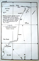 661st file - 544 KB - 900x1394
27.05.2008
upload 909
PCA Timor Annexe III.jpg -
 660th file - 775 KB - 1366x900
27.05.2008
upload 908
PCA Timor Annexe II.jpg -
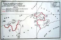 659th file - 719 KB - 1356x900
27.05.2008
upload 907
PCA Timor Annexe I.jpg -
 658th file - 2.25 MB - 4960x7016
27.05.2008
upload 906
PCA Timor Annexe C.jpg -
 657th file - 1.64 MB - 4960x7016
27.05.2008
upload 905
PCA Timor Annexe B.jpg -
 656th file - 1.61 MB - 7016x4960
27.05.2008
upload 904
PCA Timor Annexe A.jpg -
 655th file - 4.59 MB - 1353x996
25.05.2008
upload 900
Karte Region Berlin (Bearbeitungsvorlage).svg -
 654th file - 3.38 MB - 3758x2766
18.05.2008 .. 28.09.2016 (19 versions)
upload 892 .. 4038
Karte der Berliner Wasserstraßen.png -
 653rd file - 40 KB - 539x820
15.05.2008
upload 891
Icon for KWuZ-Zeitmangel.png -
 652nd file - 21 KB - 539x682
15.05.2008
upload 890
Icon for KWuZ-URV.png -
 651st file - 55 KB - 539x820
15.05.2008
upload 889
Icon for KWuZ-Stub.png -
 650th file - 19 KB - 539x820
15.05.2008
upload 888
Icon for KWuZ-Lagekarte.png -
 649th file - 36 KB - 539x820
15.05.2008
upload 887
Icon for KWuZ-kein Mehrwert.png -
 648th file - 3.73 MB - 701x562
12.05.2008 .. 14.05.2008 (2 versions)
upload 882 .. 886
Kroatien - Politische Gliederung (Karte).svg -
 647th file - 363 KB - 1460x1170
12.05.2008 .. 29.06.2008 (3 versions)
upload 881 .. 951
Kroatien - Politische Gliederung (Karte).png -
 646th file - 207 KB - 1155x1439
10.05.2008 .. 24.09.2009 (5 versions)
upload 874 .. 1347
Teilbereiche der Pfalz.png -
 645th file - 191 KB - 1280x965
10.05.2008 .. 23.07.2009 (4 versions)
upload 873 .. 1192
Stiftung Thüringer Schlösser und Gärten - Karte der verwalteten Liegenschaften.png -
 644th file - 76 KB - 326x349
10.05.2008 .. 11.05.2008 (2 versions)
upload 872 .. 876
Palau-CIA WFB Map-de.png -
 643rd file - 5.56 MB - 2395x1772
06.05.2008 .. 09.05.2008 (3 versions)
upload 865 .. 868
Blank map world gmt (more simplified).svg -
 642nd file - 10.78 MB - 2395x1772
06.05.2008 .. 06.05.2008 (2 versions)
upload 864 .. 867
Blank map world gmt (simplified).svg -
 641st file - 521 KB - 1370x1322
05.05.2008 .. 13.05.2008 (6 versions)
upload 858 .. 884
Karte von Schloss Beuggen.png -
 640th file - 223 KB - 1110x929
04.05.2008 .. 06.05.2008 (5 versions)
upload 854 .. 861
ACCOBAMS map.png -
 639th file - 269 KB - 1697x1410
04.05.2008 .. 04.05.2008 (2 versions)
upload 852 .. 853
Ramal da Figueira da Foz.png -
 638th file - 481 KB - 1548x1666
01.05.2008 .. 03.05.2008 (7 versions)
upload 843 .. 850
Objekte der Bayerische Verwaltung der staatlichen Schlösser, Gärten und Seen (Karte).png -
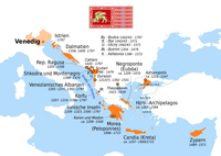 637th file - 161 KB - 1189x843
30.04.2008 .. 23.12.2016 (9 versions)
upload 842 .. 4102
Venezianische Kolonien.png -
 636th file - 188 KB - 2283x963
29.04.2008 .. 08.04.2011 (4 versions)
upload 841 .. 1888
Genuesische Kolonien.png -
 635th file - 1.6 MB - 2652x2133
27.04.2008 .. 29.04.2008 (3 versions)
upload 838 .. 840
Map of the Great Wall of China.jpg -
 634th file - 1.6 MB - 2652x2133
26.04.2008 .. 27.04.2008 (2 versions)
upload 835 .. 837
Image-Die Chinesische Mauer - Karte (mit einfachen Linien).jpg -
 633rd file - 2.1 MB - 2553x1783
26.04.2008
upload 834
Satellitenbild Nordchina und Mongolei.jpg -
 632nd file - 1.66 MB - 2652x2133
23.04.2008 .. 26.04.2008 (3 versions)
upload 832 .. 836
Die Chinesische Mauer - Karte.jpg -
 631st file - 113 KB - 756x588
20.04.2008
upload 829
München - Stadtbezirke (Karte) - V2.png -
 630th file - 708 KB - 1178x1719
13.04.2008
upload 823
Louisiana - Poverty Point - Karte (blank version).png -
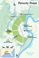 629th file - 762 KB - 1178x1719
13.04.2008 .. 13.04.2008 (2 versions)
upload 822 .. 826
Louisiana - Poverty Point - Karte (English version).png -
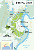 628th file - 1.01 MB - 1178x1719
12.04.2008 .. 30.12.2016 (9 versions)
upload 817 .. 4114
Louisiana - Poverty Point - Karte.png -
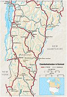 627th file - 645 KB - 963x1387
06.04.2008
upload 816
Vermont - Eisenbahnnetz - (alle Strecken als durchgehende Linien gezeichnet).jpg -
 626th file - 1.96 MB - 4791x3585
06.04.2008 .. 11.05.2008 (4 versions)
upload 815 .. 878
Chemnitz -- Straßenbahn mit möglichem Ausbauvarianten der Stadtbahn - Netzplan.jpg -
 625th file - 141 KB - 981x960
06.04.2008 .. 31.07.2012 (4 versions)
upload 811 .. 2274
Lisboa railway junction.png -
 624th file - 641 KB - 963x1387
05.04.2008 .. 05.04.2008 (2 versions)
upload 806 .. 808
Vermont - Eisenbahnnetz - (in Betrieb befindliche Strecken in schwarz-weiß).jpg -
 623rd file - 645 KB - 963x1387
05.04.2008 .. 06.04.2008 (3 versions)
upload 805 .. 809
Vermont - Eisenbahnnetz - (in Betrieb befindliche Strecken in rot-weiß).jpg -
 622nd file - 641 KB - 963x1387
04.04.2008
upload 802
Vermont - Eisenbahnnetz.jpg -
 621st file - 291 KB - 1845x1409
30.03.2008 .. 21.01.2017 (9 versions)
upload 799 .. 4144
Karte Stadtbahn Chemnitz.png -
 620th file - 768 KB - 2222x2836
30.03.2008 .. 21.01.2017 (6 versions)
upload 798 .. 4143
Chemnitz -- Straßenbahn - Netzplan.png -
 619th file - 405 KB - 2275x1313
24.03.2008 .. 24.03.2008 (3 versions)
upload 788 .. 790
Rußland - Premjer-Liga 2008 - en.png -
 618th file - 405 KB - 2275x1313
24.03.2008
upload 787
Rußland - Premjer-Liga 2008.png -
 617th file - 5.23 MB - 4057x1545
23.03.2008 .. 29.05.2009 (4 versions)
upload 784 .. 1004
Châteaux de la Loire - Karte.jpg -
 616th file - 26 KB - 552x552
18.03.2008 .. 24.07.2008 (2 versions)
upload 782 .. 952
Futsal - WM-Austragungsorte - Brasilien 2008.png -
 615th file - 55 KB - 966x737
18.03.2008
upload 781
Futsal - WM-Austragungsorte - Spanien 1996.png -
 614th file - 27 KB - 751x760
18.03.2008
upload 780
Futsal - WM-Austragungsorte - Taiwan 2004.png -
 613th file - 75 KB - 908x752
18.03.2008
upload 779
Futsal - WM-Austragungsorte - Niederlande 1989.png -
 612th file - 292 KB - 1437x907
17.03.2008 .. 18.03.2008 (2 versions)
upload 773 .. 777
USA - NBA-Conferences und Divisions 2008 (als Image Map).png -
 611th file - 811 KB - 1034x653
16.03.2008
upload 769
USA - NBA-Conferences und Divisions 2008.svg -
 610th file - 285 KB - 1437x907
16.03.2008 .. 18.03.2008 (3 versions)
upload 768 .. 776
USA - NBA-Conferences und Divisions 2008 (mit Legende in Karte).png -
 609th file - 293 KB - 1437x907
16.03.2008 .. 18.03.2008 (5 versions)
upload 766 .. 778
USA - NBA-Conferences und Divisions 2008.png -
 608th file - 1.2 MB - 1659x1582
16.03.2008 .. 16.03.2008 (2 versions)
upload 764 .. 765
KZ Dachau - Außenkommando Mühldorf - Übersichtskarte - V2.png -
 607th file - 689 KB - 1106x1055
16.03.2008 .. 16.03.2008 (2 versions)
upload 762 .. 763
KZ Dachau - Außenkommando Mühldorf - Übersichtskarte.jpg -
 606th file - 211 KB - 1062x1015
12.03.2008 .. 13.03.2008 (2 versions)
upload 757 .. 758
KZ Dachau - Außenkommando Mühldorf - Übersichtskarte.png -
 605th file - 644 KB - 552x552
11.03.2008 .. 17.03.2008 (4 versions)
upload 755 .. 772
Futsal - WM-Austragungsorte - Brasilien 2008.svg -
 604th file - 625 KB - 541x547
10.03.2008 .. 10.03.2008 (2 versions)
upload 748 .. 749
Futsal - WM-Austragungsorte - Taiwan 2004.svg -
 603rd file - 636 KB - 695x531
10.03.2008 .. 10.03.2008 (2 versions)
upload 747 .. 750
Futsal - WM-Austragungsorte - Spanien 1996.svg -
 602nd file - 707 KB - 656x541
10.03.2008 .. 10.03.2008 (3 versions)
upload 745 .. 751
Futsal - WM-Austragungsorte - Niederlande 1989.svg -
 601st file - 1.39 MB - 2470x2094
09.03.2008 .. 05.08.2016 (10 versions)
upload 743 .. 3969
Basel - Regio-S-Bahn Basel - Netzplan.jpg -
 600th file - 3.77 MB - 2470x2094
09.03.2008 .. 05.08.2016 (10 versions)
upload 742 .. 3968
Basel - Regio-S-Bahn Basel - Netzplan (mit Hintergrund).jpg -
 599th file - 1.29 MB - 705x558
06.03.2008
upload 741
München - Stadtratswahl 2008 - Sitzverteilung mit Namen der Stadträte.svg -
 598th file - 280 KB - 1958x1550
06.03.2008 .. 19.03.2008 (2 versions)
upload 740 .. 783
München - Stadtratswahl 2008 - Sitzverteilung mit Namen der Stadträte.png -
 597th file - 1.29 MB - 705x441
05.03.2008
upload 738
Nürnberg - Stadtratswahl 2008 - Sitzverteilung.svg -
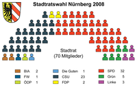 596th file - 158 KB - 1958x1225
05.03.2008
upload 737
Nürnberg - Stadtratswahl 2008 - Sitzverteilung.png -
 595th file - 1.27 MB - 705x558
05.03.2008
upload 736
München - Stadtratswahl 2008 - Sitzverteilung.svg -
 594th file - 207 KB - 1958x1550
05.03.2008 .. 06.03.2008 (2 versions)
upload 735 .. 739
München - Stadtratswahl 2008 - Sitzverteilung.png -
 593rd file - 1.12 MB - 2759x1912
02.03.2008 .. 23.12.2016 (14 versions)
upload 734 .. 4101
Metrobusnetzplan München.png -
 592nd file - 717 KB - 1426x1958
25.02.2008 .. 10.12.2017 (27 versions)
upload 730 .. 4599
Straßenbahnnetzplan München.png -
 591st file - 216 KB - x
14.02.2008 .. 14.02.2008 (2 versions)
upload by Niabot
Basel - Straßenbahn - Netzplan-2.svg -
 590th file - 144 KB - 714x839
14.02.2008
upload 726
Basel - Straßenbahn - Netzplan.svg -
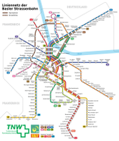 589th file - 1.1 MB - 2973x3494
11.02.2008 .. 23.09.2017 (8 versions)
upload 718 .. 4443
Basel - Straßenbahn - Netzplan.png -
 588th file - 401 KB - 787x531
03.02.2008 .. 20.03.2016 (8 versions)
upload 712 .. 3689
Dresden - S-Bahn - Liniennetz.svg -
 587th file - 251 KB - 1639x1107
03.02.2008 .. 29.12.2015 (4 versions)
upload 711 .. 3553
Dresden - S-Bahn - Liniennetz.png -
 586th file - 577 KB - 2133x1742
27.01.2008 .. 28.01.2008 (3 versions)
upload 708 .. 710
Bordeaux - Straßenbahn - Netzplan.png -
 585th file - 390 KB - 1912x1191
24.01.2008 .. 27.05.2017 (18 versions)
upload 705 .. 4328
Zahl der täglich neu erstellten Artikel in dewiki.png -
 584th file - 878 KB - 2003x2174
19.01.2008 .. 01.05.2017 (11 versions)
upload 701 .. 4295
Strasbourg - Straßenbahn - Netzplan (mit Erweiterungen).png -
 583rd file - 155 KB - 587x583
17.01.2008 .. 18.01.2008 (2 versions)
upload 698 .. 700
Lisboa - Bairros e Freguesias.svg -
 582nd file - 192 KB - 1224x1215
17.01.2008 .. 18.01.2008 (2 versions)
upload 697 .. 699
Lisboa - Bairros e Freguesias.png -
 581st file - 319 KB - 1079x1312
17.01.2008 .. 24.05.2008 (3 versions)
upload 693 .. 896
Strasbourg - Straßenbahn - Netzplan (mit großer Schrift).png -
 580th file - 3.85 MB - 4062x4580
14.01.2008
upload 692
Senf-Variationen.jpg -
 579th file - 88 KB - 587x583
14.01.2008 .. 14.01.2008 (2 versions)
upload 689 .. 691
Lisboa - Freguesias.svg -
 578th file - 230 KB - 1630x1619
14.01.2008 .. 14.01.2008 (2 versions)
upload 688 .. 690
Lisboa - Freguesias.png -
 577th file - 242 KB - 1600x1547
13.01.2008 .. 14.01.2008 (3 versions)
upload 685 .. 687
Marseille - SPNV - Netzplan 2011.png -
 576th file - 335 KB - 1600x1608
13.01.2008 .. 04.12.2015 (4 versions)
upload 684 .. 3519
Marseille - SPNV - Netzplan.png -
 575th file - 343 KB - 2353x1872
12.01.2008
upload 683
Montpellier - Straßenbahn - Netzplan.png -
 574th file - 170 KB - 1297x1270
10.01.2008 .. 03.09.2014 (2 versions)
upload 682 .. 3114
Le Mans - Straßenbahn - Netzplan.png -
 573rd file - 599 KB - 1657x1957
09.01.2008 .. 27.05.2017 (13 versions)
upload 680 .. 4330
Strasbourg - Straßenbahn - Netzplan.png -
 572nd file - 209 KB - 1352x1026
04.12.2007
upload 678
Innsbruck - Innenstadt - Gleis- und Oberleitungsplan 2005.jpg -
 571st file - 212 KB - 1352x1026
04.12.2007
upload 677
Innsbruck - Innenstadt - Gleis- und Oberleitungsplan 2004.jpg -
 570th file - 207 KB - 1352x1026
04.12.2007
upload 676
Innsbruck - Innenstadt - Gleis- und Oberleitungsplan 2003.jpg -
 569th file - 192 KB - 1352x1026
04.12.2007
upload 675
Innsbruck - Innenstadt - Gleis- und Oberleitungsplan 1995.jpg -
 568th file - 155 KB - 1352x1026
04.12.2007
upload 674
Innsbruck - Innenstadt - Gleis- und Oberleitungsplan 1993.jpg -
 567th file - 138 KB - 1352x1026
04.12.2007
upload 673
Innsbruck - Innenstadt - Gleis- und Oberleitungsplan 1992.jpg -
 566th file - 126 KB - 1352x1026
04.12.2007
upload 672
Innsbruck - Innenstadt - Gleis- und Oberleitungsplan 1988.jpg -
 565th file - 89 KB - 1352x1026
04.12.2007
upload 671
Innsbruck - Innenstadt - Gleis- und Oberleitungsplan 1983.jpg -
 564th file - 88 KB - 1352x1026
04.12.2007
upload 670
Innsbruck - Innenstadt - Gleis- und Oberleitungsplan 1976.jpg -
 563rd file - 129 KB - 1352x1026
04.12.2007
upload 669
Innsbruck - Innenstadt - Gleis- und Oberleitungsplan 1975.jpg -
 562nd file - 133 KB - 1352x1026
04.12.2007
upload 668
Innsbruck - Innenstadt - Gleis- und Oberleitungsplan 1965.jpg -
 561st file - 137 KB - 1352x1026
04.12.2007
upload 667
Innsbruck - Innenstadt - Gleis- und Oberleitungsplan 1960.jpg -
 560th file - 116 KB - 1352x1026
04.12.2007
upload 666
Innsbruck - Innenstadt - Gleis- und Oberleitungsplan 1948.jpg -
 559th file - 90 KB - 1352x1026
04.12.2007
upload 665
Innsbruck - Innenstadt - Gleis- und Oberleitungsplan 1940.jpg -
 558th file - 92 KB - 1352x1026
04.12.2007
upload 664
Innsbruck - Innenstadt - Gleis- und Oberleitungsplan 1939.jpg -
 557th file - 2.13 MB - 2816x2112
03.12.2007
upload 663
200 Route des vins d'Alsace.jpg -
 556th file - 2.21 MB - 2816x2112
03.12.2007
upload 662
Strasbourg - Straßenbahn - Stadtumgestaltung.jpg -
 555th file - 2.27 MB - 2816x2112
03.12.2007
upload 661
Strasbourg - Straßenbahn - Rasengleisabschnitt.jpg -
 554th file - 2.11 MB - 2816x2112
03.12.2007
upload 660
Strasbourg - Straßenbahn - Linienband (zentraler Teil).jpg -
 553rd file - 2.09 MB - 2816x2112
03.12.2007
upload 659
Strasbourg - Straßenbahn - Innenansicht.jpg -
 552nd file - 2.12 MB - 2816x2112
03.12.2007
upload 658
Strasbourg - Straßenbahn - Informationssäule.jpg -
 551st file - 2.15 MB - 2112x2816
03.12.2007
upload 657
Strasbourg - Straßenbahn - Haltestellenbeleuchtung.jpg -
 550th file - 2.15 MB - 2816x2112
03.12.2007
upload 656
Strasbourg - Straßenbahn - Fahrzeugtypen.jpg -
 549th file - 2.15 MB - 2816x2112
03.12.2007
upload 655
Strasbourg - Straßenbahn - Eigenwerbung.jpg -
 548th file - 2.14 MB - 2816x2112
03.12.2007
upload 654
Strasbourg - Straßenbahn - 2. Fahrzeggeneration.jpg -
 547th file - 2.13 MB - 2384x2022
03.12.2007
upload 653
Strasbourg - Straßenbahn - 1. Fahrzeuggeneration - Frontpartie.jpg -
 546th file - 2.21 MB - 2112x2816
03.12.2007
upload 652
Mulhouse - Straßenbahn - Streckensituation im Bereich Coteaux.jpg -
 545th file - 175 KB - 3568x442
03.12.2007
upload 651
Mulhouse - Straßenbahn - Linienband.jpg -
 544th file - 2.14 MB - 2816x2112
03.12.2007
upload 650
Mulhouse - Straßenbahn - Innenansicht.jpg -
 543rd file - 2.2 MB - 2816x2112
03.12.2007
upload 649
Mulhouse - Straßenbahn - Haltestelleninformation.jpg -
 542nd file - 2.18 MB - 2816x2112
03.12.2007
upload 648
Mulhouse - Straßenbahn - Fahrzeugansicht.jpg -
 541st file - 2.1 MB - 2112x2816
03.12.2007
upload 647
Mulhouse - Straßenbahn - Fahrzeugansicht - Frontalansicht.jpg -
 540th file - 176 KB - 2246x1589
03.12.2007 .. 08.02.2013 (4 versions)
upload 646 .. 2381
Mulhouse - tramway map.png -
 539th file - 593 KB - 4831x1164
25.11.2007 .. 03.03.2017 (13 versions)
upload 631 .. 4238
Linienband U-Bahn München.png -
 538th file - 547 KB - 2260x1580
25.11.2007 .. 25.11.2007 (3 versions)
upload 630 .. 635
UBahnSchemaplanMuenchenTopographisch2008.png -
 537th file - 662 KB - 2260x1580
25.11.2007 .. 13.12.2011 (9 versions)
upload 629 .. 2123
Schnellbahnplan München.png -
 536th file - 1.6 MB - 3215x2394
25.11.2007 .. 10.12.2017 (23 versions)
upload 628 .. 4597
Verkehrsnetz München.png -
 535th file - 773 KB - 3460x2434
09.09.2007
upload 626
Frankfurt (Main) - Gleisplan Flughafenbahnhof.jpg -
 534th file - 635 KB - x
02.09.2007
upload by Bibi Saint-Pol
Map Akrotiri 1600 BC-fr.png -
 533rd file - 529 KB - x
02.09.2007
upload by Bibi Saint-Pol
Map Akrotiri 1600 BC-en.png -
 532nd file - 618 KB - x
02.09.2007
upload by Bibi Saint-Pol
Map Akrotiri 1600 BC-de.png -
 531st file - 2.2 MB - 2816x2112
20.08.2007
upload 623
Stallplaketten.jpg -
 530th file - 888 KB - 1704x2272
20.08.2007
upload 622
Sylvensteinspeicher (Luftbild).jpg -
 529th file - 1.05 MB - 2272x1704
20.08.2007
upload 621
Zugspitze (Luftbild).jpg -
 528th file - 933 KB - 2272x1704
20.08.2007
upload 620
Weilheim - Ortstteil Marnbach (Luftbild).jpg -
 527th file - 1.11 MB - 2272x1704
20.08.2007
upload 619
Schliersee (Luftbild).jpg -
 526th file - 2.08 MB - 2816x2112
20.08.2007
upload 618
München - Zenith (Eingang).jpg -
 525th file - 375 KB - 2508x1374
20.08.2007
upload 617
München - Zenith (Außenfassade).jpg -
 524th file - 2.12 MB - 2112x2816
20.08.2007
upload 616
München - Volkssternwarte.jpg -
 523rd file - 2.15 MB - 2816x2112
20.08.2007
upload 615
München - Volkssternwarte (Schild).jpg -
 522nd file - 2.09 MB - 2816x2112
20.08.2007
upload 614
München - Volkssternwarte (Eingangsbereich).jpg -
 521st file - 2.22 MB - 2816x2112
20.08.2007
upload 613
München - Mittlerer Ring - Leuchtenbergring (Tunnelausfahrt).jpg -
 520th file - 2.1 MB - 2816x2112
20.08.2007
upload 612
München - Verwaltungssitz der S-Bahn München.jpg -
 519th file - 2.18 MB - 2112x2816
20.08.2007
upload 611
München - U-Bahn-Bahnhof St.-Quirin-Platz (Sperrengeschoss).jpg -
 518th file - 2.19 MB - 2112x2816
20.08.2007
upload 610
München - U-Bahn-Bahnhof St.-Quirin-Platz (Konstruktionsdetail).jpg -
 517th file - 2.16 MB - 2816x2112
20.08.2007
upload 609
München - U-Bahn-Bahnhof St.-Quirin-Platz (Blick vom Bahnsteig).jpg -
 516th file - 2.25 MB - 2816x2112
20.08.2007
upload 608
München - U-Bahn-Bahnhof St.-Quirin-Platz (Außenanblick).jpg -
515th file - 2.03 MB - 2816x2112
20.08.2007
upload 607
München - U-Bahn-Bahnhof Candidplatz (Farbgestaltung).jpg -
514th file - 2.08 MB - 2816x2112
20.08.2007
upload 606
München - U-Bahn-Bahnhof Candidplatz (Bahnsteig).jpg -
 513th file - 458 KB - 1988x1655
20.08.2007
upload 605
München - Theatinerkirche mit Blow Up.jpg -
 512th file - 2.12 MB - 2112x2816
20.08.2007
upload 604
München - TenTowers Telekom Center München (Sky Bridge).jpg -
 511th file - 493 KB - 2124x1321
20.08.2007
upload 603
München - TenTowers Telekom Center München (Rotunde).jpg -
 510th file - 2.16 MB - 2112x2816
20.08.2007
upload 602
München - Technisches Rathaus (rechts das TenTowers Telekom Center München).jpg -
 509th file - 103 KB - 563x327
20.08.2007
upload 601
München - Straßenschild 'Maximilianstraße'.jpg -
 508th file - 2.19 MB - 2816x2112
20.08.2007
upload 600
München - Stadtmuseum - Brunnen 'Schwimmende Nixen'.jpg -
 507th file - 2.08 MB - 2816x2112
20.08.2007
upload 599
München - Stadtmuseum (Pictogramm 'Fluchtweg in die City').jpg -
 506th file - 2.21 MB - 2816x2112
20.08.2007
upload 598
München - Pharao-Haus.jpg -
 505th file - 2.22 MB - 2112x2816
20.08.2007
upload 597
München - Pharao-Haus (Zugangsweg).jpg -
 504th file - 2.24 MB - 2816x2112
20.08.2007
upload 596
München - Ostbahnhof (Blick auf die S-Bahnsteige).jpg -
 503rd file - 1.06 MB - 4343x1363
20.08.2007
upload 595
München - Olympisches Dorf (Panorama).jpg -
 502nd file - 2.08 MB - 2112x2816
20.08.2007
upload 594
München - Olympisches Dorf (mit Olympiturm).jpg -
 501st file - 2.11 MB - 2112x2816
20.08.2007
upload 593
München - Olympisches Dorf (Hausanstrich).jpg -
 500th file - 2.18 MB - 2112x2816
20.08.2007
upload 592
München - Olympisches Dorf (Bungalowreihe).jpg -
 499th file - 2.17 MB - 2816x2112
20.08.2007
upload 591
München - Mohr-Villa.jpg -
 498th file - 2.16 MB - 2816x2112
20.08.2007
upload 590
München - MOC (Westfassade).jpg -
 497th file - 2.14 MB - 2112x2816
20.08.2007
upload 589
München - MOC (Nordfassade).jpg -
 496th file - 2.14 MB - 2816x2112
20.08.2007
upload 588
München - Mittlerer Ring - Petuelring mit Olympiaturm und BMW-Hochhaus.jpg -
 495th file - 2.11 MB - 2816x2112
20.08.2007
upload 587
München - Mittlerer Ring - Leuchtenbergring.jpg -
 494th file - 2.17 MB - 2816x2112
20.08.2007
upload 586
München - Mittlerer Ring - Leuchtenbergring (Tunnelmund).jpg -
 493rd file - 2.14 MB - 2112x2816
20.08.2007
upload 585
München - Mittlerer Ring - Candidberg.jpg -
 492nd file - 2.11 MB - 2816x2112
20.08.2007
upload 584
München - McGraw-Graben.jpg -
 491st file - 2.13 MB - 2112x2816
20.08.2007
upload 583
München - Marionettentheater 'Kleines Spiel'.jpg -
 490th file - 2.09 MB - 2816x2112
20.08.2007
upload 582
München - Marionettentheater 'Kleines Spiel' (Ferienschild).jpg -
 489th file - 2.13 MB - 2112x2816
20.08.2007
upload 581
München - Marionettentheater 'Kleines Spiel' (Eingang).jpg -
 488th file - 339 KB - 2028x1363
20.08.2007
upload 580
München - Kulturhaus Milbertshofen.jpg -
 487th file - 2.13 MB - 2816x2112
20.08.2007
upload 579
München - Hochschule für Fernsehen und Film.jpg -
 486th file - 2.26 MB - 2816x2112
20.08.2007
upload 578
München - Hochschule für Fernsehen und Film (Schild 'Deutschland - Land der Ideen, Ausgewählter Ort').jpg -
 485th file - 2.15 MB - 2816x2112
20.08.2007
upload 577
München - Hans im Glück-Verlag.jpg -
 484th file - 2.19 MB - 2816x2112
20.08.2007
upload 576
München - ETR 610 im DB-Ausbesserungswerk München-Freimann 2.jpg -
 483rd file - 2.13 MB - 2816x2112
20.08.2007
upload 575
München - ETR 610 im DB-Ausbesserungswerk München-Freimann 1.jpg -
 482nd file - 2.18 MB - 2816x2112
20.08.2007
upload 574
München - ehem. McGraw-Kaserne - Polizeirevier.jpg -
 481st file - 2.16 MB - 2112x2816
20.08.2007
upload 573
München - Bunker Milbertshofen.jpg -
 480th file - 348 KB - 2195x1356
20.08.2007
upload 572
München - BMW-Welt.jpg -
 479th file - 2.14 MB - 2112x2816
20.08.2007
upload 571
München - BMW-Hauptverwaltung.jpg -
 478th file - 2.07 MB - 2112x2816
20.08.2007
upload 570
München - BMW-Hauptverwaltung mit BMW-Museum.jpg -
 477th file - 941 KB - 2272x1704
20.08.2007
upload 569
München - Olympiapark (Luftbild).jpg -
 476th file - 1.09 MB - 2272x1704
20.08.2007
upload 568
Miesbach (Luftbild).jpg -
 475th file - 903 KB - 2272x1704
20.08.2007
upload 567
Kloster Ettal (Luftbild).jpg -
 474th file - 2.3 MB - 2112x2816
20.08.2007
upload 566
Hochstand.jpg -
 473rd file - 1.13 MB - 2272x1704
20.08.2007
upload 565
Garmisch-Partenkirchen (Luftbild).jpg -
 472nd file - 1.06 MB - 1704x2272
20.08.2007
upload 564
Eibsee (Luftbild).jpg -
 471st file - 889 KB - 1704x2134
20.08.2007
upload 563
Autobahn A8 beim Seehamer See (Luftbild).jpg -
 470th file - 4.54 MB - 4288x2848
19.08.2007
upload 561
München - Theresienwiese - Wies'n-Aufbau (Luftbild).jpg -
 469th file - 338 KB - 2119x1641
18.08.2007 .. 20.08.2007 (2 versions)
upload 558 .. 562
München - Stadtbezirke (Karte).png -
 468th file - 34 KB - 328x617
18.08.2007
upload 557
München - Stadtbezirk 25 (Karte) - Laim.png -
 467th file - 40 KB - 328x698
18.08.2007
upload 556
München - Stadtbezirk 24 (Karte) - Feldmoching - Hasenbergl.png -
 466th file - 38 KB - 328x669
18.08.2007
upload 555
München - Stadtbezirk 23 (Karte) - Allach - Untermenzing.png -
 465th file - 40 KB - 328x696
18.08.2007
upload 554
München - Stadtbezirk 22 (Karte) - Aubing - Lochhausen - Langwied.png -
 464th file - 44 KB - 328x717
18.08.2007
upload 553
München - Stadtbezirk 21 (Karte) - Pasing - Obermenzing.png -
 463rd file - 35 KB - 328x674
18.08.2007
upload 552
München - Stadtbezirk 20 (Karte) - Hadern.png -
 462nd file - 45 KB - 328x711
18.08.2007
upload 551
München - Stadtbezirk 19 (Karte) - Thalkirchen - Obersendling - Forstenried - Fürstenried - Solln.png -
 461st file - 45 KB - 328x797
18.08.2007
upload 550
München - Stadtbezirk 18 (Karte) - Untergiesing - Harlaching.png -
 460th file - 37 KB - 328x703
18.08.2007
upload 549
München - Stadtbezirk 17 (Karte) - Obergiesing.png -
 459th file - 41 KB - 328x634
18.08.2007
upload 548
München - Stadtbezirk 16 (Karte) - Ramersdorf - Perlach.png -
 458th file - 42 KB - 328x737
18.08.2007
upload 547
München - Stadtbezirk 15 (Karte) - Trudering - Riem.png -
 457th file - 33 KB - 328x578
18.08.2007
upload 546
München - Stadtbezirk 14 (Karte) - Berg am Laim.png -
 456th file - 44 KB - 328x656
18.08.2007 .. 25.11.2007 (2 versions)
upload 545 .. 636
München - Stadtbezirk 13 (Karte) - Bogenhausen.png -
 455th file - 48 KB - 328x840
18.08.2007
upload 544
München - Stadtbezirk 12 (Karte) - Schwabing - Freimann.png -
 454th file - 38 KB - 328x739
18.08.2007
upload 543
München - Stadtbezirk 11 (Karte) - Milbertshofen - Am Hart.png -
 453rd file - 35 KB - 328x625
18.08.2007
upload 542
München - Stadtbezirk 10 (Karte) - Moosach.png -
 452nd file - 43 KB - 328x650
18.08.2007 .. 31.05.2009 (2 versions)
upload 541 .. 1014
München - Stadtbezirk 09 (Karte) - Neuhausen - Nymphenburg.png -
 451st file - 35 KB - 328x621
18.08.2007
upload 540
München - Stadtbezirk 08 (Karte) - Schwanthalerhöhe.png -
 450th file - 39 KB - 328x651
18.08.2007 .. 18.08.2007 (2 versions)
upload 539 .. 559
München - Stadtbezirk 07 (Karte) - Sendling - Westpark.png -
 449th file - 35 KB - 328x637
18.08.2007
upload 538
München - Stadtbezirk 06 (Karte) - Sendling.png -
 448th file - 43 KB - 328x642
18.08.2007
upload 537
München - Stadtbezirk 05 (Karte) - Au - Haidhausen.png -
 447th file - 36 KB - 328x625
18.08.2007
upload 536
München - Stadtbezirk 04 (Karte) - Schwabing-West.png -
 446th file - 45 KB - 328x653
18.08.2007
upload 535
München - Stadtbezirk 03 (Karte) - Maxvorstadt.png -
 445th file - 49 KB - 328x726
18.08.2007
upload 534
München - Stadtbezirk 02 (Karte) - Ludwigsvorstadt - Isarvorstadt.png -
 444th file - 42 KB - 328x673
18.08.2007
upload 533
München - Stadtbezirk 01 (Karte) - Altstadt - Lehel.png -
 443rd file - 791 KB - 3303x2617
27.07.2007 .. 17.06.2017 (7 versions)
upload 530 .. 4349
Karte der ÖPNV-Systeme in Spanien und Portugal.png -
 442nd file - 2.21 MB - 2816x2112
21.07.2007
upload 529
München - Westend.JPG -
 441st file - 2.18 MB - 2112x2816
21.07.2007
upload 528
München - Trappentreutunnel.JPG -
 440th file - 2.19 MB - 2816x2112
21.07.2007
upload 527
München - Musikhochschule (von Norden).JPG -
 439th file - 2.07 MB - 2816x2112
21.07.2007
upload 526
München - Metropol-Theater (Neonschild).JPG -
 438th file - 2.26 MB - 2112x2816
21.07.2007
upload 525
München - Friedensengel.JPG -
 437th file - 2.2 MB - 2816x2112
21.07.2007
upload 524
München - Frachtpostzentrum.JPG -
 436th file - 2.18 MB - 2816x2112
21.07.2007
upload 523
München - ehem. Verkehrsministerium.JPG -
 435th file - 2.19 MB - 2112x2816
21.07.2007
upload 522
München - ehem. Verkehrsministerium (Kuppel).JPG -
 434th file - 2.17 MB - 2816x2112
21.07.2007
upload 521
München - ehem. LRZ.JPG -
 433rd file - 710 KB - 2218x1028
21.07.2007
upload 520
München - Donnersbergerbrücke (Panorama).JPG -
 432nd file - 2.24 MB - 2816x2112
21.07.2007
upload 519
München - Arnulfpark (Panorama).JPG -
 431st file - 2.15 MB - 2816x2112
21.07.2007
upload 518
München - Arnulfpark (mit Schild).JPG -
 430th file - 2.14 MB - 2816x2112
21.07.2007
upload 517
München - Arnulfpark (Gebäude).JPG -
 429th file - 1.38 MB - 3543x2953
20.07.2007 .. 26.03.2015 (8 versions)
upload 515 .. 3232
Hamburger Hochbahn - Entwicklungsgeschichte.png -
 428th file - 1.07 MB - 3543x2953
20.07.2007 .. 06.12.2012 (4 versions)
upload 514 .. 2360
Hamburger Hochbahn - Linienplan.png -
 427th file - 359 KB - 1506x1576
30.06.2007 .. 27.05.2016 (12 versions)
upload 509 .. 3796
Metro Lisboa with suburban railway lines.png -
 426th file - 269 KB - 1506x1576
30.06.2007 .. 27.05.2016 (9 versions)
upload 507 .. 3798
Metro Lisboa Route Map.png -
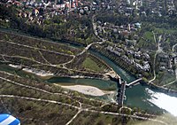 425th file - 1.23 MB - 2272x1604
24.06.2007
upload 506
München - Isarstauwehr (Luftbild).jpg -
 424th file - 1.6 MB - 2272x1704
24.06.2007
upload 505
München - Ludwigsvorstadt (Luftbild).jpg -
 423rd file - 1.23 MB - 2272x1704
24.06.2007 .. 24.06.2007 (2 versions)
upload 503 .. 504
München - Nationaltheater (Luftbild).jpg -
 422nd file - 1.36 MB - 2272x1551
24.06.2007
upload 502
München - Zamilapark (Luftbild).jpg -
 421st file - 963 KB - 2084x1704
24.06.2007
upload 501
München - Trabrennbahn (Luftbild).jpg -
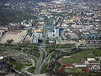 420th file - 1.2 MB - 2272x1704
24.06.2007
upload 500
München - Moosach (Luftbild).jpg -
 419th file - 384 KB - 818x994
24.06.2007
upload 499
München - o2-Zentrale (Luftbild).jpg -
 418th file - 207 KB - 542x670
24.06.2007
upload 498
München - Uptown München (Luftbild).jpg -
 417th file - 4.1 MB - 5726x5296
21.06.2007
upload 496
Region München - Satellitenbild.jpg -
 416th file - 1.54 MB - 1913x1634
21.06.2007 .. 13.12.2009 (3 versions)
upload 495 .. 1439
Streckennetz der S-Bahn München.jpg -
 415th file - 1.53 MB - 2272x1704
19.06.2007
upload 494
München - Nymphenburg (Luftbild).jpg -
 414th file - 1.18 MB - 2272x1704
19.06.2007
upload 493
München - Messe München und Neu-Riem (Luftbild).jpg -
 413th file - 1.43 MB - 1704x2272
19.06.2007
upload 492
München - Hofgarten (Luftbild).jpg -
 412th file - 979 KB - 1940x1592
19.06.2007
upload 491
München - Frauenkirche (Luftbild).jpg -
 411th file - 1,017 KB - 2168x1336
19.06.2007
upload 490
München - Allianz-Arena (Luftbild).jpg -
 410th file - 1.18 MB - 2272x1704
19.06.2007
upload 489
München - Highlight Towers (Luftbild).jpg -
 409th file - 808 KB - 1962x1524
19.06.2007
upload 488
München - Maximilianeum (Luftbild) - edit.jpg -
 408th file - 1.24 MB - 2272x1704
19.06.2007
upload 487
München - Marienplatz (Luftbild).jpg -
 407th file - 354 KB - 1912x1191
19.06.2007 .. 27.05.2017 (18 versions)
upload 486 .. 4329
Artikelwachstum in der deutschsprachigen Wikipedia.png -
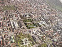 406th file - 1.29 MB - 1262x947
18.06.2007
upload 485
München - Pinakotheken (Luftbild).jpg -
 405th file - 1.4 MB - 2116x1476
18.06.2007
upload 484
München - TU München (Luftbild).jpg -
 404th file - 437 KB - 2258x1507
17.06.2007
upload 483
Istanbul Rapid Transit Map (including future projects).png -
 403rd file - 1.81 MB - 3993x2311
17.06.2007 .. 26.12.2017 (75 versions)
upload 482 .. 4622
Istanbul Rapid Transit Map.png -
 402nd file - 790 KB - 3058x3167
15.06.2007
upload 481
Transjakarta Busway Map February 2007.png -
 401st file - 2.15 MB - 2112x2816
10.06.2007
upload 480
Streetlife Festival 2.jpg -
 400th file - 2.12 MB - 2112x2816
10.06.2007
upload 479
Streetlife Festival 1.jpg -
 399th file - 2.18 MB - 2816x2112
10.06.2007
upload 478
Solarkocher 2.jpg -
 398th file - 2.14 MB - 2816x2112
10.06.2007
upload 477
Solarkocher 1.jpg -
 397th file - 2.25 MB - 2816x2112
10.06.2007
upload 476
Fahrzeug zur Fahrleitungsmontage 6.jpg -
 396th file - 2.25 MB - 2112x2816
10.06.2007
upload 475
Fahrzeug zur Fahrleitungsmontage 4.jpg -
 395th file - 2.19 MB - 2816x2112
10.06.2007
upload 474
Fahrzeug zur Fahrleitungsmontage 3.jpg -
 394th file - 2.28 MB - 2112x2816
10.06.2007
upload 473
Fahrzeug zur Fahrleitungsmontage 2.jpg -
 393rd file - 2.26 MB - 2217x1661
10.06.2007
upload 472
Fahrzeug zur Fahrleitungsmontage 1.jpg -
 392nd file - 925 KB - 1267x933
09.06.2007 .. 09.06.2007 (2 versions)
upload 469 .. 470
Metro Mondego - Route Map with Satellite Image as Background.jpg -
 391st file - 306 KB - 2540x448
02.06.2007
upload 468
München - Donnersbergerbrücke (Panorame).jpg -
 390th file - 2.11 MB - 2816x2112
02.06.2007
upload 467
München - Donnersbergerbrücke (Nordauffahrt).jpg -
 389th file - 2.11 MB - 2816x2112
02.06.2007
upload 466
München - Donnersbergerbrücke (Blick nach Süden).JPG -
 388th file - 241 KB - 3459x2211
01.06.2007 .. 02.06.2007 (4 versions)
upload 462 .. 465
Metro Mondego - Map of Possible Future Routes.png -
 387th file - 174 KB - 3376x2472
27.05.2007 .. 27.05.2007 (2 versions)
upload 457 .. 459
Metro Mondego - Route Map.png -
 386th file - 880 KB - 2764x3435
27.05.2007 .. 30.05.2007 (4 versions)
upload 456 .. 461
Metro Mondego - Locator Map.png -
 385th file - 3 KB - 24x24
26.05.2007
upload 455
Qsicon featured picture candidate.png -
 384th file - 3 KB - 24x24
26.05.2007
upload 454
Qsicon featured picture.png -
 383rd file - 479 KB - 1280x1024
26.05.2007 .. 26.05.2007 (2 versions)
upload 451 .. 452
München - Kaufingerstraße im Winter.jpg -
 382nd file - 449 KB - 1280x1024
26.05.2007 .. 26.05.2007 (2 versions)
upload 450 .. 453
München - Brienner Str. 07 (Ostteil).jpg -
 381st file - 1 KB - 24x24
23.05.2007
upload 449
Qsicon exzellent 2 Kandidat.png -
 380th file - 1,014 KB - 2271x1607
21.05.2007
upload 448
Verkehrsnetz München 2007.png -
 379th file - 2.2 MB - 2112x2816
20.05.2007
upload 447
München - KPMG-Gebäude von Otto Steidle auf der Münchner Theresienhöhe 5.JPG -
 378th file - 2.2 MB - 2816x2112
20.05.2007
upload 446
München - KPMG-Gebäude von Otto Steidle auf der Münchner Theresienhöhe 4.JPG -
 377th file - 2.14 MB - 2816x2112
20.05.2007
upload 445
München - KPMG-Gebäude von Otto Steidle auf der Münchner Theresienhöhe 3.JPG -
 376th file - 2.25 MB - 2112x2816
20.05.2007
upload 444
München - KPMG-Gebäude von Otto Steidle auf der Münchner Theresienhöhe 2.JPG -
 375th file - 2.29 MB - 2816x2112
20.05.2007
upload 443
München - KPMG-Gebäude von Otto Steidle auf der Münchner Theresienhöhe 1.JPG -
 374th file - 684 KB - 2490x1149
20.05.2007
upload 442
München - KPMG 3.jpg -
 373rd file - 2.27 MB - 2112x2816
20.05.2007
upload 441
München - Museum Mensch und Natur (Zugang aus dem Schlossrondell).JPG -
 372nd file - 2.18 MB - 1662x2800
20.05.2007
upload 440
München - Theresienhöhe - Steidle-Hochhaus.JPG -
 371st file - 733 KB - 2955x1392
20.05.2007
upload 439
München - Stadtsparkasse.jpg -
 370th file - 2.23 MB - 2816x2112
20.05.2007
upload 438
München - St. Jakob.JPG -
 369th file - 1.1 MB - 2816x1428
20.05.2007
upload 437
München - Sea Life.JPG -
 368th file - 2.28 MB - 5464x1040
20.05.2007
upload 436
München - Rotkreuzplatz.jpg -
 367th file - 2.25 MB - 2816x2112
20.05.2007
upload 435
München - Rotkreuzplatz (Brunnen).JPG -
 366th file - 2.12 MB - 2112x2816
20.05.2007
upload 434
München - Olympiaturm 3.JPG -
 365th file - 300 KB - 537x2800
20.05.2007
upload 433
München - Olympiaturm 2.jpg -
 364th file - 2.04 MB - 2112x2816
20.05.2007
upload 432
München - Olympiaturm 1.JPG -
 363rd file - 2.14 MB - 2816x2112
20.05.2007
upload 431
München - Museum Mensch und Natur (Schild).JPG -
 362nd file - 2.04 MB - 2816x2112
20.05.2007
upload 430
München - Museum Mensch und Natur (Eingang).JPG -
 361st file - 2.22 MB - 2816x2112
20.05.2007
upload 429
München - Fachhochschule.JPG -
 360th file - 2.14 MB - 2112x2816
20.05.2007
upload 428
München - Bier- und Oktoberfestmuseum.JPG -
 359th file - 2.13 MB - 2816x2112
20.05.2007
upload 427
München - Bier- und Oktoberfestmuseum (Schild).JPG -
 358th file - 2.09 MB - 2112x2816
20.05.2007
upload 425
München - Staatliches Museum Ägyptischer Kunst (Schild).JPG -
 357th file - 2.15 MB - 2112x2816
20.05.2007
upload 424
München - Staatliches Museum Ägyptischer Kunst (Obelisk).JPG -
 356th file - 2.17 MB - 2816x2112
20.05.2007
upload 423
München - Max-Planck-Gesellschaft.JPG -
 355th file - 2.13 MB - 2752x1706
20.05.2007
upload 422
München - Hypo-Kunsthalle.JPG -
 354th file - 1,018 KB - 3514x1017
20.05.2007
upload 421
München - Bayerische Staatskanzlei (Panorama).JPG -
 353rd file - 2.19 MB - 2816x2112
20.05.2007
upload 420
Gumpert Apollo 4.jpg -
 352nd file - 2.16 MB - 2551x1161
20.05.2007
upload 419
Gumpert Apollo 3.jpg -
 351st file - 2.03 MB - 2816x2112
20.05.2007
upload 418
Gumpert Apollo 2.jpg -
 350th file - 1.79 MB - 2816x2112
20.05.2007
upload 417
Gumpert Apollo 1.jpg -
 349th file - 7.32 MB - 2270x1212
08.04.2007
upload 416
Meisterwerke des mündlichen und immateriellen Erbes der Menschheit.svg -
 348th file - 394 KB - 2270x1212
08.04.2007
upload 415
Meisterwerke des mündlichen und immateriellen Erbes der Menschheit.png -
 347th file - 763 KB - 2172x1039
07.04.2007
upload 414
München - Wohnhaus Maurer.JPG -
 346th file - 452 KB - 1701x903
07.04.2007
upload 413
München - Wohnhaus Maurer (Gartenseite).JPG -
 345th file - 2.18 MB - 2816x2112
07.04.2007
upload 412
München - Pasinger Viktualienmarkt.JPG -
 344th file - 2.11 MB - 2816x2112
07.04.2007
upload 411
München - Pasinger Viktualienmarkt (Schild).JPG -
 343rd file - 530 KB - 1819x1359
07.04.2007
upload 410
München - Münchner Lach- und Schießgesellschaft.JPG -
 342nd file - 2.28 MB - 2112x2816
07.04.2007
upload 409
München - Münchner Lach- und Schießgesellschaft (Schild Variante 2).JPG -
 341st file - 2.19 MB - 2816x2112
07.04.2007
upload 408
München - Leopoldstr. (Blick Richtung Süden).JPG -
 340th file - 2.23 MB - 2816x2112
07.04.2007
upload 407
München - Leopoldstr. (Blick Richtung Norden).JPG -
 339th file - 2.22 MB - 2816x2112
07.04.2007
upload 406
München - Leopoldstr. (Außenbereich).JPG -
 338th file - 2.21 MB - 2112x2816
07.04.2007
upload 405
München - Fischbrunnen Pasing.JPG -
 337th file - 2.18 MB - 2816x2112
07.04.2007
upload 404
München - BMW-World.JPG -
 336th file - 2.14 MB - 2112x2816
07.04.2007
upload 403
München - BMW-Museum.JPG -
 335th file - 2.11 MB - 2816x2112
07.04.2007
upload 402
München - Altstadtring 26 (Blumenstr.).jpg -
 334th file - 2.21 MB - 2816x2112
07.04.2007
upload 401
München - Volkstheater.jpg -
 333rd file - 2.19 MB - 2112x2816
07.04.2007
upload 400
München - Volkstheater (Schild).jpg -
 332nd file - 2.22 MB - 2816x2112
07.04.2007
upload 399
München - Sammlung Brandhorst.jpg -
 331st file - 2.11 MB - 2112x2816
07.04.2007
upload 398
München - Prinzregentenstr. (vom Altstadtringtunnel).jpg -
 330th file - 2.13 MB - 2816x2112
07.04.2007
upload 397
München - Paläontologisches Museum.jpg -
 329th file - 2.2 MB - 2112x2816
07.04.2007
upload 396
München - Paläontologisches Museum (Schild).jpg -
 328th file - 2.09 MB - 2816x2112
07.04.2007
upload 395
München - Lenbachhaus (Eingangshalle).jpg -
 327th file - 1.07 MB - 4651x1013
07.04.2007
upload 394
München - Königsplatz (Panorama).jpg -
 326th file - 541 KB - 2215x1263
07.04.2007
upload 393
München - Königsplatz (Hinweisschild).jpg -
 325th file - 2.07 MB - 2816x2112
07.04.2007
upload 392
München - Kunstbau.jpg -
 324th file - 1 MB - 3256x1344
07.04.2007
upload 391
München - Karolinenplatz (Panorama).jpg -
 323rd file - 2.13 MB - 2816x2112
07.04.2007
upload 390
München - HS für Musik und Theater.jpg -
 322nd file - 2.21 MB - 2816x2112
07.04.2007
upload 389
München - HS für Musik und Theater (Schild).jpg -
 321st file - 2.14 MB - 2816x2112
07.04.2007
upload 388
München - HS für Musik und Theater (Dependance).jpg -
 320th file - 2.08 MB - 2112x2816
07.04.2007
upload 387
München - HS für Musik und Theater (Dependance) (Schild).jpg -
 319th file - 2.09 MB - 2112x2816
07.04.2007
upload 386
München - HS für Musik und Theater (Aushang).jpg -
 318th file - 2.22 MB - 2816x2112
07.04.2007
upload 385
München - Haus der Gegenwart.jpg -
 317th file - 2.15 MB - 2816x2112
07.04.2007
upload 384
München - Haus der Gegenwart (Schlafraum).jpg -
 316th file - 2.23 MB - 2112x2816
07.04.2007
upload 383
München - Haus der Gegenwart (Schild).jpg -
 315th file - 2.15 MB - 2816x2112
07.04.2007
upload 382
München - Brienner Str. 06 (Ostteil).jpg -
 314th file - 2.13 MB - 2816x2112
07.04.2007
upload 381
München - Brienner Str. 05 (Ostteil).jpg -
 313th file - 2.15 MB - 2816x2112
07.04.2007
upload 380
München - Brienner Str. 03 (am Königsplatz).jpg -
 312th file - 2.24 MB - 2816x2112
07.04.2007
upload 379
München - Brienner Str. 01 (Westteil).jpg -
 311th file - 2.2 MB - 2816x2112
07.04.2007
upload 378
München - Altstadtring 41 (am Prinz-Carl-Palais).jpg -
 310th file - 2.23 MB - 2816x2112
07.04.2007
upload 377
München - Altstadtring 39 (Altstadtringtunnel im Franz-Josef-Strauß-Ring).jpg -
 309th file - 2.24 MB - 2816x2112
07.04.2007
upload 376
München - Altstadtring 38 (Karl-Scharnagl-Ring).jpg -
 308th file - 2.17 MB - 2816x2112
07.04.2007
upload 375
München - Altstadtring 37 (Karl-Scharnagl-Ring).jpg -
 307th file - 2.07 MB - 2816x2112
07.04.2007
upload 374
München - Altstadtring 36 (Karl-Scharnagl-Ring).jpg -
 306th file - 2.11 MB - 2816x2112
07.04.2007
upload 373
München - Altstadtring 32 (Isartorplatz).jpg -
 305th file - 2.15 MB - 2816x2112
07.04.2007
upload 372
München - Altstadtring 31 (am Viktualienmarkt).jpg -
 304th file - 2.22 MB - 2816x2112
07.04.2007
upload 371
München - Altstadtring 25 (Blumenstr.).jpg -
 303rd file - 2.15 MB - 2816x2112
07.04.2007
upload 370
München - Altstadtring 23 (Sendlinger-Tor-Platz).jpg -
 302nd file - 772 KB - 2811x1009
07.04.2007
upload 369
München - Altstadtring 14 (Lenbachplatz).jpg -
 301st file - 833 KB - 2281x1008
07.04.2007
upload 368
München - Altstadtring 09 (Maximiliansplatz).jpg -
 300th file - 2.22 MB - 2816x2112
07.04.2007
upload 367
München - Altstadtring 05 (Altstadtringtunnel im Oskar-von-Miller-Ring).jpg -
 299th file - 2.14 MB - 2816x2112
07.04.2007
upload 366
München - Altstadtring 03 (Altstadtringtunnel in der Von-der-Tann-Str.).jpg -
 298th file - 2.17 MB - 2816x2112
07.04.2007
upload 365
München - Altstadtring 01 (Altstadtringtunnel in der Prinzregentenstr.).jpg -
 297th file - 2.19 MB - 2816x2112
07.04.2007
upload 364
Ford Transit.jpg -
 296th file - 2.16 MB - 2816x2112
07.04.2007
upload 363
Ford Transit (Rückseite).jpg -
 295th file - 1,005 KB - 2212x1415
02.04.2007
upload 361
Wilhelmsgymnasium.JPG -
 294th file - 2.14 MB - 2112x2816
02.04.2007
upload 360
Wilhelmsgymnasium (Eingang).JPG -
 293rd file - 2.16 MB - 2816x2112
02.04.2007
upload 359
Theresienhöhe 26.jpg -
 292nd file - 2.22 MB - 2112x2816
02.04.2007
upload 358
Theresienhöhe 23.jpg -
 291st file - 2.14 MB - 1820x2406
02.04.2007
upload 357
Theresienhöhe 21.jpg -
 290th file - 2.18 MB - 2816x2112
02.04.2007
upload 356
Theresienhöhe 18.jpg -
 289th file - 283 KB - 1432x542
02.04.2007
upload 355
Theresienhöhe 16 (Panorama).jpg -
 288th file - 1.46 MB - 2112x2816
02.04.2007 .. 03.04.2007 (2 versions)
upload 354 .. 362
Theresienhöhe 12.jpg -
 287th file - 596 KB - 2377x1028
02.04.2007
upload 353
Theresienhöhe 11.jpg -
 286th file - 2.13 MB - 1754x2802
02.04.2007
upload 352
Theresienhöhe 04.jpg -
 285th file - 2.17 MB - 2112x2816
02.04.2007
upload 351
Maxmonument.JPG -
 284th file - 2.23 MB - 2816x2112
27.03.2007
upload 349
München Ukrainische Freie Universität.JPG -
 283rd file - 2.25 MB - 2112x2816
27.03.2007
upload 348
München Ukrainische Freie Universität (Schild).JPG -
 282nd file - 2.2 MB - 2816x2112
27.03.2007
upload 347
München St. Anton.JPG -
 281st file - 508 KB - 2034x984
27.03.2007
upload 346
München Marstall.jpg -
 280th file - 58 KB - 746x380
27.03.2007 .. 12.04.2017 (6 versions)
upload 345 .. 4262
Chumwa Bereisungen.png -
 279th file - 189 KB - 1294x1100
26.03.2007 .. 27.12.2014 (3 versions)
upload 344 .. 3194
Stadterweiterungen München.png -
 278th file - 307 KB - 1760x1275
24.03.2007 .. 24.03.2007 (2 versions)
upload 328 .. 329
Stadtbahn Karlsruhe - Gleisplan, Blattschnitt.JPG -
 277th file - 443 KB - 1766x1272
24.03.2007
upload 327
Stadtbahn Karlsruhe - Gleisplan, Blatt S.JPG -
 276th file - 472 KB - 1272x1760
24.03.2007
upload 326
Stadtbahn Karlsruhe - Gleisplan, Blatt R.JPG -
 275th file - 423 KB - 1272x1760
24.03.2007
upload 325
Stadtbahn Karlsruhe - Gleisplan, Blatt Q.JPG -
 274th file - 453 KB - 1272x1760
24.03.2007
upload 324
Stadtbahn Karlsruhe - Gleisplan, Blatt P.JPG -
 273rd file - 471 KB - 1272x1760
24.03.2007
upload 323
Stadtbahn Karlsruhe - Gleisplan, Blatt O.JPG -
 272nd file - 522 KB - 1275x1766
24.03.2007
upload 322
Stadtbahn Karlsruhe - Gleisplan, Blatt N.JPG -
 271st file - 685 KB - 3428x2459
24.03.2007 .. 09.09.2007 (2 versions)
upload 321 .. 625
Stadtbahn Karlsruhe - Gleisplan, Blatt M.JPG -
 270th file - 482 KB - 1760x1275
24.03.2007
upload 320
Stadtbahn Karlsruhe - Gleisplan, Blatt L.JPG -
 269th file - 487 KB - 1766x1272
24.03.2007
upload 319
Stadtbahn Karlsruhe - Gleisplan, Blatt K.JPG -
 268th file - 430 KB - 1766x1272
24.03.2007
upload 318
Stadtbahn Karlsruhe - Gleisplan, Blatt J.JPG -
 267th file - 231 KB - 1766x1272
24.03.2007 .. 25.03.2007 (2 versions)
upload 317 .. 342
Stadtbahn Karlsruhe - Gleisplan, Blatt I.JPG -
 266th file - 124 KB - 1766x1272
24.03.2007 .. 25.03.2007 (2 versions)
upload 316 .. 341
Stadtbahn Karlsruhe - Gleisplan, Blatt HD.JPG -
 265th file - 188 KB - 1766x1272
24.03.2007 .. 25.03.2007 (3 versions)
upload 315 .. 343
Stadtbahn Karlsruhe - Gleisplan, Blatt HC.JPG -
 264th file - 130 KB - 1766x1272
24.03.2007 .. 25.03.2007 (2 versions)
upload 314 .. 339
Stadtbahn Karlsruhe - Gleisplan, Blatt HB.JPG -
 263rd file - 157 KB - 1766x1272
24.03.2007 .. 25.03.2007 (2 versions)
upload 313 .. 338
Stadtbahn Karlsruhe - Gleisplan, Blatt HA.JPG -
 262nd file - 232 KB - 1766x1272
24.03.2007 .. 25.03.2007 (2 versions)
upload 312 .. 337
Stadtbahn Karlsruhe - Gleisplan, Blatt H.JPG -
 261st file - 360 KB - 1272x1760
24.03.2007 .. 25.03.2007 (2 versions)
upload 311 .. 336
Stadtbahn Karlsruhe - Gleisplan, Blatt G.JPG -
 260th file - 191 KB - 1272x1760
24.03.2007 .. 25.03.2007 (2 versions)
upload 310 .. 335
Stadtbahn Karlsruhe - Gleisplan, Blatt F.JPG -
 259th file - 359 KB - 1760x1275
24.03.2007 .. 25.03.2007 (2 versions)
upload 309 .. 334
Stadtbahn Karlsruhe - Gleisplan, Blatt E.JPG -
 258th file - 516 KB - 1760x1275
24.03.2007 .. 01.04.2007 (3 versions)
upload 308 .. 350
Stadtbahn Karlsruhe - Gleisplan, Blatt D.JPG -
 257th file - 438 KB - 1766x1272
24.03.2007 .. 24.03.2007 (2 versions)
upload 307 .. 332
Stadtbahn Karlsruhe - Gleisplan, Blatt C.JPG -
 256th file - 231 KB - 1272x1760
24.03.2007 .. 24.03.2007 (2 versions)
upload 306 .. 331
Stadtbahn Karlsruhe - Gleisplan, Blatt B.JPG -
 255th file - 380 KB - 1766x1272
24.03.2007 .. 24.03.2007 (2 versions)
upload 305 .. 330
Stadtbahn Karlsruhe - Gleisplan, Blatt A.JPG -
 254th file - 1.31 MB - 2432x1765
18.03.2007
upload 304
München Englischer Garten Südtteil (Plan).jpg -
 253rd file - 523 KB - 2443x1099
14.03.2007
upload 303
München Stadtmuseum.JPG -
 252nd file - 2.17 MB - 2112x2816
14.03.2007
upload 302
München Stadtmuseum (Innenhof).JPG -
 251st file - 2.22 MB - 2816x2112
14.03.2007
upload 301
München St. Ursula.JPG -
 250th file - 2.16 MB - 2112x2816
14.03.2007
upload 300
München Schack-Galerie.JPG -
 249th file - 2.17 MB - 2112x2816
14.03.2007
upload 299
München Prinzregentenstraße (Blick nach Westen).JPG -
 248th file - 2.16 MB - 2816x2112
14.03.2007
upload 298
München Prinzregentenstraße (Blick nach Osten).JPG -
 247th file - 2.12 MB - 2816x2112
14.03.2007
upload 297
München Neue Hauptsynagoge.JPG -
 246th file - 2.21 MB - 2112x2816
14.03.2007
upload 296
München Neue Hauptsynagoge (Portal).JPG -
 245th file - 2.23 MB - 2112x2816
14.03.2007
upload 295
München Neue Hauptsynagoge (Frontansicht).JPG -
 244th file - 2.28 MB - 2816x2112
14.03.2007
upload 294
München Marionettentheater.JPG -
 243rd file - 273 KB - 892x1147
14.03.2007
upload 293
München Ludwigskirche II.JPG -
 242nd file - 2.1 MB - 2112x2816
14.03.2007
upload 292
München Ludwigskirche I.JPG -
 241st file - 2.08 MB - 2112x2816
14.03.2007
upload 291
München Ludwigskirche (Frontansicht).JPG -
 240th file - 593 KB - 2820x1380
14.03.2007
upload 290
München Jüdisches Zentrum und Jüdisches Museum.jpg -
 239th file - 2.13 MB - 2112x2816
14.03.2007
upload 289
München Ignaz-Günther-Haus.JPG -
 238th file - 2.23 MB - 2816x2112
14.03.2007
upload 288
München Feinkost Käfer.JPG -
 237th file - 2.09 MB - 2112x2816
14.03.2007
upload 287
München Damenstiftkirche (Eingang).JPG -
 236th file - 1.22 MB - 4060x1006
14.03.2007
upload 286
München Akademie der Bildenden Künste.JPG -
 235th file - 708 KB - 2296x1288
14.03.2007
upload 285
München Akademie der Bildenden Künste (Erweiterungsbau).JPG -
 234th file - 722 KB - 2054x1398
14.03.2007
upload 284
München Abtei St. Bonifaz (Kirche).jpg -
 233rd file - 2.23 MB - 2816x2112
14.03.2007
upload 283
München Abtei St. Bonifaz (Eingangsbereich).jpg -
 232nd file - 267 KB - 1620x852
13.03.2007
upload 282
München Universitätssternwarte (Schild).JPG -
 231st file - 2.21 MB - 2816x2112
13.03.2007
upload 281
München Universitätssternwarte.JPG -
 230th file - 509 KB - 2800x1465
13.03.2007
upload 280
München Stadtsparkasse III.JPG -
 229th file - 2.13 MB - 2816x2112
13.03.2007
upload 279
München Stadtsparkasse II.JPG -
 228th file - 2.13 MB - 2112x2816
13.03.2007
upload 278
München Stadtsparkasse I.JPG -
 227th file - 2.18 MB - 2112x2816
13.03.2007
upload 277
München Stadtsparkasse (Figur).JPG -
 226th file - 2.13 MB - 2816x2112
13.03.2007
upload 276
München P1 (Schild).JPG -
 225th file - 2.13 MB - 2112x2816
13.03.2007
upload 275
München P1 (Eingang).JPG -
 224th file - 2.14 MB - 2112x2816
13.03.2007
upload 274
München Fachakedemie für Fotodesign (Schild).JPG -
 223rd file - 2.12 MB - 2816x2112
13.03.2007
upload 273
München Fachakedemie für Fotodesign.JPG -
 222nd file - 2.23 MB - 2816x2112
13.03.2007
upload 272
München Akademie für Design.JPG -
 221st file - 2.12 MB - 2112x2816
12.03.2007
upload 271
München Theatermuseum (Schild).JPG -
 220th file - 2.22 MB - 2816x2112
12.03.2007
upload 270
München Theatermuseum (Ansicht mit Hofgartenarkaden).JPG -
 219th file - 2.13 MB - 2112x2816
12.03.2007
upload 269
München Theatermuseum.JPG -
 218th file - 2.13 MB - 2112x2816
12.03.2007
upload 268
München Staatliche Münzsammlung I.JPG -
 217th file - 2.09 MB - 2816x2112
12.03.2007
upload 267
München Staatliche Münzsammlung (Schild).JPG -
 216th file - 2.15 MB - 2816x2112
12.03.2007
upload 266
München Residenztheater.JPG -
 215th file - 2.13 MB - 2112x2816
12.03.2007
upload 265
München Museum Reich der Kristalle (Plakat).JPG -
 214th file - 2.22 MB - 2816x2112
12.03.2007
upload 264
München Museum Reich der Kristalle.JPG -
 213th file - 2.2 MB - 2816x2112
12.03.2007
upload 263
München Museum für Abgüsse klassischer Bildwerke (Schild).JPG -
 212th file - 1.09 MB - 2800x1467
12.03.2007
upload 262
München Museum für Abgüsse klassischer Bildwerke (Gebäuderückseite).JPG -
 211th file - 2.25 MB - 2112x2816
12.03.2007
upload 261
München Museum für Abgüsse klassischer Bildwerke (Gebäudefassade).JPG -
 210th file - 2.11 MB - 2112x2816
12.03.2007
upload 260
München Museum für Abgüsse klassischer Bildwerke.JPG -
 209th file - 2.13 MB - 2816x2112
12.03.2007
upload 259
München Max-Weber-Platz.JPG -
 208th file - 902 KB - 2168x1980
08.03.2007
upload 258
Pinnwand Moderation.jpg -
 207th file - 208 KB - 396x622
10.02.2007
upload 257
Hanno.Epitaph.edit-2.jpg -
 206th file - 371 KB - x
10.02.2007
upload 256
Raffael.rhino.edit-1.jpg -
 205th file - 2.12 MB - 2112x2816
10.02.2007
upload 255
Eingang zum Metropoltheater in München.jpg -
 204th file - 186 KB - 687x867
08.02.2007
upload 254
Hanno baraballo 2.edit-1.jpg -
 203rd file - 174 KB - x
08.02.2007
upload 253
Hanno mahout edit-4.jpg -
 202nd file - 142 KB - x
06.02.2007 .. 06.02.2007 (2 versions)
upload 251 .. 252
Hanno mahout.edit-1.jpg -
 201st file - 354 KB - 719x759
06.02.2007
upload 250
Hanno.cunha.edit-1.jpg -
 200th file - 546 KB - 646x841
06.02.2007
upload 249
Image-Hanno.testament.edit-1.jpg -
 199th file - 2.09 MB - 2816x2112
21.01.2007
upload 248
GfhR (33).jpg -
 198th file - 2.09 MB - 2816x2112
21.01.2007
upload 247
GfhR (32).jpg -
 197th file - 2.17 MB - 2816x2112
21.01.2007
upload 246
GfhR (31).jpg -
 196th file - 2.11 MB - 2816x2112
21.01.2007
upload 245
GfhR (30).jpg -
 195th file - 2.25 MB - 2816x2112
21.01.2007
upload 244
GfhR (29).jpg -
 194th file - 2.16 MB - 2816x2112
21.01.2007
upload 243
GfhR (28).jpg -
 193rd file - 2.08 MB - 2816x2112
21.01.2007
upload 242
GfhR (27).jpg -
 192nd file - 2.04 MB - 2112x2816
21.01.2007
upload 241
GfhR (26).jpg -
 191st file - 2.13 MB - 2816x2112
21.01.2007
upload 240
GfhR (25).jpg -
 190th file - 2.15 MB - 2816x2112
21.01.2007
upload 239
GfhR (24).jpg -
 189th file - 2.11 MB - 2816x2112
21.01.2007
upload 238
GfhR (23).jpg -
 188th file - 2.08 MB - 2816x2112
21.01.2007
upload 237
GfhR (22).jpg -
 187th file - 2.13 MB - 2816x2112
21.01.2007
upload 236
GfhR (21).jpg -
 186th file - 2.06 MB - 2816x2112
21.01.2007
upload 235
GfhR (20).jpg -
 185th file - 2.12 MB - 2112x2816
21.01.2007
upload 234
GfhR (19).jpg -
 184th file - 2.17 MB - 2112x2816
21.01.2007
upload 233
GfhR (18).jpg -
 183rd file - 2.1 MB - 2816x2112
21.01.2007
upload 232
GfhR (17).jpg -
 182nd file - 2.16 MB - 2112x2816
21.01.2007
upload 231
GfhR (16).jpg -
 181st file - 2.2 MB - 2112x2816
21.01.2007
upload 230
GfhR (15).jpg -
 180th file - 2.11 MB - 2816x2112
21.01.2007
upload 229
GfhR (14).jpg -
 179th file - 2.21 MB - 2112x2816
21.01.2007
upload 228
GfhR (13).jpg -
 178th file - 2.17 MB - 2816x2112
21.01.2007
upload 227
GfhR (12).jpg -
 177th file - 2.06 MB - 2816x2112
21.01.2007
upload 226
GfhR (11).jpg -
 176th file - 2.11 MB - 2816x2112
21.01.2007
upload 225
GfhR (10).jpg -
 175th file - 2.13 MB - 2816x2112
21.01.2007
upload 224
GfhR (09).jpg -
 174th file - 2.26 MB - 2816x2112
21.01.2007
upload 223
GfhR (08).jpg -
 173rd file - 2.11 MB - 2816x2112
21.01.2007
upload 222
GfhR (07).jpg -
 172nd file - 2.12 MB - 2816x2112
21.01.2007
upload 221
GfhR (06).jpg -
 171st file - 2.13 MB - 2816x2112
21.01.2007
upload 220
GfhR (05).jpg -
 170th file - 2.23 MB - 2816x2112
21.01.2007
upload 219
GfhR (04).jpg -
 169th file - 2.22 MB - 2112x2816
21.01.2007
upload 218
GfhR (03).jpg -
 168th file - 2.12 MB - 2816x2112
21.01.2007
upload 217
GfhR (02).jpg -
 167th file - 2.09 MB - 2816x2112
21.01.2007
upload 216
GfhR (01).jpg -
 166th file - 2.2 MB - 2816x2112
21.01.2007
upload 215
Châtelaillon-Plage Strand.JPG -
 165th file - 3.92 MB - 5221x2046
21.01.2007
upload 214
Châtelaillon-Plage Rathaus.JPG -
 164th file - 2.12 MB - 2112x2816
21.01.2007
upload 213
Châtelaillon-Plage Marktstraße.JPG -
 163rd file - 994 KB - 3479x2392
21.01.2007
upload 212
Châtelaillon-Plage Markthalle.JPG -
 162nd file - 2.19 MB - 2816x2112
21.01.2007
upload 211
Châtelaillon-Plage in der Markthalle.JPG -
 161st file - 2.1 MB - 2816x2112
21.01.2007
upload 210
Châtelaillon-Plage Haus am Boulevard de la mer.JPG -
 160th file - 2.23 MB - 2816x2112
21.01.2007
upload 209
Châtelaillon-Plage Hafen.JPG -
 159th file - 2.2 MB - 2816x2112
21.01.2007
upload 208
Châtelaillon-Plage Carrelage.JPG -
 158th file - 2.15 MB - 2112x2816
21.01.2007
upload 207
Châtelaillon-Plage typische Hausfassaden.JPG -
 157th file - 2.18 MB - 2112x2816
21.01.2007
upload 206
Châtelaillon-Plage Boulevard de Lattre de Tassigny.JPG -
 156th file - 2.16 MB - 2816x2112
21.01.2007
upload 205
Châtelaillon-Plage Austernpark.JPG -
 155th file - 238 KB - 1024x768
15.01.2007
upload 204
Pelni Speisesaal.jpg -
 154th file - 425 KB - 2223x1009
15.01.2007
upload 203
Pelni Schifffahrtsnetz 2006.png -
 153rd file - 253 KB - 1024x768
15.01.2007
upload 202
Pelni Kombüse.jpg -
 152nd file - 249 KB - 1024x768
15.01.2007
upload 201
Pelni Essensausgabe in der Economy Class.jpg -
 151st file - 228 KB - 1024x768
15.01.2007
upload 200
Pelni Einschiffung.jpg -
 150th file - 277 KB - 1024x768
15.01.2007
upload 199
Pelni Economy Class.jpg -
 149th file - 479 KB - 2000x1134
15.01.2007
upload 198
Pelni Bordplan KM Awu.jpg -
 148th file - 232 KB - 1024x768
15.01.2007
upload 197
Pelni Bordmoschee.jpg -
 147th file - 245 KB - 1024x768
15.01.2007
upload 196
Pelni Bordkiosk.jpg -
 146th file - 333 KB - 1024x768
15.01.2007
upload 195
Pelni auf Deck.jpg -
 145th file - 319 KB - 1172x1700
19.12.2006 .. 28.08.2017 (17 versions)
upload 191 .. 4433
OePNVSystemeDeutschland.png -
 144th file - 317 KB - 4849x1164
13.12.2006 .. 13.01.2007 (2 versions)
upload 188 .. 192
UBahnLinienbandMuenchen2007.png -
 143rd file - 378 KB - 1695x1185
13.12.2006
upload 187
UBahnSchemaplanMuenchenTopographisch2007.png -
 142nd file - 439 KB - 1695x1185
13.12.2006
upload 186
SchnellbahnschemaplanMuenchenTopographisch2007.png -
 141st file - 1,001 KB - 2271x1607
13.12.2006
upload 185
VerkehrsnetzMuenchen2007.png -
 140th file - 1,007 KB - 2048x1536
05.12.2006
upload 184
JakartaTransJakartaUmsteigenInDerHaltestelleHarmoni.jpg -
 139th file - 234 KB - 1666x756
28.11.2006 .. 28.04.2017 (6 versions)
upload 182 .. 4284
IndonesiaLicensePlatesMap.png -
 138th file - 579 KB - 2293x2375
25.11.2006
upload 181
TransjakartaNetworkAsPlannedFor2007.png -
 137th file - 100 KB - 1379x1192
20.11.2006 .. 25.11.2006 (3 versions)
upload 178 .. 180
TransJakartaFutureNetwork.png -
 136th file - 159 KB - 900x630
20.11.2006
upload 176
JakartaTransjakartaLogo.jpg -
 135th file - 250 KB - 900x662
20.11.2006
upload 175
JakartaTransjakartaWendestelleStasiunKotaJakarta.jpg -
 134th file - 190 KB - 900x675
20.11.2006
upload 174
JakartaTransjakartaWendestelleHarmoni.jpg -
 133rd file - 176 KB - 900x662
20.11.2006
upload 173
JakartaTransjakartaunabhängigerFahrweg.jpg -
 132nd file - 186 KB - 900x675
20.11.2006
upload 172
JakartaTransjakartaHaltestelleInnenraum.jpg -
 131st file - 173 KB - 800x541
20.11.2006
upload 171
JakartaTransjakartaHaltestelleGambir2.jpg -
 130th file - 231 KB - 900x675
20.11.2006
upload 170
JakartaTransjakartaHaltestelleAusgang.jpg -
 129th file - 205 KB - 900x675
20.11.2006
upload 169
JakartaTransjakartaFahrzeuglackierungen.jpg -
 128th file - 266 KB - 900x675
20.11.2006
upload 168
JakartaTransjakartaFahrzeuginnenraum.jpg -
 127th file - 242 KB - 900x675
20.11.2006
upload 167
JakartaTransjakartaFahrbahnmarkierungen.jpg -
 126th file - 188 KB - 675x900
20.11.2006
upload 166
JakartaTransjakartaEinstiegstuer.jpg -
 125th file - 311 KB - 1693x1159
19.11.2006 .. 20.11.2006 (2 versions)
upload 165 .. 177
TransjakartaBuswayMapOctober2006.png -
 124th file - 313 KB - 2220x1170
13.09.2006 .. 13.09.2006 (2 versions)
upload 159 .. 160
LinksverkehrWeltweit.png -
 123rd file - 312 KB - 2220x1170
13.09.2006
upload 158
Linksverkehr.png -
 122nd file - 327 KB - 2220x1253
12.09.2006 .. 13.09.2006 (3 versions)
upload 156 .. 161
RechtsverkehrUndLinksverkehr.png -
 121st file - 207 KB - 1660x1046
03.09.2006 .. 16.10.2017 (3 versions)
upload 155 .. 4499
ÖPNV-Systeme Tschechische Republik.png -
 120th file - 333 KB - 1280x1024
21.08.2006
upload 148
SalvadorDaBahiaBahianDress.jpg -
 119th file - 332 KB - 1024x1280
21.08.2006
upload 147
SalvadorDaBahiaPlanoInclinadoGoncalves.jpg -
 118th file - 332 KB - 1280x1024
21.08.2006
upload 146
SalvadorDaBahiaMetroLapa.jpg -
 117th file - 333 KB - 1280x1024
21.08.2006
upload 145
SalvadorDaBahiaFavelaBonfim.jpg -
 116th file - 336 KB - 1280x1024
21.08.2006
upload 144
SalvadorDaBahiaPalacioRioBranco.jpg -
 115th file - 330 KB - 1280x1024
21.08.2006
upload 143
SalvadorDaBahiaPelourinho.jpg -
 114th file - 333 KB - 1280x1024
21.08.2006
upload 142
SalvadorDaBahiaVitoria.jpg -
 113th file - 334 KB - 1024x1280
21.08.2006
upload 141
SalvadorDaBahiaTaschenkrebs.jpg -
 112th file - 325 KB - 1024x1280
21.08.2006
upload 140
SalvadorDaBahiaElevadorLacerda.jpg -
 111th file - 262 KB - 1024x1280
20.08.2006
upload 139
SaoPauloViadutoDoCha.jpg -
 110th file - 265 KB - 1280x1024
20.08.2006
upload 138
SaoPauloTrolleybus.jpg -
 109th file - 269 KB - 1280x1024
20.08.2006
upload 137
SaoPauloTheatroMunicipal.jpg -
 108th file - 189 KB - 1280x1024
20.08.2006
upload 136
SaoPauloPracaDaSe.jpg -
 107th file - 286 KB - 1024x1280
20.08.2006
upload 135
SaoPauloHochhausszenerie.jpg -
 106th file - 167 KB - 1280x1024
20.08.2006
upload 134
SaoPauloCorredorOnibusEMTU.jpg -
 105th file - 258 KB - 1280x1024
20.08.2006
upload 133
SaoPauloAvenidaPrestesMaia.jpg -
 104th file - 916 KB - 950x594
20.08.2006
upload 132
JedediahSmithLanguageIndependentVersion.png -
 103rd file - 246 KB - 1105x1042
15.08.2006
upload 127
GleisplanBuenosAires2005.png -
 102nd file - 685 KB - 1197x1701
15.08.2006
upload 126
BondeAndRackRailwayRioDeJaneiro2005.png -
 101st file - 281 KB - 2143x1157
14.08.2006 .. 13.01.2007 (3 versions)
upload 124 .. 193
SchienenverkehrIstanbul2006InBetrieb.png -
 100th file - 940 KB - 950x594
14.08.2006
upload 123
JedediahSmithEnglishVersion.png -
 99th file - 942 KB - 950x594
13.08.2006 .. 14.08.2006 (2 versions)
upload 122 .. 125
JedediahSmithGermanVersion.png -
 98th file - 435 KB - 2232x1478
13.08.2006 .. 13.01.2007 (6 versions)
upload 118 .. 194
SchienenverkehrIstanbul2006.png -
 97th file - 108 KB - 584x1650
30.07.2006
upload 116
GleisplanBlackpool1998.png -
 96th file - 330 KB - 750x600
30.07.2006
upload 115
CuritibaFaroisDeSaber.jpg -
 95th file - 329 KB - 1280x1024
30.07.2006
upload 114
CuritibaBusStop.jpg -
 94th file - 781 KB - 4120x1283
30.07.2006
upload 113
CuritibaBusBoarding.jpg -
 93rd file - 238 KB - 1204x1445
30.07.2006 .. 14.08.2012 (5 versions)
upload 110 .. 2287
OePNVSystemeFrankreich.png -
 92nd file - 353 KB - 2260x1551
30.07.2006 .. 02.01.2016 (8 versions)
upload 109 .. 3565
Karte ÖPNV-Systeme in Italien.png -
 91st file - 496 KB - 1583x1097
29.07.2006
upload 108
RERParisVision2025.png -
 90th file - 271 KB - 1519x2200
25.07.2006
upload 107
VerkehrsnetzStEtienne1995.png -
 89th file - 1.06 MB - 3300x2398
25.07.2006
upload 106
VerkehrsnetzNapoliInnenstadtbereich1998.png -
 88th file - 807 KB - 3300x2370
25.07.2006
upload 105
VerkehrsnetzNapoliAussenbereich1998.png -
 87th file - 454 KB - 1036x1740
25.07.2006 .. 15.09.2017 (3 versions)
upload 104 .. 4434
StrassenbahnUndObusPlanLinz1997.png -
 86th file - 507 KB - 2200x1521
25.07.2006
upload 103
StrassenbahnUndObusPlanInnsbruck1996.png -
 85th file - 254 KB - 1408x2870
25.07.2006 .. 21.10.2010 (2 versions)
upload 102 .. 1606
StrassenbahnNetzplanKairo1996.png -
 84th file - 213 KB - 1024x1507
25.07.2006
upload 101
StrassenbahnLinienplanSoller1997.png -
 83rd file - 578 KB - 2312x3000
25.07.2006
upload 100
StrassenbahnGleisplanTuenMun1996.png -
 82nd file - 295 KB - 1700x1902
25.07.2006
upload 99
StrassenbahnGleisplanRouen1994.png -
 81st file - 766 KB - 2200x1525
25.07.2006 .. 14.09.2011 (3 versions)
upload 98 .. 2076
StrassenbahnGleisplanRoma1994.png -
 80th file - 368 KB - 2000x1575
25.07.2006
upload 97
StrassenbahnGleisplanPlauen1995.png -
 79th file - 258 KB - 1363x2200
25.07.2006
upload 96
StrassenbahnGleisplanNuernberg1994.png -
 78th file - 355 KB - 1606x2200
25.07.2006
upload 95
StrassenbahnGleisplanNantes1994.png -
 77th file - 1.05 MB - 3300x2455
25.07.2006
upload 94
StrassenbahnGleisplanLisboa1995.png -
 76th file - 360 KB - 2200x1514
25.07.2006
upload 93
StrassenbahnGleisplanKairo1996.png -
 75th file - 299 KB - 2500x1491
25.07.2006
upload 92
StrassenbahnGleisplanHongKong1996.png -
 74th file - 288 KB - 1627x2400
25.07.2006 .. 18.08.2007 (2 versions)
upload 91 .. 560
StrassenbahnGleisplanGraz1997.png -
 73rd file - 476 KB - 2836x1871
25.07.2006 .. 17.01.2016 (5 versions)
upload 90 .. 3576
Straßenbahn-Netzplan Alexandria 1996.png -
 72nd file - 513 KB - 1674x2400
25.07.2006
upload 89
ObusOberleitungsplanSalzburg1995.png -
 71st file - 445 KB - 1527x2200
25.07.2006
upload 88
ObusOberleitungsplanSalzburg1993.png -
 70th file - 363 KB - 1457x1081
25.07.2006 .. 12.02.2008 (3 versions)
upload 87 .. 725
ObusOberleitungsplanLimoges1994.png -
 69th file - 147 KB - 2200x1186
25.07.2006
upload 86
ObusOberleitungsplanKapfenberg1997.png -
 68th file - 122 KB - 3300x445
25.07.2006
upload 85
GleisplanKusttram1994.png -
 67th file - 264 KB - 1555x1079
16.07.2006
upload 81
StrassenbahnSchemaplanMuenchen1997.png -
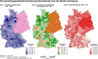 66th file - 487 KB - 1637x986
16.07.2006
upload 80
SoziodemographieDeutschlandsNachDerWiedervereinigung.png -
 65th file - 628 KB - 1669x1157
16.07.2006
upload 79
SiedlungsstrukturelleRaumtypen1996.png -
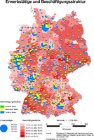 64th file - 771 KB - 1551x2311
16.07.2006
upload 78
ErwerbstaetigeUndBeschaeftigungsstrukturDeutschland1997.png -
 63rd file - 65 KB - 625x747
16.07.2006
upload 77
DemographischesStadtmodellMuenchen.png -
 62nd file - 32 KB - 479x611
16.07.2006
upload 76
BevoelkerungspyramideMuenchenPrognose2010.png -
 61st file - 148 KB - 650x969
16.07.2006
upload 75
AuslaenderanteileWien1997.png -
 60th file - 111 KB - 650x969
16.07.2006
upload 74
AuslaenderanteileMuenchen1997.png -
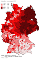 59th file - 340 KB - 920x1336
16.07.2006
upload 73
ArbeitslosigkeitInDeutschland1997.png -
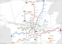 58th file - 383 KB - 1695x1185
09.07.2006 .. 12.11.2006 (5 versions)
upload 70 .. 162
UBahnSchemaplanMuenchenTopographisch2006.png -
 57th file - 745 KB - 1968x2327
09.07.2006
upload 69
StammbaumProgrammiersprachen.jpg -
 56th file - 375 KB - 2276x1405
09.07.2006 .. 21.04.2008 (6 versions)
upload 68 .. 830
WritingSystemsOfTheWorldGermanVersion.png -
 55th file - 999 KB - 2271x1607
08.07.2006 .. 04.12.2006 (2 versions)
upload 67 .. 183
VerkehrsnetzMuenchen2006.png -
 54th file - 168 KB - 1629x971
08.07.2006
upload 66
FaktorenDerMietpreisbildung.png -
 53rd file - 655 KB - 797x2161
08.07.2006
upload 65
Netzentwuerfe.png -
 52nd file - 444 KB - 1693x1183
06.07.2006 .. 12.11.2006 (9 versions)
upload 62 .. 163
SchnellbahnschemaplanMuenchenTopographisch2006.png -
 51st file - 1.07 MB - 969x1586
06.07.2006
upload 61
StrassenschilderMuenchenTypenuebersicht.png -
 50th file - 441 KB - 1034x1370
06.07.2006 .. 06.07.2006 (3 versions)
upload 60 .. 64
StrassenbahnnetzMuenchen1964.jpg -
 49th file - 427 KB - 814x569
06.07.2006
upload 59
SchnellbahnschemaplanMuenchenTopographisch2006.svg -
 48th file - 91 KB - 579x100
26.06.2006
upload 56
MuenchenStrassenschildSondertypeKorbinianBeerStrasse.png -
 47th file - 74 KB - 528x100
20.06.2006
upload 55
MuenchenStrassenschildSondertypeWalchenseeplatz.jpg -
 46th file - 78 KB - 456x100
20.06.2006
upload 54
MuenchenStrassenschildSondertypeValeppstrasse.jpg -
 45th file - 42 KB - 800x126
20.06.2006
upload 53
MuenchenStrassenschildSondertypeKopernikusstrasse.jpg -
 44th file - 57 KB - 635x100
20.06.2006
upload 52
MuenchenStrassenschildSondertypeGleichmannstrasse.jpg -
 43rd file - 175 KB - 1197x188
18.06.2006
upload 50
Kopenikusstraße.JPG -
 42nd file - 246 KB - 1056x336
17.06.2006
upload 46
MuenchenStrassenschildSondertypePronnerplatz.jpg -
 41st file - 100 KB - 636x158
17.06.2006
upload 45
MuenchenStrassenschildSondertypeMarschallstrasse.jpg -
 40th file - 156 KB - 756x254
16.06.2006
upload 42
MuenchenStrassenschildSondertypeOsserstrasse.jpg -
 39th file - 95 KB - 847x142
16.06.2006 .. 18.06.2006 (2 versions)
upload 41 .. 49
MuenchenStrassenschildSondertypeCimbernstrasse.jpg -
 38th file - 1.83 MB - 939x2988
16.06.2006 .. 18.06.2006 (3 versions)
upload 40 .. 51
MuenchenKontaktabzugFrakturschriftStrassenschilder.jpg -
 37th file - 202 KB - 408x582
16.06.2006 .. 17.06.2006 (2 versions)
upload 39 .. 43
MuenchenKontaktabzugBlockschriftStrassenschilder.jpg -
 36th file - 571 KB - 783x550
11.06.2006 .. 02.04.2010 (12 versions)
upload 32 .. 1524
MuenchenFrakturschriftStrassenschilder.png -
 35th file - 498 KB - 783x550
11.06.2006 .. 02.04.2010 (7 versions)
upload 31 .. 1523
MuenchenBlockschriftStrassenschilder.png -
 34th file - 185 KB - 1076x222
10.06.2006
upload 30
MuenchnerStraßenschild Thierschplatz.jpg -
 33rd file - 124 KB - 891x150
10.06.2006
upload 29
MuenchnerStraßenschild TypeX.jpg -
 32nd file - 157 KB - 1221x150
10.06.2006
upload 28
MuenchnerStraßenschild Type7.jpg -
 31st file - 136 KB - 1145x150
10.06.2006
upload 27
MuenchnerStraßenschild Type6b.jpg -
 30th file - 157 KB - 1068x150
10.06.2006
upload 26
MuenchnerStraßenschild Type6a.jpg -
 29th file - 144 KB - 943x150
10.06.2006
upload 25
MuenchnerStraßenschild Type6.jpg -
 28th file - 167 KB - 1120x150
10.06.2006
upload 24
MuenchnerStraßenschild Type5.jpg -
 27th file - 154 KB - 1022x150
10.06.2006
upload 23
MuenchnerStraßenschild Type4.jpg -
 26th file - 166 KB - 911x150
10.06.2006
upload 22
MuenchnerStraßenschild Type3.jpg -
 25th file - 133 KB - 869x150
10.06.2006
upload 21
MuenchnerStraßenschild Type2.jpg -
 24th file - 126 KB - 796x150
10.06.2006
upload 20
MuenchnerStraßenschild Type1.jpg -
 23rd file - 124 KB - 598x150
10.06.2006
upload 19
MuenchnerStraßenschild Type0.jpg -
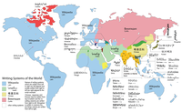 22nd file - 437 KB - 2272x1402
03.06.2006 .. 26.03.2016 (11 versions)
upload 16 .. 3699
WritingSystemsOfTheWorld.png -
 21st file - 307 KB - 1487x1735
01.04.2006 .. 20.11.2016 (9 versions)
upload 10 .. 4068
IndiaStatesByRTOcodes.png -
 20th file - 251 KB - 3953x1145
12.03.2006 .. 21.07.2007 (5 versions)
upload 9 .. 516
UBahnLinienbandRioDeJaneiro.png -
 19th file - 238 KB - 3623x871
12.03.2006 .. 12.11.2006 (7 versions)
upload 8 .. 164
UBahnLinienbandMuenchen2006.png -
 18th file - 454 KB - 2344x1656
12.02.2006 .. 08.12.2012 (6 versions)
upload 7 .. 2365
MuenchenSBahnMitZweitemTunnel.png -
 17th file - 887 KB - 1952x2773
06.02.2006
upload 6
Gleis 97b.jpg -
 16th file - 950 KB - 2055x2738
06.02.2006
upload 5
Gleis 96.jpg -
 15th file - 882 KB - 2055x2738
06.02.2006
upload 4
Gleis 93.jpg -
 14th file - 224 KB - 800x600
06.02.2006 .. 20.08.2006 (2 versions)
upload 3 .. 129
MünchenParteienhochburgen2004.jpg -
 13th file - 212 KB - 1172x828
05.02.2006 .. 03.08.2011 (4 versions)
upload 2 .. 2039
MuenchenSBahnMitSuedring.png -
 12th file - 433 KB - 1690x1074
29.12.2005
upload 1
Curitiba PublicTransport.png -
 11th file - 588 KB - x
18.07.2005
upload by Norro
VerkehrsnetzMünchen2005.png -
 10th file - 117 KB - x
18.07.2005
upload by Norro
StraßenbahnGleisplanStrasbourgMärz1999.png -
 9th file - 70 KB - x
18.07.2005
upload by Norro
StraßenbahnGleisplanNordhausenMärz1999.png -
 8th file - 237 KB - x
18.07.2005
upload by Norro
StraßenbahnGleisplanHalberstadtMärz1999.png -
 7th file - 189 KB - x
18.07.2005
upload by Norro
StraßenbahnGleisplanFreiburgBreisgauMärz1999.png -
 6th file - 596 KB - x
18.07.2005
upload by Norro
StraßenbahnGleisplanBremenNovember2002.png -
 5th file - 94 KB - x
18.07.2005
upload by Norro
StadtbahnGleisplanSaarbrückenMärz1999.png -
 4th file - 742 KB - x
18.07.2005
upload by Norro
RohrpostnetzplanMünchen.png -
 3rd file - 413 KB - x
18.07.2005
upload by Norro
OePNVSystemeJapanJanuar2003.png -
 2nd file - 317 KB - x
16.07.2005
upload by Norro
StraßenbahngleisplanKolkataOktober2004.jpg -
 1st file - 205 KB - x
16.07.2005
upload by Norro
OePNVSystemeDeutschlandJanuar2003.jpg


.jpg)
.jpg)
.jpg)
.svg)
.svg)


.png)


.svg)


.png)


.svg)


_-_Munic%C3%ADpio_of_Viqueque.png)
_-_Munic%C3%ADpio_of_Oecusse.png)
_-_Munic%C3%ADpio_of_Manufahi.png)
_-_Munic%C3%ADpio_of_Manatuto.png)
_-_Munic%C3%ADpio_of_Liqui%C3%A7%C3%A1.png)
_-_Munic%C3%ADpio_of_Laut%C3%A9m.png)
_-_Munic%C3%ADpio_of_Ermera.png)
_-_Munic%C3%ADpio_of_Dili.png)
_-_Munic%C3%ADpio_of_Covalima.png)
_-_Munic%C3%ADpio_of_Baucau.png)
_-_Munic%C3%ADpio_of_Ainaro.png)
_-_Munic%C3%ADpio_of_Bobonaro.png)
_-_Munic%C3%ADpio_of_Aileu.png)
_-_Munic%C3%ADpios,_Subdistritos_and_Postos_Administrativo.png)
_-_Munic%C3%ADpios_and_Posto_Administrativos_(with_names).png)


.png)


.png)


.svg)


.jpg)
.jpg)


.svg)


.png)


.png)
.jpg)
.png)
.png)
.png)
.png)
.png)


.png)
.png)
.png)
.png)

.png)
.png)
.png)
.jpg)
.jpg)
.png)
.png)
.png)
.png)
.png)
.png)
.png)
.png)
.png)
.png)
.png)
.png)
.png)
.png)
.png)
.png)

.png)
.png)
.png)
.png)
.png)
.png)
.png)
.png)
.png)


.png)
.png)
.png)


.jpg)
_-_colored_2016.svg)


.png)


.jpg)


.jpg)


.png)


.png)

_of_Jayapura.png)


.png)
.png)
.png)

.png)


.jpg)

.jpg)
_(14573034850).jpg)
.jpg)
.jpg)
.jpg)


_(14761156372).jpg)
.png)


.png)


.png)


.png)
.png)
.png)


.png)


.png)


.svg)

.png)


.png)


.svg)


.svg)


.jpg)


.png)


.png)
.png)

.svg)
.svg)


.svg)


.png)


.svg)

.png)


.jpg)


.png)


.png)


.svg)


.jpg)


.svg)


.svg)


.png)


.jpg)


.png)


.png)

.png)


.svg)


.jpg)


.png)

.jpg)
.jpg)
.jpg)


.jpg)


.png)


.png)


.jpg)


.png)


.png)
.png)


.png)

.jpg)

_nymph,_Middle_Franconia,_Germany_-_20110820-04.jpg)
_nymph,_Middle_Franconia,_Germany_-_20110820-03.jpg)


.jpg)

.jpg)


.png)


_-_Chinagarten_-_Station_%27Herbst%27-4.jpg)


_-_Yoga-%C3%9Cbungen_3.jpg)
_-_Yoga-%C3%9Cbungen_2.jpg)
_-_Yoga-%C3%9Cbungen_1.jpg)
_-_Wasserstufe.jpg)
_-_Wasserspielplatz.jpg)
_-_Wasserkugel_2.jpg)
_-_Wasserkugel_1.jpg)
_-_Vierer-Tischtennis.jpg)
_-_Tisch_im_B%C3%BCrgergarten_2.jpg)
_-_Tisch_im_B%C3%BCrgergarten_1.jpg)
_-_Spiellandschaft_am_Wasserzulauf_zum_See.jpg)
_-_Seniorengarten.jpg)
_-_Seecaf%C3%A9.jpg)
_-_Seeb%C3%BChne.jpg)
_-_Sardischer_Krieger.jpg)
_-_Sardenhaus.jpg)
_-_Sardenhaus_-_Kunstobjekte_am_Gartentor.jpg)
_-_Rutschbahnen.jpg)
_-_Rosengarten.jpg)
_-_Parklandschaft_im_Ostteil.jpg)
_-_Panoramablick_in_den_Westteil.jpg)
_-_Panoramablick_in_den_Ostteil.jpg)
_-_Mollsee.jpg)
_-_Japangarten_-_Wasserlaterne.jpg)
_-_Japangarten_-_Vierfenstrige_Laterne.jpg)
_-_Japangarten_-_Steg.jpg)
_-_Japangarten_-_Steg_mit_Wartehalle.jpg)
_-_Japangarten_-_Setzsteine.jpg)
_-_Japangarten_-_Seeblick.jpg)
_-_Japangarten_-_Achtfenstrige_Laterne.jpg)
_-_Grillen_am_See.jpg)
_-_Farntal_2.jpg)
_-_Farntal_1.jpg)
_-_Chinagarten_-_Station_%27Winter%27.jpg)
_-_Chinagarten_-_Station_%27Herbst%27.jpg)
_-_B%C3%A4ume_am_Seeufer.jpg)
_-_Buddhistische_M%C3%B6nche_auf_dem_Weg_zum_Khao_Phansa-Fest_an_der_Thai-Sala.jpg)
_-_Buddha_in_der_Thai-Sala_2.jpg)
_-_Buddha_in_der_Thai-Sala_1.jpg)
_-_Biotop.jpg)
_-_Alte_Eichen.jpg)
.jpg)


.png)
.png)

.png)


.png)
.png)


_distribution_map.png)


.png)
.png)


.png)
_in_Deutschland.png)


.jpg)
.jpg)


_-_Aubing_-_Lochhausen_-_Langwied_(nach_Stadtteilen).png)


.png)
.png)


.jpg)


.png)


.png)


.png)


.png)


.svg)


.png)
.svg)


.png)


.png)


.png)
.jpg)


.png)


.png)

.png)
.png)


.svg)


.png)

.png)
.png)
.jpg)
.jpg)
.jpg)


.jpg)


.png)
.jpg)
.jpg)
_-_Variante_2.jpg)
_-_Variante_1.jpg)


.png)
.png)


.png)
.png)
.png)

.svg)
.png)


.png)


.png)


.svg)


.svg)
.png)


.svg)
.svg)


.png)


.jpg)


_-_V2.png)
.png)
.png)

.jpg)


.jpg)
.jpg)


.png)

.png)


.jpg)


.png)


.png)


.jpg)


_-_Gleisplan_Flughafenbahnhof.jpg)


.jpg)
.jpg)
.jpg)
.jpg)
.jpg)
.jpg)

.jpg)
.jpg)
.jpg)

.jpg)
.jpg)
.jpg)
.jpg)

.jpg)
.jpg)
.jpg)


.jpg)

.jpg)
.jpg)
.jpg)
.jpg)
.jpg)
.jpg)

.jpg)
.jpg)


.jpg)


.jpg)
.jpg)


.jpg)


.jpg)
.jpg)
.jpg)

.jpg)
.jpg)
.jpg)
.jpg)
.png)
_-_Laim.png)
_-_Feldmoching_-_Hasenbergl.png)
_-_Allach_-_Untermenzing.png)
_-_Aubing_-_Lochhausen_-_Langwied.png)
_-_Pasing_-_Obermenzing.png)
_-_Hadern.png)
_-_Thalkirchen_-_Obersendling_-_Forstenried_-_F%C3%BCrstenried_-_Solln.png)
_-_Untergiesing_-_Harlaching.png)
_-_Obergiesing.png)
_-_Ramersdorf_-_Perlach.png)
_-_Trudering_-_Riem.png)
_-_Berg_am_Laim.png)
_-_Bogenhausen.png)
_-_Schwabing_-_Freimann.png)
_-_Milbertshofen_-_Am_Hart.png)
_-_Moosach.png)
_-_Neuhausen_-_Nymphenburg.png)
_-_Schwanthalerh%C3%B6he.png)
_-_Sendling_-_Westpark.png)
_-_Sendling.png)
_-_Au_-_Haidhausen.png)
_-_Schwabing-West.png)
_-_Maxvorstadt.png)
_-_Ludwigsvorstadt_-_Isarvorstadt.png)
_-_Altstadt_-_Lehel.png)


.JPG)
.JPG)


.JPG)

.JPG)
.JPG)
.JPG)
.JPG)


.jpg)
.jpg)
.jpg)
.jpg)
.jpg)
.jpg)
.jpg)
.jpg)


.jpg)
.jpg)
.jpg)
.jpg)
.jpg)
.jpg)
_-_edit.jpg)
.jpg)

.jpg)
.jpg)
.png)


.jpg)
.JPG)


.jpg)


.JPG)


.JPG)


.JPG)
.JPG)


.JPG)
.JPG)
.JPG)


.JPG)


.JPG)

.JPG)

.JPG)
.JPG)
.JPG)
.JPG)


.jpg)

.jpg)

.jpg)

.jpg)
.jpg)
.jpg)

.jpg)

.jpg)
.jpg)
_(Schild).jpg)
.jpg)

.jpg)
.jpg)
.jpg)
.jpg)
.jpg)
.jpg)
.jpg)
.jpg)
.jpg)
.jpg)
.jpg)
.jpg)
.jpg)
.jpg)
.jpg)
.jpg)
.jpg)
.jpg)
.jpg)
.jpg)

.jpg)

.JPG)


.jpg)


.JPG)


.jpg)

.JPG)


.JPG)
.JPG)

.JPG)
.JPG)


.JPG)


.JPG)

.JPG)
.jpg)
.jpg)
.JPG)


.JPG)
.JPG)
.JPG)
.JPG)


.JPG)
.JPG)


.JPG)

.JPG)

.JPG)
.JPG)
.JPG)


.jpg)
.jpg)
.jpg)
.jpg)
.jpg)
.jpg)
.jpg)
.jpg)
.jpg)
.jpg)
.jpg)
.jpg)
.jpg)
.jpg)
.jpg)
.jpg)
.jpg)
.jpg)
.jpg)
.jpg)
.jpg)
.jpg)
.jpg)
.jpg)
.jpg)
.jpg)
.jpg)
.jpg)
.jpg)
.jpg)
.jpg)
.jpg)
.jpg)


.jpg)
.jpg)