User:Ebyabe/southcentral
Jump to navigation
Jump to search

Arcadia[edit]
-
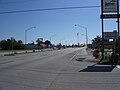
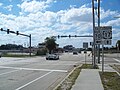 US 17/SR 70 intersection
 -
 County administration building
 -
 County administration building
 -
 County administration building


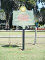
Oak Ridge Cemetery[edit]


British Plot section of cemetery[edit]


Near Arcadia[edit]


Avon Park[edit]
Blue Goose Packing Company[edit]


Brighton Seminole Indian Reservation[edit]


Bowling Green[edit]
Old RR depot[edit]


Old hotel[edit]


Clewiston[edit]
City hall[edit]


History Museum and Chamber of Commerce[edit]


Royal Palm Avenue[edit]


-
 US 27, looking east
 -
 US 27, looking west
 -
 US Sugar Corpartion Offices


Fort Denaud[edit]
-
 Cemetery
 -
 Cemetery
 -
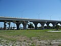
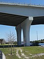
 Bridge over Okeechobee Waterway


Fort Meade[edit]
-

-

-
-
 Operations Center


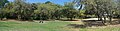
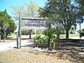
Homeland[edit]
-
 Raulerson House, in Heritage Park

-
 Peace River
 -
 Peace River
 -
 Peace River
 -
 SR 29, looking south


Kenansville[edit]
Bank[edit]


Cemetery[edit]


Heartbreak Hotel[edit]


School and post office[edit]


Turnpike[edit]


US 441[edit]


LaBelle[edit]
1910 Hampton House[edit]


1928 Sears Building[edit]


Chamber of Commerce[edit]


Firehouse Theater[edit]

City hall[edit]


Heritage museum[edit]


Houses[edit]


La Belle High School[edit]


SR 29 bridge[edit]

Lake Placid[edit]
Henscratch Winery[edit]


Lake Placid Club[edit]


Lake Placid Tower[edit]

SR 66[edit]


Martin County[edit]


Moore Haven[edit]
City hall[edit]

Geodetic marker[edit]

Old hotel[edit]


US 27 (Road and bridge over canal)[edit]
-
-

-

-
-

-

-

-
-

-

-

-
 Canal
Canal


Mulberry[edit]


Myakka[edit]
-
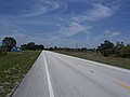
 SR 70
SR 70

Okeechobee[edit]
1st Baptist Church[edit]

Amtrak station[edit]


Old Bank[edit]


City hall[edit]


Episcopal church[edit]


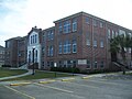
Historic High school[edit]
-
-

-
-
-

-
 Building between historic schools


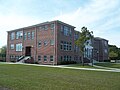
Historic Public school[edit]


History museum[edit]


House[edit]
-
 House
House

Raulerson Building[edit]


US 441/98 and SR 78 intersection[edit]


Ona[edit]
Solomon's Castle[edit]


Ortona[edit]
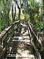
Indian Mound Park[edit]
-
-
-

-
-
-

-

-
-
 Lake Wobegon
 -
 Lake Wobegon


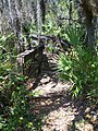
Ortona Cemetery[edit]


-
 Prairie off SR 78
 -
 SR 78
SR 78 -
 SR 78
SR 78


Osowaw Junction[edit]
-
 US 441
 -
 US 441


Pahokee[edit]


Palmdale[edit]
Railroad tracks[edit]


US 27 and SR 29 intersection[edit]


Pine Level[edit]


Port Mayaca[edit]
-
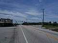
 US 441/98 and SR 15/700

Sarasota[edit]


Sebring[edit]
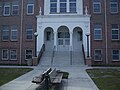
Historic houses[edit]


Wauchula[edit]
Old jail[edit]


Police department[edit]


Street[edit]


Yeehaw Junction[edit]
-
 SR 60, looking east
 -
 SR 60, looking west
 -
 US 441, looling north


