Category:Alps
Jump to navigation
Jump to search

Deutsch: Die Alpen sind das höchste innereuropäische Gebirge, welches von West nach Ost über Frankreich, Monaco, Italien, die Schweiz, den südlichsten Teil von Deutschland, Liechtenstein und Österreich bis nach Slowenien reicht.
English: The Alps is one of the great mountain range systems of Europe, stretching from Austria, Italy, and Slovenia in the east, through, Switzerland, Liechtenstein, Germany and Monaco to France in the west. See Alps for more or the discussion page for single mountains.
Français : Les Alpes sont une chaîne de montagnes qui s'étend en Europe, recouvrant la frontière nord de l'Italie, le sud-est de la France, la Suisse, le Liechtenstein, l'Autriche, le sud de l'Allemagne et la Slovénie. Voir Alps pour plus de détails.
Bahasa Indonesia: Pegunungan di Eropa.
Italiano: Immagini relative alle Alpi in Italia ed Europa. Vedi anche Alps per altre immagini
Русский: Альпы — самый высокий и протяжённый горный хребет среди систем, целиком лежащих в Европе. При этом Кавказские горы выше, а Уральские — протяжённей, но они лежат также и на территории Азии.
سنڌي: العربية: الألب هي سلسلة جبال أوروبية تقع في كل من: الحدود الشمالية لإيطاليا، الجنوب الغربي لفرنسا، موناكو، سويسرا، ليختنشتاين، النمسا، جنوب ألمانيا، وسلوفينيا. للمزيد أنظر: الألب
major mountain range system in central Europe  .jpg)  | |||||
| Upload media | |||||
| Instance of | |||||
|---|---|---|---|---|---|
| Part of | |||||
| Made from material | |||||
| Location |
| ||||
| Width |
| ||||
| Length |
| ||||
| Highest point |
| ||||
| Area |
| ||||
| Different from | |||||
 | |||||
Subcategories
This category has the following 43 subcategories, out of 43 total.
!
- Satellite pictures of the Alps (157 F)
+
?
A
- Alpine Space Programme (4 F)
B
C
F
G
H
M
N
O
S
T
V
- Videos of the Alps (29 F)
W
Media in category "Alps"
The following 67 files are in this category, out of 67 total.
-
 -i---i- (31554219452).jpg 4,032 × 3,024; 2.15 MB
-
 -i---i- (31554222422).jpg 4,032 × 3,024; 2.31 MB
-
 -i---i- (31663673336).jpg 3,024 × 4,032; 2.45 MB
-
 -i---i- (36746524043).jpg 3,024 × 4,032; 1.81 MB
-
 -i---i- (36746524083).jpg 3,024 × 4,032; 1.91 MB
-
 -i---i- (37159799380).jpg 3,024 × 4,032; 1.87 MB
-
 -i---i- (37159801260).jpg 3,024 × 4,032; 1.94 MB
-
 -i---i- (37369877516).jpg 3,024 × 4,032; 1.55 MB
-
 -i---i- (37386148692).jpg 3,024 × 4,032; 2.16 MB
-
 Aiguille Croche - face nord.jpg 1,999 × 2,876; 1.08 MB
-
 Aiguille Croche.jpg 2,676 × 1,959; 1.73 MB
-
 Alpeak eta behean lainoen itsasoa (3186648893).jpg 2,816 × 2,112; 1.06 MB
-
 Alpenglow au dessus de Grenoble.jpg 5,013 × 3,342; 1.02 MB
-
 AlpenreliefMitPfahlbauFundstellen20230117.JPG 3,581 × 1,498; 1.71 MB
-
 AlpenreliefRathausLitzelstetten20230117a.JPG 2,575 × 2,578; 2.11 MB
-
 Alpes in sufers.jpg 6,789 × 4,033; 16.24 MB
-
Alpes.ogg 13 min 34 s; 10.26 MB
-
 Alps Sunset (14334201).jpeg 1,920 × 1,440; 491 KB
-
 Alps20230617105726.jpg 4,032 × 3,024; 5.02 MB
-
 Alps20230617111552.jpg 4,032 × 3,024; 6.45 MB
-
 Au sommet de la Pyramide Vincent.jpg 3,264 × 2,448; 2.36 MB
-
 Bandeau du portail alpes.jpg 634 × 135; 45 KB
-
 BecsDeBosson20230410152102.jpg 4,032 × 3,024; 5.36 MB
-
 BecsDeBosson20230410152126.jpg 4,032 × 3,024; 4.93 MB
-
 BecsDeBosson20230410152145.jpg 4,032 × 3,024; 5.05 MB
-
 Best of the Alps - Karte.jpg 2,480 × 1,748; 1.83 MB
-
 Best of the Alps - Werte.jpg 2,480 × 3,508; 5.14 MB
-
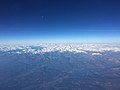
 Blick aus der Flugzeugkabine auf einen Teil der Alpen II.jpg 5,184 × 3,888; 7.38 MB
-
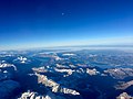
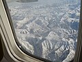 Blick aus der Flugzeugkabine auf einen Teil der Alpen.jpg 5,184 × 3,888; 8.01 MB
-

-
 Eglise Montgenèvre.jpg 1,937 × 2,526; 777 KB
-
 Emerging from the clouds (4356593673).jpg 3,358 × 1,639; 3.5 MB
-
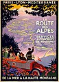 Flickr - …trialsanderrors - La route des Alpes, travel poster for PLM, ca. 1920.jpg 3,426 × 4,783; 5.91 MB
-
Flight over Alps 114129 1.webm 34 s, 2,160 × 3,840; 9.7 MB
-
 Forstenhäuser bei Scheidegg.jpg 5,232 × 3,904; 5.64 MB
-
 Friedrichshafen, 2017 (01).jpg 4,272 × 2,848; 3.65 MB
-
 Hannibal route of invasion.gif 1,280 × 968; 114 KB
-
Jer-Alpes.ogg 0.5 s; 10 KB
-
 Jungfrau20230617105758.jpg 3,024 × 4,032; 5.91 MB
-
 Jungfraujoch20230617105859.jpg 3,024 × 4,032; 5.2 MB
-
 Kreisförmige Wegmarkierung in den Alpen.jpg 3,024 × 4,032; 7.14 MB
-
 Landscape-horizon-mountain-snow-winter-cloud-844331-pxhere.jpg 2,592 × 1,936; 1.74 MB
-
 Lever de soleil sur les Alpes.jpg 5,184 × 3,456; 1.09 MB
-
 Liskamm depuis la Pyramide Vincent.jpg 3,256 × 1,933; 1.06 MB
-
 Magnificent (137989203).jpeg 1,463 × 2,048; 1.02 MB
-
 Matterhorn20230617111621.jpg 4,032 × 3,024; 5.16 MB
-
 Megève, depuis la chaîne du Mont-Joly.jpg 4,000 × 1,800; 2.24 MB
-
 Mont Janus vue près du Lac des Anges.jpg 4,032 × 1,960; 3.1 MB
-
 Montgenevre aerial 37k.jpg 6,048 × 4,024; 15.73 MB
-
 Montgenèvre.jpg 4,032 × 1,960; 2.64 MB
-
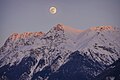 Moonrise in the Alps.jpg 1,086 × 724; 276 KB
-
 Panorama del ghiacciaio Ciardoney ripreso il 10 settembre 2018.jpg 756 × 502; 222 KB
-
 Pointe d'Andey et rochers de Leschaux depuis Amancy (74).jpg 2,794 × 2,096; 1,008 KB
-
 Replat de la Croix de Belledonne.jpg 5,312 × 2,988; 1.28 MB
-
 Sans titre (29842135586).jpg 4,160 × 3,120; 4.4 MB
-
 Sans titre. (14823214038).jpg 2,560 × 1,920; 1.18 MB
-

-
 Sommet des Anges vue sur le massif des Ecrins.jpg 4,032 × 1,960; 1.99 MB
-
 Sommet des Anges vue sur le Mont Janus et le Mont Chaberton.jpg 4,032 × 1,960; 1.78 MB
-
 The Alps (49250236337).jpg 5,584 × 3,728; 6.4 MB
-
 Tête de la Combaz.jpg 1,999 × 2,893; 1.8 MB
-
 Vercorin20230410151129.jpg 4,032 × 3,024; 5.31 MB
-
 Vercorin20230410151132.jpg 4,032 × 3,024; 5.65 MB
-
 W - como - rebbio e camerlata.jpg 5,087 × 3,422; 3.02 MB
-
 W - como - rebbio.jpg 5,184 × 3,456; 2.82 MB
-
 W - montano lucino - montano e le alpi.jpg 5,012 × 2,660; 1.56 MB
-
 Young lady wearing a traditional German dress.jpg 3,648 × 5,472; 12.09 MB
.jpg)
.jpg)
.jpg)
.jpg)
.jpg)
.jpg)
.jpg)
.jpg)
.jpg)


.jpg)


.jpeg)


.jpg)


.jpg)


.jpeg)


.jpg)

.jpg)
.jpg)


.jpg)


