Category:Church Poysdorf
Jump to navigation
Jump to search
| Object location | | View all coordinates using: OpenStreetMap |
|---|
cemetery in Lower Austria, Austria .JPG)  | |||||
| Upload media | |||||
| Instance of | |||||
|---|---|---|---|---|---|
| Named after | |||||
| Dedicated to | |||||
| Patron saint | |||||
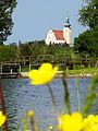
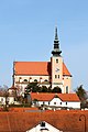
| Location | Poysdorf, Mistelbach District, Lower Austria, Austria | ||||
| Street address |
| ||||
| Architectural style | |||||
| Heritage designation | |||||
 | |||||
Media in category "Church Poysdorf"
The following 24 files are in this category, out of 24 total.
-
 Aŭstrio-Weinviertel-Poysdorf-preĝejo.jpg 480 × 640; 511 KB
-
 Kirche Poysdorf 007.JPG 4,608 × 3,456; 3.54 MB
-
 Kirche Poysdorf 010.JPG 4,608 × 3,456; 3.46 MB
-
 Kirche Poysdorf 011.JPG 4,608 × 3,456; 3.43 MB
-
 Kirche Poysdorf 018.JPG 4,608 × 3,456; 3.31 MB
-
 Kirche Poysdorf 022.JPG 4,608 × 3,456; 3.24 MB
-
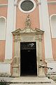
 NOE Poysdorf Kirchenportal.jpg 3,264 × 2,176; 2.92 MB
-
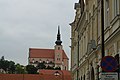
 NOE Poysdorf Pfarrkirche Ehemaliger Friedhof.jpg 3,264 × 2,176; 2.85 MB
-
 Poysdorf - ehemaliges Gerichts- und Amtsgebäude.JPG 4,534 × 3,023; 12.65 MB
-
 Poysdorf - Kirche (1).JPG 2,756 × 4,134; 7.79 MB
-
 Poysdorf - Kirche (2).JPG 3,293 × 4,940; 11.1 MB
-
 Poysdorf - Kirche (3).JPG 3,011 × 4,516; 12.43 MB
-
 Poysdorf - Kirche, Hochaltar.JPG 2,761 × 4,141; 8.63 MB
-
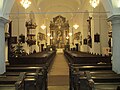
 Poysdorf - Kirche, Innenansicht.JPG 4,134 × 2,756; 7.55 MB
-
 Poysdorf 4883.jpg 2,592 × 3,888; 930 KB
-
 Poysdorf 4886.jpg 2,592 × 3,888; 681 KB
-
 Poysdorf 4887.jpg 2,592 × 3,888; 971 KB
-
 Poysdorf 4888.jpg 2,592 × 3,888; 818 KB
-
 Poysdorf 4889.jpg 3,888 × 2,592; 974 KB
-
 Poysdorf 4891.jpg 3,888 × 2,592; 1,012 KB
-
 Poysdorf 4892.jpg 2,592 × 3,888; 1,007 KB
-
 Poysdorf 4895.jpg 3,888 × 2,592; 683 KB
-
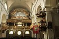
 Poysdorf Orgel Okenfus.jpg 2,563 × 3,417; 5.72 MB
-
 Wien Donaustadt Bilderuhr.jpg 2,944 × 2,776; 5.21 MB


.JPG)
.JPG)


