Category:Volksschule Kaisersdorf
Jump to navigation
Jump to search
| Object location | | View all coordinates using: OpenStreetMap |
|---|
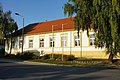
building in Kaisersdorf, Austria  | |||||
| Upload media | |||||
| Instance of | |||||
|---|---|---|---|---|---|
| Location | Kaisersdorf, Oberpullendorf District, Burgenland, Austria | ||||
| Street address |
| ||||
| Heritage designation | |||||
 | |||||
Deutsch: Volksschule, Kaisersdorf, Österreich
English: Elementary school, Kaisersdorf, Austria
Media in category "Volksschule Kaisersdorf"
The following 3 files are in this category, out of 3 total.
-
 Kaisersdorf - Volksschule (01).jpg 3,000 × 2,000; 1.31 MB
-
 Kaisersdorf - Volksschule (02).jpg 3,000 × 2,000; 1.16 MB
-
 Kaisersdorf Volksschule.jpg 4,592 × 3,056; 3.21 MB
.jpg)
.jpg)